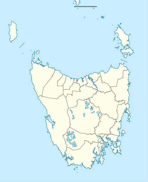
Waratah, Tasmania
Waratah is a locality and town in North Western Tasmania adjacent to Savage River National Park. The town was constructed to support a tin mine at Mount Bischoff. It is built at the top of a waterfall, and water was diverted from the stream to provide water for mine sluicing and processing. At the 2006 census, Waratah had a population of 227.[1] It was also the first town in Australia to have electric street lights in 1886.[2]
| Waratah Tasmania | |
|---|---|
 Waratah Falls in Waratah with part of the town in the background | |
 Waratah | |
| Coordinates | 41°26′S 145°31′E |
| Population | 227 (2006 census)[1] |
| Postcode(s) | 7321 |
| Time zone | AEST (UTC+10) |
| • Summer (DST) | AEDT (UTC+11) |
| Location |
|
| LGA(s) | Waratah-Wynyard Council |
| State electorate(s) | Braddon |
| Federal Division(s) | Braddon |
History
Tin was discovered at Mount Bischoff by James "Philosopher" Smith in 1871. The mine operated successfully at first. The easy ore was all extracted by 1893 when sluicing was discontinued. Mining continued opencut on the face of the mountain, and underground. The underground mine closed in 1914, but surface mining continued for some time before it also ceased after the price of tin slumped in 1929. The mine was reopened by the Commonwealth Government in 1942 to support the war effort, but it finally closed in 1947.[3] It was the mine that produced power for 400 incandescent streetlights in 1886.[2] Mount Bischoff Post Office opened on 1 September 1874 and was renamed Waratah in 1882.[4]
In the vicinity of the locality, a number of smaller mines worked at the same time as the Mount Bischoff workings. Mount Magnet silver mine was connected by the Mount Magnet Tramway within 10 miles south west of the town.
Politics
At the 2007 Australian federal election, the polling place at Waratah Primary School registered a total of 148 votes. 72 votes (49.32%) were cast for the Labor candidate Sid Sidebottom, 54 votes (36.99%) were cast for the Liberal candidate Mark Baker and 17 votes (11.64%) were cast for Greens candidate Paul O'Halloran.[5]
Climate
Waratah has an oceanic climate (Köppen climate classification: Cfb), unusually cool by Australian standards. It is one of the wettest and coldest locations in Tasmania. The town has a high frequency of cloudy days and maximum temperatures often fail to get above 10 °C, even in summer. Winter snowfall is common, and heavy rainstorms can be experienced throughout the year. Extremes have ranged from 32.8 °C (91.0 °F) to -5.5 °C (22.1 °F). Waratah's wettest month on record was May 1923 with 644.8 mm (25.3 in) of rain recorded.[6]
| Climate data for Waratah | |||||||||||||
|---|---|---|---|---|---|---|---|---|---|---|---|---|---|
| Month | Jan | Feb | Mar | Apr | May | Jun | Jul | Aug | Sep | Oct | Nov | Dec | Year |
| Record high °C (°F) | 32.8 (91.0) |
32.7 (90.9) |
31.7 (89.1) |
23.3 (73.9) |
19.4 (66.9) |
14.4 (57.9) |
12.7 (54.9) |
16.7 (62.1) |
18.5 (65.3) |
25.5 (77.9) |
27.7 (81.9) |
31.8 (89.2) |
32.8 (91.0) |
| Average high °C (°F) | 17.6 (63.7) |
18.0 (64.4) |
15.7 (60.3) |
12.5 (54.5) |
9.9 (49.8) |
7.9 (46.2) |
7.2 (45.0) |
7.9 (46.2) |
9.7 (49.5) |
11.8 (53.2) |
13.9 (57.0) |
16.0 (60.8) |
12.3 (54.1) |
| Average low °C (°F) | 6.3 (43.3) |
7.0 (44.6) |
5.9 (42.6) |
4.3 (39.7) |
2.8 (37.0) |
1.5 (34.7) |
0.8 (33.4) |
0.9 (33.6) |
1.7 (35.1) |
2.7 (36.9) |
3.8 (38.8) |
5.2 (41.4) |
3.8 (38.8) |
| Record low °C (°F) | −0.2 (31.6) |
0.0 (32.0) |
−1.7 (28.9) |
−3.9 (25.0) |
−5.5 (22.1) |
−4.7 (23.5) |
−5.3 (22.5) |
−5.0 (23.0) |
−3.9 (25.0) |
−5.0 (23.0) |
−3.9 (25.0) |
−0.6 (30.9) |
−5.5 (22.1) |
| Average rainfall mm (inches) | 109.7 (4.32) |
92.7 (3.65) |
122.5 (4.82) |
172.6 (6.80) |
214.5 (8.44) |
227.3 (8.95) |
247.9 (9.76) |
254.2 (10.01) |
227.4 (8.95) |
198.1 (7.80) |
163.0 (6.42) |
139.6 (5.50) |
2,169.5 (85.42) |
| Average rainy days (≥ 0.2mm) | 15.5 | 13.2 | 17.6 | 20.4 | 23.1 | 22.8 | 24.8 | 24.9 | 23.5 | 22.1 | 18.9 | 17.5 | 244.3 |
| Source: Bureau of Meteorology[6] | |||||||||||||
References
- Australian Bureau of Statistics (25 October 2007). "Waratah (L) (Urban Centre/Locality)". 2006 Census QuickStats. Retrieved 25 November 2011.
- http://consuleng.com.au/Duck%20Reach%20Hydro%20-%20%28McFie%20-%201992%29.pdf
- Interpretive sign at the former mine site
- Premier Postal History. "Post Office List". Premier Postal Auctions. Retrieved 16 June 2012.
- Polling Place - Waratah Australian Electoral Council. Accessed 2009-03-15
- "WARATAH (MOUNT ROAD)". Climate statistics for Australian locations. Bureau of Meteorology. March 2013. Retrieved 30 March 2013.
Further reading
- Haygarth, Nic Baron Bischoff: Philosopher Smith and the Birth of Tasmanian Mining 2004. ISBN 0-9585831-1-0