List of listed buildings in Moulin, Perth and Kinross
List
| Name | Location | Date Listed | Grid Ref. [note 1] | Geo-coordinates | Notes | LB Number [note 2] | Image |
|---|---|---|---|---|---|---|---|
| Foss Road, Chapel Stone | 56°42′44″N 3°46′24″W | Category B | 17694 |  | |||
| Pass Of Killiecrankie, Allt Essan | 56°44′25″N 3°46′13″W | Category C(S) | 17695 | | |||
| Killiecrankie Railway Viaduct And Tunnelmouth | 56°44′31″N 3°46′22″W | Category B | 17698 | | |||
| Enochdu, Kindrogan House Including Walled Garden And Ancillary Building | 56°44′55″N 3°32′50″W | Category B | 47629 | | |||
| Killiecrankie, Druimuan Including Boundary Walls | 56°44′47″N 3°46′45″W | Category B | 47633 | | |||
| Kirkmichael Road, Bridge Over Brerachan Water | 56°45′11″N 3°37′36″W | Category B | 47634 | | |||
| Straloch School And Schoolhouse With Post Box | 56°45′25″N 3°33′50″W | Category C(S) | 47645 | | |||
| Enochdu, Dirnanean, Shepherd's House Including Ancillary Building | 56°45′22″N 3°31′43″W | Category C(S) | 17699 | | |||
| Tummel Garry Hydro Electric Scheme, Clunie Power Station Including Memorial Arch | 56°43′01″N 3°46′41″W | Category B | 47621 | | |||
| Enochdu, Dirnanean Limekiln | 56°44′53″N 3°31′55″W | Category C(S) | 47626 | | |||
| Enochdu, Dirnanean Steading, Steading House And Bothy Cottage | 56°45′22″N 3°31′40″W | Category B | 47627 | | |||
| Enochdu, Kindrogan East Lodge Including Ancillary Building | 56°44′45″N 3°32′22″W | Category C(S) | 47628 | | |||
| Faskally, Kennel Cottage And Kennels | 56°43′36″N 3°46′17″W | Category C(S) | 47630 | | |||
| Killiecrankie, Bridge Over River Garry | 56°44′38″N 3°46′51″W | Category B | 47631 | | |||
| West Bridge (Of Kindrogan) Over River Ardle | 56°45′12″N 3°34′43″W | Category C(S) | 47647 | | |||
| Atholl Road, Craigeach | 56°43′22″N 3°46′19″W | Category C(S) | 47616 | | |||
| Baledmund Including Private Cemetery, Boundary Walls, Gatepiers And Gates | 56°43′05″N 3°43′47″W | Category B | 47619 | | |||
| West Lodge (Of Kindrogan) | 56°45′11″N 3°34′41″W | Category C(S) | 47648 | | |||
| Balnakeilly House Including Garden Wall, Boundary Walls, Gatepiers And Gates | 56°43′05″N 3°43′27″W | Category B | 17692 | | |||
| Atholl Road, Dalnasgadh House Including Ancillary Building, Gatepiers And Gates | 56°44′56″N 3°47′28″W | Category C(S) | 47617 | | |||
| Kirkmichael Road, War Memorial | 56°45′19″N 3°37′08″W | Category C(S) | 47635 | | |||
| Moulin, Wester Kinnaird, Carngeal With Ancillary Building, And Including Gatepiers And Boundary Walls Extending Around Carncroft | 56°42′44″N 3°42′42″W | Category B | 47638 | | |||
| Straloch, Letty Cottage Limekiln | 56°45′26″N 3°33′52″W | Category C(S) | 47644 | | |||
| Baledmund, Lodge House | 56°43′02″N 3°43′38″W | Category C(S) | 47620 | | |||
| Davan Farmhouse | 56°45′14″N 3°34′21″W | Category C(S) | 47623 | | |||
| Edradour Distillery Including Gatepiers And Railings | 56°42′06″N 3°42′03″W | Category B | 47625 | 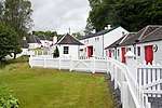 | |||
| Old Faskally Cottage | 56°44′45″N 3°46′13″W | Category C(S) | 47639 | | |||
| Old Faskally Farm | 56°44′52″N 3°46′06″W | Category C(S) | 47640 | | |||
| Straloch House | 56°45′31″N 3°34′39″W | Category B | 47643 | | |||
| Straloch, Talla-Shee, Former Straloch Church Of Scotland | 56°45′25″N 3°33′43″W | Category B | 17696 | | |||
| Atholl Road, Tigh-Na-Geat Including Ancillary Buildings | 56°43′33″N 3°46′29″W | Category C(S) | 47618 | | |||
| Old Faskally House And Gatepiers | 56°44′48″N 3°46′15″W | Category C(S) | 47641 | | |||
| Urrard House Including Walled Garden With Ancillary Building And Gate | 56°44′58″N 3°47′14″W | Category B | 47646 | | |||
| Straloch Bridge Over Allt Fearnach | 56°45′25″N 3°33′18″W | Category C(S) | 19818 | | |||
| Faskally House Including Gatepiers | 56°43′07″N 3°46′14″W | Category B | 17693 | | |||
| Enochdu, Kindrogan Bridge Over River Ardle | 56°44′42″N 3°32′09″W | Category C(S) | 17697 | | |||
| Davan, The Old Mill | 56°45′14″N 3°34′22″W | Category C(S) | 47624 | | |||
| Middleton Of Fonab Steading Including Gatepiers | 56°41′38″N 3°44′05″W | Category B | 47637 | | |||
| Orchilmore Farm, Cottage | 56°45′06″N 3°46′27″W | Category B | 47642 | | |||
| Tummel Garry Hydro Electric Scheme, Clunie Dam | 56°43′15″N 3°49′29″W | Category B | 51713 | | |||
| Coronation Bridge | 56°43′13″N 3°47′38″W | Category C(S) | 47622 | | |||
| Middleton Of Fonab Farmhouse Including Ancillary Building | 56°41′39″N 3°44′03″W | Category C(S) | 47636 | |
Key
The scheme for classifying buildings in Scotland is:
- Category A: "buildings of national or international importance, either architectural or historic; or fine, little-altered examples of some particular period, style or building type."[1]
- Category B: "buildings of regional or more than local importance; or major examples of some particular period, style or building type, which may have been altered."[1]
- Category C: "buildings of local importance; lesser examples of any period, style, or building type, as originally constructed or moderately altered; and simple traditional buildings which group well with other listed buildings."[1]
In March 2016 there were 47,288 listed buildings in Scotland. Of these, 8% were Category A, and 50% were Category B, with the remaining 42% being Category C.[2]
Notes
- Sometimes known as OSGB36, the grid reference (where provided) is based on the British national grid reference system used by the Ordnance Survey.
• "Guide to National Grid". Ordnance Survey. Retrieved 2007-12-12.
• "Get-a-map". Ordnance Survey. Retrieved 2007-12-17. - Historic Environment Scotland assign a unique alphanumeric identifier to each designated site in Scotland, for listed buildings this always begins with "LB", for example "LB12345".
gollark: it will be, initiating apiotransference?
gollark: +>inv
gollark: +>eval games.devtest.elements["[REDACTED]"] = 4
gollark: +>eval games.devtest.elements["[REDACTED]"]
gollark: +>eval Object.keys(games.devtest)
References
- All entries, addresses and coordinates are based on data from Historic Scotland. This data falls under the Open Government Licence
- "What is Listing?". Historic Environment Scotland. Retrieved 29 May 2018.
- Scotland's Historic Environment Audit 2016 (PDF). Historic Environment Scotland and the Built Environment Forum Scotland. pp. 15–16. Retrieved 29 May 2018.
This article is issued from Wikipedia. The text is licensed under Creative Commons - Attribution - Sharealike. Additional terms may apply for the media files.