List of listed buildings in Errol, Perth and Kinross
List
| Name | Location | Date Listed | Grid Ref. [note 1] | Geo-coordinates | Notes | LB Number [note 2] | Image |
|---|---|---|---|---|---|---|---|
| Errol Village, The Cross, Market Cross And Water Fountain | 56°23′29″N 3°12′55″W | Category B | 11592 |  | |||
| Errol Village, Church Lane, Former Free Church, (Sanfina Uk Ltd) | 56°23′31″N 3°12′44″W | Category C(S) | 11595 | | |||
| Glendoick House, South East Lodge Including Gatepier | 56°23′33″N 3°16′31″W | Category C(S) | 10975 | | |||
| Errol Village, High Street, Ardyne Including Boundary Wall And Gate | 56°23′27″N 3°12′59″W | Category C(S) | 48167 | | |||
| Errol Village, Station Road, Appleton House Including Ancillary Building, Boundary Walls, Gatepiers And Gates | 56°23′34″N 3°12′37″W | Category B | 48175 | | |||
| Errol Village, 1, 2 And 3 Taybank Place, Taybank Stables, Including Ancillary Building And Gates | 56°23′38″N 3°12′31″W | Category C(S) | 48178 | | |||
| Glendoick, School And Schoolhouse | 56°23′40″N 3°16′27″W | Category C(S) | 48179 | | |||
| Muirhouses Steading Including Boundary Walls | 56°24′35″N 3°10′49″W | Category B | 48187 | | |||
| Sandyhall Farmhouse With Horsemill And Steading | 56°23′49″N 3°16′32″W | Category B | 48193 | | |||
| Errol Village, 1 - 6 (Inclusive Nos) High Street, Kiersland | 56°23′28″N 3°13′02″W | Category B | 11594 | | |||
| Errol Park Stables | 56°23′25″N 3°13′15″W | Category A | 11599 | | |||
| Newbigging Dovecot | 56°24′47″N 3°11′37″W | Category B | 11602 | | |||
| Megginch Castle, Icehouse | 56°24′31″N 3°13′55″W | Category B | 10966 | | |||
| Errol Park, Folly (Troy) | 56°23′14″N 3°13′20″W | Category B | 48158 | | |||
| Errol Village, 1 And 2 Croft Terrace Including Boundary Walls And Gates | 56°23′25″N 3°12′51″W | Category C(S) | 48165 | | |||
| Megginch Castle, Kingdom Farmhouse | 56°24′40″N 3°13′55″W | Category B | 48184 | | |||
| Muirhouses Farmhouse Including Boundary Walls | 56°24′34″N 3°10′48″W | Category C(S) | 48186 | | |||
| Seasyde, Walled Garden | 56°24′19″N 3°09′53″W | Category C(S) | 48196 | | |||
| Glendoick House, Dovecot | 56°23′36″N 3°16′49″W | Category B | 13727 | | |||
| Errol Village, North Bank Dykes, Community Centre (Former Female Industrial School) Including Boundary Walls, Gatepiers And Gates | 56°23′34″N 3°12′41″W | Category B | 11590 | | |||
| Errol Station Old Station Including Footbridge And Fencing | 56°24′26″N 3°12′40″W | Category B | 11600 | | |||
| South Inchmichael | 56°24′46″N 3°13′12″W | Category C(S) | 11601 | | |||
| Flatfield Farmhouse And Garden Walls | 56°24′32″N 3°15′07″W | Category B | 10959 | | |||
| Flatfield Steading | 56°24′33″N 3°15′08″W | Category B | 10960 | | |||
| Megginch Castle, Stables, Dovecot, Screen Walls And Gatepiers | 56°24′29″N 3°13′51″W | Category A | 10964 | | |||
| Mansefield (Former Manse) | 56°23′12″N 3°16′39″W | Category C(S) | 10974 | | |||
| Chapelhill, Learig And Viewfield | 56°22′37″N 3°17′13″W | Category B | 10979 | | |||
| Errol Park, West Lodge Including Kennels | 56°23′07″N 3°13′49″W | Category B | 48163 | | |||
| Errol Village, 1 - 3 (Inclusive Nos) Church Avenue And Station Road Including Gatepier, Boundary Walls And Railings | 56°23′33″N 3°12′43″W | Category C(S) | 48164 | | |||
| Myreside Including Boundary Walls | 56°24′29″N 3°15′53″W | Category C(S) | 48191 | | |||
| Ross Steading And Horsemill | 56°23′02″N 3°16′49″W | Category B | 48192 | | |||
| Waterybutts House Including Boundary Wall And Gatepiers | 56°25′10″N 3°10′37″W | Category C(S) | 48202 | | |||
| West Leys Steading | 56°24′10″N 3°12′07″W | Category B | 48203 | | |||
| Errol Village, High Street, Commercial Hotel | 56°23′31″N 3°12′51″W | Category C(S) | 11596 | | |||
| Waterybutts Dovecot | 56°25′12″N 3°10′27″W | Category B | 11607 | | |||
| Pitroddie, Old Manse And Former Secession Church Including Boundary Walls | 56°24′26″N 3°15′51″W | Category B | 10961 | | |||
| Megginch Castle, Kennels Cottage | 56°24′32″N 3°13′53″W | Category C(S) | 10967 | | |||
| Megginch Castle, North Lodges And Gatepiers | 56°24′38″N 3°14′30″W | Category A | 10969 | 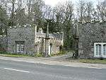 | |||
| Errol Park, South Lodge Including Gatepiers | 56°23′15″N 3°13′27″W | Category C(S) | 10973 | | |||
| Chapelhill, Chance Inn | 56°22′39″N 3°17′05″W | Category C(S) | 10977 | | |||
| East Inchmichael Farmhouse And Former Chapel Including Ancillary Building, Gatepiers And Boundary Walls | 56°24′51″N 3°12′59″W | Category B | 48154 | | |||
| Errol Village, High Street, Albert House | 56°23′28″N 3°12′57″W | Category B | 48166 | | |||
| Errol Village, North Bank Dykes, The Birks Including Ancillary Building, Boundary Walls And Gates | 56°23′32″N 3°12′58″W | Category C(S) | 48170 | | |||
| Megginch Castle, Wardheads | 56°24′18″N 3°13′14″W | Category C(S) | 48185 | | |||
| Sparrowmuir Cottage | 56°22′59″N 3°16′31″W | Category C(S) | 48197 | | |||
| Hill Of Errol Farmhouse | 56°22′33″N 3°14′56″W | Category C(S) | 13728 | | |||
| Errol Village, School Wynd, Old Churchyard Including Boundary Walls | 56°23′30″N 3°12′46″W | Category B | 13772 | | |||
| Seasyde House | 56°24′22″N 3°09′45″W | Category A | 11605 | | |||
| Megginch Castle, West Lodge And Gatepiers | 56°24′27″N 3°14′05″W | Category C(S) | 10970 | | |||
| Errol Village, School Wynd, 1-5 (Inclusive Nos) Argyle House (Former Schoolhouse And School) | 56°23′30″N 3°12′48″W | Category C(S) | 10976 | | |||
| Clashbenny Farm Cottages | 56°22′43″N 3°16′17″W | Category C(S) | 48153 | | |||
| Errol Park, Boundary Walls | 56°23′28″N 3°13′05″W | Category C(S) | 48155 | | |||
| Errol Park, Walled Garden Including Gatepiers, Gates And Ancillary Buildings | 56°23′24″N 3°13′21″W | Category B | 48161 | | |||
| Errol Village, High Street, Victoria Hall Including Boundary Walls | 56°23′28″N 3°12′57″W | Category C(S) | 48168 | | |||
| Inchmartine, Walled Garden Including Gatepiers | 56°26′15″N 3°11′53″W | Category C(S) | 48183 | | |||
| Murie Walled Garden Including Gatepiers And Ancillary Buildings | 56°23′20″N 3°14′14″W | Category C(S) | 48190 | | |||
| Errol Village, North Bank Dykes, Errol (Church Of Scotland) Parish Church Including Boundary Walls And Gatepiers | 56°23′35″N 3°12′44″W | Category A | 11589 | 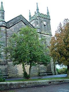 | |||
| Errol Village, High Street, Dalgleish House Including Ancillary Buildings, Boundary Walls And Gatepiers | 56°23′28″N 3°12′59″W | Category B | 11593 | | |||
| Inchmartine Coach House And Dovecot With Former Chapel | 56°26′22″N 3°11′48″W | Category B | 11610 | | |||
| Westown, Kirk Of The Blessed Virgin Of Inchmartine | 56°26′00″N 3°13′08″W | Category C(S) | 10957 | | |||
| Megginch Castle And Garden Structures | 56°24′27″N 3°13′48″W | Category A | 10963 | | |||
| Megginch Castle, Chapel | 56°24′23″N 3°14′00″W | Category B | 10968 | | |||
| Errol Park, East Lodge | 56°23′27″N 3°13′02″W | Category C(S) | 48156 | | |||
| Errol Park, West Gate With Quadrant Walls, Railings And Gates | 56°23′07″N 3°13′46″W | Category B | 48162 | | |||
| Errol Village, Station Road, Primary School Including Ancillary Buildings, Boundary Walls And Gatepiers | 56°23′37″N 3°12′35″W | Category B | 48176 | | |||
| Errol Park House | 56°23′23″N 3°13′13″W | Category A | 11598 | 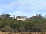 | |||
| Middlebank Farmhouse Including Ancillary Building, Boundary Walls, Gatepiers And Gates | 56°25′58″N 3°12′20″W | Category B | 10955 | | |||
| Fingask, South Lodge Including Railings | 56°25′24″N 3°13′28″W | Category B | 10958 | | |||
| Megginch Castle, The Long Walk, Gothic Arch Including Boundary Walls And Gatepiers | 56°24′23″N 3°14′16″W | Category C(S) | 10971 | | |||
| Errol Park, Steading With Cottage | 56°23′31″N 3°13′19″W | Category B | 48160 | | |||
| Errol Village, High Street, Library Buildings | 56°23′30″N 3°12′54″W | Category C(S) | 48169 | | |||
| Errol Village, North Bank Dykes, The White House Including Walled Garden, Courtyard Walls And Gatepiers | 56°23′37″N 3°12′55″W | Category C(S) | 48171 | | |||
| Murie Cemetery Including Boundary Walls, Gatepiers And Gates | 56°23′04″N 3°14′18″W | Category C(S) | 48188 | | |||
| Seasyde Coach House Including Boundary Walls | 56°24′22″N 3°09′55″W | Category C(S) | 48194 | | |||
| Inchmartine House | 56°26′21″N 3°11′52″W | Category A | 13773 | | |||
| Errol Station, Signal Box | 56°24′26″N 3°12′40″W | Category B | 11603 | | |||
| Port Allen Farm Gatepiers | 56°22′40″N 3°12′55″W | Category C(S) | 11606 | | |||
| Port Allen Farm Horsemill And Steading | 56°22′39″N 3°12′54″W | Category B | 11608 | | |||
| Inchmartine, Ice House | 56°26′10″N 3°11′46″W | Category C(S) | 11609 | | |||
| The Horn Farmhouse And Steading | 56°25′17″N 3°13′13″W | Category B | 10956 | | |||
| Megginch Castle, Walled Gardens | 56°24′31″N 3°13′49″W | Category B | 10965 | | |||
| Ardgaith, Craigie Burial Enclosure | 56°23′15″N 3°15′56″W | Category C(S) | 10972 | | |||
| Clashbenny Farmhouse Including Terraced Garden, Boundary Walls And Gates | 56°22′30″N 3°16′02″W | Category C(S) | 10980 | | |||
| Errol Park, East Lodge Gates And Gatepiers | 56°23′27″N 3°13′02″W | Category B | 48157 | | |||
| Errol Park, Gardener's Cottage | 56°23′24″N 3°13′26″W | Category C(S) | 48159 | | |||
| Errol Village, St Madoes Road, Park Cottage | 56°23′26″N 3°12′58″W | Category C(S) | 48172 | | |||
| Errol Village, School Wynd, Grey House | 56°23′30″N 3°12′50″W | Category C(S) | 48174 | | |||
| Errol Village, Station Road And North Bank Dykes, The Schoolhouse (Former Female Industrial School) Including Boundary Walls | 56°23′34″N 3°12′41″W | Category B | 48177 | | |||
| Inchcoonans Road, Errol Brick Company Brick Stacks And Kilns | 56°23′46″N 3°14′06″W | Category B | 48180 | | |||
| Murie Cross | 56°23′15″N 3°14′46″W | Category C(S) | 48189 | | |||
| Seasyde, Lodge House Including Ancillary Building | 56°24′24″N 3°09′55″W | Category C(S) | 48195 | |
Key
The scheme for classifying buildings in Scotland is:
- Category A: "buildings of national or international importance, either architectural or historic; or fine, little-altered examples of some particular period, style or building type."[1]
- Category B: "buildings of regional or more than local importance; or major examples of some particular period, style or building type, which may have been altered."[1]
- Category C: "buildings of local importance; lesser examples of any period, style, or building type, as originally constructed or moderately altered; and simple traditional buildings which group well with other listed buildings."[1]
In March 2016 there were 47,288 listed buildings in Scotland. Of these, 8% were Category A, and 50% were Category B, with the remaining 42% being Category C.[2]
Notes
- Sometimes known as OSGB36, the grid reference (where provided) is based on the British national grid reference system used by the Ordnance Survey.
• "Guide to National Grid". Ordnance Survey. Retrieved 2007-12-12.
• "Get-a-map". Ordnance Survey. Retrieved 2007-12-17. - Historic Environment Scotland assign a unique alphanumeric identifier to each designated site in Scotland, for listed buildings this always begins with "LB", for example "LB12345".
gollark: Ah, but if you want to just destroy the Earth by splitting it into unreasonably small pieces, you just need enough antimatter to overcome the gravitational binding energy.
gollark: Destroying (well, damaging in the longish run) human civilization, yes, that's quite easy, but the *Earth*?
gollark: Global warming is ALSO not destroying the Earth. The Earth is very hard to destroy.
gollark: It's described in terms of maths. I can't randomly conjure physical laws into existence by mathematically describing them.
gollark: > I think I will use politicians -- oh, wait, that's already happening.Politicians are NOT destroying the Earth. That would require directed and focused effort.
References
- All entries, addresses and coordinates are based on data from Historic Scotland. This data falls under the Open Government Licence
- "What is Listing?". Historic Environment Scotland. Retrieved 29 May 2018.
- Scotland's Historic Environment Audit 2016 (PDF). Historic Environment Scotland and the Built Environment Forum Scotland. pp. 15–16. Retrieved 29 May 2018.
This article is issued from Wikipedia. The text is licensed under Creative Commons - Attribution - Sharealike. Additional terms may apply for the media files.