List of listed buildings in Crieff, Perth and Kinross
List
| Name | Location | Date Listed | Grid Ref. [note 1] | Geo-coordinates | Notes | LB Number [note 2] | Image |
|---|---|---|---|---|---|---|---|
| 85 And 87 East High Street (Known As 81), Tower Hotel Including Boundary Walls | 56°22′23″N 3°50′04″W | Category B | 23486 |  | |||
| 1-5 (Odd Nos) Hill Street And High Street | 56°22′23″N 3°50′25″W | Category B | 23491 | | |||
| 1-7 (Inclusive Nos) Burrell Square Including Railings | 56°22′26″N 3°50′43″W | Category C(S) | 23502 | | |||
| Innerpeffray Library | 56°20′41″N 3°46′42″W | Category A | 5792 | 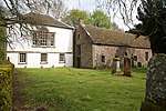 | |||
| Monzie Parish Church, Gatepiers To Churchyard | 56°24′14″N 3°49′06″W | Category B | 5774 | | |||
| Monzie Bridge Over Shaggie Burn | 56°24′16″N 3°49′09″W | Category C(S) | 5777 | | |||
| Broich House | 56°21′43″N 3°50′34″W | Category B | 5788 | | |||
| 13 And 15 Commissioner Street | 56°22′15″N 3°50′28″W | Category C(S) | 48439 | | |||
| Comrie Road, Dalvreck Bridge Over The Turret Burn | 56°23′01″N 3°51′10″W | Category C(S) | 48444 | | |||
| Comrie Road And Gordon Road, Hawkshaw And Merlin Cottage Including Terrace Walls, Cart Arch And Boundary Walls | 56°22′35″N 3°50′39″W | Category B | 48447 | | |||
| Comrie Road, Leven House Hotel Including Boundary Walls | 56°22′29″N 3°50′37″W | Category B | 48448 | | |||
| Ferntower Road, Knowehead House Including Terraced Garden With Sundial, Boundary Walls, Gatepiers And Gates | 56°22′44″N 3°49′57″W | Category B | 48465 | | |||
| Ferntower Road, Morrison's Academy Gatepiers, Gates And Boundary Walls | 56°22′26″N 3°50′24″W | Category B | 48467 | | |||
| James Square, Jubilee Lamps | 56°22′23″N 3°50′28″W | Category B | 48488 | | |||
| Macrosty Park Boundary Walls, Gatepiers, Railings And Gates | 56°22′45″N 3°50′54″W | Category C(S) | 48495 | | |||
| Perth Road, St Columba's Scottish Episcopal Church War Memorial, Gatepiers, Gates And Boundary Walls | 56°22′29″N 3°49′59″W | Category C(S) | 48498 | | |||
| 49-57 (Odd Nos) King Street And 51-59 (Odd Nos) Commissioner Street | 56°22′19″N 3°50′34″W | Category B | 23497 | | |||
| Ferntower Road, St Andrews Halls Including Boundary Walls, Gatepiers And Gates | 56°22′32″N 3°50′14″W | Category B | 23514 | | |||
| Perth Road, Ferntower Lodge Including Gatepiers And Boundary Walls | 56°22′47″N 3°49′38″W | Category B | 23516 | | |||
| 1 And 2 Dallerie Road, The Limes | 56°22′19″N 3°51′07″W | Category B | 23521 | | |||
| Innerpeffray Churchyard | 56°20′41″N 3°46′40″W | Category B | 5745 | | |||
| Monzie Parish Church | 56°24′15″N 3°49′05″W | Category B | 5773 | | |||
| C. S. Todd Monzie Manse (No Longer Used As Such And Known As 'The Old Manse': | 56°24′14″N 3°49′09″W | Category B | 5778 | | |||
| Innerpeffray Collegiate Church Of The Blessed Virgin | 56°20′41″N 3°46′41″W | Category A | 5791 | 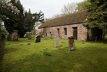 | |||
| Broich Road, Duchlage | 56°22′04″N 3°50′33″W | Category B | 48425 | | |||
| 42-46 (Even Nos) Burrell Street | 56°22′18″N 3°50′45″W | Category C(S) | 48435 | | |||
| 66 Burrell Street | 56°22′13″N 3°50′48″W | Category C(S) | 48436 | | |||
| Comrie Road, Glengyle Including Boundary Walls, Gatepiers And Gates | 56°22′39″N 3°50′47″W | Category C(S) | 48445 | | |||
| Comrie Road, Gwydyr House Hotel Including Boundary Walls And Gatepiers | 56°22′42″N 3°50′43″W | Category C(S) | 48446 | | |||
| Ferntower Road, Larchgrove Including Boundary Walls And Gates | 56°22′39″N 3°50′06″W | Category B | 48466 | | |||
| 7 - 15 A And B (Odd Nos) Galvelmore Street | 56°22′22″N 3°50′38″W | Category C(S) | 48473 | | |||
| 7 High Street | 56°22′22″N 3°50′26″W | Category C(S) | 48475 | | |||
| 35 James Square, Strathearn Tower | 56°22′23″N 3°50′31″W | Category C(S) | 48485 | | |||
| Perth Road And Rectory Road, The Old Rectory And Rectory Cottage Including Boundary Walls, Gatepiers And Gates | 56°22′31″N 3°49′59″W | Category B | 48497 | | |||
| West High Street, Clydesdale Bank With 28-30 (Even Nos), And 2 Galvelmore Street | 56°22′24″N 3°50′34″W | Category B | 48503 | | |||
| Church Street, Crieff Community Hall, Former St Michael's Parish Church | 56°22′20″N 3°50′17″W | Category B | 23481 | | |||
| Lodge Street, Masonic Lodge With 2 And 4 Comrie Street And Library | 56°22′26″N 3°50′36″W | Category B | 23500 | | |||
| 8 And 9 Burrell Square | 56°22′26″N 3°50′43″W | Category C(S) | 23503 | | |||
| 12 A, B,C & D Burrell Street | 56°22′27″N 3°50′40″W | Category C(S) | 23505 | | |||
| Drummond Terrace, Roundelwood Health Spa Including Boundary Walls With Gatepiers | 56°22′50″N 3°50′47″W | Category B | 23511 | 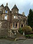 | |||
| Strathearn Terrace, St Michael's Church Of Scotland Parish Church Including Boundary Walls, Gatepiers, Gates And Lamps | 56°22′32″N 3°50′10″W | Category B | 23513 | | |||
| 147 And 151 King Street, 84 And 86 Burrell Street, 1 And 3 Gallowhill | 56°22′10″N 3°50′48″W | Category C(S) | 23520 | | |||
| Innerpeffray Castle | 56°20′26″N 3°46′24″W | Category B | 5746 |  | |||
| Monzie Churchyard | 56°24′14″N 3°49′06″W | Category C(S) | 5775 | | |||
| 'Old Roman Bridge' Over Shaggie Burn, Monzie | 56°24′16″N 3°49′08″W | Category C(S) | 5776 | | |||
| Monzie Castle, Mid-Lodge Over Keltie Burn | 56°23′51″N 3°50′16″W | Category B | 5784 | | |||
| Innerpeffray School | 56°20′41″N 3°46′37″W | Category C(S) | 5790 | | |||
| Broich Terrace, Gowrie House Including Boundary Walls And Gatepiers | 56°22′12″N 3°50′17″W | Category B | 48426 | | |||
| 2 Coldwells Road, Dalknock | 56°22′27″N 3°50′34″W | Category C(S) | 48437 | | |||
| Connaught Terrace, Tighmonadh Including Gatepiers And Boundary Walls | 56°22′43″N 3°49′50″W | Category C(S) | 48454 | | |||
| 77 - 83 (Odd Nos) East High Street | 56°22′23″N 3°50′05″W | Category B | 48460 | | |||
| 74 East High Street | 56°22′23″N 3°50′07″W | Category C(S) | 48461 | | |||
| High Street, Post Office | 56°22′21″N 3°50′20″W | Category B | 48479 | | |||
| High Street, Provost's Lamp | 56°22′22″N 3°50′18″W | Category C(S) | 48480 | | |||
| King Street, Police Station Including Boundary Walls, Gatepiers, Gates And Railings | 56°22′21″N 3°50′32″W | Category B | 48493 | | |||
| Perth Road, Keppoch House Hotel Including Boundary Walls, Gatepiers And Railings | 56°22′38″N 3°49′54″W | Category C(S) | 48496 | | |||
| 32 West High Street, Strathearn Gallery | 56°22′24″N 3°50′35″W | Category C(S) | 48504 | | |||
| 14 And 15 Burrell Square | 56°22′25″N 3°50′41″W | Category C(S) | 23504 | | |||
| Ferntower Road, Morrison's Academy, Old School Building | 56°22′30″N 3°50′26″W | Category B | 23510 | | |||
| Ewanfield, Crieff Hydro Hotel Including Gatepiers And Boundary Walls | 56°22′47″N 3°50′16″W | Category B | 23512 |  | |||
| Faichney Monument, Innerpeffray Churchyard | 56°20′41″N 3°46′41″W | Category B | 5793 | | |||
| Monzie Castle, West Lodge | 56°23′48″N 3°50′38″W | Category B | 5785 | | |||
| Inchbrakie Bower, Abercairny | 56°22′37″N 3°46′56″W | Category B | 5789 | | |||
| Broich Terrace, And Pittenzie Road, Old St Michael's And Manse Cottage Including Boundary Walls, Gatepiers And Gates | 56°22′12″N 3°50′11″W | Category B | 48428 | | |||
| Coldwells Road, Bute Cottage | 56°22′28″N 3°50′31″W | Category C(S) | 48438 | | |||
| Comrie Road, War Memorial With Boundary Walls, Railings And Gate | 56°22′29″N 3°50′39″W | Category B | 48453 | | |||
| Ewanfield, Crieff Hydro Hotel, Leigh Annex | 56°22′47″N 3°50′22″W | Category B | 48464 | | |||
| Ferntower Road, Morrison's Academy Lodge | 56°22′26″N 3°50′24″W | Category B | 48468 | | |||
| Ford Road, St Fillans Catholic Church And Presbytery | 56°22′07″N 3°51′00″W | Category B | 48471 | | |||
| 9 And 11 High Street | 56°22′22″N 3°50′26″W | Category C(S) | 48476 | | |||
| 19, 19A And 19B High Street | 56°22′22″N 3°50′24″W | Category C(S) | 48478 | | |||
| King Street, Kingdom Hall Of Jehovah's Witnesses | 56°22′20″N 3°50′30″W | Category C(S) | 48491 | | |||
| 10 Strathearn Terrace, Croftweit Including Boundary Walls, Gatepiers And Gates | 56°22′26″N 3°50′10″W | Category B | 48499 | | |||
| 89 And 91 East High Street | 56°22′24″N 3°50′03″W | Category B | 23487 | | |||
| High Street, The Bank Restaurant, Former British Linen Bank | 56°22′22″N 3°50′22″W | Category A | 23489 | .jpg) | |||
| 115 King Street | 56°22′13″N 3°50′44″W | Category B | 23499 | | |||
| Perth Road, Old Schoolhouse And Royal British Legion Hall, Former Taylor's Institute Including Gatepiers, Boundary Walls, Railings And Gate | 56°22′28″N 3°50′00″W | Category B | 23518 | | |||
| Monzie Castle, Icehouse | 56°23′54″N 3°49′42″W | Category C(S) | 5781 | | |||
| Monzie Castle, Bridge On East Drive Over Shaggie Burn | 56°23′59″N 3°49′21″W | Category C(S) | 5782 | | |||
| Craigentor, Gilmerton | 56°23′36″N 3°48′23″W | Category B | 5787 | | |||
| Ancaster Road, Newstead Including Boundary Walls And Gatepiers | 56°22′46″N 3°50′38″W | Category C(S) | 48423 | | |||
| Ardvreck School Including Sanatorium | 56°23′00″N 3°50′47″W | Category B | 48424 | | |||
| 34 Burrell Street | 56°22′22″N 3°50′43″W | Category C(S) | 48432 | | |||
| 40 Burrell Street | 56°22′19″N 3°50′44″W | Category B | 48434 | | |||
| 44 Commissioner Street | 56°22′16″N 3°50′32″W | Category B | 48441 | | |||
| 62-68 (Even Nos) Commissioner Street And 72 King Street, Commercial Place | 56°22′18″N 3°50′34″W | Category C(S) | 48442 | | |||
| Commissioner Street, Crieff Primary School Dining Hall, Former United Presbyterian Church, Including Boundary Walls And Railings | 56°22′13″N 3°50′25″W | Category C(S) | 48443 | | |||
| 32 Drummond Terrace, St Oswald's Including Boundary Walls, Gatepiers And Gates | 56°22′43″N 3°50′36″W | Category C(S) | 48458 | | |||
| Ewanfield, Crieff Hydro Hotel, East Lodge House Including Boundary Walls | 56°22′46″N 3°50′05″W | Category C(S) | 48463 | | |||
| Ferntower Road, Morrison's Academy Music Department | 56°22′32″N 3°50′24″W | Category C(S) | 48469 | | |||
| High Street, The Pretoria | 56°22′22″N 3°50′17″W | Category C(S) | 48481 | | |||
| 36 James Square | 56°22′23″N 3°50′31″W | Category C(S) | 48486 | | |||
| 60 And 62 King Street And 45 And 47 Commissioner Street | 56°22′18″N 3°50′33″W | Category B | 48490 | | |||
| Victoria Terrace, Benheath Including Boundary Walls, Gatepiers And Gates | 56°22′37″N 3°50′32″W | Category C(S) | 48501 | | |||
| Broich Terrace, Inchglas Including Boundary Walls And Gatepiers | 56°22′13″N 3°50′19″W | Category A | 23488 | | |||
| 14 Burrell Street | 56°22′24″N 3°50′41″W | Category C(S) | 23506 | | |||
| 62 And 64 Burrell Street | 56°22′14″N 3°50′48″W | Category B | 23507 | | |||
| Comrie Street, Old South Church, Antique Galleries Including Mission Hall, Boundary Walls, Railings, Gatepiers And Gates | 56°22′29″N 3°50′36″W | Category A | 23509 | | |||
| South Bridgend, Mill House Including Boundary Walls And Gate | 56°21′54″N 3°51′06″W | Category B | 23524 | | |||
| Monzie Castle, Walled Garden | 56°23′55″N 3°49′40″W | Category C(S) | 5780 | | |||
| Dalvreck Bridge Over Turret Burn | 56°23′01″N 3°51′10″W | Category C(S) | 5786 | | |||
| 41 Burrell Street Including Boundary Walls | 56°22′20″N 3°50′46″W | Category C(S) | 48429 | | |||
| 43 Burrell Street Including Boundary Walls | 56°22′20″N 3°50′46″W | Category C(S) | 48430 | | |||
| 45 Burrell Street, Sauchie Cottage Including Boundary Walls And Railings | 56°22′19″N 3°50′46″W | Category B | 48431 | | |||
| 42 Commissioner Street With Lamp Standard | 56°22′16″N 3°50′31″W | Category B | 48440 | | |||
| 39 Drummond Terrace, Tom-An-Oir Including Boundary Walls And Gatepiers | 56°22′48″N 3°50′39″W | Category C(S) | 48456 | | |||
| 41 Drummond Terrace, Castellar Including Boundary Walls And Gatepiers | 56°22′50″N 3°50′42″W | Category C(S) | 48457 | | |||
| Earnbank Road, Earnbank House Including Ancillary Building, Boundary Walls, Gatepiers And Gates | 56°22′06″N 3°51′03″W | Category C(S) | 48459 | | |||
| 1 Galvelmore Street, Bank Of Scotland Including Boundary Walls | 56°22′24″N 3°50′36″W | Category B | 48472 | | |||
| Galvelmore Street, Galvelmore House Including Boundary Walls | 56°22′23″N 3°50′37″W | Category C(S) | 48474 | | |||
| 13, 15 And 17 High Street | 56°22′22″N 3°50′25″W | Category C(S) | 48477 | | |||
| 29-31 (Inclusive Nos) James Square, The Golf Company | 56°22′21″N 3°50′28″W | Category C(S) | 48483 | | |||
| James Square, North Bank Buildings | 56°22′22″N 3°50′30″W | Category B | 48484 | | |||
| 37 - 39 (Inclusive Nos) James Square | 56°22′23″N 3°50′30″W | Category C(S) | 48487 | | |||
| King Street, Market Park | 56°22′09″N 3°50′42″W | Category C(S) | 48492 | | |||
| Macrosty Park, Bandstand | 56°22′45″N 3°51′02″W | Category B | 48494 | | |||
| Turretbank Road, West March Including Priest's Walk | 56°22′37″N 3°51′05″W | Category C(S) | 48500 | | |||
| Church Street, St Michael's Churchyard Including Boundary Walls And Gatepiers | 56°22′20″N 3°50′18″W | Category C(S) | 23482 | | |||
| Church Street, Ruberslaw House Including Boundary Walls And Railings | 56°22′18″N 3°50′18″W | Category B | 23483 | | |||
| High Street, Tourist Information Centre, Former Town Hall, Cross Of Burgh Of Regality Of Drummond | 56°22′22″N 3°50′23″W | Category B | 23485 | | |||
| 15 And 17 James Square, Royal Bank Of Scotland And Drummond Arms Hotel | 56°22′24″N 3°50′27″W | Category B | 23492 | | |||
| 9 - 13 (Inclusive Nos) James Square, Ancaster Studios | 56°22′24″N 3°50′28″W | Category C(S) | 23494 | | |||
| Burrell Square, Stone Lamp Standard And Holder | 56°22′26″N 3°50′41″W | Category B | 23501 | | |||
| Monzie Castle | 56°23′57″N 3°49′35″W | Category A | 5779 | 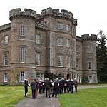 | |||
| Monzie Castle, East Lodge | 56°23′45″N 3°48′35″W | Category B | 5783 | 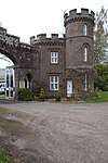 | |||
| 76 East High Street | 56°22′24″N 3°50′07″W | Category C(S) | 48462 | | |||
| Ford Road, Cemetery Including Triumphal Arches, Boundary Walls, Gatepiers, Gates And Fountain | 56°22′12″N 3°51′01″W | Category C(S) | 48470 | | |||
| James Square, Murray Fountain | 56°22′23″N 3°50′28″W | Category B | 48489 | | |||
| 26 West High Street | 56°22′24″N 3°50′34″W | Category C(S) | 48502 | | |||
| High Street, Tourist Information Centre, Former Town Hall | 56°22′21″N 3°50′22″W | Category B | 23484 | | |||
| 7 And 8 James Square, Waverley Hotel | 56°22′24″N 3°50′29″W | Category C(S) | 23495 | | |||
| 4, 5 And 6 James Square, Glenburn Hotel | 56°22′24″N 3°50′29″W | Category C(S) | 23496 | | |||
| Bridge Of Turret | 56°22′39″N 3°51′06″W | Category C(S) | 23519 | | |||
| Crieff Bridge Over River Earn | 56°22′00″N 3°51′08″W | Category B | 23522 | | |||
| 36 Burrell Street, Meadow Inn | 56°22′21″N 3°50′43″W | Category C(S) | 48433 | | |||
| Dollerie Terrace, Walton Lodge Including Boundary Walls, Gate And Railings | 56°22′26″N 3°49′54″W | Category C(S) | 48455 | |
Key
The scheme for classifying buildings in Scotland is:
- Category A: "buildings of national or international importance, either architectural or historic; or fine, little-altered examples of some particular period, style or building type."[1]
- Category B: "buildings of regional or more than local importance; or major examples of some particular period, style or building type, which may have been altered."[1]
- Category C: "buildings of local importance; lesser examples of any period, style, or building type, as originally constructed or moderately altered; and simple traditional buildings which group well with other listed buildings."[1]
In March 2016 there were 47,288 listed buildings in Scotland. Of these, 8% were Category A, and 50% were Category B, with the remaining 42% being Category C.[2]
Notes
- Sometimes known as OSGB36, the grid reference (where provided) is based on the British national grid reference system used by the Ordnance Survey.
• "Guide to National Grid". Ordnance Survey. Retrieved 12 December 2007.
• "Get-a-map". Ordnance Survey. Retrieved 17 December 2007. - Historic Environment Scotland assign a unique alphanumeric identifier to each designated site in Scotland, for listed buildings this always begins with "LB", for example "LB12345".
gollark: Emoji harvesting.
gollark: <:rust_code:747529842999689298>
gollark: <:idk:792409978111131668>
gollark: https://discordapp.com/oauth2/authorize?&client_id=235088799074484224&scope=bot&permissions=0
gollark: https://discordapp.com/oauth2/authorize?&client_id=432069474858958848&scope=bot&permissions=0
References
- All entries, addresses and coordinates are based on data from Historic Scotland. This data falls under the Open Government Licence
- "What is Listing?". Historic Environment Scotland. Retrieved 29 May 2018.
- Scotland's Historic Environment Audit 2016 (PDF). Historic Environment Scotland and the Built Environment Forum Scotland. pp. 15–16. Retrieved 29 May 2018.
This article is issued from Wikipedia. The text is licensed under Creative Commons - Attribution - Sharealike. Additional terms may apply for the media files.