Patoka Township, Marion County, Illinois
Patoka Township is located in Marion County, Illinois. As of the 2010 census, its population was 1,038 and it contained 523 housing units.[2]
Patoka Township | |
|---|---|
Township | |
 | |
.svg.png) Location of Illinois in the United States | |
| Coordinates: 38°47′N 89°5′W | |
| Country | United States |
| State | Illinois |
| County | Marion |
| Settled | November 4, 1873 |
| Area | |
| • Total | 34.97 sq mi (90.6 km2) |
| • Land | 34.95 sq mi (90.5 km2) |
| • Water | 0.03 sq mi (0.08 km2) |
| Elevation | 499 ft (152 m) |
| Population (2010) | |
| • Estimate (2016)[1] | 1,009 |
| • Density | 29.7/sq mi (11.5/km2) |
| Time zone | UTC-6 (CST) |
| • Summer (DST) | UTC-5 (CDT) |
| FIPS code | 17-121-58070 |
Geography
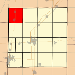
Patoka Township (T4N R1E) is centered at 38°47'N 89°5'W (38.780, -89.086). It is traversed north-south by U.S. Route 51 and east-west by the North Fork of the Kaskaskia River. The city of Patoka is located near the south end of the township. According to the 2010 census, the township has a total area of 34.97 square miles (90.6 km2), of which 34.95 square miles (90.5 km2) (or 99.94%) is land and 0.03 square miles (0.078 km2) (or 0.09%) is water.[2]
Adjacent townships
- Kaskaskia Township, Fayette County (north)
- Wilberton Township, Fayette County (northeast)
- Foster Township (east)
- Tonti Township (southeast)
- Carrigan Township (south)
- East Fork Township, Clinton County (southwest)
- Pope Township, Fayette County (west)
- Pope Township, Fayette County (northwest)
gollark: I was looking at using it for a project, but there seem to be basically no up-to-date libraries for stuff like databases.
gollark: I can!
gollark: ???
gollark: t̨͉͟h̶̟͕ë̬̻́ ̨̠̱d̪ͤ͟e̬͛͋p̰ͧ̇e̙̋͡ń̴́d̷ͪ͑ẹ͊ͪn̹ͦ͐t͔͆ͥ ͉̇͞t̸̪̬y̻̮ͅp̰̀̕e͙̟͟s̲ͯ͞҉̓̑ͦ ̡̗͐D̛͕̽È̞̈P̑ͧͯE̪̜͡Ňͧ̚D̸̃̋E̵͎̤N̶͖ͥṪ̪͉ ̨͓̄T̢̧̹҉͝Y҉̔͒̚P̬̑͗Ȅ͊͏S̞̱̓ ̵͖̄ṃ̳͜ÿ̷͡ ͕̗͚m͏̆̚ì̺ͧn̬̍͊d̷ͧ̊ ͔̺̊ḭ̀͋s̥͒̎ ͈̼ͯg͎̒̕o͑ing THE MADNESS COMES
gollark: Types can appear in values. Values can appear in types. Haskell haskell haskell haskell ha͔sͪk̙e̸l̋l̅
References
- "Population and Housing Unit Estimates". Retrieved June 9, 2017.
- "Population, Housing Units, Area, and Density: 2010 - County -- County Subdivision and Place -- 2010 Census Summary File 1". United States Census. Archived from the original on 2020-02-12. Retrieved 2013-05-28.
- "Census of Population and Housing". Census.gov. Retrieved June 4, 2016.
External links
Municipalities and communities of Marion County, Illinois, United States | ||
|---|---|---|
| Cities | Map of Illinois highlighting Marion County | |
| Villages | ||
| Townships | ||
| Unincorporated communities | ||
| Footnotes | ‡This populated place also has portions in an adjacent county or counties | |

This article is issued from Wikipedia. The text is licensed under Creative Commons - Attribution - Sharealike. Additional terms may apply for the media files.