Glen Rose, Texas
Glen Rose is a city in and the county seat of Somervell County, Texas, United States.[7] As of the 2010 census, the city population was 2,444.
Glen Rose, Texas | |
|---|---|
.jpg) Downtown Glen Rose in 2019 | |
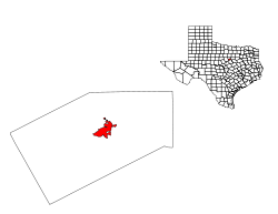
Location of Glen Rose, Texas | |
 | |
| Coordinates: 32°14′12″N 97°45′14″W | |
| Country | United States |
| State | Texas |
| County | Somervell |
| Area | |
| • Total | 3.92 sq mi (10.16 km2) |
| • Land | 3.91 sq mi (10.12 km2) |
| • Water | 0.01 sq mi (0.04 km2) |
| Elevation | 620 ft (189 m) |
| Population | |
| • Total | 2,444 |
| • Estimate (2019)[3] | 2,699 |
| • Density | 690.63/sq mi (266.67/km2) |
| Time zone | UTC-6 (Central (CST)) |
| • Summer (DST) | UTC-5 (CDT) |
| ZIP code | 76043 [4] |
| Area code(s) | 254 (exchanges 897 and 898) |
| FIPS code | 48-29876 [5] |
| GNIS feature ID | 1373854 [6] |
| Website | Official City Website |

History
19th century
The area was first settled in 1849 by Charles Barnard, who opened a trading post near Comanche Peak. After the region became a federal Indian reservation in 1855, Barnard moved his business to Fort Belknap. Circa 1859 when the reservation was abolished, he returned to the area and built the first store on what is now the site of Glen Rose.[8]
A three-story stone gristmill was constructed along the Paluxy River and the town that grew up around it became known as Barnard's Mill.[9] The mill was sold to T.C. Jordan of Dallas in 1871 for $65,000. Jordan's wife, a native of Scotland, decided to rename the town Rose Glen to reflect the area's natural surroundings.[8] The citizens later voted to call the community Glen Rose.[10] A post office opened in 1874.
When Somervell County was formed on March 15, 1875, Glen Rose was designated as its county seat.[10] A Baptist college was organized in 1879 and was later sold to the Paluxy Baptist Association. In 1889, the northern Presbyterians opened Glen Rose Collegiate Institute (also known as Glen Rose College), which remained in operation for the next 15 to 20 years.[11] A courthouse around Glen Rose's town square was completed around 1892, but burned down a year later. A newly built Romanesque Revival style courthouse was constructed soon after with locally quarried limestone.[9] That building sustained damage in a 1902 tornado that also damaged part of the town square.
20th century
Throughout the period from the 1900s to the 1920s, Glen Rose was home to approximately 1,000 people. The area's mineral springs attracted numerous doctors and self-styled healers to the community. During Prohibition, the area was a center of moonshining and Glen Rose became known as the "whiskey woods capital of the state."[8] The population remained steady during the Great Depression, although unemployment rates in both Glen Rose and Somervell County increased.[11] As part of the New Deal, Glen Rose borrowed $80,000 under the Public Works Administration (PWA) to construct a new water and sewage system. Three low-water dams on the Paluxy River, several local school buildings, and a canning plant were built with Works Projects Administration (WPA) money.[11]
During the post-war years, the population of Somervell County declined from 3,071 in 1940 to 2,542 in 1950 as many residents moved in search of greater employment opportunities. At the same time, Glen Rose grew from 1,050 residents in 1940 to 1,248 in 1950. The construction of the Comanche Peak Nuclear Power Plant in the mid-1970s brought financial advantages and new residents to the Glen Rose area. The city experienced a 34 percent increase in population between 1970 and 1980. The nuclear plant came to dominate the local economy. Other chief industries include farming, ranching, and tourism. 111 rated businesses were located in Glen Rose as of 1991. By 2000, the population of the city had grown to 2,122 and the total number of rated businesses rose to 224.
Geography
Glen Rose is located at 32°14′12″N 97°45′14″W (32.236637, -97.753823),[12] around the junction of U.S. Highway 67 and State Highway 144 in central Somervell County. The city is situated nearly 17 miles (27 km) south of Granbury and 52 miles (84 km) southwest of Fort Worth.[9] According to the United States Census Bureau, the city has a total area of 2.7 square miles (7.1 km2), all land.
Climate
The climate in this area is characterized by hot, humid summers and generally mild to cool winters. According to the Köppen Climate Classification system, Glen Rose has a humid subtropical climate, abbreviated "Cfa" on climate maps.[13]
Demographics
| Historical population | |||
|---|---|---|---|
| Census | Pop. | %± | |
| 1880 | 132 | — | |
| 1890 | 400 | 203.0% | |
| 1930 | 983 | — | |
| 1940 | 1,050 | 6.8% | |
| 1950 | 1,254 | 19.4% | |
| 1960 | 1,422 | 13.4% | |
| 1970 | 1,554 | 9.3% | |
| 1980 | 2,075 | 33.5% | |
| 1990 | 1,949 | −6.1% | |
| 2000 | 2,122 | 8.9% | |
| 2010 | 2,444 | 15.2% | |
| Est. 2019 | 2,699 | [3] | 10.4% |
| U.S. Decennial Census | |||
As of the census[5] of 2000, there were 2,122 people, 801 households, and 543 families residing in the city. The population density was 777.6 people per square mile (300.1/km2). There were 903 housing units at an average density of 330.9 per square mile (127.7/km2). The racial makeup of the city was 91.09% White, 0.28% African American, 0.94% Native American, 0.38% Asian, 5.51% from other races, and 1.79% from two or more races. Hispanic or Latino of any race were 15.32% of the population.
There were 801 households out of which 36.1% had children under the age of 18 living with them, 48.7% were married couples living together, 14.4% had a female householder with no husband present, and 32.1% were non-families. 29.1% of all households were made up of individuals and 14.9% had someone living alone who was 65 years of age or older. The average household size was 2.54 and the average family size was 3.13.
In the city, the population was spread out with 28.4% under the age of 18, 8.1% from 18 to 24, 26.5% from 25 to 44, 19.6% from 45 to 64, and 17.4% who were 65 years of age or older. The median age was 36 years. For every 100 females, there were 88.6 males. For every 100 females age 18 and over, there were 82.0 males.
The median income for a household in the city was $29,837, and the median income for a family was $37,545. Males had a median income of $30,238 versus $19,500 for females. The per capita income for the city was $14,940. About 12.2% of families and 14.7% of the population were below the poverty line, including 17.2% of those under age 18 and 16.2% of those age 65 or over.
Glen Rose is part of the Dallas-Fort Worth-Arlington, TX Metropolitan Statistical Area.
Area attractions
- Fossil Rim Wildlife Center is an 1,800-acre (7.3 km2) wildlife preserve open to the public. It features many different species of animals.
- Dinosaur Valley State Park, located about 2 miles west of Glen Rose, features a large number of dinosaur footprints, the Glen Rose Formation, in the bed of the Paluxy River. The park is one of the top local tourist attractions.
- Creation Evidence Museum, displaying purported evidence for creationism.
- The Promise, yearly since 1989, musical production of the life of Christ at Texas Amphitheatre.
Education
Glen Rose is served by the Glen Rose Independent School District.
Media
Two newspapers have offices located in Glen Rose, the Glen Rose Reporter and the Glen Rose Newspaper. Local television stations that provide coverage for the area are from the Dallas-Fort Worth and the Waco/Temple/Killeen (Central Texas) metropolitan areas. Glen Rose is also served by Tarleton State University's National Public Radio affiliate KTRL 90.5 FM. The Somervell County Salon is a local blog that has historical audio and video of public meetings.
Notable people
- Sammy Hale - Baseball Player
- Brooke Rollins - President of Texas Public Policy Foundation.
- Dan Campbell - former NFL player and former interim head coach of Miami Dolphins during the 2015 Season for 12 games, current assistant head coach/TE coach for the New Orleans Saints
- John Graves - celebrated author of Goodbye to a River.
- Ivan Stang - founder of the Church of the SubGenius.
Hospital District
.jpg)
In February 2013, the citizens decided to create a hospital district in Somervell County; those in favor of the district only won by two votes. The creation of the district has suffered much controversy, with a large population of citizens arguing that the district was not needed to save the hospital. The Somervell County Salon is the leading organization and blog in Somervell County dedicated to the opposition of the hospital district. The hospital district is the central political divide that shapes the dynamic of the town's political life.
References
- "2019 U.S. Gazetteer Files". United States Census Bureau. Retrieved August 7, 2020.
- "Population and Housing Unit Estimates". United States Census Bureau. May 24, 2020. Retrieved May 27, 2020.
- United States Postal Service (2012). "USPS - Look Up a ZIP Code". Retrieved 2012-02-15.
- "U.S. Census website". United States Census Bureau. Retrieved 2008-01-31.
- "US Board on Geographic Names". United States Geological Survey. 2007-10-25. Retrieved 2008-01-31.
- "Find a County". National Association of Counties. Archived from the original on May 31, 2011. Retrieved 2011-06-07.
- "Glen Rose, Texas". The Handbook of Texas online. Retrieved 2009-04-30.
- "Glen Rose, Texas". Texas Escapes Online Magazine. Retrieved 2009-04-30.
- "The History of Glen Rose, Texas". GlenRoseArea.com. Archived from the original on 2009-06-19. Retrieved 2009-04-30.
- "Somervell County". The Handbook of Texas online. Retrieved 2009-04-30.
- "US Gazetteer files: 2010, 2000, and 1990". United States Census Bureau. 2011-02-12. Retrieved 2011-04-23.
- "Glen Rose, Texas Köppen Climate Classification (Weatherbase)". Weatherbase.
External links
| Wikimedia Commons has media related to Glen Rose, Texas. |

