Linden, Texas
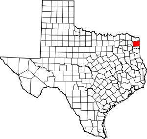
Linden is a city and the county seat of Cass County,[5] Texas, United States. The population was 1,988 at the 2010 census,[6] down from 2,256 at the 2000 census.
Linden, Texas | |
|---|---|
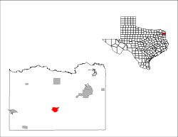
Location of Linden, Texas | |
 | |
| Coordinates: 33°0′29″N 94°21′52″W | |
| Country | United States |
| State | Texas |
| County | Cass |
| Area | |
| • Total | 3.53 sq mi (9.14 km2) |
| • Land | 3.53 sq mi (9.14 km2) |
| • Water | 0.00 sq mi (0.00 km2) |
| Elevation | 381 ft (116 m) |
| Population (2010) | |
| • Total | 1,988 |
| • Estimate (2019)[2] | 1,915 |
| • Density | 542.49/sq mi (209.44/km2) |
| Time zone | UTC-6 (Central (CST)) |
| • Summer (DST) | UTC-5 (CDT) |
| ZIP code | 75563 |
| Area code(s) | 903 |
| FIPS code | 48-42844[3] |
| GNIS feature ID | 1374534[4] |
| Website | lindentexas |
Geography
Linden is located south of the center of Cass County at 33°0′29″N 94°21′52″W (33.008026, -94.364328).[7] U.S. Route 59 passes through the east side of the city, leading northeast 14 miles (23 km) to Atlanta and south 18 miles (29 km) to Jefferson.
According to the United States Census Bureau, the city has a total area of 3.5 square miles (9.1 km2), all of it land.[6]
Demographics
| Historical population | |||
|---|---|---|---|
| Census | Pop. | %± | |
| 1890 | 444 | — | |
| 1900 | 316 | −28.8% | |
| 1910 | 329 | 4.1% | |
| 1920 | 702 | 113.4% | |
| 1930 | 718 | 2.3% | |
| 1940 | 1,168 | 62.7% | |
| 1950 | 1,744 | 49.3% | |
| 1960 | 1,832 | 5.0% | |
| 1970 | 2,264 | 23.6% | |
| 1980 | 2,443 | 7.9% | |
| 1990 | 2,375 | −2.8% | |
| 2000 | 2,256 | −5.0% | |
| 2010 | 1,988 | −11.9% | |
| Est. 2019 | 1,915 | [2] | −3.7% |
| U.S. Decennial Census[8] | |||
At the 2010 census there were 1,988 people, 940 households, and 579 families living in the city. The population density was 640.4 people per square mile (247.5/km2). There were 1,048 housing units at an average density of 297.5 per square mile (115.0/km2). The racial makeup of the city was 77.88% White, 19.86% African American, 0.44% Native American, 0.18% Asian, 0.66% from other races, and 0.98% from two or more races. Hispanic or Latino of any race were 1.64%.[3]
Of the 940 households 27.1% had children under the age of 18 living with them, 43.2% were married couples living together, 15.3% had a female householder with no husband present, and 38.3% were non-families. 36.0% of households were one person and 21.0% were one person aged 65 or older. The average household size was 2.20 and the average family size was 2.86.
The age distribution was 22.2% under the age of 18, 7.5% from 18 to 24, 23.0% from 25 to 44, 21.9% from 45 to 64, and 25.4% 65 or older. The median age was 43 years. For every 100 females, there were 85.1 males. For every 100 females age 18 and over, there were 80.1 males.
The median household income was $25,250 and the median family income was $35,938. Males had a median income of $29,762 versus $21,731 for females. The per capita income for the city was $14,846. About 11.8% of families and 18.5% of the population were below the poverty line, including 22.2% of those under age 18 and 23.0% of those age 65 or over.
Education
Linden is served by the Linden-Kildare Consolidated Independent School District.
Notable people
- John Beasley, SWC Player of the year 1965 & 10 Year ABA player
- Don Buford, former Major League Baseball player born here
- Ed Hargett, All SWC QB and NFL QB for the Oilers and Saints
- Don Henley, lead singer and drummer of the Eagles, lived here as a child
- Scott Joplin, prominent ragtime composer and musician, was born here according to some historians
- Brig Owens, professional football player with the Washington Redskins
- T-Bone Walker, blues guitarist and singer born here
References
- "2019 U.S. Gazetteer Files". United States Census Bureau. Retrieved August 7, 2020.
- "Population and Housing Unit Estimates". United States Census Bureau. May 24, 2020. Retrieved May 27, 2020.
- "U.S. Census website". United States Census Bureau. Retrieved 2008-01-31.
- "US Board on Geographic Names". United States Geological Survey. 2007-10-25. Retrieved 2008-01-31.
- "Find a County". National Association of Counties. Retrieved 2011-06-07.
- "Geographic Identifiers: 2010 Census Summary File 1 (G001): Linden city, Texas". U.S. Census Bureau, American Factfinder. Archived from the original on February 13, 2020. Retrieved July 23, 2015.
- "US Gazetteer files: 2010, 2000, and 1990". United States Census Bureau. 2011-02-12. Retrieved 2011-04-23.
- "Census of Population and Housing". Census.gov. Retrieved June 4, 2015.

