Selwyn County, New South Wales

Selwyn County is one of the 141 Cadastral divisions of New South Wales. It is located to the east of the Murray River, with part of the Tumut River as its boundary to the north-east. It includes Mount Kosciuszko, the highest mountain in Australia.

Selwyn
New South Wales
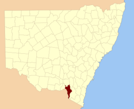
Location in New South Wales
Lands administrative divisions around Selwyn:
Goulburn Wynyard Buccleuch
Goulburn Selwyn Wallace
Benambra (Vic) Tambo (Vic) Wallace

Selwyn County was named in honour of geologist Alfred Richard Cecil Selwyn (1824–1902).[1]

Parishes within this county

A full list of parishes found within this county. After the local government mergers of 2016, all parishes of Selwyn County are in the Snowy Valleys Council.

ParishCoordinates
Beaumont35°45′54″S 148°10′04″E
Boganyera35°54′54″S 147°57′04″E
Bringenbrong36°07′54″S 148°03′04″E
Buccleuch35°44′54″S 148°18′04″E
Buddong35°38′54″S 148°16′04″E
Burra35°51′54″S 148°03′04″E
Clear Hill36°04′54″S 148°26′04″E
Cowra35°55′54″S 148°17′04″E
Craven35°40′54″S 147°50′04″E
Dargals36°09′54″S 148°18′04″E
Geehi36°19′54″S 148°06′04″E
Glenken35°55′54″S 147°48′04″E
Glenroy35°44′54″S 147°51′04″E
Greg Greg36°03′54″S 148°03′04″E
Gungartan36°13′54″S 148°22′04″E
Hay35°51′54″S 148°09′04″E
Hume36°19′54″S 148°11′04″E
Indi36°13′54″S 148°04′04″E
Jagumba35°58′54″S 148°17′04″E
Jagungal36°10′54″S 148°23′04″E
Jingellic East35°52′54″S 147°45′04″E
Khancoban36°10′54″S 148°11′04″E
King35°44′54″S 148°05′04″E
Kosciusko36°30′54″S 148°12′04″E
Lea36°07′54″S 148°10′04″E
Manjar35°51′54″S 148°19′04″E
Mannus35°49′54″S 147°57′04″E
Maragle35°53′54″S 148°09′04″E
Mate35°39′54″S 147°53′04″E
Munderoo35°49′54″S 147°51′04″E
Munyang36°12′54″S 148°27′04″E
Murray36°12′54″S 148°16′04″E
Nurenmerenmong35°49′54″S 148°15′04″E
Ournie35°56′54″S 147°52′04″E
Round Hill35°58′54″S 148°23′04″E
Scott35°59′54″S 148°30′04″E
Selwyn35°49′54″S 148°24′04″E
Table Top35°55′54″S 148°24′04″E
Tooma35°55′54″S 148°04′04″E
Tougaroo36°33′54″S 148°13′04″E
Tumbarumba35°51′54″S 148°02′04″E
Twynam36°41′54″S 148°13′04″E
Victoria36°25′54″S 148°08′04″E
Wallace35°47′54″S 148°19′04″E
Welaregang35°58′54″S 147°56′04″E
Welumba35°58′54″S 148°08′04″E
Yellowin35°27′54″S 148°14′04″E
Youngal36°13′54″S 148°10′04″E
gollark: Intel® 64 architecture delivers 64-bit computing on server, workstation, desktop and mobile platforms when combined with supporting software.¹ Intel 64 architecture improves performance by allowing systems to address more than 4 GB of both virtual and physical memory, however.
gollark: They might be. If you flip all the belts and splitters.
gollark: Oh, I got the direction wrong. Still valid.
gollark: Well, balancers are symmetric maybe.
gollark: 4 to 8 balancers are entirely valid.

References

  1. "Selwyn County". Geographical Names Register (GNR) of NSW. Geographical Names Board of New South Wales.
This article is issued from Wikipedia. The text is licensed under Creative Commons - Attribution - Sharealike. Additional terms may apply for the media files.