Champ-sur-Drac
Champ-sur-Drac is a commune in the Isère department in southeastern France.
Champ-sur-Drac | |
|---|---|
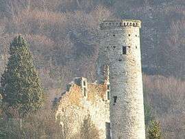
 The tower of Champ-sur-Drac | |
 Coat of arms | |
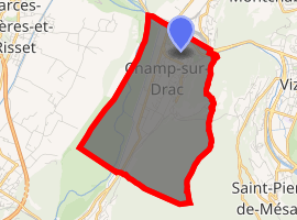
Location of Champ-sur-Drac 
| |
 Champ-sur-Drac  Champ-sur-Drac | |
| Coordinates: 45°04′44″N 5°43′55″E | |
| Country | France |
| Region | Auvergne-Rhône-Alpes |
| Department | Isère |
| Arrondissement | Grenoble |
| Canton | Le Pont-de-Claix |
| Intercommunality | Grenoble-Alpes Métropole |
| Government | |
| • Mayor (2018–2020) | Francis Dietrich |
| Area 1 | 8.92 km2 (3.44 sq mi) |
| Population (2017-01-01)[1] | 3,007 |
| • Density | 340/km2 (870/sq mi) |
| Time zone | UTC+01:00 (CET) |
| • Summer (DST) | UTC+02:00 (CEST) |
| INSEE/Postal code | 38071 /38560 |
| Elevation | 269–1,281 m (883–4,203 ft) (avg. 319 m or 1,047 ft) |
| 1 French Land Register data, which excludes lakes, ponds, glaciers > 1 km2 (0.386 sq mi or 247 acres) and river estuaries. | |
It is situated at the foot of the Alps, at the confluence of the Romanche and the Drac. Population of the whole metropolitan area at the 1999 census was 7309 inhabitants and population of the intercommunality at the 2005 census was 26,761 inhabitants.
Population
| Year | Pop. | ±% |
|---|---|---|
| 1962 | 2,232 | — |
| 1968 | 2,316 | +3.8% |
| 1975 | 2,605 | +12.5% |
| 1982 | 3,094 | +18.8% |
| 1990 | 3,140 | +1.5% |
| 1999 | 3,262 | +3.9% |
| 2011 | 3,113 | −4.6% |
Sister city

gollark: Unlikely, but you can do so.
gollark: You'd prefer to not think so?
gollark: I'm sure you'd like to think so.
gollark: I should have a convenient shortcut for exponential backoff reminders.
gollark: You're actually very much like the osmarks.net component which bridges COBOL to Python to allow me to write the Discord bot which uses Discord as a key/value database in a more familiar environment.
See also
References
- "Populations légales 2017". INSEE. Retrieved 6 January 2020.
| Wikimedia Commons has media related to Champ-sur-Drac. |
This article is issued from Wikipedia. The text is licensed under Creative Commons - Attribution - Sharealike. Additional terms may apply for the media files.