Lalley
Lalley is a commune in the Isère department in southeastern France.
Lalley | |
|---|---|
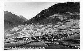 Lalley in the early 20th century | |
Location of Lalley 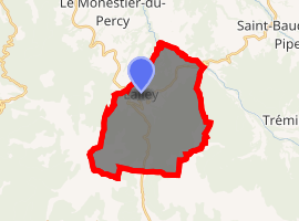
| |
 Lalley  Lalley | |
| Coordinates: 44°45′31″N 5°40′37″E | |
| Country | France |
| Region | Auvergne-Rhône-Alpes |
| Department | Isère |
| Arrondissement | Grenoble |
| Canton | Matheysine-Trièves |
| Intercommunality | Canton de Clelles |
| Government | |
| • Mayor (2014–2020) | Michel Picot |
| Area 1 | 24 km2 (9 sq mi) |
| Population (2017-01-01)[1] | 193 |
| • Density | 8.0/km2 (21/sq mi) |
| Time zone | UTC+01:00 (CET) |
| • Summer (DST) | UTC+02:00 (CEST) |
| INSEE/Postal code | 38204 /38930 |
| Elevation | 673–2,045 m (2,208–6,709 ft) |
| 1 French Land Register data, which excludes lakes, ponds, glaciers > 1 km2 (0.386 sq mi or 247 acres) and river estuaries. | |
Population
| Year | Pop. | ±% |
|---|---|---|
| 1841 | 708 | — |
| 1851 | 747 | +5.5% |
| 1861 | 646 | −13.5% |
| 1872 | 581 | −10.1% |
| 1881 | 575 | −1.0% |
| 1891 | 470 | −18.3% |
| 1901 | 376 | −20.0% |
| 1911 | 389 | +3.5% |
| 1921 | 335 | −13.9% |
| 1931 | 336 | +0.3% |
| 1946 | 299 | −11.0% |
| 1954 | 294 | −1.7% |
| 1962 | 280 | −4.8% |
| 1968 | 258 | −7.9% |
| 1975 | 273 | +5.8% |
| 1982 | 247 | −9.5% |
| 1990 | 191 | −22.7% |
| 1999 | 184 | −3.7% |
| 2010 | 210 | +14.1% |
| 2011 | 215 | +2.4% |
gollark: It's only a patent so far. But they had *better* not make it necessary to install adblockers on your car or something.
gollark: This makes sense, because social shame things are always right.
gollark: It's already too late.
gollark: The UK adopted this recently for GCSEs but it runs 9 (best) to 1 (worst).
gollark: [REDACTED]
See also
References
- "Populations légales 2017". INSEE. Retrieved 6 January 2020.
| Wikimedia Commons has media related to Lalley. |
| Authority control |
|
|---|
This article is issued from Wikipedia. The text is licensed under Creative Commons - Attribution - Sharealike. Additional terms may apply for the media files.