Saint-Ondras
Saint-Ondras is a commune in the Isère department in southeastern France.
Saint-Ondras | |
|---|---|
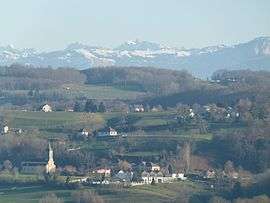
 A general view of Saint-Ondras | |
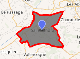
Location of Saint-Ondras 
| |
 Saint-Ondras  Saint-Ondras | |
| Coordinates: 45°31′07″N 5°32′52″E | |
| Country | France |
| Region | Auvergne-Rhône-Alpes |
| Department | Isère |
| Arrondissement | La Tour-du-Pin |
| Canton | Le Grand-Lemps |
| Government | |
| • Mayor (2014–2020) | Christian Vieux-Melchior |
| Area 1 | 8.15 km2 (3.15 sq mi) |
| Population (2017-01-01)[1] | 640 |
| • Density | 79/km2 (200/sq mi) |
| Time zone | UTC+01:00 (CET) |
| • Summer (DST) | UTC+02:00 (CEST) |
| INSEE/Postal code | 38434 /38490 |
| Elevation | 361–626 m (1,184–2,054 ft) (avg. 410 m or 1,350 ft) |
| 1 French Land Register data, which excludes lakes, ponds, glaciers > 1 km2 (0.386 sq mi or 247 acres) and river estuaries. | |
Population
| Year | Pop. | ±% |
|---|---|---|
| 1800 | 534 | — |
| 1806 | 655 | +22.7% |
| 1821 | 766 | +16.9% |
| 1831 | 901 | +17.6% |
| 1841 | 813 | −9.8% |
| 1851 | 814 | +0.1% |
| 1861 | 695 | −14.6% |
| 1872 | 714 | +2.7% |
| 1881 | 669 | −6.3% |
| 1891 | 638 | −4.6% |
| 1901 | 574 | −10.0% |
| 1911 | 535 | −6.8% |
| 1921 | 472 | −11.8% |
| 1931 | 411 | −12.9% |
| 1946 | 378 | −8.0% |
| 1954 | 380 | +0.5% |
| 1962 | 360 | −5.3% |
| 1968 | 336 | −6.7% |
| 1975 | 307 | −8.6% |
| 1982 | 362 | +17.9% |
| 1990 | 478 | +32.0% |
| 1999 | 496 | +3.8% |
| 2006 | 558 | +12.5% |
| 2011 | 604 | +8.2% |
Geography
The Bourbre forms the commune's northwestern border.
gollark: Did you check the redstone settings?
gollark: You could always pull out of fission reactor ports, you know.
gollark: I was joking about it causing slimes to phase through walls, but it does ban them spawning in superflat, and does give its creator special stuff.
gollark: No, really.
gollark: Like giving its author free ultra-powerful weapons when they log in or respawn.
See also
References
| Wikimedia Commons has media related to Saint-Ondras. |
- "Populations légales 2017". INSEE. Retrieved 6 January 2020.
This article is issued from Wikipedia. The text is licensed under Creative Commons - Attribution - Sharealike. Additional terms may apply for the media files.