Morestel
Morestel (Arpitan: Mouretél) is a commune in the Isère department in south-eastern France.
Morestel | |
|---|---|
 The centre of Morestel | |
 Coat of arms | |
Location of Morestel 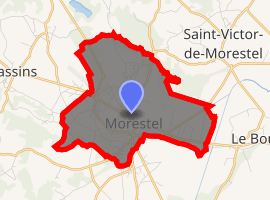
| |
 Morestel  Morestel | |
| Coordinates: 45°40′43″N 5°28′15″E | |
| Country | France |
| Region | Auvergne-Rhône-Alpes |
| Department | Isère |
| Arrondissement | La Tour-du-Pin |
| Canton | Morestel |
| Intercommunality | Pays des Couleurs |
| Government | |
| • Mayor (2019–2020) | Frederic Vial |
| Area 1 | 8.03 km2 (3.10 sq mi) |
| Population (2017-01-01)[1] | 4,469 |
| • Density | 560/km2 (1,400/sq mi) |
| Time zone | UTC+01:00 (CET) |
| • Summer (DST) | UTC+02:00 (CEST) |
| INSEE/Postal code | 38261 /38510 |
| Elevation | 205–319 m (673–1,047 ft) |
| 1 French Land Register data, which excludes lakes, ponds, glaciers > 1 km2 (0.386 sq mi or 247 acres) and river estuaries. | |
Geography
Morestel is situated on the old National Highway 75, now RD 1075, between Bourg-en-Bresse and Grenoble.
Population
| Year | Pop. | ±% |
|---|---|---|
| 1793 | 875 | — |
| 1806 | 936 | +7.0% |
| 1821 | 1,080 | +15.4% |
| 1831 | 1,326 | +22.8% |
| 1841 | 1,390 | +4.8% |
| 1851 | 1,437 | +3.4% |
| 1861 | 1,358 | −5.5% |
| 1872 | 1,296 | −4.6% |
| 1881 | 1,234 | −4.8% |
| 1891 | 1,446 | +17.2% |
| 1901 | 1,331 | −8.0% |
| 1911 | 1,405 | +5.6% |
| 1921 | 1,323 | −5.8% |
| 1931 | 1,270 | −4.0% |
| 1946 | 1,285 | +1.2% |
| 1954 | 1,286 | +0.1% |
| 1962 | 1,455 | +13.1% |
| 1968 | 1,782 | +22.5% |
| 1975 | 2,308 | +29.5% |
| 1982 | 2,738 | +18.6% |
| 1990 | 2,972 | +8.5% |
| 1999 | 3,034 | +2.1% |
| 2006 | 3,841 | +26.6% |
| 2011 | 4,256 | +10.8% |
gollark: Other things exist.
gollark: ↑
gollark: Just work on stuff which is fun and cool for you.
gollark: I don't care so why should I care?
gollark: drop Drop an item on the ground.getItem The item in the specified slot.getItemMeta The metadata of the item in the specified slot.list List all items in this inventorypullItems Pull items to this inventory from another inventory.pushItems Push items from this inventory to another inventory.size The size of the inventorysuck Suck an item from the ground
See also
External links
| Wikimedia Commons has media related to Morestel. |
| Authority control |
|
|---|
This article is issued from Wikipedia. The text is licensed under Creative Commons - Attribution - Sharealike. Additional terms may apply for the media files.