Bungalow, Queensland
Bungalow is an inner suburb of Cairns in the Cairns Region, Queensland, Australia.[2]
| Bungalow Cairns, Queensland | |||||||||||||||
|---|---|---|---|---|---|---|---|---|---|---|---|---|---|---|---|
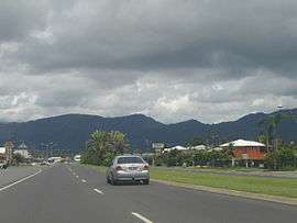 Mulgrave Road near intersection with Buchan Street looking south-west with Bungalow to the left, 2006 | |||||||||||||||
 Bungalow | |||||||||||||||
| Coordinates | 16.9383°S 145.7555°E | ||||||||||||||
| Population | 2,159 (2016 census)[1] | ||||||||||||||
| • Density | 939/km2 (2,430/sq mi) | ||||||||||||||
| Postcode(s) | 4870 | ||||||||||||||
| Area | 2.3 km2 (0.9 sq mi) | ||||||||||||||
| LGA(s) | Cairns Region | ||||||||||||||
| State electorate(s) | Cairns | ||||||||||||||
| Federal Division(s) | Leichhardt | ||||||||||||||
| |||||||||||||||
Geography
The suburb is bounded to the north by Mulgrave Street (one of the major thoroughfares through Cairns connecting the Bruce Highway from the south to the Captain Cook Highway to the north) and by Hartley Street to the south. The suburb is almost entirely freehold and has a mixture of residential and commercial areas with no green space or other civic amenities.[3]
History
The suburb name comes from "The Bungalow", the residence of Archdeacon Joseph Campbell, a clergyman and agricultural entrepreneur.[2]
gollark: Huh.
gollark: It also has a few volume buttons, Scroll Lock, and a weird thing which is labelled with a square with horizontal lines in it.
gollark: øĸ tħen
gollark: æ nørmæl uĸ ĸeybøærð
gollark: There are Piefon libraries for it.
References
- Australian Bureau of Statistics (27 June 2017). "Bungalow (State Suburb)". 2016 Census QuickStats. Retrieved 18 April 2018.

- "Bungalow - suburb in Cairns Region (entry 48548)". Queensland Place Names. Queensland Government. Retrieved 29 July 2017.
- "Queensland Globe". State of Queensland. Retrieved 24 April 2018.
This article is issued from Wikipedia. The text is licensed under Creative Commons - Attribution - Sharealike. Additional terms may apply for the media files.