Anoritooq
Anoritooq (old spelling: Anoritôq) is a nunatak (Greenlandic: nunataq) in the Qaasuitsup municipality in northwestern Greenland.
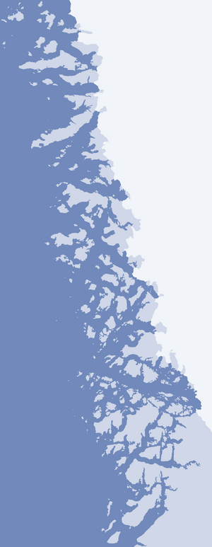
Anoritooq (Upernavik Archipelago)
Geography
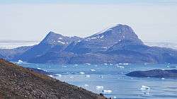
Anoritooq seen from Nuussuaq Peninsula, from the west
Anoritooq is located on the mainland of Greenland in the northern part of Upernavik Archipelago. To the north, Greenland icesheet drains into Sugar Loaf Bay via Cornell Glacier separating it from the base of Nuussuaq Peninsula.[1]
The nunatak has several summits, with the highest reaching 1,108 m (3,635 ft).[1] Due to the glacial retreat, another nunatak, Orsugissap Qaqqarsua, culminating in an 800 m (2,600 ft) summit, is now conjoint with Anoritooq.
gollark: Just don't wear armor!
gollark: INVISIBLE CIDERR
gollark: Indent yer code!
gollark: S A L T I R E
gollark: The solution is simple.
References
| Wikimedia Commons has media related to Anoritooq. |
- Upernavik Avannarleq, Saga Map, Tage Schjøtt, 1992
This article is issued from Wikipedia. The text is licensed under Creative Commons - Attribution - Sharealike. Additional terms may apply for the media files.