44th parallel north

The 44th parallel north is a circle of latitude that is 44 degrees north of the Earth's equatorial plane. It crosses Europe, the Mediterranean Sea, Asia, the Pacific Ocean, North America, and the Atlantic Ocean.

44°
44th parallel north

At this latitude the sun is visible for 15 hours, 29 minutes during the summer solstice and 8 hours, 53 minutes during the winter solstice.[1]

Around the world

Starting at the Prime Meridian and heading eastwards, the parallel 44° north passes through:

Co-ordinates Country, territory or sea Notes
44°0′N 0°0′E  France Passing through Montauban
44°0′N 7°39′E  Italy
44°0′N 8°10′E Mediterranean Sea Gulf of Genoa
44°0′N 10°6′E  Italy Passing just north of  San Marino
44°0′N 12°40′E Adriatic Sea
44°0′N 15°2′E  Croatia Islands of Dugi Otok, Pašman, and the mainland
44°0′N 16°32′E  Bosnia and Herzegovina
44°0′N 19°14′E  Serbia For about 3 km
44°0′N 19°16′E  Bosnia and Herzegovina
44°0′N 19°34′E  Serbia Passing through Kragujevac
44°0′N 22°25′E  Bulgaria Passing through Vidin
44°0′N 22°55′E  Romania
44°0′N 26°13′E  Bulgaria
44°0′N 27°41′E  Romania For about 15 km
44°0′N 27°53′E  Bulgaria For about 4 km
44°0′N 27°56′E  Romania
44°0′N 28°40′E Black Sea
44°0′N 39°11′E  Russia Passing just south of Pyatigorsk
44°0′N 47°23′E Caspian Sea Passing just north of Chechen Island,  Russia
44°0′N 50°55′E  Kazakhstan
44°0′N 56°0′E  Uzbekistan
44°0′N 61°26′E  Kazakhstan
44°0′N 80°27′E  People's Republic of China Xinjiang — passing about 22 km north of Ürümqi
44°0′N 95°30′E  Mongolia
44°0′N 111°50′E  People's Republic of China Inner Mongolia
Jilin — passing just north of Changchun
Heilongjiang
Jilin - for about 2 km
Heilongjiang - for <1 km
Jilin - for about 10 km
Heilongjiang
Jilin - for about 5 km
Heilongjiang
44°0′N 131°15′E  Russia
44°0′N 135°32′E Sea of Japan
44°0′N 141°39′E  Japan Island of Hokkaidō:
— Hokkaidō Prefecture
44°0′N 144°17′E Sea of Okhotsk
44°0′N 144°54′E  Japan Island of Hokkaidō:
— Hokkaidō Prefecture - Shiretoko Peninsula
44°0′N 145°10′E Nemuro Strait
44°0′N 145°39′E Kuril Islands Kunashir Island, administered by  Russia but claimed by  Japan
44°0′N 145°48′E Pacific Ocean Passing just north of the island of Shikotan, administered by  Russia, claimed by  Japan
44°0′N 124°8′W  United States
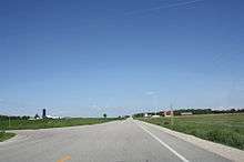
44th parallel in Wisconsin, United States
Oregon - passing just south of Eugene and Bend
Idaho
Wyoming
South Dakota - passing just south of Rapid City
Minnesota - passing through Rochester
Wisconsin - passing through Oshkosh
44°0′N 87°41′W Lake Michigan
44°0′N 86°28′W  United States Michigan
44°0′N 82°45′W Lake Huron
44°0′N 81°44′W  Canada Ontario
44°0′N 77°0′W Lake Ontario
44°0′N 76°16′W  United States New York - passing just north of Watertown
Vermont
New Hampshire
Maine
44°0′N 69°8′W Atlantic Ocean Gulf of Maine - passing just south of Vinalhaven Island and Isle au Haut, Maine,  United States
44°0′N 66°9′W  Canada Nova Scotia
44°0′N 64°40′W Atlantic Ocean
44°0′N 59°46′W  Canada Nova Scotia - Sable Island
44°0′N 59°45′W Atlantic Ocean
44°0′N 1°21′W  France
gollark: Stick a file containing the image or whatever up on a webserver, have the ESP send an HTTP request to said server for the file.
gollark: Oh, in that case you want to use an HTTP client on the ESP thingy, I think they support that.
gollark: From what?
gollark: So you want to send some pixels to an ESP8266, basically?
gollark: Well, I've never particularly needed fancy managed-switch or advanced routing capability, though more *reliable* and high-speed hardware might be nice.

See also

References

This article is issued from Wikipedia. The text is licensed under Creative Commons - Attribution - Sharealike. Additional terms may apply for the media files.