2008 Pacific typhoon season
The 2008 Pacific typhoon season had no official bounds; it ran year-round in 2008, but most tropical cyclones tend to form in the northwestern Pacific Ocean between May and November.[1] These dates conventionally delimit the period of each year when most tropical cyclones form in the northwestern Pacific Ocean.
| 2008 Pacific typhoon season | |
|---|---|
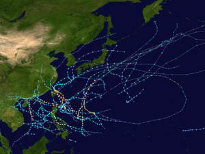 Season summary map | |
| Seasonal boundaries | |
| First system formed | January 13, 2008 |
| Last system dissipated | December 18, 2008 |
| Strongest storm | |
| Name | Jangmi |
| • Maximum winds | 215 km/h (130 mph) (10-minute sustained) |
| • Lowest pressure | 905 hPa (mbar) |
| Seasonal statistics | |
| Total depressions | 40, 1 unofficial |
| Total storms | 22 |
| Typhoons | 11 |
| Super typhoons | 2 (unofficial) |
| Total fatalities | 1,965 total |
| Total damage | $5.97 billion (2008 USD) |
| Related articles | |
The scope of this article is limited to the Pacific Ocean, north of the equator and west of the International Date Line. Storms that form east of the date line and north of the equator are called hurricanes; see 2008 Pacific hurricane season. Tropical storms formed in the entire Western North Pacific basin are assigned a name by the Japan Meteorological Agency. Tropical depressions formed in this basin are given a number with a "W" suffix by the United States' Joint Typhoon Warning Center. In addition, the Philippine Atmospheric, Geophysical and Astronomical Services Administration (PAGASA) assigns names to tropical cyclones (including tropical depressions) that enter or form in the Philippine area of responsibility. These names, however, are not in common use outside of the Philippines.
Seasonal forecasts
| Source | Date | Total TCs |
Tropical storms |
Typhoons | |
| TSR | Average (1950–2007) | – | 27 | 17 | [2] |
| GCACIC | Average (1950–2000) | 31 | 27 | 17 | [3] |
| GCACIC | April 18, 2008 | 33 | 30 | 19 | [3] |
| TSR | May 6, 2008 | – | 28 | 18 | [2] |
| GCACIC | June 24, 2008 | 33 | 30 | 19 | [4] |
| TSR | July 6, 2008 | – | 28 | 18 | [5] |
| TSR | August 5, 2008 | – | 28 | 18 | [6] |
| JMA | Actual activity | 38 | 22 | 11 | |
| JTWC | Actual activity | 27 | 27 | 12 |
Each season several national meteorological services and scientific agencies forecast either the expected amount tropical cyclones, tropical storms, and typhoons forming in a season and/or how many tropical cyclones will affect a country or territory.
City University of Hong Kong
Since the 2000 typhoon season, the Laboratory for Atmospheric Research or the Guy Carpenter Asia-Pacific Climate Impact Centre (GCACIC), both of the City University of Hong Kong have issued forecasts of activity for each upcoming typhoon season.[3] Forecasts are issued in April and June of each year and predict how many tropical cyclones, tropical storms, and typhoons there will be in a season.[3] This season, the GCACIC is predicting a slightly more active than usual season. An average season, according to the GCACIC, has 31 tropical cyclones, 27 named storms, and 17 typhoons. In its April forecast, the GCACIC predicted 33 total tropical cyclones, 30 named storms, and 19 typhoons before predicting the same number of systems, tropical storms, and typhoons in its June forecast.[3][4]
Tropical Storm Risk Consortium
Since the 2000 typhoon season, the Tropical Storm Risk Consortium (TSR) of the University College of London have issued forecasts of activity for each upcoming typhoon season. During 2008 forecasts were issued in early March, May, July and August and predict how many tropical storms, typhoons and intense typhoons there will be during a season.[nb 1][7] In its March forecast, TSR Predicted that the season would be about 20% below average with six intense tropical cyclones, however due to conflicting climate signals it was not possible to predict how many tropical storms and typhoons would form.[7] In its May forecast, TSR were now able to predict how many tropical storms and typhoons, would form during the season.[2] They also predicted that the season would be near normal with 28 tropical storms, 18 typhoons and 8 intense typhoons forming during the season.[2] In their July and August forecasts, TSR predicted the same amount of tropical storms and typhoons and intense typhoons as their May forecasts.[5][6]
National meteorological service predictions
As the name Frank was retired from PAGASA's naming lists they also released a prediction stating that there would be 16 more Tropical cyclones of any strength to pass through PAGASA'S area of responsibility which added to the six that had already moved through PAGASA's area of responsibility brought a total of 22 cyclones to pass through the PAGASA's area of responsibility during 2008.[8]
Seasonal Summary

The first tropical depression of the season, formed in mid January to the west of the Philippines. As it moved west, the depression did not develop any further and dissipated on January 18. After two more Tropical depressions, the first named storm Typhoon Neoguri formed in April to the east of Mindanao. During May as a result of convection being enhanced within the Philippine sea and the South China Sea four named storms formed which along with 1971 and 1980 was the joint highest incidence in May since 1951. Between June and October, the region was considered to be very quiet by the JMA as they only named 13 tropical cyclones. In November and December, only four tropical cyclones were named by the JMA and all four formed within the Philippine sea and the South China Sea.
Systems
Tropical Depression 01W
| Tropical depression (JMA) | |
| Tropical storm (SSHWS) | |
  | |
| Duration | January 13 – January 18 |
|---|---|
| Peak intensity | 55 km/h (35 mph) (10-min) 1004 hPa (mbar) |
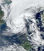
Early on January 11, the JTWC reported that an area of convection had persisted about 1010 km, (630 mi) to the southeast of Manila in the Philippines.[9] The disturbance was located near to a developing low level circulation center which was weak and remained displaced from the deep convection whilst located in an area of low to moderate vertical windshear.[9] During the next 24 hours the disturbance developed further with a tropical cyclone formation alert being issued the next day by the JTWC as the disturbance now had a well defined low level circulation center with convective banding on the northwestern edge.[10] Early on January 13, both the JMA and the JTWC reported that the first depression of the season had developed about 360 km, (225 mi) to the west of Manila.[11][12] Later that day the JMA reported that the depression had reached its 10-minute peak windspeeds of 55 km/h, (35 mph).[13] However early on January 14 the JTWC reported that the depression had continued to intensify and upgraded the depression to a Tropical storm and then six hours later reported 1-minute peak windspeeds of 65 km/h (40 mph).[12] Later that day it was downgraded to a Tropical depression due to weakening deep convection and a partially exposed low level circulation center.[12][14] Over the next few days the depression moved towards the east until early on January 18 when both the JMA and the JTWC reported that it had dissipated off the Malaysian coastline.[12][15] There were no reports of any damages or casualties associated with the depression.[16]
Typhoon Neoguri (Ambo)
| Typhoon (JMA) | |
| Category 3 typhoon (SSHWS) | |
  | |
| Duration | April 13 – April 20 |
|---|---|
| Peak intensity | 150 km/h (90 mph) (10-min) 960 hPa (mbar) |
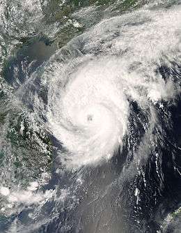
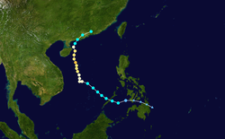
On April 11, area of convection with an area of low pressure was located between Palau and Yap.[17] Early on April 13, a low-level circulation developed near Mindanao.[18] The JMA designated the system as a minor tropical depression on the same day,[19] and PAGASA began warning on the system, naming it Tropical Depression "Ambo". The low continued to get better organized and early on April 14, the Joint Typhoon Warning Center began issuing advisories on Tropical Depression 02W, which was located about north of Zamboanga City, Philippines.[20] Later that day, the agency upgraded it to tropical storm status, based on satellite intensity estimates.[21] The JMA upgraded the system to a tropical storm, naming it Neoguri, the next day.[22] Early April 16, the system was upgraded to severe tropical storm status,[23] and then reached typhoon status a few hours later.[24] The typhoon continued north, weakening as it did so.[25][26] The cyclone made landfall as a weak tropical storm on Guangdong province in southern China,[27] and the final advisories from both agencies were issued shortly after.[28][29]
As the typhoon approached and passed Hainan Province, about 120,000 people were evacuated from low-lying areas.[30] According to the China Meteorological Administration, it was the earliest in the year a tropical cyclone had ever impacted China (the old record was for Typhoon Wanda on May 3, 1971). [31] 42,000 residents were displaced in the aftermath of Neoguri.[32] 18 Chinese fisherman and 22 Vietnamese fisherman remain missing due to the storm.[33] Three fatalities were confirmed in China, two due to a road being covered in a mud flow, and another due to winds blowing a sheet of aluminum into a person, throwing them off the roof of a stadium.[34]
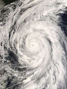
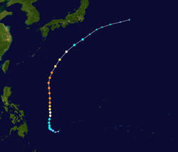
Typhoon Rammasun (Butchoy)
| Typhoon (JMA) | |
| Category 4 super typhoon (SSHWS) | |
  | |
| Duration | May 7 – May 13 |
|---|---|
| Peak intensity | 195 km/h (120 mph) (10-min) 915 hPa (mbar) |
Early on May 7, PAGASA designated an area of low pressure which was about 790 km east of Mindanao as Tropical Depression Butchoy.[35] Around the same time the Japan Meteorological Agency (JMA) and the Joint Typhoon Warning Center (JTWC) also designated the area of low pressure as a Tropical depression with the JTWC assigning the number 03W to the depression.[36][37]
Later that day the JMA upgraded the Tropical Depression to Tropical Storm status with RSMC Tokyo assigning the name Rammasun to the storm.[38] It quickly organized, intensifying into a typhoon on May 9.[39] Rapid intensification continued and it strengthened into a Category 4-equivalent typhoon by early on May 10,[40] and a super typhoon by midday.[41]
Rammasun continued on a northerly path, and reached a peak of 105 knots (194 km/h) and 915 hPa on May 10.[42] Soon after, the typhoon began slowly weakening. The JTWC downgraded it to a typhoon on May 11.[43] On May 12, the weakening became more rapid, and the JMA downgraded the system to a severe tropical storm,[44] while the JTWC issued its last advisory, noting that it was extratropical.[45] The JMA, however, held onto Rammasun until early May 13, when it downgraded the cyclone to a low and issued its final advisory.[46] Though it never hit land, it was the second strongest May typhoon in recorded history, behind Typhoon Lola of 1986.
Rammasun brushed the Japanese coastline as it became extratropical on May 13 delivering strong winds and high waves. Along with moderate to heavy rain, winds gusted up to 52 mph (83 km/h) as the storm moved out to sea.[47]
A strong storm from the "tail" of Rammasun struck the Philippines as it passed south of Japan. The winds brought by the storm caused severe damage to some buildings and numerous trees some weighing tonnes were uprooted. The damage may have been due to a possible tornado but there is no clarification for this possibility. At least 40 people were injured and damage totaled to 11 million PHP (US$280,000).[48][49]
Severe Tropical Storm Matmo (Dindo)
| Severe tropical storm (JMA) | |
| Tropical storm (SSHWS) | |
  | |
| Duration | May 14 – May 17 |
|---|---|
| Peak intensity | 95 km/h (60 mph) (10-min) 992 hPa (mbar) |
On May 13, a tropical disturbance formed about 550 km (340 mi), to the east of Manila in the Philippines.[50] The disturbance was located in an area of low vertical wind shear and had a consolidating low-level circulation center.[50] The JTWC then issued a Tropical Cyclone Formation Alert on the disturbance early the next day, as deep convection was building near to the low pressure area.[51] Later that day both the JTWC and the JMA upgraded the disturbance to a tropical depression, citing good outflow.[52][53][54] Early on May 15, as the storm was moving towards the northwest, the JMA upgraded the depression to a tropical storm.[55] The Philippine Atmospheric, Geophysical and Astronomical Services Administration (PAGASA) then designated the storm as Tropical Depression Dindo.[56] While the storm accelerated to the northwest in response to a mid-latitude trough,[57] the JTWC upped into a tropical storm and had reached its peak intensity with winds of 75 km/h (45 mph).[58] Early on May 16, both PAGASA and the JTWC issued their final advisories on the storm as it approached the edge of PAGASA's Area of responsibility, with the JTWC reporting that Matmo was now extratropical.[59][60] However, data from the JMa suggested that it obtained peak wind speeds of 95 km/h (60 mph) at this time, which made Matmo a severe tropical storm.[55] Though, within their next advisory, the JMA downgraded Matmo to a tropical storm before dissipating the net day.[55][61]
In preparation for Tropical Storm Matmo, the Japan Meteorological Agency issued warnings for the, Naha, Moji and Yokohama areas of Japan,[62] but in the end, there was no impact.[63][64]
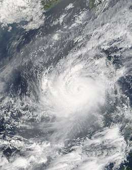
Severe Tropical Storm Halong (Cosme)
| Severe tropical storm (JMA) | |
| Category 1 typhoon (SSHWS) | |
  | |
| Duration | May 14 – May 20 |
|---|---|
| Peak intensity | 110 km/h (70 mph) (10-min) 970 hPa (mbar) |
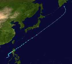
Early on May 14 PAGASA upgraded a tropical disturbance west of the Philippines to Tropical Depression Cosme.[65] Later that day the JTWC issued a TCFA,[66] later the first advisory on the system as Tropical Depression 05W.[67] On May 16, the JMA upgraded 05W to Halong.[68] Later that day, it was upgraded to a Severe Tropical Storm by JMA,[69] and a Typhoon by JTWC,[70] and reached its peak of 60 knots (110 km/h) early May 17.[71] It made landfall on western Pangasinan early May 17,[72] and weakened while crossing northern Luzon,[73][74] but after reaching open waters it re-organized while accelerating northeastward. The system intensified to a severe tropical storm again,[75] but never reached its previous peak intensity and began weakening as it moved northeast.[73] The JTWC and the JMA issued their final advisories on May 20.[76][77]
In Luzon, the storm caused 58 deaths and $94 million (USD) in damage. The storm destroyed 43,365 houses and damaged 188,830 more. Most of the damages reported were in Northern Luzon.[78] Meanwhile, Mindoro and Panay islands were also affected as the storm-induced southwest monsoon brought rains and floods to those areas.
Typhoon Nakri (Enteng)
| Typhoon (JMA) | |
| Category 4 typhoon (SSHWS) | |
  | |
| Duration | May 26 – June 3 |
|---|---|
| Peak intensity | 185 km/h (115 mph) (10-min) 930 hPa (mbar) |
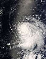
A tropical disturbance formed south of Guam on May 25.[79] On May 26, the JMA recognized it as a weak tropical depression,[80] and later that day, the JTWC issued a TCFA on the system.[81]
Early on May 27, the JTWC issued its first advisory on Tropical Depression 06W.[81] Hours after, the JMA designated the system as Tropical Storm Nakri.[82] Early on May 28, the JMA upgraded it to a severe tropical storm.[83] Twelve hours later, the JTWC upgraded 06W to a typhoon. Later that day, Nakri strengthened at a more rapid pace and the rapid intensification continued into May 29, when Nakri strengthened to a Category 4-equivalent typhoon. PAGASA then issued its first advisory on the storm on early on May 30 and named it "Enteng". By May 31 it began to weaken as it moved north.[84] But on the next day, it started to re-intensify slightly.[85] On June 2, it began to undergo transition to an extratropical system.[86] And later, both JTWC and JMA stopped issuing advisories as it already degenerated to an extratropical low.[87][88]
The name Nakri was submitted by Cambodia and refers to a type of flower found in the country.
Typhoon Fengshen (Frank)
| Typhoon (JMA) | |
| Category 3 typhoon (SSHWS) | |
  | |
| Duration | June 17 – June 25 |
|---|---|
| Peak intensity | 165 km/h (105 mph) (10-min) 945 hPa (mbar) |
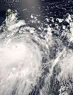
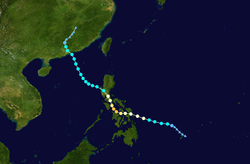
On June 18, an area of low pressure that the Philippine Atmospheric, Geophysical and Astronomical Services Administration (PAGASA) had been monitoring for a few days was upgraded to Tropical Depression Frank.[89] Later that day both the Joint Typhoon Warning Center (JTWC) and the Japan Meteorological Agency (JMA) started issuing full advisories on Frank with the JTWC designating it as Tropical Depression 07W.[90][91] Early the next day the JMA upgraded the tropical depression to a tropical storm and assigned the name Fengshen.[92] Tropical Storm Fengshen then rapidly intensified that day by becoming a severe tropical storm and then intensifying into a typhoon later that day.[93][94] The next day Typhoon Fengshen made landfall in eastern Samar in the central Philippines and travelled northwest over the islands.[95]
Fengshen was initially forecast to go through Bicol Region but later on shifted its course further westward, eventually going towards the direction of Mindoro Province. However, before even reaching Mindoro it again shifted its direction northward towards the direction of Metro Manila, mainly because of the weakening of the High Pressure area system in the northern part of the Philippines.[96]
Typhoon Fengshen, after creating havoc in the Philippines, emerged into the South China sea on the 22nd of June and moved northwards towards China.[97] After moving into the South China Sea both the JMA and PAGASA downgraded it to a severe tropical storm while the JTWC downgraded Fengshen from a Typhoon to a Tropical Storm.[98][99][100] PAGASA then issued its final advisory on Tropical Storm Fengshen (Frank) due to Fengshen leaving PAGASA's Area of Responsibility.[101] Late in the evening of the 24th June Tropical Storm Fengshen made landfall on Shenzhen, Guangdong, before moving into mainland China.[102] The next day the JTWC downgraded Fengshen to a tropical depression and issued their final warning on the system.[103] The JMA then announced their final warning as they downgraded Fengshen to a tropical depression.[104]
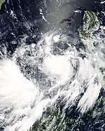
Tropical Depression Gener
| Tropical depression (JMA) | |
 _2008_track.png) | |
| Duration | July 4 – July 8 |
|---|---|
| Peak intensity | 55 km/h (35 mph) (10-min) 1000 hPa (mbar) |
On July 4, PAGASA reported that Tropical Depression Gener formed in the South China Sea to the west of the Philippines.[105][106] The precursor to Gener earlier moved across Luzon, producing 13 mm (0.51 in) of rain in the Ilocos Region.[106][107] The system had deep convection persisting on the western side of its developing low level circulation center,[108] although it was in an area of moderate wind shear,[108] and rapid development was not expected.[108] On July 7, Gener left the PAGASA area of responsibility.[109] The Joint Typhoon Warning Center (JTWC) issued a Tropical Cyclone Formation Alert on July 7 as the circulation strengthened, despite the convection being disorganized due to the shear.[110] Later that day the JMA reported that the system become a minor Tropical Depression, although the Hong Kong Observatory (HKO) did not follow suit.[111][112] The system rapidly weakened as it moved ashore on China to the east of Hong Kong.[113] Early on July 8 the JMA issued their last advisory on the depression.[114] There was no damage reported in China, although the system produced heavy rainfall in Guangdong Province.[112]
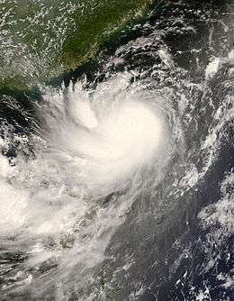
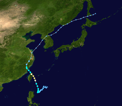
Typhoon Kalmaegi (Helen)
| Typhoon (JMA) | |
| Category 2 typhoon (SSHWS) | |
  | |
| Duration | July 13 – July 20 |
|---|---|
| Peak intensity | 120 km/h (75 mph) (10-min) 970 hPa (mbar) |
Early on July 13, the Japan Meteorological Agency (JMA), began to issue full advisories on a Tropical depression, which was located to the east of the Philippines.[115] Later that day PAGASA allocated the name Helen to the depression, followed the next day by the Joint Typhoon Warning Center (JTWC) designating the number 08W. Early on the 15th July both the JTWC, and the JMA upgraded the depression to Tropical Storm status, with RSMC Tokyo assigning the name "Kalmaegi" to the storm. Early on the 17th, Kalmaegi began rapidly intensifying; both the JTWC and JMA upgraded Kalmaegi to a Typhoon.
In the Philippines, it passed over Northern Luzon (mostly affecting Ilocos and Cagayan Valley), where it killed two people, left more than 31,129 people affected and damaged ₱ 7 million worth of property.[116] The storm also hit 82 villages (all in Northern Luzon) and caused around ₱45,000 worth of damage to farmland and livestock,[117] Typhoon Kalmaegi, which was downgraded to tropical storm status by Taiwan's Central Weather Bureau while still east of the country, made landfall at Ilan County in northeast Taiwan in the evening of July 17 at 19:40 local time (13:40 UTC) and emerged into the Taiwan Strait at 7:20 in the morning local time (01:20 UTC) on July 18.[118] At least nineteen lost their lives due to the storm and six are currently reported as missing.[119] Tainan County (now part of Tainan City) in southern Taiwan reported more than 1100 mm of rainfall in some mountain regions.[120] The storm caused NT$ 300 million worth of damage,[121] including an estimated US$16 million in agricultural losses,[119] and the typhoon destroyed about 5,100 hectares of orchards and crops.[121]
From Taiwan, the typhoon, now downgraded to a tropical storm, turned toward southeast China.[121] In Xiapu County of Fujian Province, the tropical storm made landfall at 17:50 local time (0950 UTC), with winds of about 90 miles per hour (140 km/h).[122] In that province and in neighboring Zhejiang Province, 360,000 residents left coastal and low-lying homes to escape the storm.[121] Schools and many businesses remained closed, and the storm was expected to travel northwest.[122] Early on July 19, the JTWC issued its final advisory on Kalmaegi and downgraded it to a tropical depression. However, the JMA continued to issue advisories and maintained Kalmaegi a tropical storm as it moved to Yellow Sea. Late the next day, the JMA downgraded Kalmaegi to a Remnant Low (Extratropical cyclone) as it moved in land over North Korea.
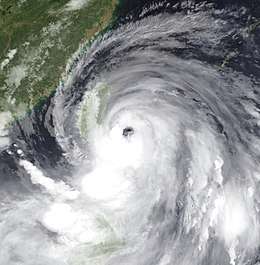
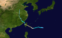
Typhoon Fung-wong (Igme)
| Typhoon (JMA) | |
| Category 2 typhoon (SSHWS) | |
  | |
| Duration | July 23 – July 30 |
|---|---|
| Peak intensity | 155 km/h (100 mph) (10-min) 960 hPa (mbar) |
On July 23 the Japan Meteorological Agency (JMA) started to issue WWJP25 warnings on a minor Tropical Depression which was located to the east of the Philippines.[123] Early the next morning PAGASA named the depression as Igme.[124] The Joint Typhoon Warning Center (JTWC) then initiated issuing advisories on the Tropical Depression designating it as Tropical Depression 09W.[125] Later that day the JMA began to issue full advisories on the tropical depression[126] whilst the JTWC upgraded the depression to tropical storm status.[127] The JMA then designated it as Tropical Storm Fung-wong on July 25.[128]
Fung-wong then carried on intensifying and during the morning off July 26 Fung-wong became a severe tropical storm. Later that day both the JTWC and PAGASA upgraded Fung-wong to Typhoon status.[129][130][131] However the JMA did not upgrade Fung-wong to Typhoon Status until early the next morning. Late on July 27 Fung-wong reached its peak wind speeds of 95 kn (110 mph, 170 km/h) which is equivalent to a strong category two Typhoon on the Saffir-Simpson Hurricane Scale. Later that day Fung-wong made landfall on Taiwan near the border of Hualien County and Taitung County as a Typhoon. PAGASA then released their final advisory on Fung-wong as it had moved out of PAGASA's area of responsibility.
Early on July 28 Fung-wong it then emerged into the Taiwan Strait from Changhua County early the next morning by this time however Fung-wong had weakened into a Severe Tropical Storm whilst the JTWC had downgraded Fung-wong to a Tropical Storm. Fung-wong then made its second landfall later that day over mainland China. The Joint Typhoon Warning Center then released its last warning on Tropical Storm Fung-wong. However the JMA continued to issue advisories on Fung-wong weakening Fung-wong into a tropical storm on July 29. The JMA then terminated issuing full advisories later that day as Fung-wong weakened into a Tropical Depression, However the JMA continued to monitor the Depression within their WWJP25 warnings until later the next day when they issued their last warning on Fung-wong.
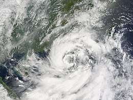
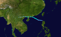
Severe Tropical Storm Kammuri (Julian)
| Severe tropical storm (JMA) | |
| Tropical storm (SSHWS) | |
  | |
| Duration | August 3 – August 8 |
|---|---|
| Peak intensity | 95 km/h (60 mph) (10-min) 975 hPa (mbar) |
On August 3 at 1500 UTC, PAGASA identified a Tropical Disturbance located to the north of Luzon island in the Philippines and designated it as Tropical Depression Julian.[132] Later that day the Japan Meteorological Agency (JMA) designated Julian as a minor Tropical Depression and initiated advisories on the Tropical Depression.[133]
Early the next day the JMA started to issue full advisories on the Tropical Depression with the Joint Typhoon Warning Center (JTWC) starting to issue warnings on the Tropical Depression with the JTWC designating it as Tropical Depression 10W.[134] Furthermore, later that day both PAGASA and the JTWC upgraded the Tropical Depression to a Tropical Storm.[135][136] On August 5 RSMC Tokyo upgraded the depression to a Tropical Storm and named it Kammuri.[137] PAGASA then released their last advisory on Tropical Storm Kammuri (Julian) as it moved out of PAGASA's Area of responsibility and headed towards Mainland China.[138] The Hong Kong Observatory then upgraded Kammuri to a Severe Tropical Storm, with the JMA upgrading it to a severe tropical storm early the next morning.[139][140]
However, Kammuri started to weaken after making landfall along the south coast of China in the Western Guangdong Province at about 12pm UTC on August 6.[141][142] After Kammuri had made landfall the JMA downgraded Kammuri to a Tropical Storm,[143] whilst the JTWC issued their final advisory later that day on Tropical Storm Kammuri.[144] Early the next day Tropical Storm Kammuri emerged into the Gulf of Tonkin, however later that day Kammuri made landfall again in the Guangxi province of China. After making landfall Kammuri weakened to a tropical depression as the JMA issued its last advisory on August 7.[145] However the JMA continued to monitor the depression in their WWJP25 warnings until early on August 8.[146]
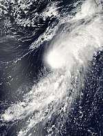
Severe Tropical Storm Phanfone
| Severe tropical storm (JMA) | |
  | |
| Duration | August 9 – August 11 |
|---|---|
| Peak intensity | 95 km/h (60 mph) (10-min) 996 hPa (mbar) |
Late on August 9, the Japan Meteorological Agency (JMA) started to issue full advisories on a Tropical Depression which was located southeast of Japan.[147] Early the next day, the depression intensified into a tropical storm and was named Phanfone by the JMA as it moved northwards.[148] Late on August 10, Phanfone reached its maximum wind speeds of 40 knots (75 km/h, 45 mph) as it was becoming extratropical.[149] Early the next day Phanfone became an extratropical low as the JMA issued their final advisory.[150]
Phanfone was upgraded to a severe tropical storm in post-storm analysis.[151]
The name Phanfone was submitted by Laos and is the name of an animal.
Tropical Depression 11W
| Tropical depression (JMA) | |
| Tropical storm (SSHWS) | |
  | |
| Duration | August 12 – August 15 |
|---|---|
| Peak intensity | 55 km/h (35 mph) (10-min) 998 hPa (mbar) |
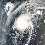
Early on August 12 the JMA identified a weak tropical depression which was located to the northwest of the Ryukyu Islands, and initiated warnings on it.[152] Early the next day the Joint Typhoon Warning Center initiated warnings on the depression designating it as Tropical Depression 11W.[153] Early the next day as Tropical Depression 11W approached Korea the depression reached its maximum wind speeds of 30 kn (55 km/h, 35 mph)[154] However, later that day the JTWC issued its final advisory as due to land interaction the depressions wind speeds would weaken to below warning level.[155] The next day the JMA released their final advisory on the depression.[156][157]
Severe Tropical Storm Vongfong
| Severe tropical storm (JMA) | |
| Tropical storm (SSHWS) | |
  | |
| Duration | August 14 – August 17 |
|---|---|
| Peak intensity | 95 km/h (60 mph) (10-min) 990 hPa (mbar) |
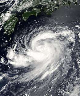
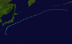
Late on August 14 the JMA identified a tropical depression which was located to the south of Japan and started issuing advisories on it.[158] Later that day the Joint Typhoon Warning Center (JTWC) started issuing advisories on the tropical depression, designating it as Tropical Depression 12W.[159] Early the next morning as the depression moved closer to Japan the JMA upgraded the depression to Tropical Storm Vongfong, the JTWC also upgraded Vongfong to a tropical storm around the same time.[160][161] On August 16, the JTWC issued its final advisory as it began transiting into an extratropical low.[162] The JMA issued their final advisory early the next day once it had become an extratropical low.[163] As Vongfong brushed by Japan, heavy rains triggered flood which killed one person. A total of 523 homes and 39 hectares (96.3 acres) were damaged by the storm and 15,520 people were left without power. The storm also damaged 139 roads and caused 54 landslides.[164]
Tropical Depression Kika
| Tropical depression (SSHWS) | |
  | |
| Duration | August 14 (Entered basin) – August 16 |
|---|---|
| Peak intensity | 35 km/h (25 mph) (1-min) 1010 hPa (mbar) |
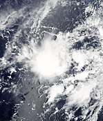
Shortly after crossing the dateline, the remnants of Kika entered the western Pacific basin and regenerated into a tropical depression. The depression continued to move towards the west-southwest before dissipating on August 16.[165]
Typhoon Nuri (Karen)
| Typhoon (JMA) | |
| Category 3 typhoon (SSHWS) | |
  | |
| Duration | August 17 – August 23 |
|---|---|
| Peak intensity | 140 km/h (85 mph) (10-min) 955 hPa (mbar) |
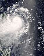
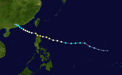
On August 17 the Joint Typhoon Warning Center identified a tropical depression located to the east of the Philippines and designated it as 13W.[166] Later that day both the JMA and PAGASA identified the tropical depression and started to issue full advisories on the depression with PAGASA naming the depression Karen. Also later that day the JTWC upgraded Karen to a Tropical Storm.[167][168][169]
The next day, both PAGASA and the JMA upgraded the depression to a Tropical Storm with RSMC Tokyo naming it as Nuri.[170][171] It then intensified rather quickly with the JMA designating it as a Severe Tropical Storm[172] with the JMA, PAGASA, and the JTWC upgrading Nuri to a Typhoon later that day.[173][174][175] Late on August 19 Typhoon Nuri made landfall on the Philippines and then over the next day moved across northern Luzon causing 12 deaths and 461.3 million PHP in damage.[176] that day Nuri entered the Babuyan Channel early the next day and started to move northwestwards towards Hong Kong and China. On August 21 PAGASA then issued its final advisory on Nuri as it was moving out of PAGASA's Area of Responsibility.[177] The JMA then downgraded Nuri to a Severe tropical storm with the JTWC also downgrading Nuri to a Tropical Storm later that day as it was approaching Hong Kong. However the JMA did not downgrade Nuri to a tropical storm until the next morning after Nuri had made a rare direct hit on Hong Kong. The JTWC then issued its final advisory later on tropical storm Nuri and the JMA then downgraded Nuri to a weak tropical depression early the next day and issued its last full advisory on Nuri as it was just moving into the Chinese mainland.
Tropical Depression 14W (Lawin)
| Tropical depression (JMA) | |
| Tropical storm (SSHWS) | |
  | |
| Duration | August 26 – August 28 |
|---|---|
| Peak intensity | 55 km/h (35 mph) (10-min) 1002 hPa (mbar) |
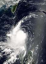
On August 24, a tropical disturbance formed to the east of Luzon in the Philippines.[178] Early the next day PAGASA designated it as Tropical Depression Lawin.[179] However, the JMA did not designate it as a Minor Tropical depression until early on August 26, with the JTWC issuing a Tropical Cyclone Formation Alert at the same time.[180][181] PAGASA then hoisted Public storm Signal number 1 for parts of Luzon which meant that wind speeds of 30–60 km/h were expected within 36 hours in the warning areas.[182] Later that day both the JMA and the JTWC, started to issue full advisories on the tropical depression, with the JTWC designating it as Tropical Depression 14W.[183][184] Early the next day the JTWC upgraded the tropical depression to a tropical storm,[185] Despite of the fact that neither the JMA nor PAGASA upgraded the depression to a tropical storm at this time (or at any time during Lawin's existence),[186][187] the JTWC then weakened the cyclone back into a tropical depression within their next advisory.[188] The JMA then terminated issuing full advisories later that day as it was no longer expected to develop into a tropical storm.[189] On August 28 the JTWC issued its final advisory on the Tropical depression followed by the JMA and PAGASA later that day.[190][191][192] There were no reported casualties from Tropical Depression 14W (Lawin).[193]
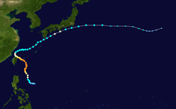
Typhoon Sinlaku (Marce)
| Typhoon (JMA) | |
| Category 4 typhoon (SSHWS) | |
  | |
| Duration | September 8 – September 21 |
|---|---|
| Peak intensity | 185 km/h (115 mph) (10-min) 935 hPa (mbar) |
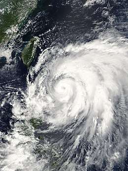
On September 8 the JMA and PAGASA started to issue advisories on a tropical depression which was located to the north of Manila with PAGASA designating it as Tropical Depression Marce. During that afternoon the JTWC designated the depression as Tropical Depression 15W. Later that day the depression intensified into a Tropical Storm as was named Sinlaku by the JMA. During the next day Sinlaku firstly rapidly intensified into a Severe Tropical Storm and then into a Typhoon. On September 10 Sinlaku reached its peak 1 minute sustained winds of 125 knots (145 mph). During September 11 Sinlaku, started to weaken as it went under an eyewall replacement cycle. On September 13 Sinlaku made landfall on Taiwan with winds of 90 knots (170 km/h) which made Sinlaku a category two typhoon. As Sinlaku moved through Taiwan Sinlaku turned to the Northeast and moved back into the South China Sea and started moving towards Japan. The next day as Sinlaku moved towards Japan it weakened into a Severe Tropical Storm and exited PAGASA's area of responsibility whilst the JTWC did not downgrade Sinlaku to a tropical storm until late on September 15. By then they were followed by the JMA which downgraded Sinlaku to a tropical storm early the next day. On September 16 the JTWC reported that Sinlaku had restrengthened into a Typhoon whilst the JMA reported that Sinlaku had strengthened into a Severe Tropical Storm. However the JTWC Quickly downgraded Sinlaku back down into a Tropical Storm whilst the JMA kept Sinlaku at Severe tropical Storm strength. The next day the JTWC reported that Sinlaku had intensified into a typhoon for a third time however later that day the JTWC downgraded Sinlaku to Tropical Storm. On September 17 the JTWC issued its final advisory on Sinlaku as it became extratropical. However the JMA kept issuing advisories on Sinlaku until early on September 21 when it became an extratropical low.
Tropical Depression 16W
| Tropical depression (JMA) | |
| Tropical storm (SSHWS) | |
  | |
| Duration | September 9 – September 11 |
|---|---|
| Peak intensity | 55 km/h (35 mph) (10-min) 1002 hPa (mbar) |
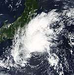
Late on September 8, a tropical disturbance formed to the southeast of Japan. It then formed into a tropical depression during the next afternoon, with the JMA designating it as a Minor Tropical Depression with wind speeds of 25 knots (46 km/h).[194] However the JTWC did not designate the depression as 16W until the morning of September 10. At that time the JTWC reported the depression had intensified into a Tropical Storm.[195] However, later that day the JTWC lowered the storm back down to a Depression[196] and then re-upgraded the Depression to a tropical storm.[197] However early the next day the storm was downgraded by the JTWC for the last time as it had started its extratropical transition.[198] Later that day as the depression raced into the Baroclinic Zone the JTWC issued its final advisory on Tropical storm 16W.[199][200]
Tropical Depression 17W
| Tropical depression (JMA) | |
| Tropical storm (SSHWS) | |
  | |
| Duration | September 13 – September 14 |
|---|---|
| Peak intensity | 45 km/h (30 mph) (10-min) 1010 hPa (mbar) |
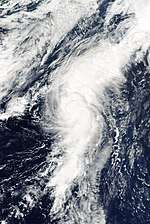
On September 13 the Japan Meteorological Agency started issuing advisories on a tropical depression located to the east of Japan and designated it as a minor tropical depression with wind speeds of 25 knots (46 km/h).[201] The following morning the Joint Typhoon Warning Center assigned the number 17W to the depression.[202] However, as it had already begun its extra tropical transition, this was the only JTWC warning issued on the system.[202][203]
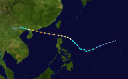
Typhoon Hagupit (Nina)
| Typhoon (JMA) | |
| Category 4 typhoon (SSHWS) | |
  | |
| Duration | September 18 – September 25 |
|---|---|
| Peak intensity | 165 km/h (105 mph) (10-min) 935 hPa (mbar) |
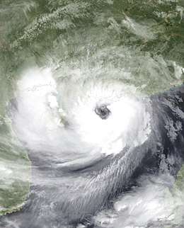
On September 14 a tropical disturbance formed to the northeast of Guam. Over the next few days it slowly developed, with the JMA designating it as a minor tropical depression on September 17. Later that day the Joint Typhoon Warning Center (JTWC) then issued a Tropical Cyclone Formation Alert on the developing tropical depression. Late the next day the JTWC designated the depression as 18W as it began to issue advisories on the depression. Early on September 19 the JMA began to issue full advisories on the depression as it moved into PAGASA's Area of Responsibility and was named Nina by PAGASA. Later that day both the JMA & the JTWC upgraded the depression to a tropical storm. The JMA named the storm as Hagupit, and assigned the international number of 0814. Early the next day Hagupit intensified into a severe tropical storm, and a category 3 typhoon later that day. It reached maximum intensity with 140 mph (230 km/h) winds on September 23, and made landfall at that strength the next day. It then dissipated over land, thus late on September 24 JTWC issued its final advisory on the system followed by JMA early the next day.
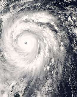
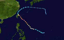
Typhoon Jangmi (Ofel)
| Typhoon (JMA) | |
| Category 5 super typhoon (SSHWS) | |
  | |
| Duration | September 23 – October 1 |
|---|---|
| Peak intensity | 215 km/h (130 mph) (10-min) 905 hPa (mbar) |
Forming south of Guam on September 22. JTWC issued a TCFA and upgraded the low-pressure area to a tropical depression on the next day.[204][205] Both JTWC and JMA upgraded the system to a tropical storm named Jangmi on September 24, as well as it entered the Philippine Area of Responsibility, earning the name Ofel from the PAGASA.[206] On September 25, Jangmi intensified into a typhoon for its developing eye.[207] On September 26, Jangmi formed an cirrus-filled and ambiguous eye, as the typhoon gradually intensified owing to strong radial outflow.[208]
On September 27, JTWC upgraded Jangmi to a super typhoon with a round eye; at noon, the typhoon attained peak intensity by the ten-minute maximum sustained winds reaching 115 knots (215 km/h, 130 mph) and the atmospheric pressure decreasing to 905 hPa (26.7 inHg).[209] On September 28, after JTWC downgraded Jangmi to a typhoon, it made landfall over Yilan, Taiwan at 15:40 TST (07:40 UTC). Jangmi weakened significantly by the mountainous terrain of Taiwan after landfall, and it arrived at the Taiwan Strait from Taoyuan County (now Taoyuan City) at 04:20 TST on September 29 (20:20 UTC on September 28).[210][211]
On September 29, both JMA and JTWC downgraded Jangmi to a tropical storm in the East China Sea.[212] On September 30, Jangmi underwent extratropical transition and became fully extratropical near the Ōsumi Islands on the next day.[213] It ultimately dissipated near Iwo Jima on October 5.
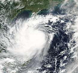
Tropical Storm Mekkhala
| Tropical storm (JMA) | |
| Tropical storm (SSHWS) | |
  | |
| Duration | September 27 – September 30 |
|---|---|
| Peak intensity | 85 km/h (50 mph) (10-min) 990 hPa (mbar) |
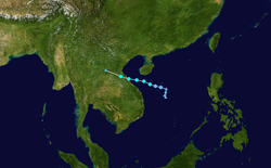
On September 25 a tropical disturbance formed to the south of China, in the Gulf of Tonkin. Over the next few days it gradually intensified and late on September 27 the JMA designated it as a tropical depression. Early the next day the JTWC issued a Tropical Cyclone Formation Alert on the developing depression and then later that day, designated the depression as Tropical Depression 20W. Early on September 28 the JMA reported that the depression had intensified into a tropical storm and named it as Mekkhala. Later that day the JTWC upgraded Mekkhala to a Tropical Storm. However, on the 30th it began to move inland and thus, early that day, JTWC issued its final advisory on Mekkhala as it is expected to dissipate within a short time. Later that day, the JMA downgraded the storm to a tropical depression and issued the final advisory.
At least 21 people have been killed due to Tropical Storm Mekkhala.[214] Damages from the storm totaled to $6.6 million (USD)[215]
Tropical Storm Higos (Pablo)
| Tropical storm (JMA) | |
| Tropical storm (SSHWS) | |
  | |
| Duration | September 29 – October 6 |
|---|---|
| Peak intensity | 75 km/h (45 mph) (10-min) 998 hPa (mbar) |
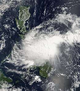
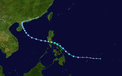
On September 27 a tropical disturbance formed in the Philippine Sea to the east of Mindanao, in the Philippines. During the next day the JTWC issued a TCFA on the tropical disturbance. Early on September 29 the JMA designated the disturbance as a tropical depression. Later that day both PAGASA and the JTWC designated the disturbance as a tropical depression, with PAGASA naming the depression as Pablo whilst the JTWC designated it as Tropical Depression 21W. The JTWC upgraded the depression to a tropical storm early in the afternoon. The JMA followed shortly after and upgraded the system to Tropical Storm Higos early on September 30. Higos tracked towards the northwest and made landfall in the eastern Philippines (on Samar island) on October 1. Higos tracked over the Philippines as a tropical storm (but PAGASA downgraded it as a tropical depression) for most of the day before moving out over open waters. Once out over water, the JTWC downgraded Higos to a tropical depression, however, the JMA kept it as a tropical storm. As Higos neared landfall, it suddenly relocated, paralleling the northeastern coast of Hainan, China. The storm later made landfall on October 4 around 2 a.m. (CST) on the northern coastline of the island. JMA then issued its final advisory as Higos weakened to a tropical depression. The JTWC followed 12 hours later.
Tropical Depression 22W
| Tropical depression (JMA) | |
| Tropical storm (SSHWS) | |
  | |
| Duration | October 12 – October 15 |
|---|---|
| Peak intensity | 55 km/h (35 mph) (10-min) 1006 hPa (mbar) |
On October 13 the Japan Meteorological Agency designated a low pressure area in the Gulf of Tonkin as a minor tropical depression with wind speeds of 25 knots (46 km/h).[216] The China Meteorological Administration and Hong Kong Observatory both declared this system a tropical depression that day as it moved slowly towards northern Vietnam. On October 14, the JMA notes that the depression has strengthened to 30 knots (56 km/h) with little northwestward movement.[217] Joint Typhoon Warning Center begun issuing warnings late morning as a tropical depression and in the evening upgraded it to a tropical storm forecasting it to strengthen even further before making its landfall over northern Vietnam. The system didn't gain anymore strength in the Gulf of Tonkin and on October 15 made landfall over northern Vietnam. The Joint Typhoon Warning Center issued its final advisory on this system expecting it to dissipate near Laos by October 16.
Tropical Storm Bavi
| Tropical storm (JMA) | |
| Tropical storm (SSHWS) | |
  | |
| Duration | October 18 – October 20 |
|---|---|
| Peak intensity | 85 km/h (50 mph) (10-min) 992 hPa (mbar) |
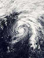
On October 18 an area of low pressure well to the southeast of Japan quickly strengthened to become a Tropical Storm, and the JMA named it Bavi. Bavi strengthened to gain 50 mph (80 km/h) winds, but transitioned into an extra-tropical cyclone on 21 October, while still well to the east of Japan.
Severe Tropical Storm Maysak (Quinta-Siony)
| Severe tropical storm (JMA) | |
| Tropical storm (SSHWS) | |
  | |
| Duration | November 6 – November 14 |
|---|---|
| Peak intensity | 95 km/h (60 mph) (10-min) 985 hPa (mbar) |
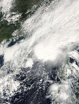
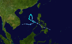
On November 5, a tropical disturbance formed in the Philippine Sea to the northeast of Zamboanga, in the Philippines. Later that day the JTWC assessed the disturbance chances of forming into a Significant Tropical cyclone within 24 hours as poor. Early the next day PAGASA designated the disturbance as a Tropical Depression and named it as Quinta, whilst the JTWC still monitored it as a disturbance. Later that day the JTWC upgraded the disturbances chances of forming into a significant tropical cyclone to Good and issued a Tropical Cyclone Formation Alert on the disturbance and then designated the disturbance as Tropical Depression 24W as they issued their first advisory on the Depression. On November 12, PAGASA issued their final warning as it transform into a low pressure area. PAGASA renamed the system as Siony on November 12 as it redeveloped. Later that day, they issued their final advisory again as it moved out of their area of responsibility.
Tropical Depression Rolly
| Tropical depression (PAGASA) | |
 _2008_track.png) | |
| Duration | November 7 – November 9 |
|---|---|
| Peak intensity | 55 km/h (35 mph) (10-min) 1006 hPa (mbar) |
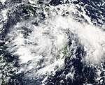
Early on November 7 a Tropical disturbance formed about 475 nm to the east of Zamboanga in the Philippines.[218] Animated multi-spectral imagery at this time showed that the disturbance had disorganized convection which was located near to a developing low level circulation center and was located within a favorable upper-level environment for development.[218] An anticyclone was providing vertical wind-sheer however the disturbance was already interacting with land as it was rapidly approaching Mindanao.[218] Later that day after it had moved through parts of Mindanao it was named as Tropical Depression Rolly by PAGASA as they placed several parts of Mindanao and Visayas under public storm signal number one.[219] All signals were then canceled the next morning as PAGASA released their final advisory on Rolly as it had weakened into an area of low pressure over Palawan.[220] The JTWC then declared that the low pressure area had dissipated later that morning.[221] Rough seas produced by the depression capsized a vessel carrying eleven people. The Philippine Coast Guard quickly responded to the incident and rescued all crew members.[222]
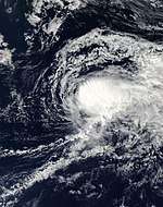
Tropical Storm Haishen
| Tropical storm (JMA) | |
| Tropical storm (SSHWS) | |
  | |
| Duration | November 14 – November 17 |
|---|---|
| Peak intensity | 75 km/h (45 mph) (10-min) 1004 hPa (mbar) |
On November 14, the JMA reported that tropical depression formed 490 km (300 mi) to the southeast of Iwo To,[55] despite the JTWC noting the tropical cyclone formation was unlikely within the next 24 hours[223] due to lack of deep convection.[224] Later that day, deep convection began to persist near the center, indicating the storm developed a fully warm tropical core.[225][226] Despite increased vertical wind shear, the JTWC issued a Tropical Cyclone Formation Alert on the system.[226] During that evening, the JMA upgraded the depression to a tropical storm while the JTWC designated Haishen as a tropical depression.[227][228] Early on November 16, Haishen attained its peak intensity of 75 km/h (45 mph).[55][229] Traveling along the north portion of a subtropical ridge to the southeast of the system, dry air began to take toll on the system.[229] The JTWC then issued their final warning later that day, as Haishen rapidly transitioned into an extratropical cyclone.[230] The JMA followed suit 24 hours later.[55][223] The extratropical low of Haishen accelerated towards the International Dateline,[223][231] where it briefly reintensified.[223]
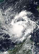
Tropical Storm Noul (Tonyo)
| Tropical storm (JMA) | |
| Tropical storm (SSHWS) | |
  | |
| Duration | November 14 – November 17 |
|---|---|
| Peak intensity | 75 km/h (45 mph) (10-min) 994 hPa (mbar) |
On November 12 a tropical disturbance formed to the east of Mindanao in the Philippines. Later that day the JTWC assessed the disturbances' chances of forming into a significant tropical cyclone within 24 hours as Poor. The next day as it moved towards Mindanao, PAGASA designated it as Tropical Depression Tonyo. Early on November 16, the JTWC declared the system Tropical Depression 26W. On November 16, PAGASA issued their final warning as the Depression moved to South China Sea. On November 17 the storm dissipated over Cambodia and both the JMA and JTWC issued their final warnings later that day.
A landslide triggered by Noul killed a schoolteacher as she was heading home in Quang Ngai province. At least 50 rescue workers searched for her through the debris before finding her body several days later. At least 20,000 people were in need of emergency assistance in the form of food, shelter, and water following the storm. Several other people were killed by landslides and flooding.[232] In all, Tropical Storm Noul killed 21 people in southern Vietnam.[233] During the storm, more than 2,000 people were isolated by floodwaters.[234] A total of 200 homes were destroyed, another 13,500 were damaged[235] 8,879 hectares of crops were destroyed and 60 km (37 mi) of roads were submerged.[236] Damages from the storm were estimated at VND143 billion (US$8.4 million).[235] Offshore, a total of 115 boats sank due to the storm.[236]
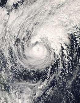
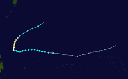
Typhoon Dolphin (Ulysses)
| Typhoon (JMA) | |
| Category 2 typhoon (SSHWS) | |
  | |
| Duration | December 11 – December 18 |
|---|---|
| Peak intensity | 130 km/h (80 mph) (10-min) 962 hPa (mbar) |
A small circulation formed over in a developing extratropical cyclone east of Japan on December 2. This type of formation is really rare, as the circulation moved east away from the developing cyclone and moved south on December 5. Dolphin was formerly an area of convection that had formed on the tail end of a shearline on December 7.[237] On December 8, the storm gained more tropical characteristics, thus JMA defined it as a tropical depression. The storm then moved westward during the following days. On December 10, the JTWC upgraded the storm to Tropical Depression 27W when it was east of Guam. On December 12, 27W was upgraded to Tropical Storm Dolphin by the JMA. The name Dolphin was submitted by Hong Kong. Later that day, Dolphin entered the Philippine Area of Responsibility and named Ulysses. On December 15, the JTWC upgraded Dolphin to a typhoon. The JMA also upgraded Dolphin to a typhoon several hours later. On December 16, the JMA downgraded Dolphin to a severe tropical storm. Both agencies issued their final advisories on Dolphin on December 18 as it transitioned into an extratropical cyclone.
Storm names
Within the North-western Pacific Ocean, both the Japan Meteorological Agency (JMA) and the Philippine Atmospheric, Geophysical and Astronomical Services Administration assign names to tropical cyclones that develop in the Western Pacific, which can result in a tropical cyclone having two names.[238] The Japan Meteorological Agency's RSMC Tokyo — Typhoon Center assigns international names to tropical cyclones on behalf of the World Meteorological Organization's Typhoon Committee, should they be judged to have 10-minute sustained windspeeds of 65 km/h, (40 mph).[239] While the Philippine Atmospheric, Geophysical and Astronomical Services Administration assigns names to tropical cyclones which move into or form as a tropical depression in their area of responsibility located between 135°E and 115°E and between 5°N-25°N even if the cyclone has had an international name assigned to it.[238] The names of significant tropical cyclones are retired, by both PAGASA and the Typhoon Committee.[239] Should the list of names for the Philippine region be exhausted then names will be taken from an auxiliary list of which the first ten are published each season. Unused names are marked in gray.
International names
During the season 22 named tropical cyclones developed in the Western Pacific and were named by the Japan Meteorological Agency, when it was determined that they had become tropical storms. These names were contributed to a list of a 140 names submitted by the fourteen members nations and territories of the ESCAP/WMO Typhoon Committee. The names Matmo, Nuri, Noul and Dolphin were used for the first time as it was replaced from Chataan, Rusa, Pongsona and Yanyan.
| Neoguri | Rammasun | Matmo | Halong | Nakri | Fengshen | Kalmaegi | Fung-wong | Kammuri | Phanfone | Vongfong |
| Nuri | Sinlaku | Hagupit | Jangmi | Mekkhala | Higos | Bavi | Maysak | Haishen | Noul | Dolphin |
Philippines
| Ambo | Butchoy | Cosme | Dindo | Enteng |
| Frank | Gener | Helen | Igme | Julian |
| Karen | Lawin | Marce | Nina | Ofel |
| Pablo | Quinta | Rolly | Siony | Tonyo |
| Ulysses | Vicky (unused) | Warren (unused) | Yoyong (unused) | Zosimo (unused) |
| Auxiliary list | ||||
|---|---|---|---|---|
| Alakdan (unused) | Baldo (unused) | Clara (unused) | Dencio (unused) | Estong (unused) |
| Felipe (unused) | Gardo (unused) | Heling (unused) | Ismael (unused) | Julio (unused) |
The Philippine Atmospheric, Geophysical and Astronomical Services Administration uses its own naming scheme for tropical cyclones in their area of responsibility. PAGASA assigns names to tropical depressions that form within their area of responsibility and any tropical cyclone that might move into their area of responsibility. Should the list of names for a given year prove to be insufficient, names are taken from an auxiliary list, the first 10 of which are published each year before the season starts. The names not retired from this list will be used again in the 2012 season. This is the same list used in the 2004 season, except for Ulysses, Vicky and Warren, which replaced Unding, Violeta and Winnie respectively. The name Ulysses is the only name which used for the first time. Names that were not assigned are marked in gray.[240]
Retirement
The Philippine Atmospheric, Geophysical and Astronomical Services Administration (PAGASA) announced that the names Cosme and Frank would be retired due to extensive damage and loss of life. In June 2012 the names Carina and Ferdie was chosen by PAGASA to replace Cosme and Frank.
Season effects
This table will list all the storms that developed in the northwestern Pacific Ocean west of the International Date Line and north of the equator during 2008. It will include their intensity, duration, name, areas affected, deaths, and damage totals. Classification and intensity values will be based on estimations conducted by the JMA. All damage figures will be in 2008 USD. Damages and deaths from a storm will include when the storm was a precursor wave or an extra tropical low.
| Name | Dates active | Peak classification | Sustained wind speeds |
Pressure | Areas affected | Damage (USD) |
Deaths | Refs |
|---|---|---|---|---|---|---|---|---|
| 01W | January 13 – 18 | Tropical depression | 55 km/h (35 mph) | 1004 hPa (29.65 inHg) | Philippines, Malaysia | None | None | |
| TD | January 22 – 23 | Tropical depression | Not specified | 1006 hPa (29.71 inHg) | None | None | None | |
| TD | March 26 – 27 | Tropical depression | Not specified | 1006 hPa (29.71 inHg) | Philippines | None | None | |
| Neoguri (Ambo) | April 13 – 20 | Typhoon | 150 km/h (90 mph) | 960 hPa (28.35 inHg) | Philippines, China | $65 million | 26 | |
| Rammasun (Butchoy) | May 7 – 13 | Typhoon | 195 km/h (120 mph) | 915 hPa (27.02 inHg) | Philippines, Japan | $9.6 million | 4 | |
| Matmo (Dindo) | May 14 – 17 | Severe tropical storm | 95 km/h (60 mph) | 992 hPa (29.29 inHg) | Philippines, Japan | None | None | |
| Halong (Cosme) | May 14 – 20 | Severe tropical storm | 110 km/h (70 mph) | 970 hPa (28.64 inHg) | Philippines, Japan | $100 million | 61 | |
| Nakri (Enteng) | May 26 – June 3 | Typhoon | 185 km/h (115 mph) | 930 hPa (27.46 inHg) | Mariana Islands, Japan | None | None | |
| TD | May 27 – 28 | Tropical depression | Not specified | 1006 hPa (29.71 inHg) | Philippines | None | None | |
| TD | June 6 | Tropical depression | Not specified | 1006 hPa (29.71 inHg) | Taiwan, Ryukyu Islands | None | None | |
| Fengshen (Frank) | June 17 – 25 | Typhoon | 165 km/h (105 mph) | 945 hPa (27.91 inHg) | Philippines, China | $430 million | 1,371 | |
| Gener | July 4 – 8 | Tropical depression | 55 km/h (30 mph) | 1000 hPa (29.53 inHg) | China | None | None | |
| TD | July 6 – 9 | Tropical depression | Not specified | 1004 hPa (29.65 inHg) | None | None | None | |
| TD | July 13 – 15 | Tropical depression | Not specified | 1006 hPa (29.71 inHg) | None | None | None | |
| Kalmaegi (Helen) | July 13 – 20 | Typhoon | 120 km/h (75 mph) | 970 hPa (28.64 inHg) | Philippines, Taiwan, China, Korea, Japan | $332 million | 25 | |
| Fung-wong (Igme) | July 23 – 30 | Typhoon | 140 km/h (85 mph) | 960 hPa (28.35 inHg) | Taiwan, China | $541 million | 23 | |
| Kammuri (Julian) | July 23 – 30 | Severe tropical storm | 95 km/h (60 mph) | 975 hPa (28.79 inHg) | Philippines, China, Hong Kong, Taiwan, Vietnam | $200 million | 204 | |
| Phanfone | August 9 – 11 | Severe tropical storm | 95 km/h (60 mph) | 996 hPa (29.41 inHg) | None | None | None | |
| TD | August 10 – 12 | Tropical depression | Not specified | 998 hPa (29.47 inHg) | China | None | None | |
| TD | August 11 – 15 | Tropical depression | Not specified | 1000 hPa (29.53 inHg) | Japan, South Korea | None | None | |
| 11W | August 12 – 15 | Tropical depression | 55 km/h (35 mph) | 998 hPa (28.47 inHg) | Japan, South Korea | Minor | None | |
| Vongfong | August 14 – 17 | Severe tropical storm | 95 km/h (60 mph) | 990 hPa (29.23 inHg) | Japan | Minor | 1 | |
| Kika | August 14 – 16 | Tropical depression | 35 km/h (25 mph) | 1010 hPa (29.83 inHg) | None | None | None | |
| Nuri (Karen) | August 17 – 23 | Typhoon | 140 km/h (85 mph) | 955 hPa (28.20 inHg) | Caroline Islands, Philippines, China | $85 million | 20 | |
| 14W (Lawin) | August 26 – 28 | Tropical depression | 55 km/h (35 mph) | 1002 hPa (29.53 inHg) | Philippines, Taiwan | None | None | |
| Sinlaku (Marce) | September 8 – 21 | Typhoon | 185 km/h (115 mph) | 935 hPa (27.61 inHg) | Philippines, Taiwan, China, Japan | $1.1 billion | 24 | |
| 16W | September 9 – 11 | Tropical depression | 55 km/h (35 mph) | 1002 hPa (29.53 inHg) | Japan | None | None | |
| 17W | September 13 – 14 | Tropical depression | 45 km/h (30 mph) | 1010 hPa (29.83 inHg) | None | None | None | |
| Hagupit (Nina) | September 18 – 25 | Typhoon | 165 km/h (105 mph) | 935 hPa (27.61 inHg) | Philippines, Taiwan, China, Vietnam | $3 billion | 67 | |
| Jangmi (Ofel) | September 23 – October 1 | Typhoon | 215 km/h (130 mph) | 905 hPa (26.72 inHg) | Taiwan, Japan | $87.7 million | 8 | |
| Mekkhala | September 27 – 30 | Tropical storm | 85 km/h (50 mph) | 990 hPa (29.23 inHg) | Vietnam, Laos, Thailand | $6.6 million | 16 | |
| Higos (Pablo) | September 29 – October 6 | Tropical storm | 65 km/h (40 mph) | 998 hPa (29.47 inHg) | Philippines, Taiwan, China | $6.5 million | Unknown | |
| 22W | October 12 – 15 | Tropical depression | 55 km/h (35 mph) | 1006 hPa (29.71 inHg) | China, Vietnam | Moderate | None | |
| Bavi | October 18 – 20 | Tropical storm | 85 km/h (50 mph) | 992 hPa (29.29 inHg) | None | None | None | |
| Maysak (Quinta-Siony) | November 6 – 14 | Severe tropical storm | 85 km/h (50 mph) | 985 hPa (29.09 inHg) | Philippines, Vietnam | Minor | 30 | |
| Rolly | November 7 – 9 | Tropical depression | 55 km/h (35 mph) | 1006 hPa (29.71 inHg) | Philippines | None | None | |
| TD | November 11 – 12 | Tropical depression | Not specified | 1004 hPa (29.65 inHg) | None | Minor | None | |
| Haishen | November 14 – 17 | Tropical storm} | 75 km/h (40 mph) | 1004 hPa (29.65 inHg) | None | None | None | |
| Noul (Tonyo) | November 14 – 17 | Tropical storm | 75 km/h (45 mph) | 994 hPa (29.35 inHg) | Philippines, Vietnam, Cambodia | $8.4 million | 21 | |
| TD | December 2 | Tropical depression | Not specified | 1006 hPa (29.71 inHg) | None | Minor | None | |
| Dolphin (Ulysses) | December 11 – 18 | Typhoon | 120 km/h (75 mph) | 970 hPa (28.64 inHg) | Caroline Islands, Mariana Islands, Philippines | $9 thousand | 47 | |
| Season aggregates | ||||||||
| 41 systems | January 13 – December 18 | 215 km/h (130 mph) | 905 hPa (26.72 inHg) | $5.97 billion | 1,936 | |||
See also
- List of Pacific typhoon seasons
- 2008 Pacific hurricane season
- 2008 Atlantic hurricane season
- 2008 North Indian Ocean cyclone season
- South-West Indian Ocean cyclone seasons: 2007-08, 2008-09
- Australian region cyclone seasons: 2007-08, 2008-09
- South Pacific cyclone seasons: 2007-08, 2008-09
Notes
- According to TSR: An intense typhoon is a typhoon that has 1-minute winds of at least 175 km/h (110 mph)
References
- Gary Padgett (August 17, 2003). "Monthly Tropical Weather Summary for May 2003". Typhoon 2000. Archived from the original on December 20, 2010. Retrieved July 13, 2010.
- Adam Lea, Mark Saunders (2008-05-06). "May Forecast Update for Northwest Pacific typhoon Activity in 2008" (PDF). Tropical Storm Risk Consortium. Archived (PDF) from the original on July 4, 2010. Retrieved 2010-07-03.
- "2008 Predictions of Seasonal Tropical Cyclone Activity over the Western North Pacific". Guy Carpenter Asia-Pacific Climate Impact Center. City University of Hong Kong. 2008-04-18. Archived from the original on 1 May 2008. Retrieved 2008-05-05.
- "Updated Prediction of Seasonal Tropical Cyclone Activity over the Western North Pacific for 2008". Guy Carpenter Asia-Pacific Climate Impact Center. City University of Hong Kong. 2008-06-24. Retrieved 2008-07-01.
- Adam Lea, Mark Saunders (2008-07-06). "July Forecast Update for Northwest Pacific Typhoon Activity in 2008" (PDF). Tropical Storm Risk Consortium. Archived (PDF) from the original on July 4, 2010. Retrieved 2010-07-03.
- Adam Lea, Mark Saunders (2008-08-05). "August Forecast Update for Northwest Pacific Typhoon Activity in 2009" (PDF). Tropical Storm Risk Consortium. Archived (PDF) from the original on July 4, 2010. Retrieved 2010-07-03.
- Adam Lea, Mark Saunders (2008-03-10). "Extended Range Forecast for Northwest Pacific Typhoon Activity in 2008" (PDF). Tropical Storm Risk Consortium. Archived (PDF) from the original on July 4, 2010. Retrieved 2010-07-03.
- ABS-CBN. "PAGASA sees 16 more typhoons to hit RP till Dec". ABS-CBN. Archived from the original on July 16, 2008. Retrieved 2006-12-08.
- "Significant Tropical Weather Advisory for the Western and Southern Pacific Oceans 2008-01-11 06z". Joint Typhoon Warning Center. 2008-01-11. Archived from the original on January 11, 2008. Retrieved 2009-05-28.
- "Tropical Cyclone Formation Alert 2008-01-12". Joint Typhoon Warning Center. 2008-01-12. Archived from the original on January 12, 2008. Retrieved 2009-05-28.
- "JMA WWJP25 Advisory 2008-01-08 06z". Japan Meteorological Agency. 2008-01-13. Archived from the original on January 13, 2008. Retrieved 2009-05-28.
- "JTWC Best track 01W". Joint Typhoon Warning Center. 2009-03-31. Archived from the original on 6 May 2009. Retrieved 2009-05-28.
- "JMA WWJP25 Advisory 2008-01-13 12z". Japan Meteorological Agency. 2008-01-13. Archived from the original on January 13, 2008. Retrieved 2009-05-29.
- "Prognastic Reasoning for Tropical Depression 01W 15-01-08 03z". Joint Typhoon Warning Center. 2008-01-15. Retrieved 2009-05-29.
- "JMA WWJP25 Advisory 2008-01-18 00z". Japan Meteorological Agency. 2008-01-18. Retrieved 2009-05-29.
- Gary Padgett (2008). "Gary Padgett Monthly Tropical Cyclone Summary January 2008". Australian Severe Weather. Retrieved 2009-05-29.
- "April 11 20z ABPW10". Joint Typhoon Warning Center. 2008-04-11.
- "April 13 01z ABPW10". Joint Typhoon Warning Center. 2008-04-13.
- ftp://ftp.met.fsu.edu/pub/weather/tropical/Tokyo/2008041312.RJTD%5B%5D
- "JTWC 02W Advisory 1". Joint Typhoon Warning Center. 2008-04-14.
- "JTWC 02W Prognostic Reasoning 1". Joint Typhoon Warning Center. 2008-04-14.
- "WebCite query result". Archived from the original on 2008-04-15. Retrieved 2008-06-22.
- "WebCite query result". Archived from the original on 2008-04-16. Retrieved 2008-06-22.
- "WebCite query result". Archived from the original on 2008-04-16. Retrieved 2008-06-22.
- "WebCite query result". Archived from the original on April 20, 2008. Retrieved 2008-06-22.
- "WebCite query result". Archived from the original on April 20, 2008. Retrieved 2008-06-22.
- "WebCite query result". Archived from the original on 2008-04-19. Retrieved 2008-06-22.
- ftp://ftp.met.fsu.edu/pub/weather/tropical/GuamStuff/2008041915-WTPN.PGTW%5B%5D
- "WebCite query result". Archived from the original on April 20, 2008. Retrieved 2008-06-22.
- "MCOT English News : China evacuates 120,000 people as Typhoon Neoguri nears". Archived from the original on 10 June 2008. Retrieved 2008-06-22.
- "China issues warning against all-time-early typhoon Neoguri". People's Daily Online. 2008-04-18. Archived from the original on 29 April 2008. Retrieved 2008-04-19.
- "Typhoon Neoguri hits South China". Retrieved 2008-06-22.
- "18 Chinese fishermen rescued after sheltering in sea beacon from Typhoon Neoguri for nearly 30 hours_English_Xinhua". Retrieved 2008-06-22.
- "Typhoon Neoguri kills 3 in Guangdong _English_Xinhua". Retrieved 2008-06-22.
- "PAGASA TY Butchoy Advisory 1". Archived from the original on May 7, 2008. Retrieved 2008-06-22.
- "JMA Advisory 07-05-2008". Archived from the original on 2008-05-07. Retrieved 2008-06-22.
- "JTWC STY 03W Advisory 1". Joint Typhoon Warning Center. Retrieved 2008-08-17.
- "JMA Advisory 07-05-2008 18Z". Japan Meteorological Agency. Archived from the original on 2008-05-07. Retrieved 2008-08-17.
- "WebCite query result". Archived from the original on 2008-05-09. Retrieved 2008-06-22.
- ftp://ftp.met.fsu.edu/pub/weather/tropical/GuamStuff/2008051003-WTPN.PGTW%5B%5D
- ftp://ftp.met.fsu.edu/pub/weather/tropical/GuamStuff/2008051015-WTPN.PGTW%5B%5D
- "WebCite query result". Archived from the original on 2008-05-10. Retrieved 2008-06-22.
- ftp://ftp.met.fsu.edu/pub/weather/tropical/GuamStuff/2008051109-WTPN.PGTW%5B%5D
- "WebCite query result". Archived from the original on 2008-05-12. Retrieved 2008-06-22.
- ftp://ftp.met.fsu.edu/pub/weather/tropical/GuamStuff/2008051221-WTPN.PGTW%5B%5D
- "WebCite query result". Archived from the original on 2008-05-13. Retrieved 2008-06-22.
- "Typhoon downgraded as it passes by Japan". Tokyo (AFP). Archived from the original on 22 June 2008. Retrieved 2008-05-13.
- "Typhoon 'tail' leaves trail of destruction in Sarawak". Archived from the original on 2008-05-16. Retrieved 2008-06-22.
- "GMANews.TV — Typhoon 'Butchoy' destroys P11M in agriculture in W. Visayas — Nation — Official Website of GMA News and Public Affairs — Latest Philippine News — BETA". Retrieved 2008-06-22.
- "Significant Tropical Weather advisory for the Western and Southern Pacific oceans". Joint Typhoon Warning Center. 2008-05-13. Retrieved 2009-02-20.
- "Tropical Cyclone Formation Alert 14-05-2008". Joint Typhoon Warning Center. 2008-05-14. Archived from the original on May 14, 2008. Retrieved 2009-02-20.
- Japan Meteorological Agency (2008-06-16). "RSMC Tropical Cyclone Best Track". Archived from the original on June 16, 2008. Retrieved 2009-02-20.
- "Tropical Cyclone Warning 14-05-2008 06z". Joint Typhoon Warning Center. 2008-05-14. Archived from the original on May 14, 2008. Retrieved 2009-02-20.
- "Prognostic Reasoning for Tropical Depression 04W 14-05-2008 12z". Joint Typhoon Warning Center. 2008-05-14. Retrieved 2009-02-20.
- "Tropical Cyclone Best tracks 2000-2009". Japan Meteorological Agency. 2014-02-06. Retrieved 2014-08-12.
- "PAGASA Advisory 15-05-2008 15z". Philippine Atmospheric, Geophysical and Astronomical Services Administration. 2008-05-15. Archived from the original on May 15, 2008. Retrieved 2009-02-20.
- "Prognostic Reasoning for Tropical Storm 04W (Matmo) 16-05-2008 03z". Joint Typhoon Warning Center. 2008-05-16. Retrieved 2009-02-20.
- "Tropical Cyclone Warning 15-05-2008 21z". Joint Typhoon Warning Center. 2008-05-15. Retrieved 2009-02-20.
- "PAGASA Advisory 16-05-08 03z". Philippine Atmospheric, Geophysical and Astronomical Services Administration. 2008-05-16. Archived from the original on May 15, 2008. Retrieved 2009-02-20.
- "Tropical Cyclone Warning 16-05-2008 06z". Joint Typhoon Warning Center. 2008-05-16. Retrieved 2009-02-20.
- "RSMC Tokyo Tropical Cyclone Summary 2008". Japan Meteorological Agency. 2009-02-20. Retrieved 2009-02-20.
- "JMA WWJP25 Tropical Cyclone Warning 14-05-2008 12z". Japan Meteorological Agency. 2008-05-14. Retrieved 2009-02-20.
- Gary Padgett (2009-02-20). "Gary Padgett's Monthly Tropical Cyclone Summary". Australian Severe Weather. Retrieved 2009-02-20.
- Japan Meteorological Agency (2008-12-23). "Japan Country report for the 41st Typhoon Committee" (PDF). World Meteorological Organisation. Retrieved 2009-02-20.
- "WebCite query result". Archived from the original on May 14, 2008. Retrieved 2008-06-22.
- "WebCite query result". Archived from the original on May 14, 2008. Retrieved 2008-06-22.
- ftp://ftp.met.fsu.edu/pub/weather/tropical/GuamStuff/2008051515-WTPN.PGTW%5B%5D
- "WebCite query result". Archived from the original on May 16, 2008. Retrieved 2008-06-22.
- "WebCite query result". Archived from the original on May 17, 2008. Retrieved 2008-06-22.
- ftp://ftp.met.fsu.edu/pub/weather/tropical/GuamStuff/2008051709-WTPN.PGTW%5B%5D
- "WebCite query result". Archived from the original on May 17, 2008. Retrieved 2008-06-22.
- "WebCite query result". Archived from the original on May 17, 2008. Retrieved 2008-06-22.
- "WebCite query result". Archived from the original on May 21, 2008. Retrieved 2008-06-22.
- ftp://ftp.met.fsu.edu/pub/weather/tropical/GuamStuff/2008051721-WTPN.PGTW%5B%5D
- "WebCite query result". Archived from the original on May 18, 2008. Retrieved 2008-06-22.
- "WebCite query result". Archived from the original on May 21, 2008. Retrieved 2008-06-22.
- ftp://ftp.met.fsu.edu/pub/weather/tropical/GuamStuff/2008052003-WTPN.PGTW%5B%5D
- "GMANews.TV — Cosme death toll reaches 58; damages exceed P4B — Nation — Official Website of GMA News and Public Affairs — Latest Philippine News — BETA". Retrieved 2008-06-22.
- ftp://ftp.met.fsu.edu/pub/weather/tropical/GuamStuff/2008052513-ABPW.PGTW%5B%5D
- ftp://ftp.met.fsu.edu/pub/weather/tropical/Tokyo/2008052612.RJTD%5B%5D
- "WebCite query result". Archived from the original on May 27, 2008. Retrieved 2008-06-22.
- "WebCite query result". Archived from the original on 2008-05-27. Retrieved 2008-06-22.
- "WebCite query result". Archived from the original on 2008-05-28. Retrieved 2008-06-22.
- "WebCite query result". Archived from the original on 2008-05-31. Retrieved 2008-06-22.
- "WebCite query result". Archived from the original on 2008-06-01. Retrieved 2008-06-22.
- "WebCite query result". Archived from the original on 2008-06-02. Retrieved 2008-06-22.
- "WebCite query result". Archived from the original on 2008-06-03. Retrieved 2008-06-22.
- "WebCite query result". Archived from the original on June 3, 2008. Retrieved 2008-06-22.
- PAGASA. "Tropical Depression Frank". Archived from the original on June 18, 2008. Retrieved 2008-06-18.
- JMA. "Tropical Cyclone Advisory". Retrieved 2008-06-18.
- JTWC. "JTWC Tropical Depression 07W Advisory 1". Retrieved 2008-06-18.
- JMA. "JMA Tropical Cyclone Advisory 19-06-08 00z". Archived from the original on 2008-06-19. Retrieved 2008-06-19.
- JMA. "JMA Tropical Cyclone Advisory 19-06-08 12z". Archived from the original on 2008-06-19. Retrieved 2008-06-19.
- JMA. "JMA Tropical Cyclone Advisory 19-06-08 18z". Archived from the original on 2008-06-19. Retrieved 2008-06-19.
- "Typhoon Frank (Fengshen) severe weather bulletin 8". Philippine Atmospheric, Geophysical and Astronomical Services Administration. 2008-06-20. Archived from the original on June 20, 2008. Retrieved 2008-06-20.
- "PAGASA says typhoon had erratic movement". Philippine Daily Inquirer. 2008-06-23. Archived from the original on 27 June 2008. Retrieved 2008-06-23.
- PAGASA. "PAGASA Tropical Cyclone Advisory 22-06-08 15z". Archived from the original on June 22, 2008. Retrieved 2008-06-22.
- JMA. "JMA Tropical Cyclone Advisory 23-06-08 00z". Archived from the original on 2008-06-23. Retrieved 2008-06-23.
- JTWC. "JTWC Tropical Storm 07W Advisory 19". Retrieved 2008-06-23.
- PAGASA. "Severe Tropical Storm Frank". Archived from the original on June 23, 2008. Retrieved 2008-06-23.
- PAGASA. "Tropical Storm Frank". Archived from the original on June 23, 2008. Retrieved 2008-06-23.
- CMA. "Tropical Storm Frank". Archived from the original on July 16, 2008. Retrieved 2008-07-16.
- JTWC. "JTWC Tropical Storm 07W Advisory 29". Retrieved 2008-06-25.
- JMA. "JMA Tropical Cyclone Advisory 25-06-08 18z". Archived from the original on 2008-06-25. Retrieved 2008-06-25.
- "PAGASA Advisory 04-07-08 03z". Philippine Atmospheric, Geophysical and Astronomical Services Administration. 2008-07-04. Archived from the original on July 4, 2008. Retrieved 2008-11-02.
- Philippine Atmospheric, Geophysical and Astronomical Services Administration (2009-01-19). "Typhoon Committee 41st Session: Member Report:PAGASA" (PDF). World Meteorological Organisation. Retrieved 2009-01-20.
- "Weather Advisory" (PDF). National Disaster Coordinating Council. 2008-07-04. Archived from the original (PDF) on 2011-05-30. Retrieved 2009-07-04.
- "JTWC ABPW10 04-07-2008 06z". Joint Typhoon Warning Center. 2008-07-04. Retrieved 2008-11-02.
- "PAGASA Advisory 05-07-08 03z". Philippine Atmospheric, Geophysical and Astronomical Services Administration. 2008-07-05. Archived from the original on July 5, 2008. Retrieved 2008-11-02.
- "Tropical Cyclone Formation Alert 07-07-2008 06z". Joint Typhoon Warning Center. 2008-07-07. Retrieved 2008-11-02.
- "JMA WWJP25 Advisory 07-07-2008 06z". Japan Meteorological Agency. 2008-07-07. Retrieved 2009-01-21.
- C Y Lam (2008-07-09). "HKO Directors Blog: Knowledge brings worry". Hong Kong Observatory. Archived from the original on March 31, 2009. Retrieved 2009-01-21.
- "Tropical Cyclone Formation Alert Cancellation". Joint Typhoon Warning Center. 2008-07-06. Archived from the original on July 7, 2008. Retrieved 2008-11-02.
- "JMA WWJP25 Advisory 08-07-2008 00z". Japan Meteorological Agency. 2008-07-08. Retrieved 2008-11-02.
- "Tropical Cyclone Information". Japan Meteorological Agency. Retrieved 2008-07-18.
- "Helen toll: 2 dead, P7M in damage". GMA. 2008-07-19. Retrieved 4 July 2010.
- Guinto, Joel (2008-07-17). "(UPDATE) 'Helen,' now typhoon, leaves 2 dead". Inquirer.net. Archived from the original on 3 August 2008. Retrieved 2008-07-18.
- United Daily News. "Center, South, Heavy Rains Until Tomorrow (中南部超大豪雨 下到明天)". Retrieved 2008-06-18.
- "19 killed by Typhoon Kalmaegi in Taiwan". Asia News Network. 2008-07-21. Archived from the original on 2008-09-27. Retrieved 2008-07-27.CS1 maint: unfit url (link)
- China Post. "Tropical storm floods southern Taiwan, 4 killed, 5 missing". Archived from the original on 19 July 2008. Retrieved 2008-06-18.
- "Typhoon hits China after killing 13 in Taiwan". Bangkok Post. 2008-07-18. Retrieved 2008-07-18.
- "Typhoon Kalmaegi hits China, leaves 13 killed in Taiwan (Lead)". Thaindian. 2008-07-18. Retrieved 2008-07-18.
- "Jma Warning 23-07-08 00z". JMA. Retrieved 2008-07-23.
- "PAGASA Igme warning 01". PAGASA. Archived from the original on July 24, 2008. Retrieved 2008-08-04.
- "JTWC TY 09W Warning 01". JTWC. Retrieved 2008-08-04.
- "JMA Warning 24-07-08 06z". JMA. Archived from the original on 2008-07-24. Retrieved 2008-08-04.
- "JTWC TY 09W Warning 03". JTWC. Retrieved 2008-08-04.
- "JMA Advisory 25-07-08 06z". JMA. Archived from the original on 2008-07-25. Retrieved 2008-08-04.
- "RSMC Warning 26-07-08 00z". JMA. Archived from the original on 2008-07-26. Retrieved 2008-08-04.
- "JTWC Warning 09". JTWC. Retrieved 2008-08-04.
- "PAGASA Warning 08". PAGASA. Archived from the original on July 26, 2008. Retrieved 2008-08-04.
- "PAGASA Julian Advisory 1". Philippine Atmospheric, Geophysical and Astronomical Services Administration. Archived from the original on August 4, 2008. Retrieved 2008-08-06.
- "JMA WWJP25 Advisory 06-08-08 18z". Japan Meteorological Agency. Retrieved 2008-08-06.
- "JTWC TS 10W Advisory 1". Joint Typhoon Warning Center. Retrieved 2008-08-06.
- "PAGASA Advisory 3". Philippine Atmospheric, Geophysical and Astronomical Services Administration. Archived from the original on August 4, 2008. Retrieved 2008-08-06.
- "JTWC TS 10W Advisory 3". Joint Typhoon Warning Center. Retrieved 2008-08-06.
- "JMA Advisory 05-08-08 00z". Japan Meteorological Agency. Archived from the original on 2008-08-05. Retrieved 2008-08-06.
- "PAGASA Advisory 07". Philippine Atmospheric, Geophysical and Astronomical Services Administration. Archived from the original on August 5, 2008. Retrieved 2008-08-06.
- "HKO Advisory 05-08-08 20z". Hong Kong Observatory. Retrieved 2008-08-06.
- "JMA Advisory 06-08-08 00z". Japan Meteorological Agency. Archived from the original on 2008-08-06. Retrieved 2008-08-06.
- "Kammuri Landfall". China Meteorological Administration. Archived from the original on 2011-07-16. Retrieved 2008-08-07.
- "JTWC 10W Prognostic Advisory 11". Joint Typhoon Warning Center. Retrieved 2008-08-06.
- "JMA Advisory 06-08-08 12z". Japan Meteorological Agency. Archived from the original on 2008-08-06. Retrieved 2008-08-06.
- "JTWC Advisory 12". Joint Typhoon Warning Center. Retrieved 2008-08-06.
- "JMA Advisory 07-08-08 21z". Japan Meteorological Agency. Archived from the original on 2008-08-08. Retrieved 2008-08-07.
- "JMA Advisory 08-08-08 00z". Japan Meteorological Agency. Retrieved 2008-08-08.
- "JMA Advisory 09-08-08 18z". Japan Meteorological Agency. Archived from the original on 2008-08-09. Retrieved 2008-08-11.
- "JMA Advisory 10-08-08 06Z". Japan Meteorological Agency. Archived from the original on 2008-08-10. Retrieved 2008-08-11.
- "JMA Advisory 10-08-08 18Z". Japan Meteorological Agency. Archived from the original on August 12, 2008. Retrieved 2008-08-12.
- "JMA Advisory 11-08-08 06Z". Japan Meteorological Agency. Archived from the original on 2008-08-11. Retrieved 2008-08-11.
- https://www.webcitation.org/5b8v7AEla?url=http://twister.sbs.ohio-state.edu/text/station/RJTD/AXPQ20.RJTD
- "JMA Advisory 12-08-08 00z". Japan Meteorological Agency. Retrieved 2008-08-12.
- "JTWC TD 11W Advisory 1". Joint Typhoon Warning Center. Retrieved 2008-08-13.
- "JTWC TD 11W Advisory 5". Joint Typhoon Warning Center. Retrieved 2008-08-14.
- "JTWC TD 11W Advisory 7". Joint Typhoon Warning Center. Retrieved 2008-08-14.
- "JMA Advisory 15-08-08 06z". Japan Meteorological Agency. Retrieved 2008-08-15.
- ftp://ftp.met.fsu.edu/pub/weather/tropical/Tokyo/2008081506.RJTD%5B%5D
- "JMA Advisory 14-08-08 18Z". Japan Meteorological Agency. Retrieved 2008-08-17.
- "JTWC TS12W Advisory 1". Joint Typhoon Warning Center. Retrieved 2008-08-17.
- "JMA Advisory 15-08-08 06Z". Japan Meteorological Agency. Archived from the original on 2008-08-15. Retrieved 2008-08-17.
- "JTWC TS12W Advisory 2". Joint Typhoon Warning Center. Retrieved 2008-08-17.
- "JTWC TS12W Advisory 9". Joint Typhoon Warning Center. Retrieved 2008-08-17.
- "JMA Advisory 17-08-08 06Z". Japan Meteorological Agency. Archived from the original on 2008-08-17. Retrieved 2008-08-17.
- "41st Session Country Report: Japan" (PDF). World Meteorological Organization. Retrieved 2009-01-09.
- Jeff Powell (2008-11-30). "Tropical Storm Kika Tropical Cyclone Report". Central Pacific Hurricane Center. Retrieved 2008-11-30.
- "JTWC TY13W Advisory 1". Joint Typhoon Warning Center. Retrieved 2008-08-17.
- "JTWC TY13W Advisory 3". Joint Typhoon Warning Center. Retrieved 2008-08-17.
- "JMA Advisory 17-08-08 12Z". Japan Meteorological Agency. Archived from the original on 21 September 2008. Retrieved 2008-08-17.
- "PAGASA Advisory 17-08-08 15Z". Philippine Atmospheric, Geophysical and Astronomical Services Administration. Archived from the original on August 17, 2008. Retrieved 2008-08-17.
- "PAGASA Advisory 18-08-08 03z". Philippine Atmospheric, Geophysical and Astronomical Services Administration. Archived from the original on August 18, 2008. Retrieved 2008-08-18.
- "JMA Advisory 18-08-08 00z". Japan Meteorological Agency. Archived from the original on 2008-08-18. Retrieved 2008-08-18.
- "JMA Advisory 18-08-08 12z". Japan Meteorological Agency. Archived from the original on 2008-08-18. Retrieved 2008-08-18.
- "JTWC TY13W Advisory 7". Joint Typhoon Warning Center. Retrieved 2008-08-18.
- "JMA Advisory 18-08-08 18z". Japan Meteorological Agency. Archived from the original on 2008-08-18. Retrieved 2008-08-18.
- "PAGASA Advisory 18-08-08 21z". Philippine Atmospheric, Geophysical and Astronomical Services Administration. Archived from the original on August 18, 2008. Retrieved 2008-08-18.
- "NDCC Sitrep 6" (PDF). NDCC. Archived from the original (PDF) on 10 September 2008. Retrieved 21 August 2008.
- "PAGASA Advisory 21-08-08 09Z". Philippine Atmospheric, Geophysical and Astronomical Services Administration. Archived from the original on August 21, 2008. Retrieved 2008-08-21.
- "ABPW10 PGTW 25-08-08 0130". Joint Typhoon Warning Center. Retrieved 2008-08-25.
- "PAGASA Advisory 25-08-08 09z". Philippine Atmospheric, Geophysical and Astronomical Services Administration. Archived from the original on August 25, 2008. Retrieved 2008-08-25.
- "JMA Advisory 26-08-08 00z". Japan Meteorological Agency. Retrieved 2008-08-26.
- "TCFA 26-08-08 01z". Joint Typhoon Warning Center. Retrieved 2008-08-26.
- "PAGASA Advisory 26-08-08 03z". Philippine Atmospheric, Geophysical and Astronomical Services Administration. Archived from the original on August 26, 2008. Retrieved 2008-08-26.
- "JMA Advisory 26-08-08 12z". Japan Meteorological Agency. Archived from the original on 2008-08-26. Retrieved 2008-08-26.
- "JTWC Advisory 26-08-08 15z". Joint Typhoon Warning Center. Retrieved 2008-08-26.
- "JTWC Advisory 27-08-08 03z". Joint Typhoon Warning Center. Archived from the original on 2008-08-28. Retrieved 2008-08-27.
- "PAGASA Advisory 27-08-08 03z". Philippine Atmospheric, Geophysical and Astronomical Services Administration. Archived from the original on August 27, 2008. Retrieved 2008-08-27.
- "JMA Advisory 27-08-08 03z". Japan Meteorological Agency. Archived from the original on 2008-08-27. Retrieved 2008-08-27.
- "JTWC Advisory 27-08-08 09z". Joint Typhoon Warning Center. Archived from the original on 2008-08-27. Retrieved 2008-08-27.
- "JMA Advisory 27-08-08 12z". Japan Meteorological Agency. Archived from the original on August 27, 2008. Retrieved 2008-08-27.
- "JMA Advisory 28-08-08 06z". Japan Meteorological Agency. Retrieved 2008-08-28.
- "JTWC Advisory 28-08-08 03z". Joint Typhoon Warning Center. Retrieved 2008-08-28.
- "PAGASA Advisory 28-08-08 09z". Philippine Atmospheric, Geophysical and Astronomical Services Administration. Archived from the original on August 28, 2008. Retrieved 2008-08-28.
- ftp://ftp.met.fsu.edu/pub/weather/tropical/Tokyo/2008082618.RJTD%5B%5D
- ftp://ftp.met.fsu.edu/pub/weather/tropical/Tokyo/2008090912.RJTD%5B%5D
- ftp://ftp.met.fsu.edu/pub/weather/tropical/GuamStuff/2008091003-WTPN.PGTW%5B%5D
- ftp://ftp.met.fsu.edu/pub/weather/tropical/GuamStuff/2008091015-WTPN.PGTW%5B%5D
- ftp://ftp.met.fsu.edu/pub/weather/tropical/GuamStuff/2008091021-WTPN.PGTW%5B%5D
- ftp://ftp.met.fsu.edu/pub/weather/tropical/GuamStuff/2008091109-WTPN.PGTW%5B%5D
- ftp://ftp.met.fsu.edu/pub/weather/tropical/GuamStuff/2008091121-WTPN.PGTW%5B%5D
- ftp://ftp.met.fsu.edu/pub/weather/tropical/Tokyo/2008091118.RJTD%5B%5D
- "WWJP25 13-09-08 00z". Japan Meteorological Agency. Retrieved 2008-09-14.
- "JTWC Advisory 14-09-08 03z". Joint Typhoon Warning Center. Retrieved 2008-09-14.
- ftp://ftp.met.fsu.edu/pub/weather/tropical/Tokyo/2008091412.RJTD%5B%5D
- "Advisories on September 22, 2008" (TXT). Mtarchive Data Server. Iowa State University of Science and Technology.
- "Advisories on September 23, 2008" (TXT). Mtarchive Data Server. Iowa State University of Science and Technology.
- "Severe Weather Bulletin Number ONE". Tropical Cyclone Alert: Tropical Storm "Opel" (Jangmi). PAGASA. Archived from the original on 24 September 2008. Retrieved 6 June 2013.
- "Advisories on September 25, 2008" (TXT). Mtarchive Data Server. Iowa State University of Science and Technology.
- "Advisories on September 26, 2008" (TXT). Mtarchive Data Server. Iowa State University of Science and Technology.
- "Advisories on September 27, 2008" (TXT). Mtarchive Data Server. Iowa State University of Science and Technology.
- "Advisories on September 28, 2008" (TXT). Mtarchive Data Server. Iowa State University of Science and Technology.
- "薔蜜(JANGMI)". 中央氣象局颱風警報發布概況表. Central Weather Bureau. Archived from the original on 22 December 2012. Retrieved 7 June 2013.
- "Advisories on September 29, 2008" (TXT). Mtarchive Data Server. Iowa State University of Science and Technology.
- "Advisories on September 30, 2008" (TXT). Mtarchive Data Server. Iowa State University of Science and Technology.
- "Vietnam latest news — Thanh Nien Daily". Thanhniennews.com. 2008-10-02. Archived from the original on July 9, 2009. Retrieved 2009-03-03.
- The Earthtimes (2008-10-01). "Typhoon Mekkhala leaves three dead in Vietnam : Environment". Earthtimes.org. Retrieved 2009-03-03.
- ftp://ftp.met.fsu.edu/pub/weather/tropical/Tokyo/2008101300.RJTD%5B%5D
- ftp://ftp.met.fsu.edu/pub/weather/tropical/Tokyo/2008101400.RJTD%5B%5D
- "Tropical Weather Advisory for the Western and Southern Pacific ocean 09-11-2008". Joint Typhoon Warning Center. 2008-11-09. Archived from the original on November 7, 2008. Retrieved 2009-05-17.
- "PAGASA Advisory 18-11-2008 21z". Philippine Atmospheric, Geophysical and Astronomical Services Administration. 2008-11-18. Archived from the original on November 7, 2008. Retrieved 2009-05-17.
- "PAGASA Advisory 09-11-08 03z". Philippine Atmospheric, Geophysical and Astronomical Services Administration. Archived from the original on November 9, 2008. Retrieved 2008-11-09.
- "Tropical Weather Outlook 09-11-08 06z". Joint Typhoon Warning Center. Archived from the original on November 9, 2008. Retrieved 2008-11-09.
- Staff Writer (November 9, 2008). "Boat capsizes of Lubang Island; 11 crew members rescued — PCG". ABC News. Retrieved May 22, 2009.
- Gary Padgett (2009-02-08). "Monthly Global Tropical Cyclone Summary November 2008". Australian Severe Weather. Retrieved 2009-02-09.
- "Significant Tropical Weather Advisory for the Western and Southern Pacific Oceans". Joint Typhoon Warning Center. 2008-11-15. Archived from the original on November 15, 2008. Retrieved 2009-02-09.
- "Tropical Cyclone Advisory 15-11-08 12z". Japan Meteorological Agency. 2008-11-15. Archived from the original on November 15, 2008. Retrieved 2009-02-09.
- "Tropical Cyclone Formation Alert". Joint Typhoon Warning Center. 2008-11-15. Archived from the original on November 15, 2008. Retrieved 2009-02-09.
- "Tropical Cyclone Advisory 15-11-08 18z". Japan Meteorological Agency. 2008-11-15. Archived from the original on 2008-11-15. Retrieved 2009-02-09.
- "Tropical Cyclone Warning 15-11-08 18z". Joint Typhoon Warning Center. 2008-11-15. Archived from the original on November 15, 2008. Retrieved 2009-02-09.
- "Tropical Cyclone Warning 16-11-08 00z". Joint Typhoon Warning Center. 2008-11-16. Archived from the original on November 16, 2008. Retrieved 2009-02-09.
- "Tropical Cyclone Warning 16-11-08 12z". Joint Typhoon Warning Center. 2008-11-16. Archived from the original on November 16, 2008. Retrieved 2009-02-09.
- "Summary of the 2008 Typhoon Season". Japan Meteorological Agency. 2008-01-20. Retrieved 2009-02-09.
- Deutsche Presse Agentur (November 28, 2008). "Death toll rises in central Vietnam post floods". ReliefWeb. Retrieved March 19, 2009.
- Reuters (November 20, 2008). "Central Vietnam floods peak, toll rises to 21". ReliefWeb. Retrieved March 19, 2009.
- Government of Vietnam (November 21, 2008). "Storm Noul Batters Vietnam". ReliefWeb. Retrieved March 19, 2009.
- Government of Vietnam (November 28, 2008). "New tropical low threatens provinces on central coast". ReliefWeb. Retrieved March 19, 2009.
- Government of Vietnam (November 24, 2008). "Tropical storm kills 15 in central region". ReliefWeb. Retrieved March 19, 2009.
- https://www.webcitation.org/5cvIJCvha?url=http://metocph.nmci.navy.mil/jtwc/ab/abpwweb.txt
- Padgett, Gary. "Monthly Tropical Cyclone summary December 1999". Australian Severe Weather. Archived from the original on August 28, 2012. Retrieved August 28, 2012.
- the Typhoon Committee (February 21, 2012). "Typhoon Committee Operational Manual 2012" (PDF). World Meteorological Organization. pp. 37–38. Archived (PDF) from the original on August 28, 2012.
- "The Philippine Tropical Cyclone Names". Typhoon 2000. 2008-10-30. Retrieved 2009-10-23.
External links
| Wikimedia Commons has media related to 2008 Pacific typhoon season. |
| Wikinews has news related to: |
- China Meteorological Agency
- Digital Typhoon
- Hong Kong Observatory
- Japan Meteorological Agency
- Joint Typhoon Warning Center
- Korea Meteorological Administration
- Malaysian Meteorological Department
- National Weather Service Guam
- Philippine Atmospheric, Geophysical and Astronomical Services Administration
- Taiwan Central Weather Bureau
- TCWC Jakarta (in Indonesian)
- Thai Meteorological Department (in Thai)
- Typhoon2000
- Vietnam's National Hydro-Meteorological Service
- Satellite movie of 2008 Pacific typhoon season