Travilah, Maryland
Travilah is a United States census-designated place and an unincorporated area in Montgomery County, Maryland. It is 17.28 square miles (44.8 km2) located along the north side of the Potomac River, and surrounded by the communities of Potomac, North Potomac, and Darnestown—all census-designated places. It has a population of nearly 12,000.
Travilah, Maryland | |
|---|---|
 Historic Travilah Oak | |
 Location of Travilah, Maryland | |
| Coordinates: 39°3′25″N 77°14′45″W | |
| Country | |
| State | |
| County | |
| Area | |
| • Total | 17.28 sq mi (44.8 km2) |
| • Land | 15.83 sq mi (41.0 km2) |
| • Water | 1.45 sq mi (3.8 km2) |
| Elevation | 233 ft (71 m) |
| Population (2010) | |
| • Total | 12,159 |
| • Density | 768.1/sq mi (296.6/km2) |
| Time zone | UTC−5 (Eastern (EST)) |
| • Summer (DST) | UTC−4 (EDT) |
| ZIP Codes | 20854, 20878, 20850 |
| Area code(s) | 301, 240 |
| FIPS code | 24-78650 |
| GNIS feature ID | 2390400 |
Within the Travilah census-designated place at the intersection of what are now Travilah Road and Glen Road, the small rural community of Travilah existed in the late 1800s and early 1900s. The community had its own post office, general store, school, town hall, church, and a few homes. The crossroads was popular with area farmers because it was close to the Chesapeake and Ohio Canal (C&O Canal) and at least two mills. The name Travilah comes from Travilah Clagett, who was the community's first postmaster in 1883.
In 2000, the United States Census Bureau began recognizing the area around the original Travilah crossroads community as a census designated place. Much of this tranquil community is simply large homes on large tracts of land with numerous parks and nature preserves mixed in. The community is within driving-distance of Washington, D.C., and the I-270 Technology Corridor. Travilah has a median household income of about $235,000.
Geography

As an unincorporated area, Travilah's boundaries are not officially defined. However, the United States Census Bureau began recognizing a Travilah census-designated place (Travilah CDP) in the 2000 Census when the new Travilah CDP was created using portions of the Potomac and North Potomac CDPs.[1] According to the state of Maryland, "The boundaries for CDPs often are defined in partnership with state, local, and/or tribal officials and usually coincide with visible features or the boundary of an adjacent incorporated place or another legal entity."[2] The boundaries of the Travilah CDP are currently those used in the 2010 Census.[3] The Travilah CDP is surrounded by the Darnestown CDP, the North Potomac CDP, the city of Rockville, the Potomac CDP, and the Potomac River—and the old crossroads community of Travilah is located in the west central portion of the CDP.[3]
According to the 2000 Census, the Travilah CDP is part rural and part urban. The urban portion had a 2000 population of 6,894 on 11.71 square miles (30.3 km2), while the rural portion has a 2000 population of 548 on a land area of 2.66 square miles (6.9 km2). An additional 1.19 square miles (3.1 km2) of non-land is located in the rural section.[4] The 2010 Census shows a total population of 12,159 in 3,950 housing units on a land area of 15.83 square miles (41.0 km2) and total area of 17.28 square miles (44.8 km2).[5] Using 2010 Census Data, Travilah has a GIS ID of 303 and a FID of 302. The State FIPS code is 24 and the Place FIPS is 78650. The ANSI Code for Travilah is 02390400 and the Place Identifier is 2478650.[6]
The United States Geological Survey lists six features in Montgomery County with Travilah in all or part of their name. The Travilah Census Designated Place has an ID of 2390400 and an elevation of 233 feet. It has a latitude of 390325N and a longitude of 0771445W—a location of 39°3′25″N 77°14′45″W. The feature named Travilah, different from the Travilah Census Designated Place, is a populated place and has an elevation of 358 with a latitude of 390457N and a longitude of 0771547W. Other features listed are Travilah Acres, Travilah Elementary School, Travilah Meadows, and Travilah Square Shopping Center.[Note 1]
The three ZIP Codes for the Travilah CDP are 20854 (Potomac), 20878 (Gaithersburg/North Potomac), and 20850 (Rockville). A large portion of the territory uses the Potomac ZIP code, but the northern portion uses the Rockville and Gaithersburg codes.[8][9] As examples, Greenbrier Park, the Glenstone Museum, and Pennyfield Lock all have Potomac ZIP Codes of 20854 and are in the Travilah CDP.[10][11][12]
Rivers and streams

Because the state of Maryland controls the Potomac River, the Travilah CDP includes portions of the Potomac River in addition to the C&O Canal. Several streams flow through Travilah and into the Potomac River. On the west edge of the CDP, the Muddy Branch flows to the Potomac and forms the western border for the Travilah CDP.[3] The Watts Branch, Sandy Branch, and Greenbrier Branch flow through the middle of the CDP.[13][14] The Piney Branch flows on the east edge of the CDP forming part of the eastern border.[15]
Climate
According to the Köppen Climate Classification system, the region close to North Potomac has a humid subtropical climate, abbreviated "Cfa" on climate maps.[16] There are four distinct seasons, with winters being cold with moderate snowfall, while summers can be warm and humid. July is the warmest month, while January is the coldest. Average monthly precipitation ranges from about 2.5 to 4 inches (6.4 to 10.2 centimetres). The highest recorded temperature was 105.0 °F (40.6 °C) and the lowest recorded temperature was −13.0 °F (−25.0 °C).[17] There is a 50 percent probability that the first frost of the season will occur by October 21, and a 50 percent probability that the final frost will occur by April 16.[18]
| Climate data for Potomac, MD (same zip code as part of Travilah CDP) | |||||||||||||
|---|---|---|---|---|---|---|---|---|---|---|---|---|---|
| Month | Jan | Feb | Mar | Apr | May | Jun | Jul | Aug | Sep | Oct | Nov | Dec | Year |
| Average high °F (°C) | 40 (4) |
44 (7) |
53 (12) |
65 (18) |
73 (23) |
81 (27) |
85 (29) |
83 (28) |
76 (24) |
65 (18) |
55 (13) |
44 (7) |
64 (18) |
| Average low °F (°C) | 27 (−3) |
29 (−2) |
36 (2) |
46 (8) |
55 (13) |
64 (18) |
69 (21) |
67 (19) |
60 (16) |
48 (9) |
39 (4) |
31 (−1) |
48 (9) |
| Average precipitation inches (mm) | 2.88 (73) |
2.81 (71) |
3.61 (92) |
3.22 (82) |
4.13 (105) |
3.49 (89) |
3.67 (93) |
2.90 (74) |
3.83 (97) |
3.29 (84) |
3.53 (90) |
3.00 (76) |
40.36 (1,026) |
| Source: Weather Channel[17] | |||||||||||||
Demographics
| Historical population | |||
|---|---|---|---|
| Census | Pop. | %± | |
| 2000 | 7,442 | — | |
| 2010 | 12,159 | 63.4% | |
| Source: U.S. Census[Note 2] | |||
The 2010 Census shows Travilah with a population of 12,159 in 3,950 housing units, and a land area of 15.83 square miles (41.0 km2) out of a total of 17.28 square miles (44.8 km2).[5] It has an average population density of 768.1 per square mile (296.6/km2), which is much lower than the comparable figure for Maryland's largest city (Baltimore) and Montgomery County's largest city (Rockville)—which are 7,671.9 per square mile (2,962.1/km2) and 4,530.6 per square mile (1,749.3/km2), respectively.[19] Similarly for housing unit density, Travilah is 249.5 per square mile (96.3/km2) while Baltimore and Rockville are 3,665.5 per square mile (1,415.3/km2) and 1,865.2 per square mile (720.2/km2), respectively.[19]
The latest census data for 2018 show a Travilah population of 11,633 with a median household income of $235,669 and a poverty rate of 1.6 percent.[20] The number of housing units in Travilah are estimated to be 3,784, and owner–occupied housing units account for 93 percent of housing for workers.[21][22] The median age is 47.3 years, which is higher than the 37.9 median for the United States.[20] Nearly 76 percent of the population is aged 18 or older. The community has slightly more elderly people than the United States average, as 17 percent are aged 65 or older while the United States average is 15 percent.[20][20][23]
The racial makeup of Travilah is 56.2 percent White alone, 35.4 percent Asian alone, 3.4 percent Black or African American alone, and a 5 percent total for all other categories.[20] Over half of the Asian population is Chinese, while Asian Indian and Korean ethnic groups also have significant populations.[21] English is the only language spoken at home for 55 percent of the population, while 22 percent speak Asian and Pacific Island languages. A total of 45 percent speak a language other than English at home, while the average for the United States is 22 percent. The educational attainment for the community compares favorably to the average for the United States, with 97.3 percent of Travilah residents eligible being a high school graduate or higher, while the same figure for the United States is 87.7 percent. A graduate or professional degree was attained by 53.0 percent.[20]
Government
Citizens of Travilah are part of either District 1 or District 3 in the Montgomery County Council.[24] The county council has representatives from each of five districts plus four at-large members. All members are elected at once and serve four-year terms.[25]
Economy

In 2011, Potomac (and a portion of Travilah) was described as a place "dotted with massive houses that sit on vast plots of land" or with "jaw dropping houses".[26] In 2019, Bloomberg News listed Potomac and Travilah among the top 50 wealthiest places in America.[27] Travilah was ranked 24th, and had been ranked 25th in the previous year.[27] A 2018 article in USA Today said Travilah "is the wealthiest town in the wealthiest state" and "only town in Maryland where over half of all homes are worth over $1 million".[28]
The median household income in Travilah is $235,669. The median earnings for male full–time, year–round workers is $144,298 based on 2018 data. Median earnings for female full–time, year–round workers is $108,984—more than double the United States average of $41,690.[20] The most common means of transportation to work is driving alone, and 68 percent of the workers do that, while 13 percent carpool. The average commuting time is 34 minutes, higher than the U.S. average of 27 minutes. About 12 percent of Travilah residents work at home.[20] The distance from Travilah to Washington DC is less than 20 miles (32 km), and from Travilah to Shady Grove Hospital and Interstate 270 (and its technology corridor) is under 10 miles (16 km).[Note 3]
Much of Travilah's wealth has been attributed to "high-paying government and contracting jobs in and around the nation's capital".[27] Of the civilian employed workforce aged 16 or higher, 52 percent are employees of private companies, 21 percent are government workers, and 13 percent are employed in their own business.[33] The Professional, Scientific, Management, Administrative, and Waste Management Services category accounts for about 25 percent of employees, while the Educational Services, and Healthcare and Social Assistance category accounts for about 21 percent of employees. Public Administration accounts for an additional 12 percent; and Finance and Insurance, and Real Estate and Rental and Leasing accounts for 11 percent.[33]
Travilah residents are attracted to the area because of its serenity, schools, and proximity to Washington.[26] There are few shopping centers in the area. The Potomac Oak Center is a small shopping center within the Travilah CDP that is a favorite of area cyclists.[34] The Potomac Village Shopping Center is just outside of Travilah on River Road on the west side of the Potomac CDP.[35] North Potomac and Rockville also have shopping and other businesses.[36] Based on 2012 Census data, total healthcare and social assistance receipts for the Travilah CDP totaled to $15.6 million, and accommodation and food service sales totaled to $11.6 million. Total merchant wholesaler sales were $10.4 million, and total retail sales were $8.9 million.[20]
Transportation
Roads and highways


Maryland Route 190, a state highway known as River Road, is an important highway for the southern portion of Travilah that runs along the Potomac River and connects with Interstate 495 (Capital Beltway)—the highway that circles Washington, DC. River Road can also be used to connect to the Clara Barton Parkway for another route to Washington. Both highways are part of the Chesapeake and Ohio Canal Scenic Byway. Washington is less than 20 miles away, and the drive to Washington for some residents using the Clara Barton Parkway takes only 30 minutes.[26]
In northern Travilah, residents can use Piney Meetinghouse Road to connect to Shady Grove Road and then Interstate 270 or Interstate 370 and the Intercounty Connector toll road (MD 200). On the western side of Travilah, Travilah Road connects River Road in the south to Darnestown Road and Shady Grove Road in the north. Maryland's Interstate 270 is a major north–south highway in the area.[37] Interstate 370 and the Intercounty Connector are major east–west highways that connect to Interstate 95.[38]
Public transportation
Portions of the Washington Metropolitan Area Transit Authority's (a.k.a. as "Metro" or "Metrorail") subway system are located in Montgomery County, and Red Line stations on the west side of the county are closest to Travilah.[39] Among those west side Metro stations are Shady Grove (Gaithersburg), Rockville, Twinbrook (south Rockville), White Flint, and Grosvenor-Strathmore (North Bethesda).[40] Montgomery County's Ride-On bus route 301 runs from Tobytown Drive (Travilah CDP near River Road) to the Rockville Metro station, and has stops along its route at Travilah's Glenstone museum and at the intersection of Travilah and Glen Roads (Potomac Oak Shopping Center) through the west side of Travilah.[41] This route also has a stop at the Shady Grove Hospital.[41] Ride-On bus route 67 runs from the Universities at Shady Grove (Traville Transit Center) to the Shady Grove Metro station, and has a stop on Piney Meetinghouse Road along a route that proceeds through North Potomac on Travilah Road and Dufief Mill Road.[42]
Education

Travilah is served by Montgomery County Public Schools. Depending on the location in the Travilah CDP, public high school students attend Winston Churchill, Thomas S. Wootton, or Northwest.[43][44][45][Note 4] Churchill High School has been ranked as the top school in Maryland and one of the top 500 in the nation.[47] For Travilah Residents that attend Churchill (which has a Potomac address) Herbert Hoover Middle School feeds into that school, and Potomac or Wayside Elementary feed into Hoover.[48][49][50][51] Wootton High School has a Rockville address.[52] Area residents have cited the Wootton school cluster as a factor in their home buying decision.[53] In 2019, U.S. News & World Report ranked Wootton High School 2nd highest in Maryland and 125th in the nation.[54] For most Travilah residents that will attend Wootton, Robert Frost Middle School feeds into Wootton, and Travilah Elementary School feeds into Frost.[55][56] A small area in the Travilah CDP that is in the Wootton district attends Stone Mill Elementary and Cabin John Middle School.[57][58] Travilah residents that live in the extreme southwest portion of the CDP start at Darnestown Elementary School, then go to Lakelands Park Middle School and Northwest High School.[59][60][61] Northwest High School is a "county powerhouse" in football, winning state championships in 2013 and 2014.[62] Bullis is a private school located in Potomac on Falls Road that serves elementary, middle, and high school students.[63] Other private school options are available in Rockville, Bethesda, and North Bethesda.[64]
Higher education

Travilah residents have higher education opportunities in nearby Rockville plus larger universities such as Georgetown, American University, Catholic University, University of Maryland, and others located farther away. The Universities at Shady Grove is located close to the Travilah CDP and uses a Rockville address. It offers select degree programs from nine public Maryland universities.[65] This unique partnership with University System of Maryland universities enables 80 upper-level undergraduate, graduate degree and certificate programs to be made available to about 3,000 students.[66] Johns Hopkins University has a campus in Rockville located close to the Universities at Shady Grove.[67] Montgomery College has a campus in Rockville and a training center in Gaithersburg. Three Montgomery College campuses and online classes serve about 54,000 students who can earn an associate degree or advance their education.[68]
Public library
Potomac Library, constructed in 1985 by the county as part of the Montgomery County Public Library system, is located in Potomac near the southeast portion of the Travilah CDP.[69] Two more nearby libraries are also in the county library system. The Quince Orchard Library is located on Quince Orchard Road in North Potomac, and Rockville Memorial Library is located two blocks from the Rockville Metro station.[70][71] The Quince Orchard Library began operations around 2000, while the Rockville library began in 1951.[72] Priddy Library is part of the University of Maryland Libraries system and is located at the Universities at Shady Grove in North Potomac.[73] The Priddy Library opened in 2007 and is available to the public.[74][75]
History


The Travilah community has a long history that dates back to the 1800s at a crossroads at what is now Travilah Road and Glen Road.[76] A small unnamed agricultural community grew at this intersection in the mid-1800s because it was less than 2 miles (3.2 km) from the Chesapeake and Ohio Canal (a.k.a. C&O Canal).[Note 5] The intersecting roads also led to mills that were located within a few miles of the intersection, and many of the area farms produced the wheat used by the mills to make flour.[Note 6]
The community had a general store in 1882 that may have existed as early as the 1840s.[Note 7] In 1883, the unnamed community was assigned a Post Office. Travilah Clagett was the first postmaster, and the United States Post Office used the name Travilah to identify the unnamed location.[Note 8] The Clagetts were prominent land owners in this portion of Montgomery County.[Note 9] Clagett served as postmaster for about half the year, and died from tuberculosis before the year was over.[76]
In addition to the general store, the crossroads had a blacksmith, church, schoolhouse, and town hall. The Travilah Baptist Church was built in 1894 and had over 300 members in 1976.[92] It was destroyed by fire in 1980.[81] A Travilah Elementary School exists today at the intersection of Dufief Mill Road and Travilah Road in North Potomac, but it should not be confused with the one-room schoolhouse formerly located at the Travilah crossroads that closed in 1943 (and later burned down). The original schoolhouse was built in 1865.[Note 10] A town hall was built in 1910, and the building still exists today although it is privately owned.[95] The general store, which eventually was also a gas station, closed in 1967.[81]
A small corner shopping center, built in 1979, is located at the Travilah Road-Glen Road intersection. The center was originally named Glenvilah Shopping Center, but was renamed Potomac Oak Center in honor of the historic Travilah Oak tree located there close to Travilah Road.[86] Several homes were also located in the area and a large 150-year-old farmhouse remains across from the shopping center.[34][96]
Historic Places
Montgomery County has a long history that began over 300 years ago.[97] The Travilah area has some historic sites, although some are privately owned. For example, the original Travilah Town Hall, built in 1910, still stands—but it is privately owned.[81] The historic Travilah Baptist Church, built in 1894, burned down in 1980.[81][92]
Harrison and Ada Ward Farm


The Harrison and Ada Ward Farm was built around 1885, and prospered in part because it was located not far from the Pennyfield Lock on the Chesapeake and Ohio Canal on what is now Travilah Road. The farm originally grew wheat, corn, and hay, and later raised dairy cows.[98][99] The farm's bright red bank barn, which has exceptional architectural detail, is located right next to the road.[100]
Pennyfield Lock House
The Pennyfield Lock House (Lock #22) is located in the western portion of the Travilah CDP in the Chesapeake and Ohio Canal National Historical Park. The lock house was built around 1830, and its lock was completed around 1831.[101][Note 11] John L. DuFief built a mill around 1850 on the Muddy Branch, and it had a road that connected to the Pennyfield Lock.[82] His mill had the capacity to manufacture 10–12,000 barrels of flour per year, and a network of roads grew that enabled farmers to get their crops to the mill and canal.[82] The DuFief Mill was about 1.7 miles (2.7 km) from the Travilah crossroads, and an alternative mill (Glen Mill) was 3.3 miles away.[Note 12] The small community of Travilah thrived because of its crossroads location and proximity to the canal.[76] The canal was completed as far north as Cumberland, Maryland, by 1850 (and never did reach the Ohio River), and one fourth of its 185 miles (298 km) are in Montgomery County.[101] By 1859, about 83 barges per week were using the canal to transport coal, grain, flour, and farm products to Washington and Georgetown.[101]
Swain's Lock House
Swain's Lock House (Lock #21) is located in the eastern portion of the Travilah CDP in the Chesapeake and Ohio Canal National Historical Park. The lock and lock house were built in 1831.[103] The house is one of the largest canal lock houses, and made from oversized sandstone bricks. Jesse Swain was lock keeper beginning in 1907, and had been a canal boatman. His father (John) had helped with the canal construction, and his grandson (Fred) has lived in the house and operated an onsite concession stand into the 21st century.[103] At least two Swain children, and a cousin, were born in the house. The family lived in the house until 2006, when the National Park Service took over maintenance.[104] Today, picnic tables are located between the Potomac River and the lock and lock house.[105]
Tobytown cemetery
The Tobytown Cemetery, which is located off River Road near the Pennyfield Lock, is the only remaining relic associated with the black community of Tobytown that was established in 1875 by former slaves.[106] The community was established by William Davis, Ailsie Martin, and Emory Genus, and is believed to be named for Ailsie Martin's son—Tobias Martin. The cemetery contains about 25 gravestones for early settlers and family members. Most of the stones are unmarked, which is typical for early African American cemeteries.[107][108]
Travilah Oak
The Travilah Oak, a white oak tree estimated to be 275 to 300 years old, is located at the intersection of Travilah and Glen roads in Maryland.[76] In 2006, the tree was listed as having a height of 98 feet (30 m), a crown spread of approximately 100 feet (30 m), and a circumference of 17.5 feet (5.3 m).[86] A small park, open to the public, surrounds the huge tree. The crossroads was once the community of Travilah, and consisted of a general store, a town hall, a few homes, and a church.[86]
Travilah Town Hall
The Travilah Town Hall was built around 1910, and the building was used for meetings and entertainment. The corporation formed to construct the building defaulted on its mortgage in 1918, and it became privately owned although it continued to be used for community purposes.[81] Although the building has historical significance, it is currently privately–owned.[109]
Culture, recreation, and wildlife
Travilah has been called one of the best places to live in Maryland by multiple sources.[110][111][112] In addition to its highly rated schools, proximity to desirable workplaces, tranquility, and history, it has numerous parks and a museum. Glenstone Modern Art Museum is located in Travilah on Glen Road not far from the historic Travilah crossroads at the intersection of Travilah Road and Glen Road. It is a private art museum owned by a couple considered "among the world's top art collectors". Visitors are admitted every 30 minutes and therefore should have reservations.[113]
Parks

- Adventure Conservation Park – undeveloped 14 acres (5.7 ha)[114]
- Chesapeake & Ohio Canal National Park – historic canal 184.5 miles (296.9 km) with falls, trails, campgrounds[115]
- Glen Hills Local Park – 25.2 acres (10.2 ha) sports and picnic area[116]
- Greenbrier Local Park – 25 acres (10 ha) playground, sports and picnic area[117]
- Muddy Branch Stream Valley Park – 876 acres (355 ha) and 9 miles (14 km) of trails[118][119]
- Pennyfield Lock Neighborhood Conservation Area – 1.9 acres (0.77 ha) with boat ramp[120]
- Serpentine Barrens Conservation Park – 350 acres (140 ha) horseback limited to park edge[121]
- Tobytown Neighborhood Park – playground, tennis, basketball[122]
- Watts Branch Stream Valley Park – 438 acres (177 ha) undeveloped[123]
Wildlife
The Travilah area has a population of white-tailed deer that is managed by Montgomery County.[124] Other animals common in the area include red foxes and eastern gray squirrels.[125] The county has Canada geese, hawks, owls, woodpeckers, blue jays, crows, and other birds that stay year-round.[125][126] Birds such as the Carolina wren, house finch, American goldfinch, eastern bluebird, and northern cardinal can be found at bird feeders.[127][128]
Notes
Footnotes
- From the USGS web site: Feature Name: Travilah, State: Maryland, County: Montgomery, then click Send Query.[7]
- The 2000 U.S. Census lists a Travilah population for 2000, but not for 1980 or 1990.[4]
- Distances are from the Pennyfield Lock in the southwestern corner of the Travilah CDP, so most Travilah mileages will be shorter. The distance from the lock to Washington DC is 18.4 miles (29.6 km).[29] The distance from the lock to Interstate 270 is 7.6 miles (12.2 km).[30] The distance from the lock to Shady Grove Hospital is 6.5 miles (10.5 km).[31] The I-270 Technology Corridor is "one of the top tech/biotech clusters in the United States".[32]
- For example: the historic Harrison and Ada Ward Farm address of 13501 Travilah Rd 20878 is in the Wootton High School district with Robert Frost Middle School and Travilah Elementary School, and the old house at the intersection of Travilah and Glen roads with an address of 12601 Glenn Rd 20854 is in the Churchill High School district with Herbert Hoover Middle School and Potomac Elementary School.[46]
- Construction of the C&O Canal, which began in the 1830s and was completed in 1850, "created markets for goods and services" and "lowered the cost of shipping commodities such as flour, wheat, and corn".[77] A newspaper article discussing Travilah says that "The canal was the main thing that held this together".[76] Using today's roads, the driving distance from the intersection of Glen and Travilah roads to C&O Canal Lockhouse 22 (Pennyfield Lock) is 1.9 miles (3.1 km) and the distance to Lockhouse 21 (Swains) is 3.5 miles (5.6 km).[78][79]
- In the 1790s, wheat farms became more common in Montgomery County compared to the tobacco farms of earlier years.[80] The intersecting roads at what became Travilah were parts of routes to "two productive mills".[81] The DuFief Mill, established around 1850, was about 1.7 miles (2.7 km) from the Travilah crossroads (using today's roads).[82][83] It had the capacity to make 10-12,000 barrels of flour per year.[82] The Glen Mill, built in the early 1800s, was about 3.5 miles (5.6 km) away from the crossroads.[84][85]
- Sources do not agree on the beginning date for the general store. One source mentions "the Old Travilah Country Store built in the 1840s", while another source says "Later (in 1882), a store was opened...."[86][87]
- A newspaper article mentions Travilah Clagett's relationship with the Post Office as does Kelly in Places from the Past, including the start date.[76][81] An example of the Travilah Post Office listing can be found in the 1886 United States Official Postal Guide.[88]
- Henry Clagett patented a tract called Quince Orchard in 1766.[89] The land was located at the intersection of what is now Quince Orchard Road and Darnestown Road (Maryland 28) in Montgomery County.[90] A portion of that land eventually became Gaithersburg's Kentlands neighberhood.[91] Henry's grandson John H. Clagett, who served as a captain in a Maryland regiment during the War of 1812, bought a farm in what is now Germantown, Maryland, in 1810. He was one of "many of that family living nearby".[89] John Clagett's son, Nathaniel, was a prominent and affluent member of the community and was the father of Travilah Clagett.[89]
- Sources conflict on the build date for the old Travilah schoolhouse—one says 1865 while another says 1886.[87][93] However, an 1865 map of Montgomery County by Martenet and Bond shows a schoolhouse (Sch.H.) at the location that became Travilah.[94]
- The Chesapeake and Ohio Canal was necessary because the Potomac River was not navigable by ships/barges at Great Falls—"a spectacular series of falls and rapids".[102]
- The Glen Mill was built in the early 1800s.[84] Using today's roads, the driving distance from the intersection of Glen and Travilah roads to the miller's house for the DuFief Mill is 1.7 miles (2.7 km) and the distance to Glen Mill is 3.5 miles (5.6 km).[83][85]
Citations
- U.S. Census Bureau 2003, p. III-7
- "Maryland Census Designated Areas - Census Designated Places 2010 - Overview". Maryland.gov. Maryland government. Retrieved 2020-04-05.
- "Travilah, CDP, Maryland". United States Census Bureau. United States Census Bureau. Retrieved 2020-04-05.
- U.S. Census Bureau 2003, p. 24
- U.S. Census Bureau 2012, p. 402
- "Maryland Census Designated Areas - Census Designated Places 2010 - Map". Maryland.gov. Maryland government. Retrieved 2020-04-05.
- "USGS Query Form For The United States And Its Territories". USGS. U.S. Department of the Interior. Retrieved 2020-04-19.
- "Zip Codes - Montgomery County, MD" (PDF). Maryland National Capital Park and Planning Commission. Montgomery County government. Retrieved 2020-04-06.
- "Map of ZIP Codes in Travilah, Maryland". ZipDataMaps. zipdatamaps.com. Retrieved 2020-04-04.
- "Greenbriar Local Park". Montgomery County, Maryland - Montgomery Parks. Montgomery County, Maryland. Retrieved 2020-04-04.
- "Glenstone Museum zip code". Google Search. Google, LLC. Retrieved 2020-04-06.
- "Pennyfield Lock C&O Canal". Google Search. Google, LLC. Retrieved 2020-04-06.
- "Watts Branch Stream Valley Park". Montgomery County, Maryland - Montgomery Parks. Montgomery County, Maryland. Retrieved 2020-04-05.
- "Parks and Trails Atlas of Montgomery County, Maryland". Montgomery County, Maryland - Montgomery Parks. Montgomery County, Maryland. Retrieved 2020-04-05.
- "Piney Branch Special Protection Area" (PDF). Montgomery County Department of Environmental Protection. Montgomery County, Maryland. Retrieved 2020-04-05.
- "Rockville Climate". Climate-Data.org. Climate-Data.org. Retrieved 2020-03-14.
- "Gaithersburg, MD Monthly Weather". The Weather Channel. TWC Product and Technology LLC. Retrieved 2020-04-06.
- "Freeze / Frost Occurrence Data (Rockville, Maryland)" (PDF). NOAA National Centers for Environmental Information. National Oceanic and Atmospheric Administration. Retrieved 2020-03-18.
- U.S. Census Bureau 2012, pp. 400–402
- "Travilah CDP, Maryland". United States Census Bureau. United States Census Bureau, United States Department of Commerce. Retrieved 2020-04-04.
- "Travilah CDP, Maryland - ACS Demographic and Housing Estimates". United States Census Bureau. United States Census Bureau, United States Department of Commerce. Retrieved 2020-04-04.
- "Means of Transportation to Work by Selected Characteristics for Workplace Geography - Travilah CDP, Maryland". United States Census Bureau. United States Census Bureau, United States Department of Commerce. Retrieved 2020-04-09.
- "United States". United States Census Bureau. United States Census Bureau, United States Department of Commerce. Retrieved 2020-04-07.
- "Montgomery County Council (map)". Montgomery County Council. Montgomery County Government. Retrieved 2020-03-28.
- "Montgomery County Council - About the Council". Montgomery County Council. Montgomery County Government. Retrieved 2020-03-28.
- Abrams, Amanda (2011-07-07). "Potomac: A Suburb on Steroids". Urban Turf. UrbanTurf, LLC. Retrieved 2020-04-12.
- Byrne, Deirdre (2019-02-15). "Bloomberg's Wealthiest Towns List Includes Potomac, Travilah". MyMCMedia. Montgomery Community Media. Retrieved 2020-04-12.
- Stebbins, Samuel (2018-05-30). "What's the Richest Town in Every State?". USA Today. Retrieved 2020-04-12.
- "Distance 12100 Pennyfield Lock Road to Washington DC". Google. Google, LLC. Retrieved 2020-04-12.
- "Distance 12100 Pennyfield Lock Road to I-270". Google. Google, LLC. Retrieved 2020-04-12.
- "Distance 12100 Pennyfield Lock Road to Shady Grove Hospital". Google. Google, LLC. Retrieved 2020-04-12.
- "I 270 Technology Corridor Report". Germantown-Gaithersburg Chamber of Commerce. Germantown-Gaithersburg Chamber of Commerce. Retrieved 2020-03-25.
- "Industry by Class of Worker for the Civilian Employed Population 16 Years and Over - Travilah CDP, Maryland". United States Census Bureau. United States Census Bureau, United States Department of Commerce. Retrieved 2020-04-08.
- Eisinger, Page (2019-11-13). "A Travilah/Potomac Landmark Awaits A New Life". Potomac Patch. Patch Media. Retrieved 2020-03-31.
- "Montgomery County Planning Department - Staff Report: Site Plan 820110070, Potomac Village" (PDF). Montgomery Planning Board. The Maryland-National Capital Park and Planning Commission. Retrieved 2011-02-18.
- Peetz, Caitlynn (2019-09-12). "Travilah Square Shopping Center Sold for $52 Million". Bethesda Magazine. Retrieved 2020-04-13.
- U.S. Department of Transportation & Maryland Department of Transportation 2002, p. 12
- "Intercounty Connector (ICC)/MD 200". Maryland Transportation Authority - Intercounty Connector (ICC)/MD 200. Maryland Transportation Authority. Retrieved 2020-03-16.
- "Montgomery, Maryland - Washington DC". MD DC Montgomery, Maryland. Conference and Visitors Bureau of Montgomery County, MD, Inc. Retrieved 2020-03-16.
- "Metro System Map" (PDF). Metro System Map. Washington Metropolitan Area Transit Authority. Retrieved 2020-03-16.
- "Department of Transportation - Transit Services: Ride On Routes and Schedules - Route 301". Montgomery County Department of Transportation. Montgomery County, Maryland, Government. Retrieved 2020-04-12.
- "67 Shady Grove Rd – Dufief Mill Rd – North Potomac – Travilah Rd – Traville Transit Center" (PDF). Montgomery County Department of Transportation. Montgomery County, Maryland, Government. Retrieved 2020-03-19.
- "Winston Churchill High School". Public School Review. Public School Review. Retrieved 2020-04-09.
- "Thomas S. Wootton High School". Public School Review. Public School Review. Retrieved 2020-04-09.
- "Northwest High School". Public School Review. Public School Review. Retrieved 2020-04-09.
- "Montgomery County Public Schools - School Assignment Tool". Montgomery County Public Schools. Montgomery County Public Schools. Retrieved 2020-04-09.
- Rogers, Bethany (2018-05-09). "Winston Churchill High Leads Ranking of Maryland Public Schools for Second Year Running". Bethesda Magazine. Retrieved 2020-04-09.
- "Winston Churchill Cluster". Montgomery County Public Schools. Montgomery County Public Schools. Retrieved 2020-04-08.
- "Herbert Hoover Middle School". Public School Review. Public School Review. Retrieved 2020-04-09.
- "Potomac Elementary High School". Public School Review. Public School Review. Retrieved 2020-04-09.
- "Wayside Elementary High School". Public School Review. Public School Review. Retrieved 2020-04-09.
- "Thomas S. Wootton Cluster". Montgomery County Public Schools. Montgomery County Public Schools. Retrieved 2020-04-08.
- Straight, Susan (2013-02-08). "Neighborhood Profile: Flints Grove". Washington Post. Katharine Weymouth. Retrieved 2020-03-17.
- "US News Best High Schools Rankings - Thomas S. Wootton High". U.S. News & World Report. 2020-03-18. Retrieved 2020-03-18.
- "Robert Frost Middle School". Public School Review. Public School Review. Retrieved 2020-04-09.
- "Travilah Elementary High School". Public School Review. Public School Review. Retrieved 2020-04-09.
- "Stone Mill Elementary School". Public School Review. Public School Review. Retrieved 2020-04-09.
- "Cabin John Middle School". Public School Review. Public School Review. Retrieved 2020-04-09.
- "Northwest Cluster". Montgomery County Public Schools. Montgomery County Public Schools. Retrieved 2020-04-08.
- "Darnestown Elementary School". Public School Review. Public School Review. Retrieved 2020-04-09.
- "Lakelands Park Middle School". Public School Review. Public School Review. Retrieved 2020-04-09.
- Alfaro, Carlos (2019-08-29). "Football Preview 2019: With New playbook, Northwest Football Plans a Few Tricks Heading Into Season". Montgomery County Sentinel. Montgomery County Sentinel. Retrieved 2020-04-14.
- "Bullis School". Bethesda Magazine. 2020-04-14. Retrieved 2020-04-14.
- "Private School Guide". Bethesda Magazine. 2020-04-14. Retrieved 2020-04-14.
- "The Universities at Shady Grove - About USG". The Universities at Shady Grove. The Universities at Shady Grove. Retrieved 2020-03-17.
- "The Universities at Shady Grove - USG at a Glance" (PDF). The Universities at Shady Grove. The Universities at Shady Grove. Retrieved 2020-03-19.
- "Johns Hopkins University - Montgomery County". Johns Hopkins University - Montgomery County. Johns Hopkins University - Montgomery County. Retrieved 2020-03-25.
- "Montgomery College". Montgomery College. Montgomery College. Retrieved 2020-03-17.
- Welles 2019, p. 121
- "Montgomery County Public Libraries - Quince Orchard Library". Montgomery County Public Libraries. Montgomery County Government. Retrieved 2020-03-17.
- "Montgomery County Public Libraries - Rockville Memorial Library". Montgomery County Public Libraries. Montgomery County Government. Retrieved 2020-03-17.
- Ruben, Barbara (2001-04-26). "Library Celebrates 50th Anniversary". The Washington Post. Retrieved 2020-05-20.
- "The Universities at Shady Grove - Priddy Library". The Universities at Shady Grove. Retrieved 2020-05-22.
- Zdravkovska 2011, p. 135
- "Discover USG - Students & Alumni: The Priddy Library is here to Help You!". The Universities at Shady Grove. Retrieved 2020-03-17.
- "If These Leaves Could Talk - Birthday Party for Centuries-Old Tree in Travilah". The Connection - Potomac Almanac. Mary Kimm. 2003-10-07. Retrieved 2020-03-26.
- "Canal History: Canal Era from the 1830s-1870s". C&O Canal Trust. C&O Canal Trust. Retrieved 2020-03-31.
- "Distance 12100 Pennyfield Lock Road to 12808 Glen Road Travilah MD". Google Search. Google, LLC. Retrieved 2020-03-27.
- "Distance 10700 Swains Lock Road Potomac MD to 12808 Glen Road Travilah MD". Google Search. Google, LLC. Retrieved 2020-03-27.
- MacMaster & Hiebert 1994, p. 116
- Kelly & Maryland-National Capital Park and Planning Commission 2011, p. 226
- Kelly & Maryland-National Capital Park and Planning Commission 2011, p. 12
- "Distance 14000 Turkey Foot Road to 12808 Glen Road Maryland". Google Search. Google, LLC. Retrieved 2020-03-27.
- Kelly & Maryland-National Capital Park and Planning Commission 2011, p. 224
- "Distance 11530 S. Glen Road to 12808 Glen Road Maryland". Google Search. Google, LLC. Retrieved 2020-03-27.
- "Annual Rendezvous at the Travilah Oak Tree". The Connection - Potomac Almanac. Mary Kimm. 2006-09-26. Retrieved 2020-03-28.
- "Maryland Historical Trust Inventory Form for State Historic Sites Survey - Travilah Historic District" (PDF). Maryland Historical Trust. Maryland Government. Retrieved 2020-03-30.
- United States Post Office Department 1886, p. 193
- "ACHS Summary Form - Nathaniel Clagett Farm" (PDF). Maryland Historical Trust. Maryland Government. Retrieved 2020-04-03.
- "Maryland Historical Trust State Historic Sites Inventory Form - Wheatlands, F.A. Tschiffely Farm" (PDF). Maryland Historical Trust. Maryland Government. Retrieved 2020-04-03.
- "Kentlands History and Future". Kentlands Community Foundation. Kentlands Community Foundation. Retrieved 2020-04-03.
- "ACHS Summary Form - Travilah Baptist Church" (PDF). Maryland Historical Trust. Maryland Government. Retrieved 2020-03-30.
- "Travilah ES - History". Montgomery County Public Schools - Travilah Elementary School. Montgomery County Public Schools. Retrieved 2020-03-30.
- "Martenet and Bond's Map of Montgomery County, Maryland". Library of Congress. United States Library of Congress. Retrieved 2020-05-05.
- "Maryland Historical Trust Inventory Form for State Historic Sites Survey - Travilah Hall" (PDF). Maryland Historical Trust. Maryland Government. Retrieved 2020-03-30.
- Fabrizio, Phil (2018-07-19). "A Chainsaw Artist and Travilah's Eagle". MyMCMedia. Montgomery Community Media. Retrieved 2020-03-31.
- "Montgomery County, Maryland - Our History and Government" (PDF). Montgomery County Government Office of Public Information. Montgomery County, Maryland and the Montgomery County Historical Society. Retrieved 2020-04-14.
- Kelly & Maryland-National Capital Park and Planning Commission 2011, p. 223
- "Capsule Summary for Harrison and Ada Ward Farm" (PDF). Maryland Historical Trust. Maryland Government. Retrieved 2020-03-30.
- Dwyer 2006, p. 114
- Kelly & Maryland-National Capital Park and Planning Commission 2011, p. 18
- "Chesapeake & Ohio Canal". Maryland Department of Commerce. Visit Maryland, Maryland Office of Tourism Development. Retrieved 2020-03-29.
- Kelly & Maryland-National Capital Park and Planning Commission 2011, pp. 213–214
- McEwan, Peggy (2019-07-04). "Swains Share History of Lockhouse". Potomac Almanac. Connection Newspapers. Retrieved 2020-04-20.
- "C&O Canal Trust - Swains Tent Camping". C&O Canal Trust. C&O Canal Trust. Retrieved 2020-04-20.
- "Capsule Summary for Tobytown Cemetery" (PDF). Maryland Historical Trust. Maryland Government. Retrieved 2020-03-30.
- Kelly & Maryland-National Capital Park and Planning Commission 2011, p. 221
- "Capsule Summary for Tobytown Cemetery" (PDF). Maryland Historical Trust. Maryland Government. Retrieved 2020-03-28.
- "Inventory Form for State Historic Sites Survey - Travilah Hall" (PDF). Maryland Historical Trust. Maryland Government. Retrieved 2020-03-29.
- "These Are The 10 Best Places In Maryland". MovotoBlog. MovotoBlog. Retrieved 2020-04-19.
- "Travilah - #5 in Best Suburbs to Raise a Family in Maryland". Niche. Niche. Retrieved 2020-04-19.
- Zimmermann, Joe (2017-04-17). "North Potomac and North Bethesda Rank Among Best Places To Live in Maryland". Bethesda Magazine - Bethesda Beat. Retrieved 2020-03-18.
- Ramanathan, Lavanya; Hahn, Fritz (2018-10-03). "Going to Glenstone? Here's what you need to know about D.C.'s new must-see art museum". Washington Post. Katharine Weymouth. Retrieved 2020-04-05.
- "Adventure Conservation Park". Montgomery County, Maryland - Montgomery Parks. Montgomery County, Maryland. Retrieved 2020-04-14.
- "Chesapeake & Ohio Canal - National Historical Park". National Park Service. National Park Service, U.S. Department of the Interior. Retrieved 2020-04-14.
- "Glen Hills Local Park". Montgomery County, Maryland - Montgomery Parks. Montgomery County, Maryland. Retrieved 2020-04-14.
- "Greenbrier Local Park". Montgomery County, Maryland - Montgomery Parks. Montgomery County, Maryland. Retrieved 2020-04-14.
- "Muddy Branch Stream Valley Park". Montgomery County, Maryland - Montgomery Parks. Montgomery County, Maryland. Retrieved 2020-04-19.
- "Muddy Branch Greenway Trail". Montgomery County, Maryland - Montgomery Parks. Montgomery County, Maryland. Retrieved 2020-04-19.
- "Pennyfield Lock Neighborhood Conservation Area". Montgomery County, Maryland - Montgomery Parks. Montgomery County, Maryland. Retrieved 2020-04-14.
- "Serpentine Barrens Conservation Park". Montgomery County, Maryland - Montgomery Parks. Montgomery County, Maryland. Retrieved 2020-04-14.
- "Tobytown Neighborhood Park". Montgomery County, Maryland - Montgomery Parks. Montgomery County, Maryland. Retrieved 2020-04-14.
- "Watts Branch Stream Valley Park". Montgomery County, Maryland - Montgomery Parks. Montgomery County, Maryland. Retrieved 2020-04-14.
- McEwan, Peggy (2019-09-19). "Annual Montgomery County Deer Population Management Underway". Potomac Almanac. The Connection Newspapers. Retrieved 2020-04-14.
- "Montgomery Parks - Living with Wildlife". Montgomery County, Maryland - Montgomery Parks. Montgomery County, Maryland. Retrieved 2020-04-19.
- "Checklist - A Birder's Guide to Montgomery County, Maryland" (PDF). Montgomery Bird Club. Montgomery Bird Club - Maryland Ornithological Society. Retrieved 2020-03-16.
- "Christmas Bird Count and Feederwatch – December 15, a Good Day". Bethesda-Chevy Chase (B-CC) Chapter of the Izaak Walton League of America. Bethesda-Chevy Chase (B-CC) Chapter of the Izaak Walton League of America. Retrieved 2020-03-12.
- "Maryland's Wildlife Species". Maryland Department of Natural Resources. Maryland government. Retrieved 2020-04-14.
References
- Dwyer, Michael (2006). Montgomery County. Charleston, SC: Arcadia Publishing. ISBN 978-0-73854-274-4. OCLC 70850434. Retrieved 2020-03-28.
- Kelly, Clare Lise; Maryland-National Capital Park and Planning Commission (2011). Places from the Past: The Tradition of Gardez Bien in Montgomery County, Maryland - 10th Anniversary Edition (PDF). Silver Spring, Maryland: Maryland-National Capital Park and Planning Commission. ISBN 978-0-97156-070-3. OCLC 48177160. Retrieved 2020-03-26.
- MacMaster, Richard K.; Hiebert, Ray Eldon (1994). A Grateful Remembrance : The Story of Montgomery County, Maryland. Rockville, Maryland: Montgomery County Historical Society. ISBN 978-0-96438-198-8. OCLC 871719075.
- U.S. Census Bureau (2003). 2000 Census of Population and Housing, Population and Housing Unit Counts, Maryland. Washington, DC: U.S. Government Printing Office. ISBN 978-0-16067-313-9. OCLC 53980126. Retrieved 2020-03-15.
- U.S. Census Bureau (2012). United States Summary, 2010 - Population and Housing Unit Counts. Washington, DC: U.S. Government Printing Office. OCLC 829388018. Retrieved 2020-04-04.
- U.S. Department of Transportation; Maryland Department of Transportation (2002). Multi-Modal Corridor Study, Frederick and Montgomery Counties, Maryland - Draft Environmental Impact Statement and Section 4(f) Evaluation Volume 2 of 2. Baltimore, MD: Maryland Department of Transportation. OCLC 49960675. Retrieved 2020-03-15.
- United States Post Office Department (1886). United States Official Postal Guide - Second Series Vol. VIII No. 1. Washington, DC: U.S. Government Printing Office. OCLC 2483030. Retrieved 2020-03-26.
- Welles, Judith (2019). Potomac. Charleston, South Carolina: Arcadia Publishing. ISBN 978-1-46710-436-4. OCLC 1111392250.
- Zdravkovska, Nevenka (2011). Academic Branch Libraries in Changing Times. Oxford, U.K.: Chandos Pub. ISBN 978-1-78063-270-4. OCLC 1047817835.CS1 maint: ref=harv (link)
External links
| Wikimedia Commons has media related to Travilah, Maryland. |
Municipalities and communities of Montgomery County, Maryland, United States | ||
|---|---|---|
| Cities | 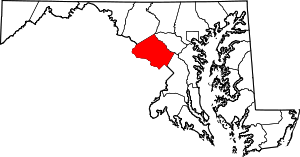 | |
| Towns | ||
| Villages & Special Tax Districts | ||
| CDPs |
| |
| Unincorporated communities | ||
| Footnotes | ‡This populated place also has portions in an adjacent county or counties | |
| Authority control |
|---|