Four Corners, Maryland
Four Corners is a neighborhood located in Montgomery County, Maryland, United States. Many residents of Four Corners consider the neighborhood to be a part of Silver Spring. The United States Census Bureau defines Four Corners as a distinct census-designated place (CDP).[1] Prior to the 2010 U.S. Census, it was defined as a part of the Silver Spring CDP.[2]
Four Corners | |
|---|---|
 Intersection of MD 193 and its western turnaround in Four Corners | |
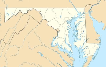 Four Corners Location in Maryland | |
| Coordinates: 39°1′13.44″N 77°0′46.0794″W | |
| Country | |
| State | |
| County | |
| Unincorporated community | Silver Spring |
| ZIP Code | 20901 |
| Area codes | 301, 240 |
| FIPS code | 24-29790 |
| GNIS feature IDs | 2583623, 590232 |
Location
Four Corners is bounded by Dennis Avenue to the northwest, the Sligo Creek Trail to the northeast, and Interstate 495 (Capital Beltway) to the south. It borders the neighborhoods of Woodmoor and Indian Spring Village, Franklin Knolls, Indian Spring Terrace, North Hills Sligo Park, and Burnt Mills Hills. The community of Northwood Park is also considered to be part of the Four Corners neighborhood, and is commonly known as Northwood-Four Corners or simply North Four Corners.
Landmarks
Located within Four Corners,[1] Montgomery Blair High School (MBHS)[3] is a public high school named after Montgomery Blair, the son of Francis Preston Blair, the founder of Silver Spring. Blair was a lawyer who represented Dred Scott in his United States Supreme Court case, and served as Postmaster General under President Abraham Lincoln. The school is nationally recognized for its magnet program and Communication Arts Program (CAP).
The Polychrome Historic District is a national historic district in the Four Corners neighborhood. It recognizes a group of five houses built by John Joseph Earley in 1934 and 1935.[4][5][6]
The land that comprises North Four Corners Park was first acquired in the mid-1940s. It was a plot of land for temporary homes for the military during World War II. It was a white only neighborhood for a short while. The park grew in size to 14 acres in 1998. The park features a recreation building, playground, ballfields, tennis courts, and a picnic area.[7]
A number of historic homes exist in North Four Corners. These include the Silver Spring 1939 World’s Fair Home (House No. 15 in the 'Town of Tomorrow'), and the brick Tudor Revival Washington Gas Model Home that opened the 1938 building program in Northwood Park.[8]
History
In the 1700s, a water mill was built at the easternmost corner of Four Corners, where today's Colesville Road passes over the Northwest Branch of the Anacostia River and becomes Columbia Pike. The mill building burned down in 1788, hence the name Burnt Mills. Rebuilt in the late 1700s or early 1800s, ownership of the mill changed hands several times in the 19th Century before closing down in the early years of the 20th Century. The land was then donated to the Boy Scouts of America, who established a camp named for President Woodrow Wilson. In the early 1920s, the boy scouts donated part of the land to the Washington Suburban Sanitary Commission, and a temporary water filtration plant was erected at the site. Work on a new plant was completed in 1936, and the plant was named for the Washington Suburban Sanitary Commission's chief engineer, Robert Morse. The dam and the two Georgian Revival pump houses were acquired by the Maryland-National Capital Park and Planning Commission between 1996 and 2000 and are now on the Historic Register. The Burnt Mills Dam is a popular starting point for hikers of the Northwest Branch Trail, whose northernmost section runs along the eastern and northern border of the neighborhood.[9][10][11]
In the 19th century, there was an agricultural community located at the crossroads on the Bladensburg and Colesville Roads. The community remained rural until the post-World War I building boom in suburban Montgomery County. Four Corners came into being as a residential neighborhood between the world wars[12], beginning in the late 1930s with the development of Northwood Park, Woodmoor, Indian Spring Village, Indian Spring Terrace, North Hills of Sligo Park, and Fairway. These subdivisions expanded between 1945 and 1955 even as new ones, such as Northwood and Franklin Knolls, were constructed. The single-family house subdivisions that soon surrounded Four Corners had winding streets that formed an irregular grid in between major roads. Four Corners was largely developed by the late 1950s.[13]
Transportation
Washington Metro service is available on the Red Line at the nearby Wheaton and Silver Spring stations. Four Corners is served by Metrobus numbers Z6, Z8, C2, and C4, as well as Ride On numbers 8, 9, and 19. The Piney Branch Road station of the Purple Line will be built in nearby Long Branch at the intersection of University Boulevard and Piney Branch Road and is expected to be open to the public by 2022.
Demographics
As of the 2010 United States Census,[14] the racial makeup of Four Corners was 67% White, 12.6% African American, 0% Native American or Alaska Native, 7.2% Asian, 0% Native Hawaiian or Pacific Islander, and 4.1% mixed race. Hispanics and Latinos of any race were 17.7% of the population. Non-Hispanic whites were 59.8% of the population.
References
| Wikimedia Commons has media related to Four Corners, Maryland. |
- "2010 CENSUS - CENSUS BLOCK MAP: Four Corners CDP, MD" (Archive). U.S. Census Bureau. Retrieved on June 22, 2015.
- "CENSUS 2000 BLOCK MAP: SILVER SPRING CDP" (Archive). U.S. Census Bureau. Retrieved on June 22, 2015. Detail 1 (Archive), Detail 2 (Archive)
- "Montgomery Blair High School". Mbhs.edu. Retrieved August 9, 2012.
- "John Kelly - Answer Man: Art Deco Homes Cast in Concrete". Washingtonpost.com. 2006-12-31. Retrieved 2012-08-09.
- "Art Deco Style Sparkles in Silver Spring". Washingtonpost.com. 2005-08-20. Retrieved 2012-08-09.
- "National Register Listings in Maryland". Mht.maryland.gov. Retrieved 2012-08-09.
- "Parks & Facilities Directory - North Four Corners Local Park". Montgomery Parks. Retrieved 2012-08-09.
- Rotenstein, David (1 October 2010). "Silver Spring World's Fair Home Featured at National Building Museum".
- http://blog.rosssutton.com/blog/burnt-mills-dam-long-history-montgomery-county/
- https://archive.org/details/TheHistoryAndConstructionOfTheMillAtBurntMillsMarylandInitiation
- https://www.loc.gov/resource/hhh.md1796.sheet/
- "North Four Corners places and buildings collage | History Sidebar". Blog.historian4hire.net. 2010-12-30. Retrieved 2012-08-09.
- "Maryland Historical Trust" (PDF). mht.maryland.gov.
- "Four Corners CDP, Maryland". United States Census. Retrieved 2020-01-18.
Municipalities and communities of Montgomery County, Maryland, United States | ||
|---|---|---|
| Cities | 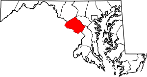 | |
| Towns | ||
| Villages & Special Tax Districts | ||
| CDPs |
| |
| Unincorporated communities | ||
| Footnotes | ‡This populated place also has portions in an adjacent county or counties | |