Chevy Chase View, Maryland
Chevy Chase View is a town located in Montgomery County, Maryland, United States. Established as a Special Tax District in 1924, the town was formally incorporated on October 28, 1993.[1][5] The population was 920 at the 2010 census.
Chevy Chase View, Maryland | |
|---|---|
 Location of Chevy Chase View, Maryland | |
| Coordinates: 39°1′4″N 77°4′50″W | |
| Country | |
| State | |
| County | |
| Special Tax District | 1924 |
| Incorporated | October 28, 1993[1] |
| Area | |
| • Total | 0.27 sq mi (0.69 km2) |
| • Land | 0.27 sq mi (0.69 km2) |
| • Water | 0.00 sq mi (0.00 km2) |
| Elevation | 318 ft (97 m) |
| Population | |
| • Total | 920 |
| • Estimate (2019)[4] | 980 |
| • Density | 3,656.72/sq mi (1,410.48/km2) |
| Time zone | UTC-5 (Eastern (EST)) |
| • Summer (DST) | UTC-4 (EDT) |
| FIPS code | 24-16775 |
| GNIS feature ID | 0589968 |
| Website | www |
Geography
Chevy Chase View is located at 39°1'4" North, 77°4'50" West (39.017759, -77.080508).[6]
According to the United States Census Bureau, the town has a total area of 0.28 square miles (0.73 km2), all land.[7]
The town lies between Kensington to the north and the Capital Beltway to the south. It is bisected by Connecticut Avenue. To the east lies Silver Spring, to the west are Garrett Park and Bethesda, and to the south is the Beltway, Rock Creek Park, and North Chevy Chase.
Except for the three houses of worship within its bounds, Chevy Chase View is entirely residential. Its streets are lined by hundred-year-old oaks, maples, and evergreens, plus decorative plantings which the town maintains in its right-of-ways. Housing turnover is slow.
History
The origins of the town date to 18 April 1910 when a "Plat of Chevy Chase View" was recorded.[1] Real estate developer Claude Livingstone designed the community the previous year and then conveyed it to Harry E. Smith and John L. Whitmore.[1] Livingstone's design, except for a few minor street changes, has remained largely the same since. In 1924, a special tax district was formed.[1]
On August 3, 1993, the Montgomery County Council unanimously voted to allow residents to vote on whether to incorporate as a town.[8] Residents voted in favor of incorporation in a referendum held on September 21, 1993.[5] The Montgomery County Council certified the results of the referendum, effective October 28, 1993.[5]
Demographics
| Historical population | |||
|---|---|---|---|
| Census | Pop. | %± | |
| 2000 | 863 | — | |
| 2010 | 920 | 6.6% | |
| Est. 2019 | 980 | [4] | 6.5% |
| U.S. Decennial Census[9] | |||
2010 census
As of the census[3] of 2010, there were 920 people, 298 households, and 250 families living in the town. The population density was 3,285.7 inhabitants per square mile (1,268.6/km2). There were 311 housing units at an average density of 1,110.7 per square mile (428.8/km2). The racial makeup of the town was 94.3% White, 2.2% African American, 0.1% Native American, 2.0% Asian, 0.1% Pacific Islander, and 1.3% from two or more races. Hispanic or Latino of any race were 4.0% of the population.
There were 298 households of which 42.3% had children under the age of 18 living with them, 76.5% were married couples living together, 6.4% had a female householder with no husband present, 1.0% had a male householder with no wife present, and 16.1% were non-families. 13.1% of all households were made up of individuals and 6.7% had someone living alone who was 65 years of age or older. The average household size was 3.09 and the average family size was 3.38.
The median age in the town was 44.1 years. 32% of residents were under the age of 18; 4.4% were between the ages of 18 and 24; 15.2% were from 25 to 44; 32% were from 45 to 64; and 16.1% were 65 years of age or older. The gender makeup of the town was 48.5% male and 51.5% female.
2000 census
As of the census of 2000, there were 863 people, 303 households, and 232 families living in the town. The population density was 3,274.6 people per square mile (1,281.6/km2). There were 306 housing units at an average density of 1,161.1 per square mile (454.4/km2). The racial makeup of the town was 95.25% White, 2.43% Asian, 1.85% Hispanic or Latino, and 1.51% African- American.
There were 303 households, out of which 38.6% had children under the age of 18 living with them, 70.6% were married couples living together, 4.3% had a female householder with no husband present, and 23.4% were non-families. 18.8% of all households were made up of individuals. The average household size was 2.85 and the average family size was 3.29.
30.5% of residents were under the age of 18, 3.2% from 18 to 24, 20.0% from 25 to 44, 32.2% from 45 to 64, and 14.0% 65 years of age or older. The median age was 43 years.
The median income for a household in the town was $120,828, and the median income for a family was $139,468. Males had a median income of $100,000 versus $77,899 for females. The per capita income for the town was $58,916. 1.1% of the population and 0.0% of families were below the poverty line.
Government
The town has a town council with a chairman and four councilmembers.[1] The town council maintains its own website, and meets monthly to ensure the maintenance of Chevy Chase View's environment.
Education
Resident students are zoned to schools in the Montgomery County Public Schools district, more specifically to Rosemary Hills Elementary School (PreK–2), North Chevy Chase Elementary School (3–5), Silver Creek Middle School (6–8), and Bethesda-Chevy Chase High School (9–12).
Transportation
_just_south_of_Franklin_Street_in_Chevy_Chase_View%2C_Montgomery_County%2C_Maryland.jpg)
The main state highway serving Chevy Chase View is Maryland Route 185 (Connecticut Avenue). MD 185 has an interchange with the nearest Interstate highway, Interstate 495 (the Capital Beltway), just south of the town limits. MD 185 also provides direct access to Washington, D.C.
References
- Linda M. Burrell et al., eds. Maryland's 157: The Incorporated Cities and Towns. Annapolis, MD: Maryland Municipal League, 2000. p. 82.
- "2019 U.S. Gazetteer Files". United States Census Bureau. Retrieved July 25, 2020.
- "U.S. Census website". United States Census Bureau. Retrieved 2013-01-25.
- "Population and Housing Unit Estimates". United States Census Bureau. May 24, 2020. Retrieved May 27, 2020.
- "Charter of the Town of Chevy Chase View". Town of Chevy Chase View. 1993.
- "US Gazetteer files: 2010, 2000, and 1990". United States Census Bureau. 2011-02-12. Retrieved 2011-04-23.
- "US Gazetteer files 2010". United States Census Bureau. Archived from the original on 2012-01-25. Retrieved 2013-01-25.
- Wagner, Arlo. "Village's incorporation passes: Residents' OK a technicality". The Washington Times. August 4, 1993.
- "Census of Population and Housing". Census.gov. Retrieved June 4, 2015.
External links
| Wikimedia Commons has media related to Chevy Chase View, Maryland. |
| Authority control |
|
|---|
Municipalities and communities of Montgomery County, Maryland, United States | ||
|---|---|---|
| Cities | 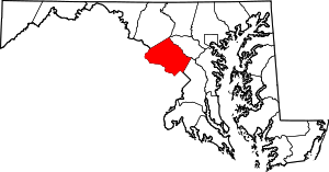 | |
| Towns | ||
| Villages & Special Tax Districts | ||
| CDPs |
| |
| Unincorporated communities | ||
| Footnotes | ‡This populated place also has portions in an adjacent county or counties | |