Shire of Wongan–Ballidu
The Shire of Wongan-Ballidu is a local government area in the Wheatbelt region of Western Australia, about 180 kilometres (112 mi) NNE of Perth, the state capital. The Shire covers an area of 3,369 square kilometres (1,301 sq mi) and its seat of government is the town of Wongan Hills.
| Shire of Wongan-Ballidu Western Australia | |||||||||||||||
|---|---|---|---|---|---|---|---|---|---|---|---|---|---|---|---|
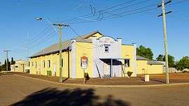 Ballidu Hall, 2014 | |||||||||||||||
 Location in Western Australia | |||||||||||||||
| Population | 1,331 (2016 census)[1] | ||||||||||||||
| • Density | 0.39511/km2 (1.0233/sq mi) | ||||||||||||||
| Established | 1887 | ||||||||||||||
| Area | 3,368.7 km2 (1,300.7 sq mi) | ||||||||||||||
| President | Jon Hasson | ||||||||||||||
| Council seat | Wongan Hills | ||||||||||||||
| Region | Wheatbelt | ||||||||||||||
| State electorate(s) | Moore | ||||||||||||||
| Federal Division(s) | Durack | ||||||||||||||
| Website | Shire of Wongan-Ballidu | ||||||||||||||
| |||||||||||||||
History
On 10 February 1887, the Melbourne Road District was created. It was renamed the Wongan-Ballidu Road District on 18 June 1926. On 1 July 1961, it became a shire following the passage of the Local Government Act 1960, which reformed all remaining road districts into shires.[2]
Wards
As of 3 May 2003, there are ten councillors and no wards. The mayor is directly elected.
Population
| Year | Population |
|---|---|
| 1921 | 666 |
| 1933 | 1,582 |
| 1947 | 1,530 |
| 1954 | 2,048 |
| 1961 | 2,145 |
| 1966 | 2,333 |
| 1971 | 2,243 |
| 1976 | 2,177 |
| 1981 | 2,087 |
| 1986 | 1,922 |
| 1991 | 1,685 |
| 1996 | 1,538 |
| 2001 | 1,503 |
| 2006 | 1,385 |
| 2011 | 1,434 |
| 2016 | 1,331 |
References
- Australian Bureau of Statistics (27 June 2017). "Wongan-Ballidu (S)". 2016 Census QuickStats. Retrieved 28 October 2019.

- "Municipality Boundary Amendments Register" (PDF). Western Australian Electoral Distribution Commission. Retrieved 11 January 2020.
This article is issued from Wikipedia. The text is licensed under Creative Commons - Attribution - Sharealike. Additional terms may apply for the media files.