Shire of Gingin
The Shire of Gingin is a local government area in the Wheatbelt region of Western Australia, just beyond the northern fringe of the Perth metropolitan area. The Shire covers an area of 3,211 square kilometres (1,240 sq mi) and its seat of government is the town of Gingin.
| Shire of Gingin Western Australia | |||||||||||||||
|---|---|---|---|---|---|---|---|---|---|---|---|---|---|---|---|
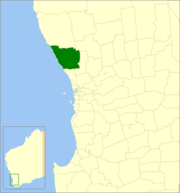 Location in Western Australia | |||||||||||||||
| Population | 5,217 (2016 census)[1] | ||||||||||||||
| • Density | 1.62468/km2 (4.2079/sq mi) | ||||||||||||||
| Established | 1893 | ||||||||||||||
| Area | 3,211.1 km2 (1,239.8 sq mi) | ||||||||||||||
| Council seat | Gingin | ||||||||||||||
| Region | Wheatbelt | ||||||||||||||
| State electorate(s) | Moore | ||||||||||||||
| Federal Division(s) | Pearce | ||||||||||||||
| Website | Shire of Gingin | ||||||||||||||
| |||||||||||||||
History
The Gingin Road District was established on 12 January 1893. 11 days later, on 23 February 1893, the township of Gingin separated as the Municipality of Gingin. The municipality merged back into the road district on 26 June 1903.[2]
On 1 July 1961, it became a shire following the passage of the Local Government Act 1960, which reformed all remaining road districts into shires.[2]
Wards
The Shire had been divided into several wards, most with one councillor: This was changed to a no ward system in 2013.
Towns and localities
- Gingin
- Beermullah
- Breton Bay
- Caraban
- Gabbadah
- Ginginup
- Granville
- Guilderton
- Karakin
- Lancelin
- Ledge Point
- Moore River National Park
- Muckenburra
- Nilgen
- Red Gully
- Seabird
- Wanerie
- Wilbinga
- Woodridge
- Yeal
Population
| Year | Population |
|---|---|
| 1911 | 669 |
| 1921 | 686 |
| 1933 | 1,063 |
| 1947 | 751 |
| 1954 | 757 |
| 1961 | 769 |
| 1966 | 1,021 |
| 1971 | 1,169 |
| 1976 | 1,255 |
| 1981 | 1,875 |
| 1986 | 2,589 |
| 1991 | 2,708 |
| 1996 | 3,178 |
| 2001 | 3,803 |
| 2006 | 4,318 |
| 2011 | 4,685 |
| 2016 | 5,217 |
References
- Australian Bureau of Statistics (27 June 2017). "Gingin (S)". 2016 Census QuickStats. Retrieved 1 December 2017.

- "Municipality Boundary Amendments Register" (PDF). Western Australian Electoral Distribution Commission. Retrieved 11 January 2020.