Shire of Peppermint Grove
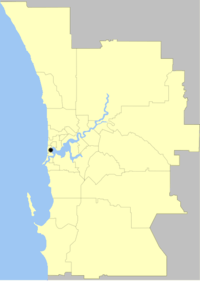
The Shire of Peppermint Grove is a small local government area in the Inner Metro Area of Perth, the capital of Western Australia, between Mosman Park and Claremont, about 12 km southwest of the Perth CBD. The Shire of Peppermint Grove, at 1.1 square kilometres (0.42 sq mi), is the smallest local government area in Australia and contains a single suburb, also named Peppermint Grove. The Council of the Shire comprises seven elected councillors, with no ward divisions.
| Shire of Peppermint Grove Western Australia | |||||||||||||||
|---|---|---|---|---|---|---|---|---|---|---|---|---|---|---|---|
 | |||||||||||||||
| Population | 1,636 (2016 census)[1] | ||||||||||||||
| • Density | 1,490/km2 (3,850/sq mi) | ||||||||||||||
| Established | 1895 | ||||||||||||||
| Area | 1.1 km2 (0.4 sq mi) | ||||||||||||||
| President | Ian Wallace | ||||||||||||||
| Council seat | Peppermint Grove | ||||||||||||||
| Region | Inner Metro Area of Metropolitan Perth | ||||||||||||||
| State electorate(s) | Cottesloe | ||||||||||||||
| Federal Division(s) | Curtin | ||||||||||||||
| Website | Shire of Peppermint Grove | ||||||||||||||
| |||||||||||||||
History
The Peppermint Grove Road District was gazetted on 4 October 1895.[2] On 1 July 1961, it became a shire under the Local Government Act 1960, which reformed all remaining road districts into shires.[3]
The shire was located on the Perth–Fremantle road (now Stirling Highway) and had received assistance in its maintenance in the past.[4]
In 2014 the Barnett Government sought to encourage the amalgamation of smaller Western Australian Local Governments and reduce the number of Perth metropolitan Councils from 30 to 16. This included the potential merger of Peppermint Grove with other western suburbs local governments, including Claremont, Nedlands, Mosman Park and Cottesloe. Community opposition and threats of legal actions from Peppermint Grove and other local governments[5] led to the collapse of the reform process.[6]
Population
| Year | Population |
|---|---|
| 1911 | 1,043 |
| 1921 | 1,110 |
| 1933 | 1,428 |
| 1947 | 1,474 |
| 1954 | 1,468 |
| 1961 | 1,502 |
| 1966 | 1,602 |
| 1971 | 1,511 |
| 1976 | 1,587 |
| 1981 | 1,540 |
| 1986 | 1,243 |
| 1991 | 1,453 |
| 1996 | 1,592 |
| 2001 | 1,527 |
| 2006 | 1,580 |
| 2011 | 1,528 |
| 2016 | 1,636 |
Heritage-listed places
As of 2020, 177 places are heritage-listed in the Shire of Peppermint Grove,[7] of which seven are on the State Register of Heritage Places.[8] In 2019, the Shire lost a six year legal battle with a resident who opposed the local government's heritage classification of his property.[9] [10]
References
- Australian Bureau of Statistics (27 June 2017). "Peppermint Grove (T)". 2016 Census QuickStats. Retrieved 26 November 2017.

- Illustrations Ltd; HRRC (1951), Peppermint Grove Road Board Chairman & members, jubilee year, 1951, retrieved 5 March 2015
- "Municipality Boundary Amendments Register" (PDF). Western Australian Electoral Distribution Commission. Retrieved 11 January 2020.
- "PEPPERMINT GROVE ROAD BOARD". The West Australian. Perth: National Library of Australia. 9 July 1908. p. 7. Retrieved 5 March 2015.
- Strutt, Jessica (4 November 2014). "Peppermint Grove council to launch legal action over state government's merger plans". ABC News. Retrieved 6 April 2020.
- Foster, Brendan; Riddell, Alex (8 February 2015). "Council mergers scrapped after ratepayer polls". WA Today.
- "Shire of Peppermint Grove Heritage Places". inherit.stateheritage.wa.gov.au. Heritage Council of Western Australia. Retrieved 2 April 2020.
- "Shire of Peppermint Grove State Register of Heritage Places". inherit.stateheritage.wa.gov.au. Heritage Council of Western Australia. Retrieved 2 April 2020.
- Bassett, Jon (25 October 2017). "Town of Peppermint Grove heads to Supreme Court over heritage listing for multi-million dollar home". Perth Now.
- Macdonald, Kim (2 August 2019). "Retired pearl farmer's $15m victory against Peppermint Grove council over heritage listing". The West Australian.