City of Belmont
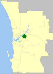
The City of Belmont is a local government area in the inner eastern suburbs of the Western Australian capital city of Perth, located about 8 kilometres (5 mi) east of Perth's central business district on the south bank of the Swan River. The City covers an area of 39.8 square kilometres (15.4 sq mi), maintains 225 km of roads and had a population of almost 40,000 as at the 2016 Census. The City of Belmont is a member of the Eastern Metropolitan Regional Council
| City of Belmont Western Australia | |||||||||||||||
|---|---|---|---|---|---|---|---|---|---|---|---|---|---|---|---|
 | |||||||||||||||
| Population |
| ||||||||||||||
| • Density | 997.0/km2 (2,582/sq mi) | ||||||||||||||
| Established | 1898 | ||||||||||||||
| Area | 39.8 km2 (15.4 sq mi) | ||||||||||||||
| Mayor | Philip Marks, Deputy Mayor Robert Rossi | ||||||||||||||
| Council seat | Belmont | ||||||||||||||
| Region | Eastern Metropolitan Perth | ||||||||||||||
| State electorate(s) | Belmont | ||||||||||||||
| Federal Division(s) | Swan | ||||||||||||||
| Website | City of Belmont | ||||||||||||||
| |||||||||||||||
Belmont contains Perth's domestic and international airports which account for 33.7% of the City of Belmont's land area.
History
The Belmont Road District was created on 2 December 1898. On 4 October 1907, it was renamed Belmont Park. From 1906 until 1909, Burswood Island was part of the district.
On 1 July 1961, the Belmont Park Road District became the Shire of Belmont following the enactment of the Local Government Act 1960. On 17 February 1979 it attained city status.[3][4]
Ascot and Belmont are suburbs long associated with horses, being close to the race tracks (see Ascot Racecourse and Belmont Park). Until 1956 the Belmont Spur Railway linked Bayswater on the Perth to Midland line to the Ascot race track.
Wards
The City is divided into four wards:
- West Ward (three councillors)
- East Ward (three councillors)
- South Ward (three councillors)
Population
| Year | Population |
|---|---|
| 1911 | 1,088 |
| 1921 | 1,866 |
| 1933 | 3,139 |
| 1947 | 5,712 |
| 1954 | 15,820 |
| 1961 | 20,393 |
| 1966 | 26,978 |
| 1971 | 32,656 |
| 1976 | 31,531 |
| 1981 | 29,855 |
| 1986 | 28,867 |
| 1991 | 26,744 |
| 1996 | 26,613 |
| 2001 | 28,817 |
| 2006 | 30,331 |
| 2011 | 35,209 |
| 2016 | 39,682 |
Mayors
Heritage-listed places
As of 2020, 109 places are heritage-listed in the City of Belmont,[6] of which seven are on the State Register of Heritage Places, among them the Garratt Road Bridge.[7]
References
- Australian Bureau of Statistics (27 June 2017). "Belmont (C)". 2016 Census QuickStats. Retrieved 26 November 2017.

- "3218.0 – Regional Population Growth, Australia, 2017-18". Australian Bureau of Statistics. 27 March 2019. Retrieved 31 December 2019. Estimated resident population (ERP) at 30 June 2018.
- WA Electoral Commission, Municipality Boundary Amendments Register (release 3.0), 31 July 2007.
- "Local Government Act 1960-1978 - Order in Council (per LG. BL-1-10)". Western Australia Government Gazette. 22 December 1978. p. 1978:4778.
- "Archived copy". Archived from the original on 10 October 2008. Retrieved 22 October 2009.CS1 maint: archived copy as title (link)
- "City of Belmont Heritage Places". inherit.stateheritage.wa.gov.au. Heritage Council of Western Australia. Retrieved 12 April 2020.
- "City of Belmont State Register of Heritage Places". inherit.stateheritage.wa.gov.au. Heritage Council of Western Australia. Retrieved 12 April 2020.