Shire of Dowerin
The Shire of Dowerin is a local government area in the Wheatbelt region of Western Australia, about 160 kilometres (100 mi) northeast of Perth, the state capital. The Shire covers an area of 1,847 square kilometres (713 sq mi) and its seat of government is the town of Dowerin.
| Shire of Dowerin Western Australia | |||||||||||||||
|---|---|---|---|---|---|---|---|---|---|---|---|---|---|---|---|
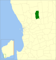 Location in Western Australia | |||||||||||||||
| Population | 690 (2016 census)[1] | ||||||||||||||
| • Density | 0.3736/km2 (0.968/sq mi) | ||||||||||||||
| Established | 1911 | ||||||||||||||
| Area | 1,846.7 km2 (713.0 sq mi) | ||||||||||||||
| Mayor | Darrel Hudson | ||||||||||||||
| Council seat | Dowerin | ||||||||||||||
| Region | Wheatbelt | ||||||||||||||
| State electorate(s) | Moore | ||||||||||||||
| Federal Division(s) | Durack | ||||||||||||||
| Website | Shire of Dowerin | ||||||||||||||
| |||||||||||||||
History
On 3 November 1911, the Dowerin Road District was gazetted. On 1 July 1961, it became a shire following enactment of the Local Government Act 1960.[2]
Wards
Council resolved to dissolve Wards in December 2016.
Towns and localities
- Dowerin
- Amery
- Ejanding
- Koomberkine
- Manmanning
- Minnivale
- Ucarty
Population
| Year | Population |
|---|---|
| 1921 | 1,063 |
| 1933 | 1,475 |
| 1947 | 1,152 |
| 1954 | 1,311 |
| 1961 | 1,392 |
| 1966 | 1,300 |
| 1971 | 1,071 |
| 1976 | 1,070 |
| 1981 | 998 |
| 1986 | 961 |
| 1991 | 881 |
| 1996 | 817 |
| 2001 | 782 |
| 2006 | 702 |
| 2011 | 678 |
References
- Australian Bureau of Statistics (27 June 2017). "Dowerin (S)". 2016 Census QuickStats. Retrieved 28 October 2019.

- WA Electoral Commission, Municipality Boundary Amendments Register (release 3.0), 31 July 2007.
External links
This article is issued from Wikipedia. The text is licensed under Creative Commons - Attribution - Sharealike. Additional terms may apply for the media files.