Lauderdale County, Mississippi
Lauderdale County is a county located on the eastern border of the U.S. state of Mississippi. As of the 2010 census, the population was 80,261.[1] The county seat is Meridian.[2] The county is named for Colonel James Lauderdale, who was killed at the Battle of New Orleans in the War of 1812.[3]
Lauderdale County | |
|---|---|
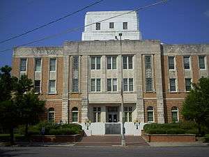 Lauderdale County Courthouse | |
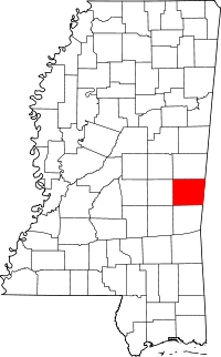 Location within the U.S. state of Mississippi | |
 Mississippi's location within the U.S. | |
| Coordinates: 32°24′N 88°40′W | |
| Country | |
| State | |
| Founded | 1833 |
| Named for | James Lauderdale |
| Seat | Meridian |
| Largest city | Meridian |
| Area | |
| • Total | 715 sq mi (1,850 km2) |
| • Land | 704 sq mi (1,820 km2) |
| • Water | 12 sq mi (30 km2) 1.6% |
| Population (2010) | |
| • Total | 80,261 |
| • Estimate (2018) | 75,317 |
| • Density | 110/sq mi (43/km2) |
| Time zone | UTC−6 (Central) |
| • Summer (DST) | UTC−5 (CDT) |
| Congressional district | 3rd |
| Website | www |
Lauderdale County is included in the Meridian, MS Micropolitan Statistical Area.
History
Andrew Jackson traveled through the county on his way to New Orleans and a town was named Hickory after his nickname "Old Hickory". An early explorer Sam Dale died in the county and is buried in Daleville, and a large monument is placed at his burial site. The largest city in the county is Meridian, which was in important railway intersection during the early 20th century. It was also home to the Soule Steam Feed Works which manufactured steam engines. Logging and rail transport were important early industries in the county. One of the largest waterfalls in Mississippi, Dunns Falls, is located in the county and a water driven mill still exists on the site. Lauderdale county is also home to the headquarters of Peavey Electronics which has manufactured audio and music equipment for half a century.
Like much of the post-Reconstruction South the county has a checkered racial history with 16 documented lynchings in the period from 1877 to 1950; most occurred around the turn of the 20th century.[4]
Geography
According to the U.S. Census Bureau, the county has a total area of 715 square miles (1,850 km2), of which 704 square miles (1,820 km2) is land and 12 square miles (31 km2) (1.6%) is water.[5]
Major highways


Adjacent counties
- Kemper County (north)
- Sumter County, Alabama (east)
- Choctaw County, Alabama (southeast)
- Clarke County (south)
- Newton County (west)
Demographics
| Historical population | |||
|---|---|---|---|
| Census | Pop. | %± | |
| 1840 | 5,358 | — | |
| 1850 | 8,717 | 62.7% | |
| 1860 | 13,313 | 52.7% | |
| 1870 | 13,462 | 1.1% | |
| 1880 | 21,501 | 59.7% | |
| 1890 | 29,661 | 38.0% | |
| 1900 | 38,150 | 28.6% | |
| 1910 | 46,919 | 23.0% | |
| 1920 | 45,897 | −2.2% | |
| 1930 | 52,748 | 14.9% | |
| 1940 | 58,247 | 10.4% | |
| 1950 | 64,171 | 10.2% | |
| 1960 | 67,119 | 4.6% | |
| 1970 | 67,087 | 0.0% | |
| 1980 | 77,285 | 15.2% | |
| 1990 | 75,555 | −2.2% | |
| 2000 | 78,161 | 3.4% | |
| 2010 | 80,261 | 2.7% | |
| Est. 2018 | 75,317 | [6] | −6.2% |
| U.S. Decennial Census[7] 1790-1960[8] 1900-1990[9] 1990-2000[10] 2010-2013[1] | |||
As of the census[11] of 2000, there were 78,161 people, 29,990 households, and 20,573 families residing in the county. The population density was 111 people per square mile (43/km²). There were 33,418 housing units at an average density of 48 per square mile (18/km²). The racial makeup of the county was 60.15% White, 38.18% Black or African American, 0.18% Native American, 0.50% Asian, 0.03% Pacific Islander, 0.34% from other races, and 0.63% from two or more races. 1.14% of the population were Hispanic or Latino of any race.
There were 29,990 households out of which 33.90% had children under the age of 18 living with them, 46.70% were married couples living together, 18.30% had a female householder with no husband present, and 31.40% were non-families. 28.00% of all households were made up of individuals and 11.70% had someone living alone who was 65 years of age or older. The average household size was 2.49 and the average family size was 3.06.
In the county, the population was spread out with 26.60% under the age of 18, 9.80% from 18 to 24, 28.00% from 25 to 44, 21.40% from 45 to 64, and 14.20% who were 65 years of age or older. The median age was 35 years. For every 100 females there were 90.60 males. For every 100 females age 18 and over, there were 85.50 males.
The median income for a household in the county was $30,768, and the median income for a family was $37,581. Males had a median income of $31,069 versus $21,111 for females. The per capita income for the county was $16,026. About 17.10% of families and 20.80% of the population were below the poverty line, including 28.80% of those under age 18 and 18.80% of those age 65 or over.
2015
As of 2015 the largest self-identified ancestry groups in Lauderdale County, Mississippi are:
- English - 9.3%
- Irish - 8.9%
- American - 8.0%
- German - 5.9%
- Scottish - 2.1%
- Scots-Irish - 1.7%
- Italian - 1.2%
- French (except Basque) - 1.1%
- French-Canadian - 0.6%[12]
Government and infrastructure
The East Mississippi Correctional Facility is located in an unincorporated area of the county, near Meridian. Intended to provide intensive treatment for up to 1500 state prisoners who are mentally ill, it has been operated since 2012 by Management and Training Corporation under contract to the Mississippi Department of Corrections. In 2013 the ACLU and Southern Poverty Law Center filed a class-action suit against the state and MTC for poor conditions at the facility.[13] The court granted the plaintiffs class certification in 2015, allowing the case to proceed.[14] The former for-profit contractor, GEO Group,[15] was forced out of its contracts for this and two other state facilities in 2012 as a result of settlement of a class-action suit for its poor management of the Walnut Grove Youth Correctional Facility.[16]
| Year | Republican | Democratic | Third parties |
|---|---|---|---|
| 2016 | 60.1% 17,741 | 38.2% 11,269 | 1.7% 496 |
| 2012 | 57.1% 18,700 | 42.2% 13,814 | 0.8% 263 |
| 2008 | 59.1% 19,582 | 40.3% 13,332 | 0.6% 200 |
| 2004 | 65.4% 19,736 | 34.1% 10,292 | 0.5% 142 |
| 2000 | 66.7% 17,315 | 32.4% 8,412 | 0.9% 243 |
| 1996 | 60.6% 15,055 | 34.9% 8,668 | 4.5% 1,111 |
| 1992 | 62.3% 17,098 | 30.9% 8,489 | 6.8% 1,879 |
| 1988 | 69.0% 18,302 | 30.0% 7,967 | 1.0% 260 |
| 1984 | 69.0% 18,807 | 27.6% 7,534 | 3.4% 916 |
| 1980 | 56.4% 14,727 | 38.0% 9,918 | 5.6% 1,474 |
| 1976 | 58.4% 14,273 | 40.1% 9,813 | 1.5% 360 |
| 1972 | 81.8% 18,337 | 15.4% 3,453 | 2.8% 630 |
| 1968 | 11.4% 2,328 | 15.7% 3,195 | 72.9% 14,842 |
| 1964 | 89.4% 13,291 | 10.6% 1,583 | |
| 1960 | 26.4% 2,836 | 35.0% 3,755 | 38.7% 4,154 |
| 1956 | 30.9% 2,817 | 59.3% 5,414 | 9.8% 896 |
| 1952 | 41.5% 4,137 | 58.5% 5,841 | |
| 1948 | 2.8% 171 | 9.5% 578 | 87.7% 5,330 |
| 1944 | 5.9% 379 | 94.1% 6,036 | |
| 1940 | 4.9% 303 | 95.0% 5,936 | 0.1% 7 |
| 1936 | 1.1% 67 | 98.7% 6,075 | 0.2% 12 |
| 1932 | 3.8% 191 | 95.9% 4,830 | 0.4% 18 |
| 1928 | 33.6% 1,798 | 66.4% 3,558 | |
| 1924 | 7.8% 320 | 77.9% 3,204 | 14.3% 589 |
| 1920 | 7.9% 228 | 87.8% 2,539 | 4.4% 126 |
| 1916 | 4.8% 157 | 92.7% 3,058 | 2.6% 85 |
| 1912 | 2.1% 50 | 90.3% 2,204 | 7.6% 186 |
Education
Lauderdale County is within the service area of the East Mississippi Community College system.[18] The system offers classes at the Naval Air Station Meridian Extension in Meridian.[19] Other academic institutions are Meridian Community College, University of Southern Mississippi School of Nursing (located inside Reed Hall building of Meridian Community College), and Mississippi State University Meridian Campus.
Notable people
- Samuel Dale (1772–1841), American frontiersman, known as the "Daniel Boone of Alabama" and a veteran of the Creek War of 1813-14. In 1836, Dale was elected as Lauderdale County's first representative in the Mississippi state legislature.[20]
References
- "State & County QuickFacts". United States Census Bureau. Archived from the original on June 7, 2011. Retrieved September 4, 2013.
- "Find a County". National Association of Counties. Retrieved 2011-06-07.
- Gannett, Henry (1905). The Origin of Certain Place Names in the United States. U.S. Government Printing Office. p. 182.
- Lynching in America, 2nd edition Archived 2018-06-27 at the Wayback Machine, Supplement by County, p. 5
- "2010 Census Gazetteer Files". United States Census Bureau. August 22, 2012. Archived from the original on September 28, 2013. Retrieved November 6, 2014.
- "Population and Housing Unit Estimates". Retrieved November 9, 2019.
- "U.S. Decennial Census". United States Census Bureau. Retrieved November 6, 2014.
- "Historical Census Browser". University of Virginia Library. Retrieved November 6, 2014.
- "Population of Counties by Decennial Census: 1900 to 1990". United States Census Bureau. Retrieved November 6, 2014.
- "Census 2000 PHC-T-4. Ranking Tables for Counties: 1990 and 2000" (PDF). United States Census Bureau. Retrieved November 6, 2014.
- "U.S. Census website". United States Census Bureau. Retrieved 2008-01-31.
- Bureau, U.S. Census. "American FactFinder - Results". factfinder.census.gov. Archived from the original on 2020-02-13. Retrieved 2018-03-04.
- Gabriel Eber (May 30, 2013). "NEW LAWSUIT: Massive Human Rights Violations at Mississippi Prison", ACLU. Retrieved December 3, 2014.
- Dockery v. Epps, updated September 2015, Cases: Prisoners' Rights, ACLU official website; accessed 7 March 2017
- "Private Prisons Archived 2012-10-13 at the Wayback Machine," Mississippi Department of Corrections. Retrieved on November 19, 2010.
- Goode, Erica (2014-06-07). "Seeing Squalor and Unconcern in a Mississippi Jail". New York Times. Retrieved 2015-01-08.
- Leip, David. "Dave Leip's Atlas of U.S. Presidential Elections". uselectionatlas.org. Retrieved 2018-03-04.
- "CATALOG 2007-2009 Archived 2010-12-18 at the Wayback Machine." East Mississippi Community College. 3 (3/147). Retrieved on March 1, 2011.
- "CATALOG 2007-2009 Archived 2010-12-18 at the Wayback Machine." East Mississippi Community College. 10 (10/147). Retrieved on March 1, 2011.
- Lewis, Herbert J. "Jim" (July 25, 2012). "Samuel Dale". Encyclopedia of Alabama.
External links
- Lauderdale County, MS
- Meridian/Lauderdale County Tourism Bureau
- Laurerdale County Courthouse Pictures
Places adjacent to Lauderdale County, Mississippi | ||||||||||
|---|---|---|---|---|---|---|---|---|---|---|
| ||||||||||
Municipalities and communities of Lauderdale County, Mississippi, United States | ||
|---|---|---|
| City | Map of Mississippi highlighting Lauderdale County | |
| Town | ||
| CDPs | ||
| Other unincorporated communities | ||
| Authority control |
|
|---|