Marshall County, Mississippi
Marshall County is a county located in the U.S. state of Mississippi. As of the 2010 census, the population was 37,144.[1] Its county seat is Holly Springs.[2] The county is named for Chief Justice of the United States John Marshall.[3]
Marshall County | |
|---|---|
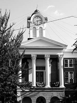 The Marshall County courthouse in Holly Springs | |
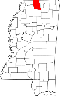 Location within the U.S. state of Mississippi | |
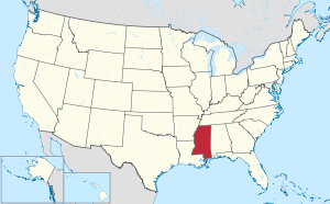 Mississippi's location within the U.S. | |
| Coordinates: 34°46′N 89°31′W | |
| Country | |
| State | |
| Founded | 1836 |
| Named for | John Marshall |
| Seat | Holly Springs |
| Largest city | Holly Springs |
| Area | |
| • Total | 710 sq mi (1,800 km2) |
| • Land | 706 sq mi (1,830 km2) |
| • Water | 3.6 sq mi (9 km2) 0.5%% |
| Population (2010) | |
| • Total | 37,144 |
| • Estimate (2018) | 35,451 |
| • Density | 52/sq mi (20/km2) |
| Time zone | UTC−6 (Central) |
| • Summer (DST) | UTC−5 (CDT) |
| Congressional district | 1st |
| Website | www |
Marshall County is part of the Memphis, TN-MS-AR Metropolitan Statistical Area.
Geography
According to the U.S. Census Bureau, the county has a total area of 710 square miles (1,800 km2), of which 706 square miles (1,830 km2) is land and 3.6 square miles (9.3 km2) (0.5%) is water.[4]
Major highways
Adjacent counties
- Fayette County, Tennessee (north)
- Benton County (east)
- Union County (southeast)
- Lafayette County (south)
- Tate County (southwest)
- DeSoto County (west)
- Shelby County, Tennessee (northwest)
National protected area
Demographics
| Historical population | |||
|---|---|---|---|
| Census | Pop. | %± | |
| 1840 | 17,526 | — | |
| 1850 | 29,689 | 69.4% | |
| 1860 | 28,823 | −2.9% | |
| 1870 | 29,416 | 2.1% | |
| 1880 | 29,330 | −0.3% | |
| 1890 | 26,043 | −11.2% | |
| 1900 | 27,674 | 6.3% | |
| 1910 | 26,796 | −3.2% | |
| 1920 | 26,105 | −2.6% | |
| 1930 | 24,869 | −4.7% | |
| 1940 | 25,522 | 2.6% | |
| 1950 | 25,106 | −1.6% | |
| 1960 | 24,503 | −2.4% | |
| 1970 | 24,027 | −1.9% | |
| 1980 | 29,296 | 21.9% | |
| 1990 | 30,361 | 3.6% | |
| 2000 | 34,993 | 15.3% | |
| 2010 | 37,144 | 6.1% | |
| Est. 2018 | 35,451 | [5] | −4.6% |
| U.S. Decennial Census[6] 1790-1960[7] 1900-1990[8] 1990-2000[9] 2010-2013[1] | |||
As of the 2010 United States Census, there were 37,144 people living in the county. 50.1% were White, 46.9% Black or African American, 0.2% Native American, 0.2% Asian, 1.7% of some other race and 0.8% of two or more races. 3.2% were Hispanic or Latino (of any race).
At the 2000 census,[10] there were 34,993 people, 12,163 households and 9,110 families living in the county. The population density was 50 per square mile (19/km²). There were 13,252 housing units at an average density of 19 per square mile (7/km²). The racial makeup of the county was 50.36% Black or African American, 48.37% White, 0.17% Native American, 0.11% Asian, 0.01% Pacific Islander, 0.37% from other races, and 0.62% from two or more races. 1.21% of the population were Hispanic or Latino of any race.
According to the census[10] of 2000, the largest ancestry groups in Marshall County were African 50.36%, English 31.87%, Scottish 7.1%, Scots-Irish 3.13%, Irish 1.2% and Welsh 1.1%
There were 12,163 households of which 34.30% had children under the age of 18 living with them, 49.60% were married couples living together, 20.10% had a female householder with no husband present, and 25.10% were non-families. 22.00% of all households were made up of individuals and 7.90% had someone living alone who was 65 years of age or older. The average household size was 2.74 and the average family size was 3.19.
Age distribution was 26.60% under the age of 18, 11.80% from 18 to 24, 28.60% from 25 to 44, 22.00% from 45 to 64, and 11.10% who were 65 years of age or older. The median age was 34 years. For every 100 females there were 98.00 males. For every 100 females age 18 and over, there were 96.50 males.
The median household income was $28,756, and the median family income was $33,125. Males had a median income of $28,852 versus $21,227 for females. The per capita income for the county was $14,028. About 18.00% of families and 21.90% of the population were below the poverty line, including 28.70% of those under age 18 and 23.10% of those age 65 or over.
Communities
City
- Holly Springs (county seat and largest municipality)
Towns
Unincorporated communities
- Barton
- Bethlehem
- Cayce
- Chulahoma
- Hudsonville
- Marianna
- Mount Pleasant
- Orion
- Red Banks
- Slayden
- Victoria
- Wall Hill
- Waterford
- Watson
Politics
| Year | Republican | Democratic | Third parties |
|---|---|---|---|
| 2016 | 44.4% 6,587 | 54.1% 8,023 | 1.5% 229 |
| 2012 | 39.9% 6,473 | 59.4% 9,650 | 0.7% 117 |
| 2008 | 40.6% 6,683 | 58.8% 9,685 | 0.7% 110 |
| 2004 | 40.8% 5,975 | 58.7% 8,591 | 0.6% 83 |
| 2000 | 37.5% 4,723 | 61.4% 7,735 | 1.1% 134 |
| 1996 | 28.9% 3,272 | 66.3% 7,521 | 4.8% 547 |
| 1992 | 30.8% 3,847 | 63.2% 7,913 | 6.0% 752 |
| 1988 | 39.7% 4,668 | 59.4% 6,982 | 0.9% 101 |
| 1984 | 42.7% 4,389 | 56.9% 5,845 | 0.4% 44 |
| 1980 | 31.9% 3,455 | 65.9% 7,153 | 2.2% 240 |
| 1976 | 24.3% 2,242 | 73.4% 6,769 | 2.3% 215 |
| 1972 | 62.1% 3,326 | 35.0% 1,875 | 2.9% 155 |
| 1968 | 9.2% 577 | 46.3% 2,907 | 44.5% 2,794 |
| 1964 | 86.8% 2,251 | 13.2% 343 | |
| 1960 | 22.6% 404 | 38.2% 681 | 39.2% 700 |
| 1956 | 16.9% 287 | 70.4% 1,192 | 12.7% 215 |
| 1952 | 24.6% 604 | 75.4% 1,847 | |
| 1948 | 2.1% 29 | 10.9% 152 | 87.0% 1,216 |
| 1944 | 4.2% 63 | 95.8% 1,441 | 0.0% 0 |
| 1940 | 3.3% 48 | 96.7% 1,403 | |
| 1936 | 1.9% 22 | 98.0% 1,111 | 0.1% 1 |
| 1932 | 2.9% 38 | 97.1% 1,281 | 0.1% 1 |
| 1928 | 6.6% 100 | 93.4% 1,422 | |
| 1924 | 3.4% 40 | 96.6% 1,142 | |
| 1920 | 3.5% 30 | 96.1% 823 | 0.4% 3 |
| 1916 | 0.8% 8 | 99.1% 1,017 | 0.1% 1 |
| 1912 | 1.1% 9 | 93.2% 779 | 5.7% 48 |
References
| Wikimedia Commons has media related to Marshall County, Mississippi. |
- "State & County QuickFacts". United States Census Bureau. Archived from the original on June 7, 2011. Retrieved September 4, 2013.
- "Find a County". National Association of Counties. Retrieved 2011-06-07.
- Gannett, Henry (1905). The Origin of Certain Place Names in the United States. U.S. Government Printing Office. p. 200.
- "2010 Census Gazetteer Files". United States Census Bureau. August 22, 2012. Archived from the original on September 28, 2013. Retrieved November 6, 2014.
- "Population and Housing Unit Estimates". Retrieved November 9, 2019.
- "U.S. Decennial Census". United States Census Bureau. Retrieved November 6, 2014.
- "Historical Census Browser". University of Virginia Library. Retrieved November 6, 2014.
- "Population of Counties by Decennial Census: 1900 to 1990". United States Census Bureau. Retrieved November 6, 2014.
- "Census 2000 PHC-T-4. Ranking Tables for Counties: 1990 and 2000" (PDF). United States Census Bureau. Retrieved November 6, 2014.
- "U.S. Census website". United States Census Bureau. Retrieved 2008-01-31.
- Leip, David. "Dave Leip's Atlas of U.S. Presidential Elections". uselectionatlas.org. Retrieved 2018-03-05.
External links
- Official website of Marshall County
- McAlexander/Marshall County Collection (MUM00287) owned by the University of Mississippi, Archives and Special Collections.
Places adjacent to Marshall County, Mississippi | ||||||||||
|---|---|---|---|---|---|---|---|---|---|---|
| ||||||||||
Municipalities and communities of Marshall County, Mississippi, United States | ||
|---|---|---|
| City | Map of Mississippi highlighting Marshall County | |
| Towns | ||
| Unincorporated communities |
| |


| Authority control |
|
|---|