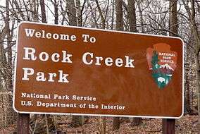
Rock Creek Park
Rock Creek Park is a large urban park that bisects the Northwest quadrant of Washington, D.C. The park was created by an Act of Congress in 1890 and today is administered by the National Park Service. In addition to the park proper, the Rock Creek administrative unit of the National Park Service administers various other federally owned properties in the District of Columbia located to the north and west of the National Mall, including Meridian Hill Park on 16th Street, N.W., the Old Stone House in Georgetown, and certain of the Fort Circle Parks, a series of batteries and forts encircling the District of Columbia for its defense during the U.S. Civil War.
| Rock Creek Park | |
|---|---|
IUCN category V (protected landscape/seascape) | |
 Maryland border entrance | |
| Location | District of Columbia, United States |
| Nearest city | Washington, D.C. |
| Area | Over 2,000 acres (3 sq mi; 8 km2)[1] |
| Established | September 27, 1890 |
| Visitors | 2,115,516 (in 2004) |
| Governing body | National Park Service |
Rock Creek Park Historic District | |
 Rock Creek Park | |
| Location | Roughly, Rock Creek Park from Klingle Road to Montgomery County line, Washington, D.C. |
| Coordinates | 38°57′27″N 77°2′42″W |
| Area | 1,754 acres (2.7 sq mi; 7.1 km2)[1] |
| Built | 1820s (Peirce Mill) 1897–1912 (Park facilities)[2] |
| Architect | Frederick Law Olmsted Jr., John Charles Olmsted |
| Architectural style | Late 19th and 20th Century Revivals, Early Republic, and NPS Rustic |
| NRHP reference No. | 91001524[3] |
| Added to NRHP | October 23, 1991 |
History
Rock Creek Park was established by an act of Congress signed into law by President Benjamin Harrison on September 27, 1890, following active advocacy by Charles C. Glover and other civic leaders and in the wake of the creation of the National Zoo the preceding year.
It was only the third national park established by the U.S., following Yellowstone in 1872 and Mackinac National Park in 1875. Sequoia was created at the same time, and Yosemite shortly thereafter. In 1933, Rock Creek Park became part of the newly formed National Capital Parks unit of the National Park Service.
The Rock Creek Park Act authorized the purchase of no more than 2,000 acres (810 ha) of land, extending north from Klingle Ford Bridge in the District of Columbia (approximately the northern limit of the National Zoo), to be "perpetually dedicated and set apart as a public park or pleasure ground for the benefit and enjoyment of the people of the United States".[4] The Act also called for regulations to "provide for the preservation from injury or spoliation of all timber, animals, or curiosities within said park, and their retention in their natural condition, as nearly as possible".[5] Rock Creek Park is the oldest natural urban park in the National Park System.[6] Park construction began in 1897.[2]
In 1913, Congress authorized creation of the Rock Creek and Potomac Parkway and extended the park along a narrow corridor from the zoo to the mouth of Rock Creek at the Potomac River.[7] The parkway is a major traffic thoroughfare, especially along the portion south of the zoo. The park is patrolled by the United States Park Police.
Description

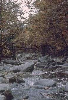
The main section of the park comprises 1754 acres (2.74 mi2, 7.10 km2), along the Rock Creek Valley. Including the other green areas the park administers (Glover Archbold Park, Montrose Park, Dumbarton Oaks Park, Meridian Hill Park, Battery Kemble Park, Palisades Park, Whitehaven Park, etc.), it encompasses more than 2000 acres (3 mi2, 8 km2).
The parklands follow the course of Rock Creek across the D.C.-Maryland border to connect with Rock Creek Stream Valley Park and Rock Creek Regional Park in Montgomery County. The Maryland parks are operated by the Maryland-National Capital Park and Planning Commission.
The Rock Creek Historic District was listed on the National Register of Historic Places on October 23, 1991.[8]
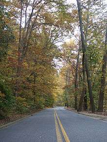
Recreation facilities include a golf course; equestrian trails; sport venues, including a tennis stadium which hosts major professional events; a nature center and planetarium; the Carter Barron Amphitheatre, an outdoor concert venue; and picnic and playground facilities. Rock Creek Park also maintains cultural exhibits, including the Peirce Mill. Rock Creek is a popular venue for jogging, cycling, and inline skating, especially on the long, winding Beach Drive, portions of which are closed to vehicles on weekends.[1]
A number of the city's outstanding bridges, such as the Lauzun's Legion, Dumbarton, Taft and the Duke Ellington bridges, span the creek and ravine.
Among the park's few monuments is a pink granite bench on Beach Drive south of the Peirce Mill, dedicated on November 7, 1936 by President Franklin Delano Roosevelt in memory of former French ambassador Jean Jules Jusserand.[9] In 2014, it was named "best obscure memorial" by Washington City Paper.[10]
Horse Center
Rock Creek Park Horse Center, founded in 1972, is located in the middle of the park near the Nature Center. The barn, run by Guest Services Inc, has 57 stalls, two outdoor rings, one indoor ring, and three bluestone turnout paddocks. The stable provides trail rides, pony rides, and lessons for the public, along with boarding for private horses. The stable primarily teaches English riding, with an emphasis on lower-level jumping and dressage.[11]
The barn is also home to Rock Creek Riders, a therapeutic riding program for adults and children with special needs in the DC area. Past participants in the program include brain-injured veterans of the conflicts in Iraq and Afghanistan and people with autism, cerebral palsy, or attention deficit disorder. The program is volunteer-run and relies on donations and contributions for funding. Previously, Rock Creek Riders has worked with the United States Mounted Police, National Park Service, Wounded Warrior Project, and the Caisson Platoon Equine Assisted Programs to provide these therapeutic riding services.[12]
The horse center's summer camps are popular with DC residents. The stable offers summer camp from 9–3 for children over eight, and a two-hour afternoon camp for children between five and eight years old. The stable also recently implemented a summer CIT training program for teenagers.
Peirce Mill

Peirce Mill is a water-powered grist mill in Rock Creek Park. There were at least eight mills along Rock Creek within what is now Washington, D.C., and many more farther upstream in Montgomery County, Maryland. Of those eight, only Peirce Mill is still standing.
It was built in the 1820s by Isaac Peirce, along with a house, barn, and other buildings. It was later owned by a son, Joshua Peirce, and a nephew Peirce Shoemaker. It became part of Rock Creek Park in 1892.[13]
The mill was listed on the National Register in 1969 as Peirce Mill.[3] It was repaired and re-opened October 15, 2011.
The Peirce Carriage Barn, adjacent to the mill, usually is open every day. The barn is the National Park Service point of contact. The barn was part of the Peirce estate built in 1810 and used as a tack room and carriage barn. The barn is now a mini-museum containing information on the milling process, the Peirce family estate and other mills along the Rock Creek Valley.
Rock Creek Multi-Use Trails
A set of hiker/biker trails in the park serve both commuters and recreational users. The mainline trail extends for about 1 mile (1.6 km) from Broad Branch Road to the southern end of the Park where the trail continues several miles to Arlington Memorial Bridge and Hains Point. The northern trails, consist of a loop along Bingham, Oregon, Beach and Military Roads with spurs along Oregon to the Nature Center and Wise Road. In the Park, the mainline trail starts at the parking lot just west of the creek and south of Broad Branch. From there, it is co-located with a section of the Western Ridge Trail south past Pierce Mill to a trail bridge over the creek, where the two separate. After a short distance on the east side of the creek, it crosses back to the west side on Bluff Bridge. Dating back to 1934, it is the oldest part of the trail in the park, and the same age as the Devil's Chair and Saddle Club Bridges farther south.[14] The trail remains on the west side until just south of Klingle Bridge where it crosses back to the east and leaves the park to enter the Zoo property.
The Park Service began to experiment with trails in August 1963 when mile-long Ross Drive was closed to cars from 6 am to noon on Sundays,[15] but planning for a separate trail system didn't begin until 1965, when the federal "Trails for America" report identified a trail along Rock Creek as one of many trails for the DC area. That same year, the “Fort Park System, A Re-evaluation Study of Fort Drive, Washington, D.C.” report suggested running the Circle Fort Trail through the park.[16][17]
Planning for trails led to action. In January 1967, NPS announced weekend road closures in April over a 5-mile loop in the center of the park, made up of Beach, Ross, Ridge and Joyce and they announced a plan to build a trail from Military Road to the District boundary.[18] That trail, the first hiker-biker trail in the park, was built in the summer of 1967.[19] The crushed bluestone trail was constructed from the Nature Center, past Wise Road to a turnaround loop just southwest of Beach Drive and the DC boundary.[20]
Over the next few months, NPS announced plans to add additional unpaved trails along Military Road from Oregon to Beach, along Wise to Fenwick Branch, beside Fenwick Branch to the District boundary and through Pinehurst Parkway Park (most of which were never constructed).[21] In 1968, they built a second trail along Beach from Joyce to Bingham.[22] By 1969, the two existing northern trails were connected with a trail along Bingham from Oregon to Beach.[23] Later that year, NPS built the final section of the loop along Military between Oregon and Beach. By 1972, NPS had paved all of these trails except the section north of Wise to the DC Boundary.[24] The section along Military Road was originally intended to serve as part of the Fort Circle Trail, passing by Fort DeRussy, but work on the Fort Circle Trail ended in the 1970s with only three parts, the one in Rock Creek, a section of the C&O Canal towpath and another from Fort Stanton to Fort Mahon, completed.[25][21] Over time, the Rock Creek section ceased to be viewed as part of the Fort Circle Trail system. Between 1979 and 1981, the unpaved trail and turnaround loop north of Wise was abandoned.[26][27]
Farther south, a trail along the creek was extended into the park in 1972. A trail along the Potomac built prior to 1967 was extended along the Rock Creek and Potomac Parkway in 1971 and then into the park in 1972. It was built on a bridle path that dated back to the early 20th century up to the Bluff Bridge, which was built in 1934.[28][29][30] The section of bridle path used between P and Q streets was built in conjunction with the Pentagon, as that project needed dirt and the park service needed dirt removed.[31] These first sections of trail were 4 to 8 feet wide with rough pavement, steep slopes, poor visibility and sharp curves. By 1977, the trail was extended to Broad Branch Road, crossing the creek at Bluff Bridge and twice on newly-constructed "breakaway" bridges.[32]
NPS and cyclists have long sought a way to close the gap on the north end of the park. After a 1973 proposal to extend the trail, NPS launched a study and announced a plan to do so in 1983, but quickly retracted it.[33] In 1980, NPS, inspired by road closures in New York's Central Park, prepared an assessment of alternatives for a Bicycle Trail Study of the park that analyzed nine alternatives for completing the trail system, including construction of a new bike trail and alteration of the existing road network. After a period of public comment, NPS proposed expanding the weekend closure; constructing an additional 3.5 miles (5.6 km) of trail, designating Beach Drive north of Bingham a bicycle route and studying the suitability of a trail in that section.[34][35] After years of additional study, public hearings and trial closures, NPS announced in February 1983 a plan to expand weekend closures and close Beach between Joyce and Broad Branch to automobile traffic. At first only one lane of Beach would be closed during rush hour, but after Metro's Red Line opened in Montgomery County in 1985, the section would be permanently closed.[36] Six months later, under pressure from The American Automobile Association and the governments of DC and Montgomery County, the park service decided not to close the section of Beach. Instead, they decided to go ahead with the weekend closures and build a bicycle trail along a horse trail between Joyce and Broad Branch by 1986. But that trail was never built.[37][2]
In 1982, the Park Service built two new bridges for the trail. One bridge across Rock Creek between Pennsylvania Ave and K Street was built in conjunction with the roadway bridge reconstruction.[38] Prior to the project, the trail used a narrow section of the existing bridge. That same year one of the two low-water breakaway bridges, just south of Pierce Mill, that was washed away by Hurricane David in 1979 was replaced with a high water bridge.[39][40]
By 1990, biking on foot trails or bridle paths was no longer allowed.[41] In 1991, the trail bridge beneath Porter Road, the other low-water breakaway bridge built in the 1970s, was replaced with a high-water bridge.[42]
The prospect of completing a bike route across the park re-emerged in the 1990s when the Park was required to come up with a General Management Plan. In 1991, a loosely knit, cyclist-dominated group called "Auto-Free DC" renewed the push to ban automobile traffic on Beach Drive. They suggested limited road closures to discourage commuters, but allow access to most locations in the park by car. When NPS failed to take up their suggestion, the group led a series of "rolling road block" protests which aimed to peaceably draw attention to the cause by disrupting rush hour traffic. Nonetheless, the protests led to some confrontations and arrests, and at one point the Military Road Bridge was graffitied with anti-automobile slogans. In 1996, NPS initiated a federally-mandated General Management Plan for the park. In June 1997, NPS laid out several management alternatives, one of which would improve and expand the paved multi-use trails and add a new trail along Wise, with the police substation converted to a visitor center and bicycle rental facility. Another alternative suggested that sections of Beach Drive be permanently closed and converted into a wide multi-use trail and that Wise Road, Sherrill Drive, Bingham Drive, Grant Road, and Blagden Avenue be converted to paved trails. Both of these alternatives were less popular than the status quo. An additional alternative created by the People's Alliance for Rock Creek (PARC), a group consisting of the Washington Area Bicyclists Association, the Sierra Club, Friends of the Earth and 18 other advocacy groups, suggested making Beach Drive auto-free north of Broad Branch as a means of completing the trail envisioned in 1965.[43] In 2003, in an attempt to appease both groups, the Park Service proposed extending the weekend closures of Beach Drive to weekdays from 9:30am to 3:30pm. The proposal was one of several, but was the "preferred alternative."[44] The plan had popular support, but no political support. Mayor Anthony Williams who had supported closure as a candidate, opposed it as mayor, citing the need to evacuate in a post-9/11 world. In May 2004, NPS proposed instead to only close the section from Joyce to Broad Branch, but again found opposition among politicians. So, in November 2005, the Park Service finalized their management plan which included no further road closures, the prospect of lowering speed limits and adding speed bumps, and improvements to the trail south of Broad Branch.[45][46][47] However, speed limits were never reduced and no traffic calming was ever implemented.
The management plan completion cleared the way for the Park Service and DDOT to rebuild Beach Drive and the trail. Despite planning that started in 2005, work on the project didn't begin until September 22, 2016.[48][49] The project rebuilt both Beach Drive and the trail. The trail section between Shoreham Drive and Broad Branch was widened to 8–10 feet (2.4–3.0 m), repaved and realigned; the Shoreham Drive crossing, reworked in 2006, was again improved; the traffic lanes in the Zoo Tunnel were narrowed to widen the trail through it by 3 feet (0.91 m); a new access to Harvard Street was built and 1,000 feet (300 m) of new trail was constructed between the Porter Street Bridge and Bluff Bridge.[50] In conjunction with the project, the trail through the Klingle Road intersection was redesigned to connect to the new Klingle Valley Trail, which was built on the washed out section of Klingle Road and opened on June 24, 2017. The work on the trail south of Broad Branch was completed on January 8, 2018. Work on Beach Drive between Joyce and Bingham, which improved a short section of trail near the bridge over the creek was completed on September 27, 2019.[51]
In 2018, DDOT announced plans to rehabilitate and expand the trail within both Rock Creek Park and outside of it. Within Rock Creek Park, they will rehabilitate a section between Klingle Road and Bluff Bridge and a section on the west side of the creek south of Broad Branch Road. They will also build a new trail along Piney Ridge Road from Beach Drive to Arkansas Avenue.[52]
Though the 2005 DC bicycle plan only identified a need for "an improved bicycle connection" between Broad Branch and the Maryland line, the 2013 MoveDC Multi-modal transportation plan includes a future trail on this section.
Sections of park roads have been subject to weekly closures to motor vehicles since the 1960s, though the times and locations changed. After the 1963 closure experiment, another was attempted in 1967 on Beach between Joyce and Broad Branch on Sunday mornings, but the response was not positive and it was discontinued. In 1970, NPS tried again, closing 2 miles (3.2 km) of Beach, and part of Morrow, every Sunday from 9am to 6pm, but was again discontinued due to a lack of use. But, in 1972, NPS tried for a fourth time, again closing Beach between Broad Branch and Joyce from 8am to 6pm on Sundays and it became a permanent feature.[35][43] On more than one occasion in the 1970s they experimented with Saturday closures in the summer, once to support a new bicycle concession near Carter Barron, which generated no negative response, but also little use.[35][53] By 1980, they added the section from Tilden to Piney Branch Road and expanded the hours to 7am to 7pm and in August 1981, they expanded the closure to Saturdays and holidays as an experiment.[53] In July 1982, the weekend automobile ban was extended to the section of Beach from Picnic Grove 10 to Wise, and between West Beach and the DC boundary.[54] In August 1983 they made the closures, between 7am and 7pm every Saturday and Sunday, official policy as part of the scaled back 1983 Plan.[37] In 1985, the hours were increased from 7am Saturday to 7pm Sunday from early April to Veterans Day on upper Beach Drive and year-round between Joyce and Broad Branch roads.[55][2] Finally, by 1998 the closures had expanded to include not just the three sections of Beach but also the entirety of Bingham and Sherril Drives within the park and last all year long.[56]
Administration
As originally authorized by Congress, the park was governed by the Rock Creek Park Commission, comprising the Chief of Engineers of the Army, the engineer commissioner of the District of Columbia, and three presidential appointees. In 1933, the park, along with other National Capital Parks, was transferred to the jurisdiction of the National Park Service.[57]
Rock Creek Park is also an administrative unit of the National Park Service responsible for administration of 99 properties in the District of Columbia north and west of the National Mall and Memorial Parks. The properties include various parks, parkways, buildings, circles, triangles, memorials, and statues and include:[4][58][59]
Rock Creek and Potomac ParkwayTributary park extensions
Other parks
|
Traffic circlesOther areasOther small areas
|
Demographic significance
Although D.C.'s primary geographic metonyms for racial and class divisions are the city's quadrants (i.e., Northwest, Southwest, Northeast, and Southeast), Rock Creek Park also separates prominent neighborhoods such as Georgetown, Cathedral Heights and Spring Valley from the rest of the city; hence, the designations WOTP (West of the Park) and EOTP (East of the Park) also serve this role.[60]
Legislative history
Congressional authorizations:
- Rock Creek Park – September 27, 1890
- Meridian Hill Park – June 25, 1910
- Montrose Park – March 2, 1911
- Rock Creek & Potomac Parkway – March 4, 1913
- Dumbarton Oaks Park – December 2, 1940[61]
See also
References
- Rock Creek Park, District of Columbia. "Frequently Asked Questions." National Park Service, U. S. Dept. of the Interior. Last updated 2014-08-15. Accessed 2014-08-23.
- Construction of initial roads, bridle paths and foot paths took place during 1897–1912. Mackintosh, Barry (1985). "Under Military Rule". Rock Creek Park: An Administrative History (Report). Washington, DC: National Park Service (NPS).
- "National Register Information System". National Register of Historic Places. National Park Service. March 13, 2009.
- NPS (March 2010). "Rock Creek Park Long Range Interpretive Plan."
- NPS (1985). "Success." An Administrative History, Rock Creek Park.
- "Our Wild Heart – A Tribute to Rock Creek Park", Washington Post, July 11, 2014
- NPS (2004). "Parkway and Other Additions." Rock Creek Park: An Administrative History.
- Record display, National Register of Historic Places
-
- NPS. "Rock Creek Park: Monuments, Statues and Memorials." 2013-01-05.
- Michael E. Grass (2014). "Best Obscure Memorial: Jules Jusserand Memorial". Washington City Paper.
- "Rock Creek Park Horse Center". Rockcreekhorsecenter.com. Retrieved March 26, 2014.
- "Equine Therapeutic Activities in Rock Creek Park". Rock Creek Riders. January 27, 2014. Retrieved March 26, 2014.
- NPS (2004). "Under Military Rule: Peirce Mill." Rock Creek Park: An Administrative History.
- Ross, Amy (1992). Bluffs Footbridge (PDF). National Park Service. Retrieved http://lcweb2.loc.gov/master/pnp/habshaer/dc/dc0700/dc0770/data/dc0770data.pdf. Check date values in:
|accessdate=(help) - "Park Bike Trail Will Open Here". The Washington Post. June 27, 1963.
- Tuemmler, Fred W. (1965). Fort Park System, A Re-evaluation Study of Fort Drive, Washington, D.C.
- Trails for America (PDF). December 1966.
- Hornig, Roberta (January 24, 1967). "Rock Creek Bike Trail Due". The Evening Star.
- Balchen, Bess (July 12, 1967). "Even The Wheels Are on Wheels These Days: He's Blazing Bicycle Trail". The Washington Post.
- "Rock Creek Bike Trail is Now Open". The Evening Star. May 4, 1968.
- Clopton, Jr., Williard (March 2, 1968). "Hike-And-Bike Trails Shape Up, Will Give City a New 'Beltway'". The Washington Post.
- House, Toni (May 12, 1968). "Wheels Go Round and Round". The Evening Star.
- "1969 Rock Creek Park Map". Retrieved July 16, 2019.
- "Bike guide, Washington area national parks". National Park Service. Retrieved July 11, 2019.
- "Morton Dedicates Hiking, Bike Trails". The Evening Star. June 2, 1971.
- "1979 Rock Creek Park Map". Retrieved July 17, 2019.
- "1981 Rock Creek Park Map". Retrieved July 17, 2019.
- "Bike Way Test to End, Another Route to Open". The Evening Star. September 16, 1971.
- Sagnier, Thierry J. (October 31, 1971). "Newly Paved Path for a Freer Ride". The Washington Post.
- Hodge, Paul (November 11, 1971). "Bike Path to Extend South of Alexandria: Before Christmas". The Washington Post.
- "Pentagon Project gets dirt from Rock Creek Hills". The Evening Star. October 12, 1942.
- "1977 Rock Creek Park Map". Retrieved July 16, 2019.
- Rock Creek Park, National Capital Park, Bicycle Trail Study and Environmental Assessment (EA). United States. National Park Service. November 1980.
- McNamara, James (September 12, 1980). "Pedal Power: Many Paths To Pleasure". The Washington Post.
- "Rock Creek Park, National Capital Park, Bicycle Trail Study and Environmental Assessment (EA) B1; Record of Decision, Finding of No Significant Impact (FONSI): Environmental Impact Statement". United States Department of the Interior. Retrieved July 9, 2019.
- Hodge, Paul (February 17, 1983). "'85 Ban on Cars In Rock Creek Section Planned". The Washington Post.
- Lynton, Stephen (August 6, 1983). "Closing Plan For Beach Dr. Is Abandoned". The Washington Post.
- "Rock Creek Parkway Construction". The Washington Post. August 27, 1981.
- Morgan, Thomas (September 12, 1979). "Rock Creek Park Damage By Storm Set at $374,000". The Washington Post.
- Based on the engraving on the upstream side of the bridge.
- "1990 Rock Creek Park map". Retrieved July 17, 2019.
- "Rock Creek Span To Stay High, Dry". The Washington Post. November 28, 1991.
- Davis, Timothy (1998). Rock Creek Park Road System (PDF). National Park Service. pp. 150–162. Retrieved August 9, 2019.
- Barker, Karlyn (March 30, 2003). "Park Service Proposes Beach Drive Closures". The Washington Post.
- Schwartzman, Paul (November 30, 2005). "Vision of the Future For Rock Creek Park". The Washington Post. Retrieved August 13, 2019.
- Rock Creek Park (N.P.), Rock Creek Park and the Rock Creek and Potomac Parkway Project General Management Plan: Environmental Impact Statement. National Park Service. 2005. Retrieved August 13, 2019.
- Cranor, David. "Would it be the end of the world if fewer cars could pass through Rock Creek Park? We'll find out soon". Greater Greater Washington. Retrieved August 27, 2019.
- Schaffer, Ron (October 20, 2005). "On Beltway, Full Access to Arena Drive Is a Few Years Off". The Washington Post. Retrieved September 13, 2019.
- Lazo, Luz (September 19, 2019). "Beach Drive closure next week likely to cause abysmal traffic in Northwest D.C." The Washington Post. Retrieved September 5, 2019.
- Cranor, David (April 21, 2016). "Work on the Rock Creek Park Trail will fulfill a long-ago promise". Greater Greater Washington. Retrieved September 19, 2019.
- "Beach Drive Rehabilitation". nps.gov. Retrieved September 19, 2019.
- "Rock Creek Park Multi-Use Trail and Pedestrian Bridge Project" (PDF). Retrieved September 26, 2019.
- Eng, Peter (August 30, 1981). "Park Service Closes Beach Drive To Autos on Weekends, Holidays". The Washington Post.
- Hodge, Paul (July 14, 1982). "More Sections of Road In Park to Be Closed". The Washington Post.
- "Cars Give Way to Bikes in Rock Creek Park". The Washington Post. April 11, 1985.
- "1998 Rock Creek Park map". Retrieved July 17, 2019.
- NPS (2004). "Under the Park Service: The Changing of the Guard." Rock Creek Park: An Administrative History.
- Mullin, Beth (2015). "Revitalizing Rock Creek Park:The Next 125 Years" (PDF). Rock Creek Conservancy. Retrieved November 29, 2017.
- "Reservation List: The Parks of the National Park System, Washington, DC" (PDF). www.nps.gov. National Park Service; Land Resources Program Center; National Capital Region. Retrieved November 25, 2017.
- Peterson, Britt (September 2015). "East of the Park vs. West of the Park: Which One Are You?". Washingtonian. Retrieved August 31, 2015.; for an example of this in political discussion, see Archer, Ken (November 16, 2012). "DC Drifting towards Separate School Systems. Are they Equal?". Greater Greater Washington. Retrieved August 31, 2015.
- NPS (2004). "Appendix A—Legislation." Rock Creek Park: An Administrative History.
External links
| Wikimedia Commons has media related to Rock Creek Park. |
- National Park Service: Rock Creek Park
- Dumbarton Oaks
- Friends of Peirce Mill
- Rock Creek Conservancy
- Rock Creek Park Documentary produced by WETA-TV
- Geology of Rock Creek Park
| Topics | |
|---|---|
| Lists by state |
|
| Lists by insular areas | |
| Lists by associated state | |
| Other areas | |
| Related | |
| |
| ||
| Authority control |
|
|---|