Xivray-et-Marvoisin
Xivray-et-Marvoisin is a commune in the Meuse department in Grand Est in north-eastern France.
Xivray-et-Marvoisin | |
|---|---|
Location of Xivray-et-Marvoisin 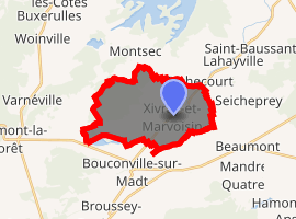
| |
 Xivray-et-Marvoisin  Xivray-et-Marvoisin | |
| Coordinates: 48°51′55″N 5°44′40″E | |
| Country | France |
| Region | Grand Est |
| Department | Meuse |
| Arrondissement | Commercy |
| Canton | Saint-Mihiel |
| Intercommunality | Côtes de Meuse-Woëvre |
| Government | |
| • Mayor (2014-2020) | Jean-Claude Vaucelle |
| Area 1 | 14.45 km2 (5.58 sq mi) |
| Population (2017-01-01)[1] | 99 |
| • Density | 6.9/km2 (18/sq mi) |
| Time zone | UTC+01:00 (CET) |
| • Summer (DST) | UTC+02:00 (CEST) |
| INSEE/Postal code | 55586 /55300 |
| Elevation | 222–253 m (728–830 ft) (avg. 234 m or 768 ft) |
| 1 French Land Register data, which excludes lakes, ponds, glaciers > 1 km2 (0.386 sq mi or 247 acres) and river estuaries. | |
Geography
The Rupt de Mad forms part of the commune's southern border, then flows northeastward through its eastern part.
Population
| Year | Pop. | ±% |
|---|---|---|
| 2005 | 85 | — |
| 2006 | 81 | −4.7% |
| 2007 | 80 | −1.2% |
| 2008 | 83 | +3.8% |
| 2009 | 86 | +3.6% |
| 2010 | 89 | +3.5% |
| 2011 | 89 | +0.0% |
| 2012 | 88 | −1.1% |
| 2013 | 91 | +3.4% |
| 2014 | 94 | +3.3% |
| 2015 | 97 | +3.2% |
| 2016 | 98 | +1.0% |
gollark: tio!debug
gollark: ```c#define four 4#define new malloc#define int var#define fn void#define __init__ main#define byte char#define pointer *#define print printf#include <stdio.h>fn __init__() { byte pointer = new(four); print("Hello, World!")}```
gollark: +>wm combine wiseguy hexamessage
gollark: +>wm inv
gollark: +>wm combine tattler dodecamessage
See also
- Communes of the Meuse department
- Parc naturel régional de Lorraine
References
- "Populations légales 2017". INSEE. Retrieved 6 January 2020.
| Wikimedia Commons has media related to Xivray-et-Marvoisin. |
| Authority control |
|
|---|
This article is issued from Wikipedia. The text is licensed under Creative Commons - Attribution - Sharealike. Additional terms may apply for the media files.