Inor, Meuse
Inor is a commune in the Meuse department in Grand Est in north-eastern France.
Inor | |
|---|---|
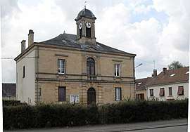 The town hall in Inor | |
Location of Inor 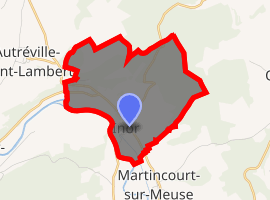
| |
 Inor  Inor | |
| Coordinates: 49°32′51″N 5°09′48″E | |
| Country | France |
| Region | Grand Est |
| Department | Meuse |
| Arrondissement | Verdun |
| Canton | Stenay |
| Government | |
| • Mayor (2001–2008) | Claude Huard |
| Area 1 | 6.46 km2 (2.49 sq mi) |
| Population (2017-01-01)[1] | 185 |
| • Density | 29/km2 (74/sq mi) |
| Time zone | UTC+01:00 (CET) |
| • Summer (DST) | UTC+02:00 (CEST) |
| INSEE/Postal code | 55250 /55700 |
| Elevation | 161–326 m (528–1,070 ft) (avg. 180 m or 590 ft) |
| 1 French Land Register data, which excludes lakes, ponds, glaciers > 1 km2 (0.386 sq mi or 247 acres) and river estuaries. | |
Demography
| Year | 1962 | 1968 | 1975 | 1982 | 1990 | 1999 | 2012 |
|---|---|---|---|---|---|---|---|
| Population | 2625365276 | 267 | 248 | 214 | 183 | 204 | 191 |
| From the year 1962 on: No double counting—residents of multiple communes (e.g. students and military personnel) are counted only once. | |||||||
gollark: You basically just base your launch power/direction on your offset from the height you want and the derivative of that offset.
gollark: Read the Wikipedia page. It's probably more helpful than me.
gollark: A PID controller without the I.
gollark: You can fly at constant height with a PD controller and active feedback from GPS.
gollark: I scrolled up.
See also
References
- "Populations légales 2017". INSEE. Retrieved 6 January 2020.
| Wikimedia Commons has media related to Inor. |
| Authority control |
|
|---|
This article is issued from Wikipedia. The text is licensed under Creative Commons - Attribution - Sharealike. Additional terms may apply for the media files.