Villécloye
Villécloye is a commune in the Meuse department in Grand Est in north-eastern France.
Villécloye | |
|---|---|
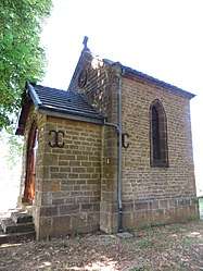 The chapel in Villécloye | |
Location of Villécloye 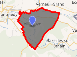
| |
 Villécloye  Villécloye | |
| Coordinates: 49°30′41″N 5°23′54″E | |
| Country | France |
| Region | Grand Est |
| Department | Meuse |
| Arrondissement | Verdun |
| Canton | Montmédy |
| Intercommunality | Communauté de communes du pays de Montmédy |
| Government | |
| • Mayor (2008–2014) | Marc Maylin |
| Area 1 | 7.18 km2 (2.77 sq mi) |
| Population (2017-01-01)[1] | 265 |
| • Density | 37/km2 (96/sq mi) |
| Time zone | UTC+01:00 (CET) |
| • Summer (DST) | UTC+02:00 (CEST) |
| INSEE/Postal code | 55554 /55600 |
| Elevation | 182–319 m (597–1,047 ft) (avg. 188 m or 617 ft) |
| 1 French Land Register data, which excludes lakes, ponds, glaciers > 1 km2 (0.386 sq mi or 247 acres) and river estuaries. | |
Geography
The village lies in the middle of the commune, on the right bank of the Othain, which flows northwestward through the commune, then flows into the Chiers, which forms all of the commune's northern border.
gollark: ↑ Macron
gollark: https://github.com/PaddlePaddle/PaddleOCR/blob/develop/doc/imgs_results/1101.jpg
gollark: But will you actually *do* it? Probably not.
gollark: You can just ignore it.
gollark: You brought this on yourself. You and our ongoing experimental applied memetics projects.
See also
References
- "Populations légales 2017". INSEE. Retrieved 6 January 2020.
| Wikimedia Commons has media related to Villécloye. |
| Authority control |
|
|---|
This article is issued from Wikipedia. The text is licensed under Creative Commons - Attribution - Sharealike. Additional terms may apply for the media files.