Autrécourt-sur-Aire
Autrécourt-sur-Aire is a commune in the Meuse department in the Grand Est region in northeastern France.
Autrécourt-sur-Aire | |
|---|---|
.JPG) A general view of Autrécourt-sur-Aire | |
 Coat of arms | |
Location of Autrécourt-sur-Aire 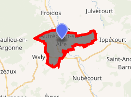
| |
 Autrécourt-sur-Aire  Autrécourt-sur-Aire | |
| Coordinates: 49°02′09″N 5°08′20″E | |
| Country | France |
| Region | Grand Est |
| Department | Meuse |
| Arrondissement | Bar-le-Duc |
| Canton | Dieue-sur-Meuse |
| Intercommunality | CC Aire Argonne |
| Government | |
| • Mayor (2017-2020) | Pierrette Dauphin |
| Area 1 | 10.85 km2 (4.19 sq mi) |
| Population (2017-01-01)[1] | 115 |
| • Density | 11/km2 (27/sq mi) |
| Time zone | UTC+01:00 (CET) |
| • Summer (DST) | UTC+02:00 (CEST) |
| INSEE/Postal code | 55017 /55120 |
| Elevation | 202–281 m (663–922 ft) (avg. 205 m or 673 ft) |
| 1 French Land Register data, which excludes lakes, ponds, glaciers > 1 km2 (0.386 sq mi or 247 acres) and river estuaries. | |
Autrécourt-sur-Aire is the only village in this commune. The nearest town is Verdun, 27.4 km to the northeast.
Population
| Year | Pop. | ±% |
|---|---|---|
| 1962 | 212 | — |
| 1968 | 146 | −31.1% |
| 1975 | 105 | −28.1% |
| 1982 | 96 | −8.6% |
| 1990 | 105 | +9.4% |
| 1999 | 110 | +4.8% |
| 2007 | 134 | +21.8% |
| 2009 | 137 | +2.2% |
| 2015 | 110 | −19.7% |
Gallery
.JPG) Spring in Autrécourt-sur-Aire
Spring in Autrécourt-sur-Aire.JPG) Church of St. Avitus
Church of St. Avitus
gollark: Clearly what we need is C with better macros, so that "extensions" are no longer necessary.
gollark: What's the issue with `{}`?
gollark: Unlike all osmarkscode™, as I pride myself on strict compliance with what the compiler complains about or not.
gollark: Urbit's code really makes me feel better about myself.
gollark: Well, this is irritating, APPARENTLY the packets are very mean and will not go both directions.
See also
References
- "Populations légales 2017". INSEE. Retrieved 6 January 2020.
External links

| Authority control |
|
|---|
This article is issued from Wikipedia. The text is licensed under Creative Commons - Attribution - Sharealike. Additional terms may apply for the media files.