Damloup
Damloup is a commune in the Meuse department in Grand Est in north-eastern France. It is in the arrondissement of Verdun.
Damloup | |
|---|---|
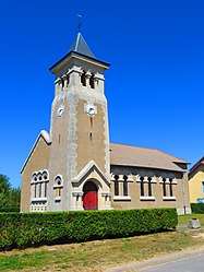 The church in Damloup | |
.svg.png) Coat of arms | |
Location of Damloup 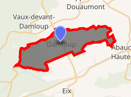
| |
 Damloup  Damloup | |
| Coordinates: 49°12′08″N 5°29′31″E | |
| Country | France |
| Region | Grand Est |
| Department | Meuse |
| Arrondissement | Verdun |
| Canton | Belleville-sur-Meuse |
| Intercommunality | Communauté de communes du pays d'Étain |
| Government | |
| • Mayor (2008–2014) | Jean-Paul Colin |
| Area 1 | 5.28 km2 (2.04 sq mi) |
| Population (2017-01-01)[1] | 131 |
| • Density | 25/km2 (64/sq mi) |
| Time zone | UTC+01:00 (CET) |
| • Summer (DST) | UTC+02:00 (CEST) |
| INSEE/Postal code | 55143 /55400 |
| Elevation | 220–357 m (722–1,171 ft) (avg. 230 m or 750 ft) |
| 1 French Land Register data, which excludes lakes, ponds, glaciers > 1 km2 (0.386 sq mi or 247 acres) and river estuaries. | |
World War I
Fort Vaux is partially within the boundaries of the commune (the other part is in the commune of Vaux-devant-Damloup). The Batterie de Damloup is located between Fort Vaux and the Laufée works (l'ouvrage D de la Laufée[2]) which are both within the boundaries of the commune.
gollark: At my schol™, your email is `[first 4 letters of last name][random 4-digit number]@[REDACTED]`, and the password is the password.
gollark: The first part is very easy to guess since it's generally your initials or something.
gollark: Oh, I see.
gollark: Just guess it.
gollark: If you're addicted to drugs, smoking or bees, stop being addicted™.
See also
References
- "Populations légales 2017". INSEE. Retrieved 6 January 2020.
- l'ouvrage D de la Laufée
| Wikimedia Commons has media related to Damloup. |
| Authority control |
|
|---|
This article is issued from Wikipedia. The text is licensed under Creative Commons - Attribution - Sharealike. Additional terms may apply for the media files.