Worsley
Worsley (/ˈwɔːrzli/) is a district and suburban town within the metropolitan borough of the City of Salford in Greater Manchester, England, which in 2014 had a population of 10,090.[1] It lies along Worsley Brook, 5.75 miles (9.25 km) west of Manchester. The M60 motorway bisects the area.
| Worsley | |
|---|---|
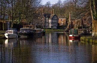 Bridgewater Canal in Worsley, with the Packet House in the background | |
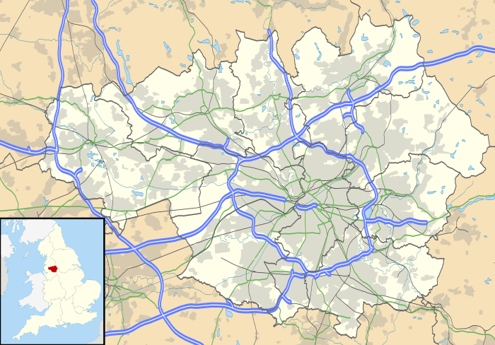 Worsley Location within Greater Manchester | |
| Population | 10,090 Ward profile conducted by Salford City Council in 2014.[1] |
| OS grid reference | SD7401 |
| Metropolitan borough | |
| Metropolitan county | |
| Region | |
| Country | England |
| Sovereign state | United Kingdom |
| Post town | MANCHESTER |
| Postcode district | M28 |
| Dialling code | 0161 |
| Police | Greater Manchester |
| Fire | Greater Manchester |
| Ambulance | North West |
| UK Parliament | |
Historically part of Lancashire, there is evidence of Roman and Anglo-Saxon activity, including two Roman roads. The completion in 1761 of the Bridgewater Canal allowed Worsley to expand from a small village of cottage industries to an important town based upon cotton manufacture, iron-working, brick-making and extensive coal mining. Later expansion came after the First and Second World Wars, when large urban estates were built.
Worsley Delph is a scheduled monument and a significant part of the town's historic centre is now a conservation area.
History
Toponymy
Worsley is first mentioned in a Pipe roll of 1195–96 as Werkesleia, in the claim of a Hugh Putrell to a part of the fee of two knights in nearby Barton-upon-Irwell and Worsley. There are many variations on the name; Werkesleia, 1195; Wyrkedele, 1212; Whurkedeleye, c. 1220; Worketley, 1254; Worcotesley, Workedesle, 1276; Wrkesley, Wrkedeley, Workedeley, 1292; Wyrkeslegh, Workesley, 1301; Worsley, 1444; and "Workdisley alias Workesley alias Worseley", 1581.[2] The spelling of the name in early documents, suggests a Saxon origin. Ge-Weore, the Old English form of the name, means "the cleared place which was cultivated or settled." The Anglo-Saxon Chronicle contain no references to Worsley.[3]
Early history
Two Roman roads run through the area. Connecting Mamucium (Manchester) with Coccium (Wigan), one passes through Worsley near Drywood, and over Mosley Common. The present-day A6 road follows part of the course of another Roman road, which passes through the northern part of the area near Walkden and Little Hulton.[4] In 1947 a hoard of 550 Roman coins was found near a quarry in Boothstown, dated to between AD 250 and 275,[5][6] and in 1958 the head of a man was found on Worsley Moss. Named "Worsley man", and originally thought to be no more than 20 years old, upon the discovery of Lindow Man it was re-examined and dated to approximately the 2nd century AD, in the Romano-British period.[7]
Worsley later fell under the control of the Anglo-Saxons, who controlled much of the area around Manchester and who also defeated the British at the Battle of Chester in AD 615.[5] Edward the Elder rebuilt the fortifications at Manchester, and in AD 924 captured all the land between the rivers Mersey and Irwell, making it demesne in the Kingdom of Wessex.[3] During the Middle Ages the area was covered with forests and marshlands. Thinly populated by craftsmen and serfs, Worsley grew as a settlement adjoining an ancient corn mill, close to the location of the present-day Worsley Road Bridge.[8] Most farms throughout Lancashire were small with their tenants dependent upon secondary employment, however in 1719 a John Kay of Worsley had five stirks, two bulls, 17 cows, "young cattle upon the moors", and a "cow at hire", all valued at £97 5s. Marl was commonly used as a fertiliser, and is recorded in use in 1719.[9] Wheeler's Manchester: Its Political, Social and Commercial History, Ancient and Modern (1836) states that about one-fifth of the land around Worsley, Astley and Tyldesley was in tillage, lower on average than the surrounding areas.[10]
Bridgewater estates
Worsley was, originally, the largest manor of the seven ancient manors of the Bridgewater Estates. It was created by William I and held for him by the Barton family in thegnage, and for them by a Norman knight named Elias, who fought in the crusades. On his death in Rhodes, the manor remained with Elias' son, whose family had by that time adopted the name of the village as its family name. On 23 June 1311 a substantial part of the Manor of Hulton was granted to the Worsleys. The family held both manors until the late 14th century,[11] whereon they passed to the Massey family of Tatton, and then in the 16th century to the Brereton family of Malpas, Cheshire.[2] The Brereton family added the Manor of Bedford (a small area of land to the west of Worsley) to the estate. Richard Brereton later married Dorothy Egerton, and upon his death the estates passed into the Egerton family.[11]
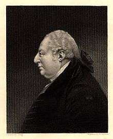
In 1617 John Egerton, son of Sir Thomas Egerton, became Earl of Bridgewater. The Egerton family was descended from Sir Richard Egerton of Ridley, Cheshire.[2] His illegitimate son, Thomas Egerton, was a prominent lawyer who served as Master of the Rolls from 1594 to 1603, and Lord Keeper of the Great Seal from 1596 to 1617 and also as Lord High Chancellor of England.[12] John Egerton succeeded to Worsley in 1639, and died in 1649. He was succeeded by the second and third Earls of Bridgewater. The title of Duke of Bridgewater was first given to Scroop Egerton in 1720. He devised a navigation system for Worsley which was not carried out. His son, the third Duke of Bridgewater Francis Egerton, was to build the Bridgewater Canal.[2]
The Duke purchased the Manor of Pemberton (near Wigan) in 1758, the Manor of Hindley in 1765, and the Manor of Cadishead in 1776. Upon his death in 1803 he was succeeded by George Leveson-Gower, 1st Duke of Sutherland. In 1833 the estate was inherited by Gower's son, Francis Leveson-Gower who changed his surname to Egerton, and in 1846 became the Earl of Ellesmere.[8] In 1836 he purchased the Manor of Tyldesley.[11] He is recorded as saying that he found Worsley to be "a God-forsaken place, full of drunken, rude people with deplorable morals".[13]
Worsley New Hall, designed by Edward Blore, was built in 1846 for Francis Egerton the First Earl of Ellesmere. The plans are held at the Victoria and Albert Museum. Queen Victoria visited the hall in 1851 and 1857; Edward VII and Queen Alexandra visited when Edward was Prince of Wales in 1869, and on 6 July 1909.[14] The hall was used as a hospital in World War I and in World War II housed Dunkirk evacuees, American soldiers preparing for D-Day and the Lancashire Fusiliers. In 1943 the hall was badly damaged by fire and demolished in 1949.[15]
Industrial Revolution
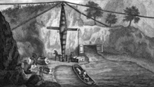
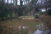
Coal has been mined around Worsley from as long ago as 1376,[17] originally in bell pits. The coal seams in the area tend to be fairly thin, slanting downwards from north to south, and so deeper mining became necessary during the 17th century.[18]
With the onset of the Industrial Revolution and the growing use of steam power, there was a rapid increase in the demand for coal.[19] The Duke's mines were among those supplying the surrounding districts[20] but transport was both inefficient and expensive, and the mines also suffered from persistent flooding. His solution to these problems was to build a canal from Worsley to Salford,[21] and an underground canal into the mines from Worsley Delph. The canal boats would carry 30 long tons (30 t) at a time,[22] – more than ten times the amount of cargo per horse that was possible with a cart. The Duke and his estate manager obtained an Act of Parliament empowering them to begin construction[21] on a planned route directly to Salford, avoiding the River Irwell.
James Brindley was brought in for his technical expertise and suggested varying the route of the proposed canal away from Salford and across the Irwell into Manchester.[23] A second Act was secured for this variance,[21] which included an aqueduct to cross the Irwell. This was built relatively quickly for the time; work commenced in September 1760 and the first boat crossed on 17 July 1761.[24] The canal opened in 1761 and along with the stone aqueduct at Barton-upon-Irwell, was considered a major engineering achievement. One writer said that when finished, it "will be the most extraordanary thing in the kingdom, if not in Europe. The boats in some places are to go underground, and in other places over a navigable river, without communicating with its waters ..."[25]
Worsley Delph, now a scheduled monument,[26] was the entrance to the Duke's underground mines. Two entrances, built years apart, allowed access to the Starvationer boats, the largest of which could carry 12 long tons (12 t) of coal. The entrances allow access to 46 miles (74 km) of underground canal on four levels, linked by inclined planes.
The burgeoning village became a hub of commercial activity. The Duke employed craftsmen to service a wide range of industries including boat-making, plastering, blacksmithing and mining. A local quarry supplied limestone, for which a kiln was constructed at the junction of Barton Road (B5211) and Stableford Road. A quarry at the Delph supplied building materials for the region, including the stone used to construct Brindley's aqueduct. To accommodate the workers needed for these industries the Duke built extra housing and cottages.[8] In a diary entry of 1773, Josiah Wedgwood wrote of the area "We next visited Worsley which has the appearance of a considerable Seaport Town. His Grace has built some hundreds of houses, & is every year adding considerably to their number."[27] Worsley Green became a thriving centre of industry.[8]
With the death of the Duke in 1803, his estates were inherited by his nephew, George Leveson-Gower, who later became the Duke of Sutherland. The canal and coal estates were placed under the control of the Bridgewater Trust, and in 1833 the rest of the estates were inherited by the Duke of Sutherland's son, Francis Leveson-Gower who changed his surname to Egerton, and in 1846 became the Earl of Ellesmere.[8] The mines ceased production in 1887,[28] and with the expiration of the Bridgewater Trust in 1903 the village began to change; the Duke's warehouse and the works on what is now Worsley Green were demolished. Worsley Brook was culverted, and a memorial fountain to the Duke was built from the bricks of the works' chimney.[8]
Although much of the industry that dominated Worsley was in decline, in 1937 Sir Montague Maurice Burton opened a clothing factory along the East Lancashire Road. Built in the Art Deco style, in 1938 the factory employed 3,000 people.[29]
Modern history
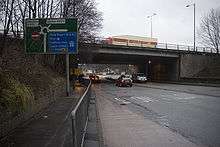
Under the Housing Act 1919, large overspill estates were built by the council for veterans of the First World War,[30] but a larger change to the area came after the end of the Second World War, when the then pre 1974 City of Salford was forced to rehouse many of its inhabitants. With little land left, 4,518 new houses were built in the urban district by the Worsley Project. 18,000 people were rehoused under the scheme, which included new facilities, shops and schools.[31] Another housing estate was built during the 1970s to the north of Worsley Green.[8]
In 1944, during the Second World War, a flying bomb landed on a house near Worsley Dam.[32] An Anti Aircraft Operations Room (AAOR) was built in the 1950s. Although unused the building still exists, in wooded land to the west of the town, on the site of the former Worsley New Hall.[33]
Governance
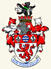
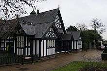
From the 11th century, Worsley was a township in the Eccles parish of the hundred of Salford, and county of Lancashire.[35] Worsley was originally in Eccles ecclesiastical parish, and also in Barton-upon-Irwell Poor Law Union. The Swinton area of the township was in 1867 included in the Swinton Local Board of Health, which from 1869 became the Swinton and Pendlebury Local Board of Health. In 1892 a small part of the township of Worsley was included in the Borough of Eccles. In 1894, under the Local Government Act 1894, Worsley Urban District was created. A part of the township then within the area of the Swinton and Pendlebury Local Board of Health was formed into Swinton township, becoming part of Swinton and Pendlebury Urban District. In 1907 two small detached parts of Worsley civil parish, then inside Swinton civil parish, were added to Swinton civil parish. A town hall was opened on 22 June 1911.[14] Worsley Urban District gained 21 acres (85,000 m2) of land from Barton-upon-Irwell Civil Parish in 1921, and in 1933 gained the area of Little Hulton Urban District. Parts were added to Eccles Borough and Irlam Urban District.
In 1955 Swinton and Pendlebury Borough gained a small part of Worsley Urban District,[36] and under the Local Government Act 1972, in 1974 Worsley's Urban District status was abolished,[37] becoming part of Salford Metropolitan District.[36]
Following its 2006 review of parliamentary representation in Greater Manchester, the Boundary Commission for England recommended the creation of a modified Worsley constituency, incorporating a part of Eccles. The new constituency is called Worsley and Eccles South.[38] Until the 2010 general election, Worsley was represented in the House of Commons by Barbara Keeley, Labour Party member for the Worsley constituency.[39] After the election, Keeley became the MP for Worsley and Eccles South.
The ward elect three councillors to Salford City Council via its Worsley ward.[40] The current councillors are: Graham Compton,[41] Chris Clarkson,[42] and Karen Garrido,[43] all from the Conservative Party.
Geography
At 53°30′0″N 2°23′0″W (53.5000°, −2.3833°), Worsley stands about 206 feet (63 m) above sea level.[44] Sheltered at the foot of a middle coal measure running approximately northwest and southeast across the area, the village lies along the course of Worsley Brook, which cuts through the ridge. The ridge also forms part of the northern edge of the Irwell Valley.[45] The area is bordered on the north by the East Lancashire Road, and on the south by the Liverpool and Manchester Railway and part of the Bridgewater Canal.[46] The larger towns of Swinton and Eccles lie to the east and southeast respectively, and to the west the area is largely bordered by Chat Moss, open fields, and forest. The M60 and M62 motorways cut directly through the area.[47]
The underlying measures of coal have proved important for the development of the area; it was around Worsley Delph that the settlement first began to grow.[48] Parts of the area are within an indicated floodplain.[49] Worsley's climate is generally temperate, like the rest of Greater Manchester. The mean highest and lowest temperatures (13.2 °C (55.8 °F) and 6.4 °C (43.5 °F)) are slightly above the national average, while the annual rainfall (806.6 millimetres (31.76 in)) and average hours of sunshine (1394.5 hours) are respectively above and below the national averages.[50][51]
Demography
| Worsley Compared | |||
|---|---|---|---|
| 2001 UK census | Worsley (ward)[52][53][54] | City of Salford[52] | England[52] |
| Total population | 9,833 | 216,103 | 49,138,831 |
| White | 9,373 | 96.13% | 90.92% |
| Asian | 115 | 1.39% | 4.57% |
| Black | 10 | 1.12% | 2.3% |
| Christian | 8,252 | 76.46% | 71.74% |
| Buddhist | 14 | 0.22% | 0.28% |
| Hindu | 60 | 0.32% | 1.11% |
| Jewish | 28 | 2.4% | 0.52% |
| Muslim | 66 | 1.2% | 3.1% |
| Sikh | 4 | 0.11% | 0.67% |
| Other religions | 13 | 0.15% | 0.29% |
| No religion | 930 | 11.01% | 14.59% |
| Religion not stated | 465 | 8.12% | 7.69% |
According to the Office for National Statistics, at the time of the United Kingdom Census 2001, the ward of Worsley had a population of 9,833, of which 4,801 were male and 5,032 female.[55] It is the fifth least populous ward in Salford, and the third least densely populated. The ward has a higher proportion of married couples with and without children than Salford as a whole.[46] Of those over 16 years old, 1,929 were single (never married) and 4,267 married.[56] Worsley's 4,102 households included 632 married couples without children, 818 with dependent children and 356 with non-dependent children. There were 249 lone-parent households with children. 642 households were occupied by pensioners living alone.[57]
Of those aged 16–74, 1,428 had no academic qualifications, 1,078 had attained a level one qualification,[58] 183 children aged between 16–17 and 242 people aged 18–74 were in full-time education.[59] Worsley ward has the lowest levels of unemployment in Salford, in April 2006 0.9% of the economically active population were unemployment benefit claimants, comparing well to Salford as a whole where the figure is 3.7%.[46] The area is considered to be one of the more affluent parts of Salford.[60]
At 12.6 reported crimes per thousand population, the crime rate in Worsley is lower on average than Salford, which stands at 163.1 per thousand population.[46]
Economy
One of Worsley's early industries was weaving. A cottage industry, cotton would be spun on spinning wheels and hand-operated looms in people's homes to produce cloth. Merchants would then purchase this cloth, selling it at the Bridgewater Hotel, then known as the Old Grapes Inn.[61]
Worsley now has little industry, and is in the main a tourist destination and commuter town.[62] The area has two large hotels; a Novotel[63] and a Marriott.[64] Worsley Old Hall is now a public house and restaurant in the Brunning and Price chain, part of the Restaurant Group.[65]
Landmarks
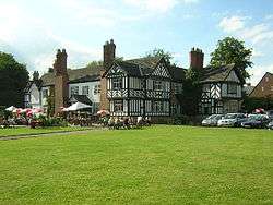
Worsley Village was in 1969 designated as a conservation area by the former Lancashire County Council. Bisected by the A572 Worsley Road,[66] the area covered about 34.25 acres (138,600 m2) of land and included 40 listed buildings, such as the Packet House, a telephone kiosk, and the Delph sluice gates,[48] but this list has since increased to 48 listed buildings.[48] Much of the area around the canal and Worsley Delph was restored and landscaped between 1966 and 1967 by the Worsley Civic Trust and the local council, ready for a visit by Elizabeth II on 17 May 1968.[16] As the canal passes through Worsley, iron oxide from the mines has, for many years, stained the water bright orange. The removal of this colouration is the subject of a £2.5 million remedial scheme, which was completed in 2004. This has not been successful and as of 2017 much of the canal centered on the Delph is still bright orange.[67]
Wardley Hall is an early medieval manor house and a Grade I listed building in Wardley.[68] The current hall dates from around 1500 but was extensively rebuilt in the 19th and 20th centuries.[69] Worsley Old Hall is a Grade II listed building near Walkden Road. The Post Medieval building is said to have been moated, but no signs of the moat now remain.[70]
Parts of Worsley are currently being considered as World Heritage Sites. The area includes Worsley Delph (itself a scheduled monument),[26] parts of Worsley Green, and the Bridgewater Canal.[71]
In 2015, the Royal Horticultural Society announced plans for a restoration of the garden at Worsley New Hall, to open in 2019 under the name RHS Garden Bridgewater.[72]
Transport
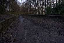
Following an Act of Parliament of 1861,[73] in 1864 the Eccles, Tyldesley and Wigan branch line was opened by the London and North Western Railway, along with a station at Worsley which required the demolition of six cottages. The first sod had been cut by the Earl of Ellesmere.[74] An additional branch line to Bolton was opened in 1870,[74] branching from the Tyldesley Loopline line at Roe Green. A railway station at Monton Green was opened in 1887 to cater mainly for commuters into Manchester. The lines were important thoroughfares for the transport of coal in the area, including Mosley Common Colliery. Both lines were closed under the Beeching Axe in 1969, and have since been partially reclaimed by Salford City Council as recreational pathways.[74]
Early public transport included the Farnworth horse-bus service, with a terminus at the nearby Stocks Hotel in 1885. An electric tram service was founded in 1903 by the South Lancashire Tramways Company.[75]
Education
One of the first Sunday schools to be established in England may have been at Worsley. Built in the 1780s in a cottage close to the present-day courthouse, and founded by Thomas Bury (a colliery manager for the 3rd Duke) children were taught by a Luke Lowe, a cooper also in the Duke's employ. In 1785 a further three Sunday schools were established in the area, and by 1788 over 300 children were attending the four schools.[76] Francis Egerton built a day school in 1838, which later became known as St Mark's School.[77] This was demolished during construction of the M62 motorway, and replaced with a new school on Aviary Road, opened 19 October 1968.[78]
The area of Worsley contains a number of primary schools, including (but not limited to) Christ the King RC Primary School, Hilton Lane Primary School and Mesne Lea Primary School. Secondary schools include Bridgewater School and Harrop Fold School.[79]
Salford College has a campus in nearby Walkden (once within Worsley Urban District).[80] The college's Worsley Campus, the Learning Resource and specialist Media Centre, caters for 16- to 18-year-olds, and provides access to 50 internet workstations, 15,000 books, and resources for e-learning. It also has a suite of hair and beauty salons, a performing arts theatre and a sports hall and fitness suite.[81]
Religious sites
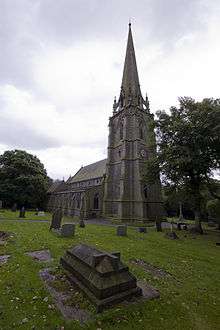
Ellenbrook Chapel, the first church in Worsley was built in 1209 by the Worsley family.[82] Methodism was first practised in the area in 1784, by the notable preacher Matthew Mayer. Later services were held in various locations around the area, and in 1801 a Methodist chapel was built along Barton Road.[83] The foundation stone for St Mark's Church was laid on 14 June 1844 by George Granville Francis Egerton, the son of Francis Egerton. Designed by the architect George Gilbert Scott, the church was consecrated on 2 July 1846 by the Bishop of Chester, John Bird Sumner.[84] The church tower is now home to the mechanism for the Bridgewater Clock from the Bridgewater workshops at Worsley Green. The clock strikes 13 times at 1 pm, originally so that workmen did not miss the end of their dinner break.[85] Many gravestones in the churchyard were cut from rock sourced at Worsley Delph.[86] Following a proposed hotel development in 1981 the area around the church and vicarage was designated a conservation area.[87]
Sports
Worsley Golf Club was founded in 1894 on part of the Earl of Ellesmere's estate at Broadoak Park.[88] The area has a clay pigeon shooting club, west of the M60.[89] A racecourse development proposed on land near Boothstown was the subject of a public inquiry[90] and rejected by the local council after a sustained campaign by local councillors.
Public services
Home Office policing in Worsley is provided by the Greater Manchester Police. The nearest police station is at Little Hulton.[91] Public transport is co-ordinated by the Greater Manchester Passenger Transport Executive.[92] Statutory emergency fire and rescue service is provided by the Greater Manchester Fire and Rescue Service.[93]
Notable people
Notable people from Worsley include the actress Helen Cherry,[94] and television commentator Kenneth Wolstenholme.[95] Statistician Harry Campion, who played a leading role in the development of official statistics after the Second World War, was born in Kearsley in May 1905 and brought up in Worsley.[96] Arthur Thomas Doodson was a mathematician and oceanographer born in Boothstown in March 1890.[97] Footballer Ryan Giggs caused controversy in the mid-2000s when he bought a Victorian mansion on the outskirts of the village and demolished it to build a new house. The house was put on the market in 2019 with an asking price of £3.5m.[98]
See also
- Listed buildings in Worsley
- William Brereton (groom)
References
Notes
- Worsley Ward Profile (pdf). salford.gov.uk. Salford City Council. March 2016.
- Farrer & Brownbill 1911, pp. 376–392.
- Pratt 1977, pp. 16–18.
- Pratt 1977, p. 13.
- Pratt 1977, pp. 14–15.
- Historic England, "Monument No. 44272", PastScape, retrieved 19 March 2008
- Menotti 2004, p. 111.
- Worsley Village Conservation Area Appraisal (PDF), Salford City Council, 1 July 2007, p. 2.11, retrieved 13 February 2009
- Thirsk 1984, pp. 63, 65.
- Wheeler 1836, pp. 433–434.
- Grayling 1983, pp. 7–15.
- Baker, J. H. (May 2007), Egerton, Thomas, first Viscount Brackley (1540–1617), Oxford Dictionary of National Biography, Oxford University Press, retrieved 22 January 2009
- Robinson 1986, p. 160.
- Pratt 1977, p. 77.
- "Plans to bring Worsley Hall back to life". BBC News. 13 January 2012.
- Aldred 1988, pp. 30–32.
- Pratt 1977, p. 47.
- Cooper 2005, p. 50.
- Parkinson-Bailey 2000, p. 15.
- Chaloner 1963, p. 34.
- Priestley 1831, p. 89.
- N/A 1978, p. 990.
- Skempton 2002, p. 76.
- Collins 1812, p. 213.
- Boughey 1998
- Historic England, "Worsley Delph (44278)", PastScape, retrieved 30 December 2007
- Meteyard 1866, p. 249.
- Ware 1989, p. 11.
- Honeyman 2000, pp. 88–90.
- Pratt 1977, pp. 79–80.
- Pratt 1977, p. 80.
- Milliken 2007, p. 36.
- Catford, Nick (11 April 2002), Site Records – Worsley, subbrit.org.uk, retrieved 7 July 2009
- Information taken from red plaque on the front wall of the building
- Farrer & Brownbill 1911, pp. 171–173.
- Greater Manchester Gazetteer, Greater Manchester County Record Office, Place Names T to W, archived from the original on 18 July 2011, retrieved 21 January 2009
- Great Britain Historical GIS Project (2004), "Worsley UD through time. Census tables with data for the Local Government District", A vision of Britain through time, University of Portsmouth, retrieved 22 January 2009
- "Final Recommendations for Parliamentary Constituency Boundaries in Greater Manchester", Boundary Commission for England (North West), Government News Network, 19 July 2006, archived from the original (HTTP) on 30 September 2007, retrieved 21 January 2009
- Alphabetical List of Members of Parliament, Office of Public Sector Information, archived from the original on 22 August 2008, retrieved 3 November 2008
- "Your Councillors". sccdemocracy.salford.gov.uk. Salford City Council. Retrieved 10 April 2017.
- "Councillor Graham Compton". sccdemocracy.salford.gov.uk. Salford City Council. Retrieved 10 April 2017.
- "Councillor Chris Clarkson". sccdemocracy.salford.gov.uk. Salford City Council. Retrieved 10 April 2017.
- "Councillor Karen Garrido". sccdemocracy.salford.gov.uk. Salford City Council. Retrieved 10 April 2017.
- "Worsley, United Kingdom Page", Global Gazetteer, Version 2.1, Falling Rain Genomics, Inc, retrieved 22 January 2009
- Aldred 1988, p. 1.
- Worsley Ward Profile (PDF), Salford City Council, archived from the original (PDF) on 4 April 2008, retrieved 22 January 2009
- OS Landranger Map sheet 109, Ordnance Survey, archived from the original on 12 November 2008, retrieved 22 January 2009
- Worsley Village, Salford City Council, retrieved 22 January 2009
- City of Salford Unitary Development Plan 2004–2016 chapter 208, Salford City Council, archived from the original on 21 February 2009, retrieved 10 March 2009
- Manchester Airport 1971–2000 weather averages, Met Office, 2001, archived from the original on 29 September 2007, retrieved 12 August 2008
- Met Office (2007), Annual England weather averages, Met Office, archived from the original on 5 June 2011, retrieved 23 April 2007
- Worsley (Ward) key statistics, statistics.gov.uk, retrieved 21 January 2009
- Worsley (Ward) Ethnic Group statistics, Statistics.gov.uk, retrieved 21 January 2009
- Worsley (Ward) key statistics KS07, statistics.gov.uk, 9 November 2004, retrieved 21 January 2009
- KS01 Usual resident population: Census 2001, Key Statistics for urban areas, Statistics.gov.uk, 9 August 2006, retrieved 22 January 2009
- KS04 Marital status: Census 2001, Key Statistics for urban areas, Statistics.gov.uk, 9 November 2004, retrieved 22 January 2009
- KS20 Household composition: Census 2001, Key Statistics for urban areas, Statistics.gov.uk, 9 November 2004, retrieved 22 January 2009
- 1+ 'O' level passes; 1+ CSE/GCSE any grades; NVQ level 1; or Foundation level GNVQ.
- KS13 Qualifications and students: Census 2001, Key Statistics for urban areas, Statistics.gov.uk, 9 November 2004, retrieved 22 January 2009
- Strategic Planning Background part 2.8, salford.gov.uk, 17 May 2004, archived from the original on 5 August 2012, retrieved 27 February 2009
- Pratt 1977, p. 48.
- On the Costa Del Salford, BBC, 13 April 2006, retrieved 6 April 2009
- Hotel Novotel Manchester West, novotel.com, retrieved 23 February 2009
- Worsley Park, A Marriott Hotel & Country Club, marriott.com, retrieved 23 February 2009
- Worsley Old Hall, Brunning & Price Limited, retrieved 6 February 2014
- Worsley Village Conservation Area Map (PDF), Salford City Council, retrieved 22 January 2009
- Transformation of Worsley's Orange Canal (PDF), archived from the original (pdf) on 27 March 2009, retrieved 15 July 2008
- Historic England, "Wardley Hall (44262)", PastScape, retrieved 14 January 2008
- Hartwell, Hyde & Pevsner 2004, p. 673.
- Historic England, "Worsley Old Hall (44273)", PastScape, retrieved 21 January 2009
- Manchester and Salford (Ancoats, Castlefield and Worsley), whc.unesco.org, 21 June 1999, retrieved 22 January 2009
- RHS https://www.rhs.org.uk/gardens/blogs/RHS-Gardens/new-rhs-garden-announced
- Rickards 1861, p. 907.
- Monton and Roe Green Loopline Heritage Trail (PDF), Salford City Council, retrieved 29 January 2009
- Pratt 1977, p. 81.
- Milliken 2007, pp. 5–6.
- Milliken 2007, pp. 7.
- Milliken 2007, p. 42.
- UK Schools & Colleges Database, schoolswebdirectory.co.uk, retrieved 6 April 2009
- Greater Manchester Gazetteer, Greater Manchester County Record Office, Place Names T to W, archived from the original on 18 July 2011, retrieved 3 April 2007
- Salford College – Worsley Campus, salford-col.ac.uk, archived from the original on 2 April 2009, retrieved 27 February 2009
- Pratt 1977, p. 19.
- Milliken 2007, p. 6.
- Milliken 2007, pp. 8–9.
- Milliken 2007, p. 37.
- Aldred 1988, pp. 9–10.
- St Mark's, salford.gov.uk, retrieved 27 February 2009
- Worsley Golf Club – The Inauguration, Worsley Golf Club, retrieved 22 January 2009
- Manchester Clay Shooting Club, Manchester Clay Pigeon Shooting Club, archived from the original on 5 July 2007, retrieved 22 January 2009
- "Racecourse public inquiry starts", BBC News, 21 April 2009, retrieved 21 April 2009
- Greater Manchester Police, Salford Division, gmp.police.uk, retrieved 23 January 2009
- GMPTE – Maps – Network Maps, gmpte.com, archived from the original on 17 November 2008, retrieved 6 April 2009
- Greater Manchester Fire and Rescue Service, manchesterfire.gov.uk, archived from the original on 7 April 2008, retrieved 6 April 2009
- Taylor, Lib (2004), Howard, Trevor (1913–1988) rev. Oxford Dictionary of National Biography, Oxford University Press, retrieved 6 April 2009
- Mason, Tony (2006), Wolstenholme, Kenneth (1920–2002), Oxford Dictionary of National Biography, Oxford University Press, retrieved 6 April 2009
- Rudoe, Wulf (2004), Campion, Sir Harry (1905–1996), Oxford Dictionary of National Biography, Oxford University Press, retrieved 22 January 2009
- Charnock, H. (2004), Doodson, Arthur Thomas (1890–1968), Oxford Dictionary of National Biography, Oxford University Press, retrieved 22 January 2009
- White, Stephen (31 January 2019). "Ryan Giggs is selling his £3.5m home - and it has some amazing features inside". mirror. Retrieved 28 February 2019.
Bibliography
- N/A, N/A (1978), Reader's Digest Library of Modern Knowledge, London: Reader's Digest
- Aldred, John (1988), Worsley, an Historical Geography 1200–1850, n/a
- Boughey, Joseph (1998), Hadfield's British Canals: The Inland Waterways of Britain and Ireland (8 ed.), Alan Sutton Publishing, Ltd., ISBN 0-7509-1840-3
- Chaloner, William Henry (1963), People and Industries, Routledge, ISBN 0-7146-1284-7
- Collins, Arthur (1812), Collins's peerage of England; genealogical, biographical, and historical, F. C. and J. Rivington, Otridge and son
- Cooper, Glynis (2005), Salford: An Illustrated History, The Breedon Books Publishing Company, ISBN 1-85983-455-8
- Farrer, William; Brownbill, John (1911), "The Hundred of Salford", A History of the County of Lancaster, Vol. 4, British History Online, retrieved 21 January 2009
- Farrer, William; Brownbill, John (1911), "Townships: Worsley", A History of the County of Lancaster, Vol. 4, British History Online, retrieved 21 January 2009
- Grayling, Christopher (1983), The Bridgewater Heritage – The Story of Bridgewater Estates, Worsley local library: Bridgewater Estates Plc.
- Hartwell, Clare; Hyde, Matthew; Pevsner, Nikolaus (2004), The Buildings of England: Lancashire: Manchester and the South-East, New Haven: Yale University Press, ISBN 0-300-10583-5
- Honeyman, Katrina (2000), Well Suited: A History of the Leeds Clothing Industry, 1850–1990, Oxford University Press, ISBN 0-19-920237-0
- Menotti, Francesco (2004), Living on the Lake in Prehistoric Europe, Routledge, ISBN 0-415-31719-3
- Meteyard, Eliza (1866), The Life of Josiah Wedgwood, Hurst and Blackett
- Milliken, H. T. (2007), Changing Scene, Worsley local library: Sharon Press
- Parkinson-Bailey, John (2000), Manchester: An Architectural History, Manchester University Press, ISBN 0-7190-5606-3
- Pratt, Ian S. (1977), Workedslegh: A History of Worsley, Manchester Pratt
- Priestley, Joseph (1831), Historical Account of the Navigable Rivers, Canals, and Railways of Great Britain, Longman, Green
- Rickards, George Kettilby (1861), The Statutes of the United Kingdom of Great Britain and Ireland (1807–1868/69), His Majesty's statute and law printers
- Robinson, John Martin (1986), The Architecture of Northern England, Macmillan, ISBN 0-333-37396-0
- Skempton, Sir Alec (2002), A Biographical Dictionary of Civil Engineers in Great Britain and Ireland: 1500 to 1830, Thomas Telford, ISBN 0-7277-2939-X
- Thirsk, Joan (1984), The Agrarian History of England and Wales, CUP Archive, ISBN 0-521-20076-8
- Ware, Michael (1989), Britain's Lost Waterways, Moorland Publishing, ISBN 0-86190-327-7
- Wheeler, James (1836), Manchester: Its Political, Social and Commercial History, Ancient and Modern, Whittaker
External links
| Wikimedia Commons has media related to Worsley. |
| Wikivoyage has a travel guide for Worsley. |
.png)