Walkden
Walkden is a town within the metropolitan borough of the City of Salford, Greater Manchester, England,[2] 6 miles (9.7 km) northwest of Salford, and 7 miles (11.3 km) of Manchester.
| Walkden | |
|---|---|
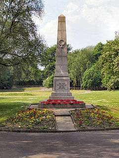
 Walkden War Memorial in the middle of Parr Fold Park | |
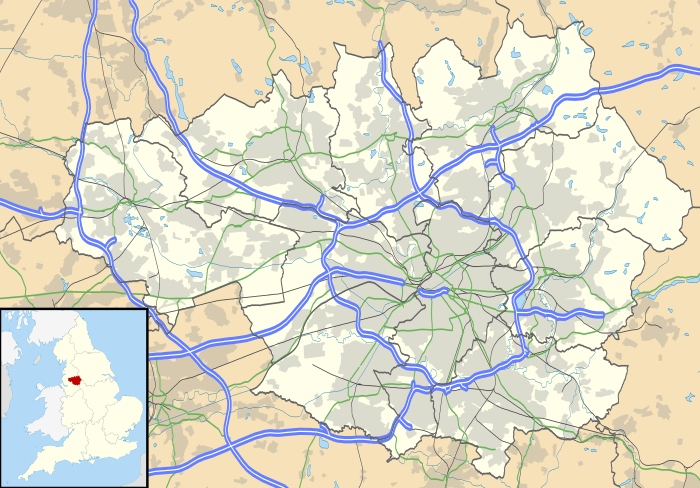
 Walkden Location within Greater Manchester | |
| Population | 35,616 Ward profile conducted by Salford City Council in 2014.[1] |
| OS grid reference | SD751030 |
| • London | 169 mi (272 km) SE |
| Metropolitan borough | |
| Metropolitan county | |
| Region | |
| Country | England |
| Sovereign state | United Kingdom |
| Post town | MANCHESTER |
| Postcode district | M28 |
| Dialling code | 0161 |
| Police | Greater Manchester |
| Fire | Greater Manchester |
| Ambulance | North West |
| UK Parliament | |
Historically in the township of Worsley in Lancashire,[3] Walkden was a centre for coal mining and textile manufacture.
In 2014, the electoral wards of Walkden North, Walkden South and Little Hulton had a combined population of 35,616.[1]
History
The name Walkden or Walkeden derives from the Old English denu, a valley, belonging to a man possibly called Wealca (fuller), an Old English personal name. It has been in existence since at least the 13th century.[4] The name was recorded in documents dating to 1246.[5] In the local dialect and accent, it is pronounced Wogden.
A Roman road crossed the area roughly on the line of the present A6 road through Walkden and Little Hulton.[6] In 1313 in a dispute involving land, a jury decided that Walkden was too small to be considered a hamlet or a town but was "only a place in Farnworth".[7] In the 15th century Walkden appears to have covered a wider area than at present, spreading into Farnworth and Little Hulton.[8] In 1765 "Walkden Moor" was the subject of a parliamentary Enclosure Act.[9] The Duke of Bridgewater was the biggest landowner in 1786, owning over half the land. At one time Walkden was the centre for coaling mines and textile manufacturing.
Industry
Walkden's industrial history links are mainly to coal mining, but also to cotton mills. There were many shafts for small collieries sunk to the shallow coal seams of the Worsley Four Foot mine on land owned by the Egertons, the Lords of the Manor of Worsley which included Walkden. Named shafts were, Speakman's, Edge Fold, Lloyd's and Hey's Field before 1770, Turnpike Lime, Barlow Fold, Scowcroft's, and Crippin's Croft before 1780, Pin Fold, Parr Fold and Tub Engine before 1790 and Grundy's Field, Stone, Windmill, Charlton's, and the Inclined Plane Pit all before 1800. The Worsley Navigable Levels linked many of the mines to the Bridgewater Canal at Worsley.[10] The levels were used to transport coal from the mines of the Bridgewater Collieries in Walkden until railways were used as an improved form of transportation.[11] After 1800 Urmston's Meadow, Moss Hill Top, Parkinson's and Sawney, Atkin's Croft, Barrack's, Magnall's, Ashton's Field and the Ellesmere were sunk but were independent of the levels.[10] Walkden Yard or NCB Central Workshops was situated south of High Street, close to Ellesmere Colliery was partly in Little Hulton. It was built 1878 by the Bridgewater Trustees as a central works depot providing engineering services for their collieries and colliery railways. On the site there was a Drafting Office, Machine and Fitting workshop, Pump Shop, Joiners Shop, Electricians shop, Paint Shop, Blacksmith and Tinsmith Shop, Welders Shop, Locomotive Overhaul and Repair Shop, Waggon sheds and Waggon machine shop and a Conveyor Belt Repair Shop. The yard closed as a British Coal workshop in 1986 and is now a housing estate.[12]
Governance
Until 1894, Walkden lay within the township of Worsley in the ancient ecclesiastical parish of Eccles, within the Hundred of Salford in the historic county of Lancashire, although some parts including Linnyshaw and Toppings Bridge were within the parish of Deane.[13] Worsley Urban District Council, which included Walkden, was formed in 1894. Walkden was amalgamated into the City of Salford metropolitan district of Greater Manchester in April 1974, as part of the provisions of the Local Government Act 1972, having previously formed part of the Worsley Urban District in the administrative county of Lancashire.[2] Walkden is divided by three electoral wards; Little Hulton, Walkden North and Walkden South.
Walkden is part of the Worsley and Eccles South parliamentary constituency. Between 1983 and 2010 it was part of the Worsley parliamentary consistituency. Between 1885 and 1983 Walkden lay in the now defunct Farnworth constituency[14] and before that, from 1868 to 1885, within the South East Lancashire constituency.
Geography
Walkden is situated at the junction of the A6 Manchester to Chorley road, the A575 Worsley to Moses Gate, Farnworth road and the B5232.
Economy
The Ellesmere Centre shopping precinct opened in 2010 in a major redevelopment of the old Ellesmere Centre which was built in the late 1960s to replace the old shopping centre and market hall. The adjoining Pembroke Halls, an entertainment venue for variety acts and stand-up comedians was demolished in 2004. Walkden's post office is in the centre along with cafes, national and local retailers, charity shops, hairdressers and bakers. The centre incorporates a "market square". The retail park's tenants include a superstore, gym, bingo hall, a sports store, an 'Instore' and a video rental store. There are fast-food restaurants and independent local businesses and services. Banks and building societies on Bolton Road. High street banks include Santander, Nationwide, Lloyds, The Royal Bank of Scotland, Halifax and Barclays.
A survey of town centres by "Experian" in 2009 found that Walkden had almost 60% retail premises standing empty.[15] A new Health Centre and library called the 'Walkden Gateway' opened here in 2008.[16]
A 185,500 sq ft (17,230 m2) Tesco Extra concept store opened in the market square on 27 September 2010 creating more than 300 jobs.[17] It replaced a Tesco superstore that was built in 1973. It is the largest supermarket in the United Kingdom by floor space with 17,230 square metres (185,500 sq ft) of floorspace.[18] On the retail park is an Aldi, Marks & Spencer, Greggs, McDonald's, KFC, Subway, Domino's Pizza, Pizza Hut and Costa Coffee, as well as a café inside. Other stores include B&M Bargains, Pets at Home, JD, Ladbrokes, Gala Coral Group Ltd and Boots.
Culture and community

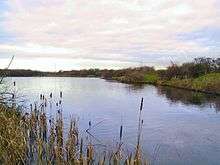
Blackleach Country Park covers 50 hectares half mile north of the town centre. The site is a designated local nature reserve. The reservoir was originally used by factories.[19] The derelict and badly polluted site was crossed by a disused railway line and next to a chemical waste tip. It was reclaimed and restored after a community campaign.[20]
Landmarks
The Ellesmere Centre had a clock-tower which is a replica of the Lady Bourke Clock which once stood by the NCB Offices in Bridgewater Road. It was taken down when the Tesco store was erected. The original clock was used to alert coal miners to the beginning or end of their shifts. The workers claimed that they could not hear the clock strike once at 1 o'clock to mark the end of dinnertime and the resumption of the working day and it was altered to strike 13 times at 1.00pm, a tradition continued by the replica clock.[21] The opening line of George Orwell's novel Nineteen Eighty-Four (1949), referring to the clocks striking thirteen, might have been inspired by his time in the area writing The Road to Wigan Pier (1937).
The Ellesmere Monument in St Paul's Churchyard was erected in 1868 to commemorate Harriet (d. 1866), wife of the 1st Earl of Ellesmere.[22] It was designed by T. G. Jackson, and inspired by the medieval Eleanor crosses. It originally stood at the junction of the A6, A575 and B5232 roads but was moved into the churchyard in 1968 to reduce traffic congestion. Statues of four angels on the monument were stolen. A project to restore the monument was completed in 2006. It was later rebuilt.
Walkden Town Hall was demolished in 1999, to create extra car parking spaces for Walkden College.[23]
Transport
Walkden is at the junction of A6 and the Bolton to Worsley A575. The East Lancashire Road (A580) passes to the south and connects to the M60 ring-road and the motorway network. The M61 to the east of Walkden is in the Guinness Book of Records for being the widest section of motorway in Britain, (there are 17 lanes side by side at Linnyshaw Moss).[24]
There are extensive and frequent bus services, mainly operated by First Greater Manchester, linking the town with Manchester, Bolton and Leigh. Services include the 36 and 37 routes between Bolton and Manchester via Farnworth (37), Little Hulton (36) and Swinton.
.jpg)
Walkden once had two railway stations. In 1875, the London and North Western Railway opened a station on the Bolton to Eccles line known as Walkden Low Level. It was closed in 1954.[25] The Lancashire and Yorkshire Railway provided a station on the Manchester to Wigan line in 1888. Walkden railway station, originally known as "Walkden High Level railway station", remains open. Both lines were built as a result of the coal mining in the area.
According to 2006 figures, Walkden station was used by over 150,000 passengers annually.;[26] by 2012/2013 this had risen to 322,590. There are twice-hourly daytime services to both Manchester and Wigan, from where there are connecting services to Manchester Airport and the rest of the UK. This is reduced to an hourly service each way in the evenings. In 2009 the GMITA voted to approve funding for a one-year trial of hourly Sunday trains from Walkden, starting on 23 May 2010.[27]
Education
Walkden has several primary schools, two high schools and a sixth form college which include The Co-operative Academy of Walkden and Harrop Fold School. Until 2014 Walkden had three high schools, before the closure of St. George's RC High School in July 2014.[28]
Christ the King RC Primary School, James Brindley Primary School, Mesne Lea Primary School, North Walkden Primary School, St Mark's CE Primary School and St Paul's CE Primary School are primary schools in Walkden and serve students ages 3–11.
A number of the town's primary schools are church schools. They include: St Paul's, Crompton Street, and St Paul's, Heathside, which are both Church of England schools. Christ the King RC Primary School is the Roman Catholic primary school for Walkden, Worsley and Roe Green. In addition there are three county primary schools - they are North Walkden Primary School in the north of the town and Mesne Lea Primary School and James Brindley Primary School in south Walkden.
Salford City College, a post-16 vocational college, has a campus located in Walkden on Walkden Road, close to the railway station.[29]
Religion
St Paul's Church was founded in 1838 in the church school and was originally known as St George's Chapel. The foundation stone for St. Paul's at Walkden Moor was laid in 1847 by Lady Brackley, daughter of the Earl of Ellesmere. The church cost £4,500 and was dedicated in 1848 by the Bishop of Manchester. The church was extended in 1881 by the addition of the north aisle, built at a cost of £1,000 which was raised by the parishioners. The east windows date from 1884 and mosaic panels are from 1904.[30]
St John's Church was founded in 1876 in Walkden although most of its parish is in Little Hulton, it is part of the Walkden & Little Hulton Team Ministry.[31]
There are two Methodist churches, Walkden Methodist Church and Worsley Road North Methodist Church. Christ the King Roman Catholic Church serves the Roman Catholic communities of Walkden, Roe Green and Worsley.[32] There is also a Congregational church.[33]
Notable people
- Christopher Eccleston, actor
- Sacha Parkinson, actress.
- Carol Klein, gardener and TV presenter, Gardener's World
- Jamie Moore, former British light-middleweight boxing champion,
- Alan Halsall, actor, Tyrone Dobbs on Coronation Street
- Catherine Tyldesley, actress, Eva Price on Coronation Street
- Sarah Whatmore, singer
- Andrew Rushton, table tennis player
- Andrew Sweeney, entrepreneur and founder of tech publisher Infinite Skills which was acquired by O'Reilly Media in 2013
- David Bamber, actor
- Jason Done, actor
- Adam Eckersley, footballer
- Mark Barry, singer, BBMak
- John Wilkinson, former chairman of Salford RLFC
- John Hallows, footballer, scored 74 League goals for Bradford City between 1930 and 36 (currently the 4th highest ever). He then played for Barnsley F.C. for a season, before he set himself up as a bespoke tailor in Walkden.
- Andrew Stevenson, DJ, skateboarder.
- Chris Irwin, Rugby Player.
See also
References
Notes
- See:
- Walkden North Ward Profile (pdf). salford.gov.uk. Salford City Council. March 2016.
- Walkden South Ward Profile (pdf). salford.gov.uk. Salford City Council. March 2016.
- and Little Hulton Ward Profile (pdf). salford.gov.uk. Salford City Council. March 2016.
- Greater Manchester Gazetteer, Greater Manchester County Record Office, Place Names T to W, archived from the original on 18 July 2011, retrieved 3 April 2007
- Worsley Township Boundaries, genuki.org.uk, retrieved 27 April 2011
- Mills 1998, p. 362
- Gazeteer of Manchester Place Names, retrieved 24 September 2007
- Worsley and Walkden — local history, Salford.gov, retrieved 26 April 2011
- Farrer, William; Brownbill, J, eds. (1911), "Townships: Farnworth", A History of the County of Lancaster: Volume 5, British History Online, pp. 34–39, retrieved 20 January 2010
- Farrer, William; Brownbill, J, eds. (1911), "Townships: Worsley", A History of the County of Lancaster: Volume 4, British History Online, pp. 376–392, retrieved 20 January 2010
- Moffit, Louis W (1 January 1963). England on the eve of the Industrial Revolution. ISBN 978-0-7146-1345-1. Retrieved 3 October 2007.
- Atkinson 1998, p. 67
- Walkden Pits, Walkden Local History, retrieved 17 January 2010
- Sweeney 1997, p. 361
- Great Britain Historical GIS Project (2004). "Descriptive Gazetteer Entry for Walkden (or Walkden Moor)". A vision of Britain through time. University of Portsmouth. Retrieved 20 September 2007.
- "Review of Greater Manchester Boroughs". Archived from the original on 9 January 2007. Retrieved 20 September 2007.
- gateshead-high-street-worst-hit-by-recession, daily.info, retrieved 17 January 2010
- Walkden Gateway, salford.gov, retrieved 17 January 2010
- AEW Architects. "Tesco Walkden".
- "AEW Architects". AEW Architects. Retrieved 16 August 2011.
- Blackleach Country Park, Salford.gov, retrieved 17 January 2010
- Park life: Blackleach Country Park, bbc.co.uk, retrieved 26 April 2011
- Elsie gets a taste of the high life!, Bolton Evening News, retrieved 20 January 2010
- The University of the Third Age, retrieved 21 September 2007
- O'Rourke, Aidan (5 November 2006). "Walkden Town Hall under demolition 1999". eyewitness in Manchester. Manchester Online. Archived from the original on 5 November 2006. Retrieved 23 May 2019.
- British Roads, retrieved 21 September 2007
- Walkden Low Level Station, Subterranea Britannica, retrieved 20 January 2010
- "Railway Passenger Numbers 2005–06". Retrieved 30 September 2007.
- "New Sunday services for rail line", BBC News, 20 December 2009, retrieved 13 January 2010
- "Manchester Evening News". Retrieved 5 February 2015.
- "Salford City College". Retrieved 5 February 2015.
- Walkden St Paul, Genuki, retrieved 17 January 2010
- St John the Baptist, Genuki, retrieved 17 January 2010
- Christ the King, Genuki, retrieved 17 January 2010
- Places of Worship, lan-opc.org, retrieved 20 January 2010
Bibliography
- Atkinson, Glen (1998), The Canal Duke's Collieries Worsley 1760–1900, Neil Richardson (Second Edition), ISBN 978-1-85216-120-0
- Mills, A.D. (1998), A Dictionary of English Place-Names, Oxford University Press, ISBN 0-19-280074-4
- Sweeney, D.J. (1997), A Lancashire Triangle Part Two, Triangle Publishing, ISBN 0-9529333-2-2
External links
| Wikimedia Commons has media related to Walkden. |
| Wikivoyage has a travel guide for Walkden. |