Woolsington
Woolsington is a village in and also a civil parish of the City of Newcastle upon Tyne, England. It is north-west of the city centre, and covers a large geographical area. It is one of the city's 26 electoral wards, although the ward is slightly larger than the civil parish, extending slightly further south. The parish also includes Newbiggin Hall, Woolsington village and Newcastle Airport. It has a population of 11,160 as of the 2011 Census.[1]
| Woolsington | |
|---|---|
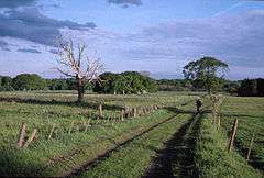
 Woolsington Park in Woolsington, looking south from near Woolsington Hall | |
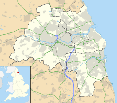
 Woolsington Location within Tyne and Wear | |
| Population | 11,160 (2011) |
| OS grid reference | NZ199697 |
| Civil parish |
|
| Metropolitan borough | |
| Metropolitan county | |
| Region | |
| Country | England |
| Sovereign state | United Kingdom |
| Post town | NEWCASTLE UPON TYNE |
| Postcode district | NE13 |
| Dialling code | 0191 |
| Police | Northumbria |
| Fire | Tyne and Wear |
| Ambulance | North East |
| UK Parliament | |
The place-name 'Woolsington' is first attested in Charter Rolls of 1204, where it appears as Wlsinton. The name means 'the town or settlement of Wulfsige's people'.[2]
The Grade II* listed Woolsington Hall and its 92-acre estate are located in the parish. The hall is on English Heritage's Heritage at Risk Register. In December 2015 the hall was severely damaged by fire.[3]
There are four primary schools in the ward as well as a nursery and creche. There is also a children's centre. Other community facilities include Simonside Community Centre, Newbiggin Hall library, Gala Field Youth Centre and Chevyside Learning First. Newbiggin Hall Library has computers with free internet access. Gala Field Youth Centre provides activities and support to children and young people in the area. Simonside Community Centre on Bedeburn Road offers rooms to hire for events or meetings and a fitness suite.
The Woolsington ward boundary starts at the junction with the A1 and A696 Woolsington Bypass. It heads northwest along the A696 to the junction with Newbiggin Dene where it heads north to the metro line. From here the boundary runs along the Westerhope ward boundary to join Stamfordham Road at the junction of the Ouseburn. The boundary continues southeast along Stamfordham Road to the junction with the A1 Western Bypass. It heads north along the A1 back to the start at the Woolsington Bypass.
House prices in the ward average at £154,500. However, property prices within the boundaries of the village itself range from £250,000 to £1,100,000.
References
- "Newcastle-upon-Tyne ward population 2011". Retrieved 6 July 2015.
- Eilert Ekwall, The Concise Oxford Dictionary of English Place-names, p.533.
- Liz Walker (27 February 2013). "Sir John Hall's Woolsington Hall back on the market". Evening Chronicle. Retrieved 25 August 2013.