Blakelaw
Blakelaw is an electoral ward situated in the West End of the city of Newcastle upon Tyne in North East England. The population of the ward is 11,186, which is 4.6% of the city's population. Car ownership in the area is 50.6%: this is lower than the city average of 54.7%, increasing to 11,507 at the 2011 Census.[1] House prices in this area average at £114,000 (Feb 2007).
| Blakelaw | |
|---|---|
| Ward | |
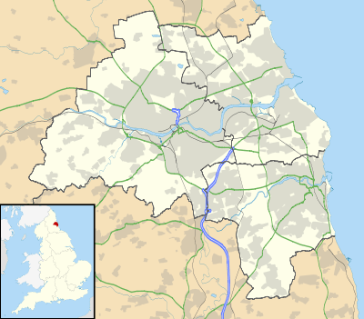
 Blakelaw  Blakelaw Location within Tyne and Wear | |
| OS grid reference | NZ211666 |
| Metropolitan borough | |
| Metropolitan county | |
| Ceremonial county | |
| Region | |
| Country | England |
| Sovereign state | United Kingdom |
| Post town | Newcastle upon Tyne |
| Postcode district | NE5 |
| Police | Northumbria |
| Fire | Tyne and Wear |
| Ambulance | North East |
| UK Parliament | |
| Councillors | Oskar Avery (Labour) Nora Casey (Labour) Linda Hobson (Labour) |
Blakelaw was developed in the early part of the 20th century in order to meet demand for more housing in the North East. During the Second World War a secret war centre was built in the old quarry and extended many levels below ground. This was the headquarters for No 13 Group, who played a vital part in the Battle of Britain.[2] Five posts have been installed in Blakelaw Park as part of a 'listening trail' which tells the story of the life of the bunkers and people who worked in them.[3]
Education
The ward has one Nursery, Willow Avenue Community Nursery and three primary schools: Hilton Primary Academy on Hilton Avenue, Thomas Walling Primary Academy,[4] and English Martyrs'.
Recreation and leisure
The Blakelaw Centre houses a library, a community centre and a community cafe. The centre is operated by the Blakelaw Ward Community Partnership which is chaired by the Labour Councillor for Blakelaw Ward, David Stockdale. Open green spaces in the ward are Blakelaw Park[5] and the Cowgate sports ground.
Boundary
The boundary of Blakelaw ward begins at the A1 junction with the Woolsington Bypass and Ponteland Road. It heads south-west along the A1 to the Stamdfordham Road junction and south to Slatyford Lane bus depot. The boundary joins Silver Lonnen and continues down to Netherby Drive and Fenham Hall Drive. It heads north up Moorside Road North to Ponteland Road where it continues back to the starting point of the A1 junction.
Political
Blakelaw is represented by 3 Councillors: Councillor Nora Casey (Labour), Councillor Oskar Avery (Labour), Councillor Linda Hobson (Labour). It is also part of Newcastle Central Constituency and represented by Labour MP, Chi Onwurah.
There is also Blakelaw and North Fenham Community Council - Meetings are held on the second Thursday of each month, (except August and December), at 6.30pm at the new Neighbourhood Centre on Binswood Avenue. Members of the public are welcome to attend.
Charts and tables
| Age group | Number |
|---|---|
| Under 16 | 2,529 |
| 16-24 | 1,216 |
| 25-44 | 3,097 |
| 45-64 | 2,568 |
| 65-74 | 983 |
| 75+ | 782 |
| Ethnicity | Number | % |
|---|---|---|
| White | 10,475 | 93.5 |
| Afro-Caribbean | 15 | 0.1 |
| South Asian | 575 | 5.1 |
| Chinese | 30 | 0.3 |
| Other | 102 | 0.9 |
The ward has 4,882 housing spaces of which 3.2% are vacant this is lower than the city average of 5.3%. Owner occupied property stands at 52% slightly lower than the city average of 53.3%. The properties are as follows.
| Property type | Number | % |
|---|---|---|
| Detached | 231 | 4.7 |
| Semi-detached | 2,470 | 50.7 |
| Terraced | 1,169 | 24 |
| Flats | 1,005 | 20.6 |
| Other | 0 | 0 |
See also
References
- "Ward population 2011". Retrieved 5 July 2015.
- http://www.chroniclelive.co.uk/all-about/blakelaw
- http://loveblakelaw.com/
- "Archived copy". Archived from the original on 15 March 2015. Retrieved 2015-03-16.CS1 maint: archived copy as title (link)
- "Archived copy". Archived from the original on 22 July 2013. Retrieved 16 March 2015.CS1 maint: archived copy as title (link)