Woolmar, Queensland
Woolmar is a rural locality in the Somerset Region, Queensland, Australia.[2] In the 2016 census, Woolmar had a population of 421 people.[1]
| Woolmar Queensland | |||||||||||||||
|---|---|---|---|---|---|---|---|---|---|---|---|---|---|---|---|
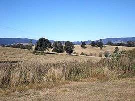 Esk Kilcoy Road, 2015 | |||||||||||||||
 Woolmar | |||||||||||||||
| Coordinates | 26.9277°S 152.5083°E | ||||||||||||||
| Population | 421 (2016 census)[1] | ||||||||||||||
| • Density | 6.200/km2 (16.059/sq mi) | ||||||||||||||
| Postcode(s) | 4515 | ||||||||||||||
| Area | 67.9 km2 (26.2 sq mi) | ||||||||||||||
| Time zone | AEST (UTC+10:00) | ||||||||||||||
| LGA(s) | Somerset Region | ||||||||||||||
| State electorate(s) | Nanango | ||||||||||||||
| Federal Division(s) | Blair | ||||||||||||||
| |||||||||||||||
Geography
The Kilcoy Showgrounds are located in Woolmar.The D'Aguilar Highway passes through Woolmar. Kilcoy Creek marks a small section of the eastern boundary. In the west elevated terrain reaches higher than 400 metres above sea level.
History
Woolmar Provisional School opened on 8 March 1894. On 1 January 1909 it became Woolmar State School. It had temporary closures in 1931 and 1940, closing permanently on 14 April 1941.[3]
gollark: Actually, we planned to do this in 2044 as part of the lunar redevelopment project.
gollark: Well, you could use self-replicating assemblers to convert the moon into a vast phased array transceiver system.
gollark: They won't go very far though mostly.
gollark: You can broadcast legally in the ISM bands.
gollark: Idea: mondecitronne.com ideatic radio™.
References
- Australian Bureau of Statistics (27 June 2017). "Woolmar (SSC)". 2016 Census QuickStats. Retrieved 20 October 2018.

- "Woolmar - locality in Somerset Region (entry 48228)". Queensland Place Names. Queensland Government. Retrieved 17 November 2019.
- Queensland Family History Society (2010), Queensland schools past and present (Version 1.01 ed.), Queensland Family History Society, ISBN 978-1-921171-26-0
External links
![]()
This article is issued from Wikipedia. The text is licensed under Creative Commons - Attribution - Sharealike. Additional terms may apply for the media files.