Royston, Queensland
Royston is a rural locality in the Somerset Region, Queensland, Australia.[2] In the 2016 census, Royston had a population of 336 people.[1]
| Royston Queensland | |||||||||||||||
|---|---|---|---|---|---|---|---|---|---|---|---|---|---|---|---|
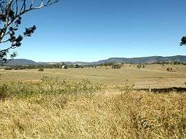 Paddocks, 2015 | |||||||||||||||
 Royston | |||||||||||||||
| Coordinates | 26.9230°S 152.6502°E | ||||||||||||||
| Population | 336 (2016 census)[1] | ||||||||||||||
| • Density | 17.50/km2 (45.32/sq mi) | ||||||||||||||
| Postcode(s) | 4515 | ||||||||||||||
| Area | 19.2 km2 (7.4 sq mi) | ||||||||||||||
| Time zone | AEST (UTC+10:00) | ||||||||||||||
| LGA(s) | Somerset Region | ||||||||||||||
| State electorate(s) | Nanango | ||||||||||||||
| Federal Division(s) | Blair | ||||||||||||||
| |||||||||||||||
Geography
The D'Aguilar Highway passes through the south of Royston where the Stanley River marks the southern boundary. In the north lies the southern foothills of the Conondale Range.
History
In the 2011 census the locality had a population of 320 people.[3]
gollark: Which reminds me, I should add fuzzy page title search to minoteaur.
gollark: In my experience, it is more performant to give SQLite a large list of things to match against (using accursed JSONous hacks) than to do many small queries.
gollark: I see.
gollark: How will it know?
gollark: Interesting!
See also
References
- Australian Bureau of Statistics (27 June 2017). "Royston (SSC)". 2016 Census QuickStats. Retrieved 20 October 2018.

- "Royston - locality in Somerset Region (entry 44912)". Queensland Place Names. Queensland Government. Retrieved 17 November 2019.
- Australian Bureau of Statistics (31 October 2012). "Royston (State Suburb)". 2011 Census QuickStats. Retrieved 12 August 2015.
This article is issued from Wikipedia. The text is licensed under Creative Commons - Attribution - Sharealike. Additional terms may apply for the media files.