Union Covered Bridge State Historic Site
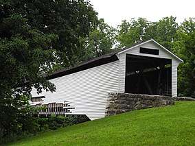
The Union Covered Bridge State Historic Site in Monroe County, Missouri, is maintained by the Missouri Department of Natural Resources as a state historic site to preserve the Union covered bridge.[4] The bridge was built in 1871 across the Elk Fork of the Salt River as a link in the Paris-to-Fayette road. Its name comes from the nearby Union Church. In 1968 a partial restoration was completed using materials from the Mexico Covered Bridge, which flood waters had destroyed the previous year. In 1970 the Union bridge was closed after structural timbers were damaged by overweight trucks. A total restoration was completed in 1988. The bridge was entered on the National Register of Historic Places in 1970.[5][6]
| Union Covered Bridge State Historic Site | |
|---|---|
 | |
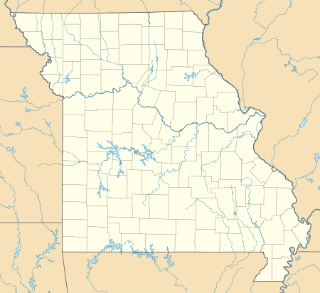
 Location in Missouri  Union Covered Bridge State Historic Site (the United States) | |
| Location | Monroe, Missouri, United States |
| Coordinates | 39°25′58″N 92°06′09″W[1] |
| Area | 1.24 acres (0.50 ha)[2] |
| Elevation | 676 ft (206 m)[1] |
| Established | 1967[3] |
| Governing body | Missouri Department of Natural Resources |
| Website | Union Covered Bridge State Historic Site |
Union Covered Bridge | |
| Nearest city | Paris, Missouri |
| Area | 9.9 acres (4.0 ha) |
| Built | 1870 |
| Built by | Elliot, Joseph C. |
| NRHP reference No. | 70000342 |
| Added to NRHP | June 15, 1970 |
The bridge is a 120-foot-long (37 m) Burr Arch span that is 17 feet 6 inches (5.33 m) wide and 12 feet (3.7 m) high. Joseph C. Elliot built the bridge in 1871 from local oak. It is sided in clapboard and uses wood shingles. Two earlier uncovered bridges at this site were replaced in turn due to deterioration.[5]
Some siding was removed as an emergency measure in 2008 when the bridge was threatened by severe flooding. Removal of the lowest siding allowed the stream to flow freely through the understructure of the bridge, thus sparing it the full force of the current. The bridge was saved, but the removed siding is still missing while funds for repair are sought.
See also
- List of Missouri covered bridges
References
- "Union Bridge". Geographic Names Information System. United States Geological Survey.
- "Union Covered Bridge State Historic Site: Data Sheet" (PDF). Missouri Department of Natural Resources. November 2017. Retrieved May 19, 2018.
- "State Park Land Acquisition Summary". Missouri State Parks. Retrieved May 19, 2018.
- "Union Covered Bridge State Historic Site". Missouri Department of Natural Resources. Retrieved September 4, 2014.
- "Union Covered Bridge State Historic Site: General Information". Missouri Department of Natural Resources. Retrieved September 4, 2014.
- Charla A. Piggott (March 1970). "Union Covered Bridge" (PDF). National Register of Historic Places Inventory Nomination Form. Missouri Department of Natural Resources. Retrieved January 1, 2017. (includes 1 photograph from 1970)

