National Register of Historic Places listings in Boone County, Missouri
This is a list of the National Register of Historic Places listings in Boone County, Missouri.
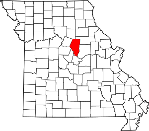
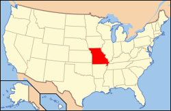
Location of Boone County in Missouri
This is intended to be a complete list of the properties and districts on the National Register of Historic Places in Boone County, Missouri, United States. Latitude and longitude coordinates are provided for many National Register properties and districts; these locations may be seen together in a map.[1]
There are 51 properties and districts listed on the National Register in the county, including 1 National Historic Landmark.
- This National Park Service list is complete through NPS recent listings posted August 14, 2020.[2]
Current listings
| [3] | Name on the Register | Image | Date listed[4] | Location | City or town | Description |
|---|---|---|---|---|---|---|
| 1 | Ballenger Building |  Ballenger Building |
January 21, 2004 (#03001474) |
27-29 South Ninth St. 38°57′02″N 92°19′40″W |
Columbia | |
| 2 | Bond's Chapel Methodist Episcopal Church | 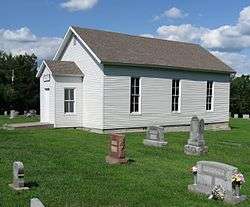 Bond's Chapel Methodist Episcopal Church |
September 9, 1993 (#93000940) |
MO A, 2.5 miles (4.0 km) northeast of Hartsburg 38°42′34″N 92°17′08″W |
Hartsburg | |
| 3 | John W. Boone House | 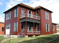 John W. Boone House |
September 4, 1980 (#80002309) |
4th St. between E. Broadway and Walnut 38°57′08″N 92°19′57″W |
Columbia | |
| 4 | Central Dairy Building | 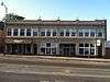 Central Dairy Building |
January 20, 2005 (#04001519) |
1104-1106 East Broadway 38°57′05″N 92°19′30″W |
Columbia | |
| 5 | Albert Bishop Chance House and Gardens | 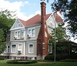 Albert Bishop Chance House and Gardens |
July 3, 1979 (#79001345) |
319 E. Sneed St. 39°12′36″N 92°08′04″W |
Centralia | |
| 6 | Chatol | 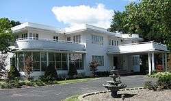 Chatol |
April 20, 1979 (#79001346) |
543 S. Jefferson St. 39°12′17″N 92°08′06″W |
Centralia | |
| 7 | Coca-Cola Bottling Company Building | 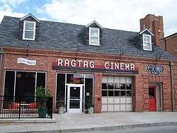 Coca-Cola Bottling Company Building |
February 14, 2006 (#06000043) |
10 Hitt St. 38°57′03″N 92°19′30″W |
Columbia | |
| 8 | Columbia Cemetery | 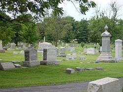 Columbia Cemetery |
February 1, 2007 (#06001335) |
30 East Broadway 38°56′56″N 92°20′13″W |
Columbia | |
| 9 | Columbia National Guard Armory | Columbia National Guard Armory |
March 25, 1993 (#93000197) |
701 E. Ash St. 38°57′14″N 92°19′45″W |
Columbia | |
| 10 | Sanford F. Conley House | 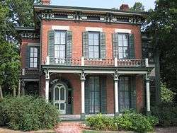 Sanford F. Conley House |
December 18, 1973 (#73001035) |
602 Sanford Pl. 38°56′39″N 92°19′52″W |
Columbia | |
| 11 | Fred Douglass School | 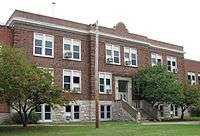 Fred Douglass School |
September 4, 1980 (#80002310) |
310 N. Providence Rd. 38°57′18″N 92°19′59″W |
Columbia | |
| 12 | Downtown Columbia Historic District | 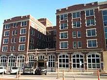 Downtown Columbia Historic District |
November 8, 2006 (#06000990) |
Parts of 7th, 8th, 9th, 10th, E. Broadway, Cherry, Hitt, Locust, and E. Walnut Sts.; also 1019, 1020, 1023, and 1025-33 E. Walnut St. 38°57′05″N 92°19′39″W |
Columbia | Addresses along E. Walnut St. represent a boundary increase of May 8, 2008 |
| 13 | East Campus Neighborhood Historic District |  East Campus Neighborhood Historic District |
February 16, 1996 (#96000019) |
Roughly bounded by Bouchelle, College, University and High Sts. including parts of Willis, Bass, Dorsey and Anthony Sts. 38°56′44″N 92°19′07″W |
Columbia | |
| 14 | Eighth and Broadway Historic District | 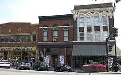 Eighth and Broadway Historic District |
April 22, 2003 (#03000298) |
800-810 E. Broadway Blvd. 38°57′04″N 92°19′42″W |
Columbia | The contributing properties include the Miller Building, Matthews Hardware, and Metropolitan Building. |
| 15 | Samuel H. and Isabel Smith Elkins House | 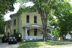 Samuel H. and Isabel Smith Elkins House |
September 12, 1996 (#96001012) |
315 N. 10th St. 38°57′20″N 92°19′36″W |
Columbia | |
| 16 | First Christian Church | 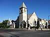 First Christian Church |
October 29, 1991 (#91001590) |
101 N. Tenth St. 38°57′10″N 92°19′36″W |
Columbia | |
| 17 | Francis Quadrangle Historic District | 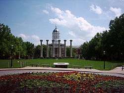 Francis Quadrangle Historic District |
December 18, 1973 (#73001036) |
Bounded by Conley Ave. and Elm, 6th, and 9th Sts. 38°56′46″N 92°19′44″W |
Columbia | |
| 18 | Frederick Apartments | 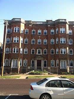 Frederick Apartments |
April 16, 2013 (#13000172) |
1001 University Avenue 38°56′48″N 92°19′34″W |
Columbia | |
| 19 | David Gordon House and Collins Log Cabin | 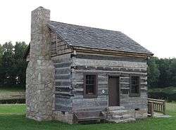 David Gordon House and Collins Log Cabin |
August 29, 1983 (#83000972) |
2100 E. Broadway 38°54′24″N 92°17′41″W |
Columbia | |
| 20 | Gordon Tract Archeological Site |  Gordon Tract Archeological Site |
March 16, 1972 (#72000705) |
Address Restricted |
Columbia | |
| 21 | Greenwood | 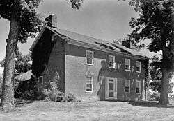 Greenwood |
January 15, 1979 (#79001347) |
3005 Mexico Gravel Rd. 38°58′47″N 92°17′32″W |
Columbia | |
| 22 | David Guitar House |  David Guitar House |
September 9, 1993 (#93000939) |
2815 Oakland Gravel Rd. 38°58′47″N 92°18′16″W |
Columbia | |
| 23 | Samuel E. Hackman Building | 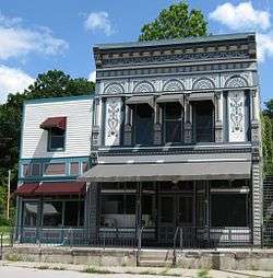 Samuel E. Hackman Building |
December 10, 1998 (#98001501) |
30 S. Second St. 38°41′41″N 92°18′31″W |
Hartsburg | |
| 24 | Hamilton-Brown Shoe Factory | 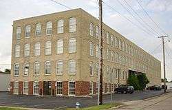 Hamilton-Brown Shoe Factory |
July 19, 2002 (#02000791) |
1123 Wilkes Blvd. 38°57′38″N 92°19′22″W |
Columbia | |
| 25 | Harrisburg School--Ancient Landmark Masonic Lodge Number 356 A.F. & A.M. |  Harrisburg School--Ancient Landmark Masonic Lodge Number 356 A.F. & A.M. |
December 24, 2013 (#13000970) |
140 S. Harris St. 39°08′28″N 92°27′43″W |
Harrisburg | |
| 26 | William B. Hunt House | 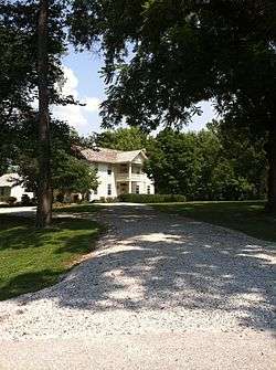 William B. Hunt House |
January 9, 1997 (#96001567) |
8939 W. Terrapin Hills Rd. 38°55′09″N 92°28′27″W |
Columbia | |
| 27 | Kress Building | 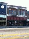 Kress Building |
March 9, 2005 (#05000122) |
1025 E. Broadway 38°57′07″N 92°19′32″W |
Columbia | |
| 28 | Maplewood | 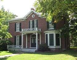 Maplewood |
April 13, 1979 (#79001348) |
Nifong Blvd. and Ponderosa Dr. 38°54′29″N 92°17′43″W |
Columbia | |
| 29 | McCain Furniture Store | 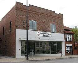 McCain Furniture Store |
August 17, 2005 (#05000890) |
916 E. Walnut 38°57′09″N 92°19′37″W |
Columbia | |
| 30 | Missouri State Teachers Association Building | 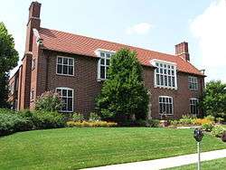 Missouri State Teachers Association Building |
September 4, 1980 (#80002311) |
407 S. 6th St. 38°56′50″N 92°19′53″W |
Columbia | |
| 31 | Missouri Theater | 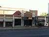 Missouri Theater |
June 6, 1979 (#79001349) |
201-215 S. 9th St. 38°56′57″N 92°19′39″W |
Columbia | |
| 32 | Missouri United Methodist Church | 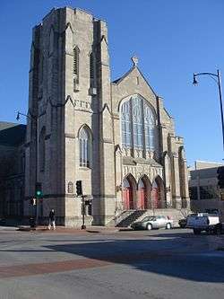 Missouri United Methodist Church |
September 4, 1980 (#80002312) |
204 S. 9th St. 38°56′57″N 92°19′37″W |
Columbia | |
| 33 | Missouri, Kansas, and Texas Railroad Depot |  Missouri, Kansas, and Texas Railroad Depot |
January 29, 1979 (#79001350) |
402 E. Broadway 38°57′05″N 92°19′58″W |
Columbia | |
| 34 | Mount Zion Church and Cemetery |  Mount Zion Church and Cemetery |
January 14, 2013 (#12001177) |
11070 Mount Zion Rd. 39°04′09″N 92°10′44″W |
Hallsville | |
| 35 | North Ninth Street Historic District | 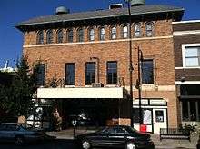 North Ninth Street Historic District |
January 21, 2004 (#03001473) |
5-36 North Ninth St. 38°57′07″N 92°19′39″W |
Columbia | |
| 36 | Moses U. Payne House | 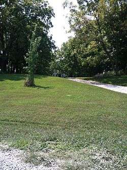 Moses U. Payne House |
October 7, 1994 (#94001204) |
201 N. Roby Farm Rd. 38°57′45″N 92°31′53″W |
Rocheport | |
| 37 | Pierce Pennant Motor Hotel | 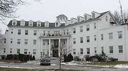 Pierce Pennant Motor Hotel |
September 2, 1982 (#82003125) |
1406 Old US 40W 38°58′02″N 92°21′32″W |
Columbia | |
| 38 | Rocheport |  Rocheport |
October 8, 1976 (#76001108) |
MO 240 38°58′43″N 92°33′49″W |
Rocheport | |
| 39 | St. Paul A.M.E. Church | 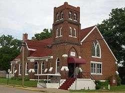 St. Paul A.M.E. Church |
September 4, 1980 (#80002315) |
5th and Park Sts. 38°57′17″N 92°19′54″W |
Columbia | |
| 40 | Sanborn Field and Soil Erosion Plots | 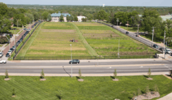 Sanborn Field and Soil Erosion Plots |
October 15, 1966 (#66000413) |
University of Missouri campus 38°56′33″N 92°19′14″W |
Columbia | |
| 41 | Second Baptist Church | 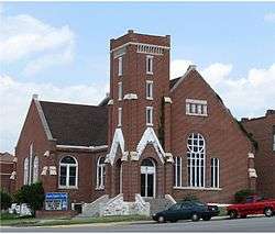 Second Baptist Church |
September 4, 1980 (#80002313) |
4th St. and Broadway 38°57′07″N 92°19′58″W |
Columbia | |
| 42 | Second Christian Church | 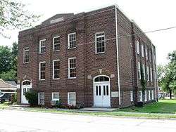 Second Christian Church |
September 4, 1980 (#80002314) |
401 N. 5th 38°57′20″N 92°19′55″W |
Columbia | |
| 43 | Senior Hall |  Senior Hall |
August 2, 1977 (#77000799) |
Stephens College campus 38°57′01″N 92°19′23″W |
Columbia | |
| 44 | Sigma Alpha Epsilon Building | 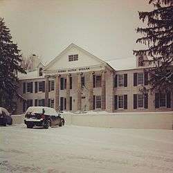 Sigma Alpha Epsilon Building |
October 20, 2014 (#14000870) |
24 E. Stewart Rd. 38°56′47″N 92°20′12″W |
Columbia | |
| 45 | Stephens College South Campus Historic District | 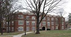 Stephens College South Campus Historic District |
November 25, 2005 (#05001326) |
1200 E. Broadway 38°57′03″N 92°19′22″W |
Columbia | |
| 46 | John N. and Elizabeth Taylor House | 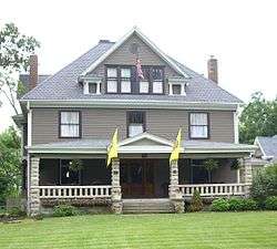 John N. and Elizabeth Taylor House |
May 25, 2001 (#01000546) |
716 W Broadway 38°57′04″N 92°20′57″W |
Columbia | |
| 47 | Tiger Hotel | 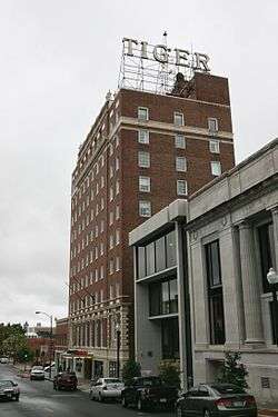 Tiger Hotel |
February 29, 1980 (#80002316) |
23 S. 8th St. 38°57′03″N 92°19′44″W |
Columbia | |
| 48 | Virginia Building | 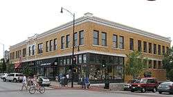 Virginia Building |
March 13, 2002 (#02000163) |
111 S. Ninth St. 38°57′01″N 92°19′40″W |
Columbia | |
| 49 | Wabash Railroad Station and Freight House | 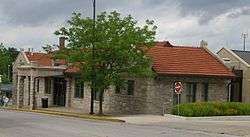 Wabash Railroad Station and Freight House |
October 11, 1979 (#79001351) |
126 N. 10th St. 38°57′12″N 92°19′34″W |
Columbia | |
| 50 | West Broadway Historic District | 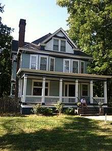 West Broadway Historic District |
April 27, 2010 (#10000221) |
300-922 W. Broadway (except 800, 808, 812) 38°57′06″N 92°20′51″W |
Columbia | |
| 51 | Wright Brothers Mule Barn | Wright Brothers Mule Barn |
November 1, 2007 (#07001119) |
1101-1107 Hinkson Ave. & 501-507 Fay St. 38°57′26″N 92°19′22″W |
Columbia |
gollark: <@351074492577218560> Technically you can use external PCIe GPUs with the Pi. It's fiddly and you have to desolder the USB chip.
gollark: Besides, YouTube and random free content hosting things are "the internet" too.
gollark: Some people, like [FRIEND NAME EXPUNGED], have connections with CGNAT and/or brokenness and can't run stuff at home, but there are plenty of very cheap options.
gollark: You can also buy web hosting for £3/month or less in the C L O U D.
gollark: I host my website off a normal home connection with a dynamic IP on a cheap tower server which runs internal stuff too, although a raspberry pi would work.
See also
References
| Wikimedia Commons has media related to National Register of Historic Places in Boone County, Missouri. |
- The latitude and longitude information provided in this table was derived originally from the National Register Information System, which has been found to be fairly accurate for about 99% of listings. Some locations in this table may have been corrected to current GPS standards.
- "National Register of Historic Places: Weekly List Actions". National Park Service, United States Department of the Interior. Retrieved on August 14, 2020.
- Numbers represent an ordering by significant words. Various colorings, defined here, differentiate National Historic Landmarks and historic districts from other NRHP buildings, structures, sites or objects.
- The eight-digit number below each date is the number assigned to each location in the National Register Information System database, which can be viewed by clicking the number.
This article is issued from Wikipedia. The text is licensed under Creative Commons - Attribution - Sharealike. Additional terms may apply for the media files.