Taratanr
Taratanr (also spelled Taratand) is a village in Gandey CD Block in Giridih Sadar subdivision of Giridih district in the Indian state of Jharkhand.
Taratanr | |
|---|---|
Village | |
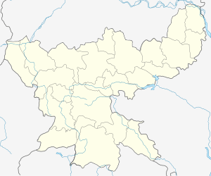
 Taratanr Location in Jharkhand, India  Taratanr Taratanr (India) | |
| Coordinates: 24.051111°N 86.433545°E | |
| Country | |
| State | Jharkhand |
| District | Giridih |
| Population (2011) | |
| • Total | 3,401 |
| Languages | |
| • Official | Hindi, Urdu |
| Time zone | UTC+5:30 (IST) |
| Telephone/ STD code | 06532 |
Demographics
As per the 2011 Census of India Taratanr had a total population of 3,401, of which 1,757 (52%) were males and 1,644 (48%) were females. Population below 6 years was 714. The total number of literates in Taratanr was 1,527 (56.83% of the population over 6 years). [2]
Transport
State Highway 13 (Jharkhand), running from Koderma to Gobindpur, passes through Taratanr. There is a bridge over the Barakar nearby, crossing over to Tundi CD Block in Dhanbad district.[3]
gollark: ... why forge 1.13?
gollark: While many didn't, I actually *liked* the weird hexagon minigame TC4 had.
gollark: The 1.8 one is Thaumcraft 5 which nobody used much.
gollark: No, the 1.7 version.
gollark: Unrelated: trying to make a nice base, so I made this 70-block-tall staircase, but now I want something to put at the top and am being indecisive again.
References
- "District Statistical Handbook, Giridih". Tables 2.1, 2.4. Directorate of Economics and Statistics, Department of Planning and Development, Jharkhand. Retrieved 28 November 2017.
- "2011 Census C.D. Block Wise Primary Census Abstract Data(PCA)". Jharkhand – District-wise CD Blocks. Registrar General and Census Commissioner, India. Retrieved 28 November 2017.
- Google maps
This article is issued from Wikipedia. The text is licensed under Creative Commons - Attribution - Sharealike. Additional terms may apply for the media files.