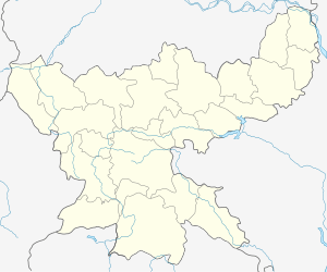
Khori Mahua
Khori Mahua (also spelled Khorimahua or Khuri Mahaua) is a village in Dhanwar CD Block in Khuri Mahua subdivision of Giridih district in the Indian state of Jharkhand.
Khori Mahua | |
|---|---|
Village | |
 Khori Mahua Location in Jharkhand, India  Khori Mahua Khori Mahua (India) | |
| Coordinates: 24.4638°N 86.0043°E | |
| Country | |
| State | Jharkhand |
| District | Giridih |
| Languages | |
| • Official | Hindi |
| Time zone | UTC+5:30 (IST) |
| PIN | 825412 (Rajdhanwar) |
| Telephone/ STD code | 06556 |
Geography
Khori Mahua is 48 km from Giridih and 6 km from Rajdhanwar. The headquarters of Khori Mahua subdivision are located at Khori Mahua.[1]
Demographics
As per the 2011 Census of India Khorimahua had a total population of 1,112, of which 602 (54%) were males and 510 (46%) were females. Population below 6 years was 253. The total number of literates in Khorimahua was 706 (82.19% of the population over 6 years).[2]
Transport
State Highway 13 (Jharkhand) passes through Khori Mahua.[3]
gollark: Do the chunkloaders actually *work*?!
gollark: If you want GPSless location for some reason I guess I can add an API to my trilaterator.
gollark: Why would you not just use ender modems directly instead of nonsensy nonsense like underground kablez?
gollark: Telegrams would be if we were mad and sent it over redstone.
gollark: You mean faxes?
References
- "Construction of Residential Building in the Campus of S.D.O. Office in Khori Mahua". India Mart. Retrieved 23 September 2017.
- "2011 Census C.D. Block Wise Primary Census Abstract Data(PCA)". Jharkhand – District-wise CD Blocks. Registrar General and Census Commissioner, India. Retrieved 23 September 2017.
- Google maps
This article is issued from Wikipedia. The text is licensed under Creative Commons - Attribution - Sharealike. Additional terms may apply for the media files.