Bagodar
Bagodar is a village in Bagodar CD Block in Bagodar-Saria subdivision of Giridih district in the Indian state of Jharkhand.
Bagodar | |
|---|---|
Village | |
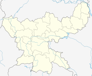
 Bagodar Location in Jharkhand, India  Bagodar Bagodar (India) | |
| Coordinates: 24.0803°N 85.8306°E | |
| Country | |
| State | Jharkhand |
| District | Giridih |
| Elevation | 308 m (1,010 ft) |
| Population (2011) | |
| • Total | 9,934 |
| Languages | |
| • Official | Hindi, Urdu |
| Time zone | UTC+5:30 (IST) |
| PIN | 825322 (Bagodar) |
| Telephone/ STD code | 06557 |
Demographics
As per the 2011 Census of India Bagodar had a total population of 9,934, of which 5,124 (52%) were males and 4,810 (48%) were females. Population below 6 years was 1,804. The total number of literates in Bagodar was 5,569 (68.50% of the population over 6 years). [1]
Police station
Bagodar police station has jurisdiction over Bagodar CD Block.[2]According to old British records, Bagodar PS was opened in 1838, following the opening of the Grand Trunk Road.[3]
Transport
NH 19 (old numbering NH 2)/ Grand Trunk Road and the Hazaribagh town-Hazaribagh Road railway station road pass through Bagodar.[6][7]
Economy
Banks
- State Bank of India
- Bank of India
- Jharkhand Gramin Bank
- Co-operative Bank
- UCO Bank
- United Bank Of India
- Bank of Baroda
- Punjab National Bank
- Allahabad Bank Aoura
Education
- Ram Krishna Vivekananda College of Education was established at Bagodar in 2009. Affiliated to Vinoba Bhave University, it offers courses in arts, science, commerce and education.[8]
- Govt Teachers Training College
- High School Bagodar
- Gyanodya Public School, Bagodar
- Children's Guide Academy School, Bagodar
- Primary Girls' School, Bagodar (Niche Bazaar)
- Govt. Basic School, Bagodar
- Girls' High School
- Beko High School (Gopald)
- Arun Kumar Memorial School Residential
- Model School
- Ghaghra Inter Science College
- Swami Dayanand Residential School Krishna Nagar, Bagodar
- J.C. Bose High School (Residential)
- St. Thomas Public School
- Gayatri Vidya Mandir
- Ram Krishna Vivekanand Vidyalaya
- Jharkhand Public School
- Sardar Ballabh Bhai Patel High School, Mahauri
- Manan Vidya, Mahuri, Bagodar
- Bhawna Edutech Tutorial, Block more, Bagodar
- Saraswati Vidya Niketan High School, Bagodar
- High School Hesla
Main colonies
- Suriya Road
- G.T Road, Sonturpi
- Mulla Muslim Mohalla
- Krishna Nagar
- Vivek Nagar
- Mahavir Nagar (Niche Bazaar, Bagodar)
- Ghaghra (Kasiyadih, Badkadih)
- Manjhaladih
- Atka (Laxibagi)
- Yamuna Nagar
- Hesla (Gendodih)
- Shiv Nagar
- Banpura
- Tirla (Aamtar)
Cricket clubs
- Kranti Club Jarmune
- Sonturpi Club
- Savera Sporting Club
- Mahavir Friends Club (Niche Bazar)
- Bagodardih Cricket Club
- Mahuri Cricket Club (G.T.Road)
- Ghaghra Cricket CLub (Kasiyadih)
- Five Star Club (Banpura)
- Tirla Cricket Club
Temples
- Harihardham (Baba Dham)
- Sri Shakti Mandir (Bagodar)
- Vaishno Devi Mandir
- Banhe Baba Jarmune
- Durgamata Mandir (Atkadih, DMUAA)
- Mahavir Mandir (Niche Bazaar)
- Gupt Nath Dham
- Sai Mandir, Bagodar
- Surya Mandir, Hazaribag Road, Bagodar
- Vaishno Devi Mandir, Hazaribag Road, Bagodar
- Sona Pahad, Beko
- Khataya Hanumaan Mandir
- Kali Mandir Tirla
- Khataya Pahadi Mandir
gollark: Their decision to use IPv5 for that instead of something else was stupidious.
gollark: Yes, I know.
gollark: I used PHP to SSH into the matrix using BIOS and a binary tree to PXE across IPv5 with AVX and started the server briefly.
gollark: It keeps timing out.
gollark: o noes..
References
- "2011 Census C.D. Block Wise Primary Census Abstract Data(PCA)". Jharkhand – District-wise CD Blocks. Registrar General and Census Commissioner, India. Retrieved 23 September 2017.
- "District Statistical Handbook, Giridih". Tables 2.1, 2.4. Directorate of Economics and Statistics, Department of Planning and Development, Jharkhand. Retrieved 23 September 2017.
- "District Census Handbook Giridih, 2011, Series 21, Part XII A" (PDF). Pages 5-7. Directorate of Census Operations, Jharkhand. Retrieved 2 December 2017.
- "2011 District Census Handbook Giridih, Series 21, Part XII B" (PDF). Map on Page 3. Directorate of Census Operations, Jharkhand. Retrieved 23 September 2017.
- "Giridih". District Administration, Giridih. Archived from the original on 27 May 2011. Retrieved 23 September 2017.
- "Rationalisation of Numbering Systems of National Highways" (PDF). New Delhi: Department of Road Transport and Highways. Archived from the original (PDF) on 1 February 2016. Retrieved 23 September 2017.
- Google maps
- "RKV College of Education". way2college. Retrieved 2 December 2017.
This article is issued from Wikipedia. The text is licensed under Creative Commons - Attribution - Sharealike. Additional terms may apply for the media files.