Kharagdiha
Kharagdiha is a village in Giridih district in the Indian state of Jharkhand. It had been known as Curruckdea[1] or Curruckdeah[2] during the British Raj.
Kharagdiha | |
|---|---|
village | |
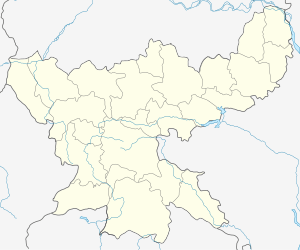
 Kharagdiha Location in Jharkhand, India  Kharagdiha Kharagdiha (India) | |
| Coordinates: 24°25′24″N 86°09′57″E | |
| Country | |
| State | Jharkhand |
| District | Giridih |
| Languages | |
| • Official | Hindi, Santhali, English |
| Time zone | UTC+5:30 (IST) |
| Vehicle registration | JH |
History
Kharagdiha estate was founded in 15th century when the then Maharaja was able to influence and impress the ghatwals of Kharagdiha Gadis. The Hazaribagh Gazetteer describes this kingdom 600 miles long which spread from Hazaribagh to Gaya. The Kharagdiha gadis were semi-independent chiefdoms. All that the ruler of the Gadi had to do on succession was to acknowledge the supremacy of the Kharagdiha Maharaja. Koderma, Gadi Palganj, Ledo Gadi, Ghoranji Gadi and Gadi Sirsia were notable gadis. There were a total of 38 Gadis in the kingdom. [3]
During the British Raj Kharagdiha became a part of Jungle Terry. The Gadis of Kharagdiha were permanently settled and they became Zamindari estates. The rulers of kharagdiha were separately settled the zamindari estate of Raj Dhanwar in 1809.
Subsequent to the Kol uprising in 1831 that, did not seriously affect Hazaribag, however, the administrative structure of the territory was changed. The parganas of Ramgarh, Kharagdiha, Kendi and Kunda became parts of the South-West Frontier Agency and were formed into a division named Hazaribag as the administrative headquarters.
In 1854, the designation of South-West Frontier Agency was changed to Chota Nagpur Division and it began to be administered as a Non-regulation province under the Lieutenant Governor of the then Bihar. In 1855-56 there was the great uprising of the Santhals against the British but was brutally suppressed.[4]
Places of interest
The Langta Baba Samadhi Sthal is located in Kharagdiha, about 30 km North West of the town on road towards Jamua. Langta Baba is revered both by the Hindus and the Muslims alike. People offer chadar to his samadhi as a ritual, and it is believed the wish made here by a true devotee always get fulfilled.[5]
References
- India Tracts: Containing a Description of the Jungle Terry Districts. By James Browne (Lieut.-Colonel.)
- A geographical dictionary, or Universal gazetteer, ancient and modern. : In two volumes. Vol. I[-II]
- Hazaribagh District Gazetteer.
- Wilson Hunter, Sir William; Sutherland Cotton, James; Sir Richard Burn, Sir William Stevenson Meyer. Great Britain India Office. The Imperial Gazetteer of India. Oxford: Clarendon Press, 1908.
- "Giridih Tourism". Official Website of Giridih. Retrieved 7 March 2012.