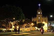
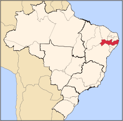
Tabira, Pernambuco
Tabira is a city in the state of Pernambuco, Brazil. The population in 2009, according to the Brazilian Institute of Geography and Statistics, was 27.219 inhabitants.[1] Its land area is 388 km².
Geography
- State - Pernambuco
- Region - Sertão Pernambucano
- Boundaries - Santa Terezinha and Paraiba state (N); Ingazeira and Iguaraci (S); Santa Terezinha and São José do Egito (E); Afogados da Ingazeira and Solidão (W).
- Area - 388 km²
- Elevation - 558 m
- Hydrography - Pajeú River
- Vegetation - Caatinga hiperxerófila
- Climate - semi-arid hot and tropical hot
- Annual average temperature - 27.0 c
- Distance to Recife - 398 km
Economy
The main economic activities in Tabira are based in the food and beverage industry, commerce and agribusiness, especially the raising of cattle, sheep, pigs, goats; and plantations of corn and beans.
Economic indicators
| Population | GDP x(1000 R$).[2] | GDP pc (R$) | PE |
|---|---|---|---|
| 27.219 | 79.835 | 3.090 | 0.132% |
Economy by sector 2006
| Primary sector | Secondary sector | Service sector |
|---|---|---|
| 11.45% | 10.54% | 78.01% |
Health indicators
| HDI (2000) | Hospitals (2007) | Hospitals beds (2007) | Children's mortality every 1000 (2005) |
|---|---|---|---|
| 0.630 | 1 | 66 | na |
gollark: The existing system probably isn't because inverted index.
gollark: The *bigger* problem is that without some very clever engineering the time would be linear *in the number of messages*.
gollark: Search is a Hard Problem™ and it's hardly Discord's core business.
gollark: Bytes are very nice, yes.
gollark: gollark.
References
- http://www.ibge.gov.br/home/estatistica/populacao/estimativa2009/POP2009_DOU.pdf IBGE Population 2009 Tabira, page 35]
- Tabira 2007 GDP IBGE page 32 Archived 2016-03-04 at the Wayback Machine
- PE State site - City by city profile
Capital: Recife | ||||||||||||||
| Mesoregion Agreste Pernambucano |
|  | ||||||||||||
| Mesoregion Mata Pernambucana |
| |||||||||||||
| Mesoregion Metropolitana de Recife |
| |||||||||||||
| Mesoregion Sao Francisco Pernambucano |
| |||||||||||||
| Mesoregion Sertao Pernambucano |
| |||||||||||||
This article is issued from Wikipedia. The text is licensed under Creative Commons - Attribution - Sharealike. Additional terms may apply for the media files.