Paranatama
Paranatama is a municipality/city in the state of Pernambuco in Brazil. The population in 2009 was 12.441 and the total area is 230.88 km2.

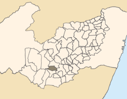
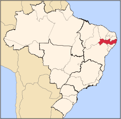
Paranatama in Pernambuco.
Geography
- State - Pernambuco
- Region - Agreste of Pernambuco
- Boundaries - Caetés (N); Saloá (S); Garanhuns (E); Pedra (W).
- Area - 230.88 km2
- Elevation - 879 m
- Hydrography - Mundaú River
- Vegetation - Caatinga hipoxerófila
- Climate - Transition between tropical hot and humid and, semi arid hot
- Annual average temperature - 20.8 c
- Distance to Recife - 192 km
Economy
The main economic activity in Paranatama is agribusiness, especially cattle, goat, pig, sheep, and chicken farming; and plantations of beans, manioc, coffee and corn.
Economic Indicators
| Population [1] | GDP x(1000 R$).[2] | GDP pc (R$) | PE |
|---|---|---|---|
| 12.441 | 37.227 | 3.190 | 0.06% |
Economy by Sector 2006
| Primary sector | Secondary sector | Service sector |
|---|---|---|
| 21.52% | 8.69% | 69.79% |
Health Indicators
| HDI (2000) | Hospitals (2007) | Hospitals beds (2007) | Children's Mortality every 1000 (2005) |
|---|---|---|---|
| 0.561 | 1 | 8 | 7.6 |
gollark: Maybe. I'm not sure how inherently.
gollark: I can't find any information on performance tuning for it.
gollark: Does anyone know of good personal search engine-type things? Right now I use Recoll, but it's taking entire decaseconds on my ~4GB index and this is too much.
gollark: As an alternative, you can run a VM, probably.
gollark: Or at least important features of how fares are encoded mean that this could happen, but in practice it's just quite hard.
References
- http://www.ibge.gov.br/home/estatistica/populacao/estimativa2009/POP2009_DOU.pdf IBGE Population 2009 Paranatama, page 34]
- Paranatama 2007 GDP IBGE Archived 2016-03-04 at the Wayback Machine
- PE State site - City by city profile
This article is issued from Wikipedia. The text is licensed under Creative Commons - Attribution - Sharealike. Additional terms may apply for the media files.
