Ibirajuba
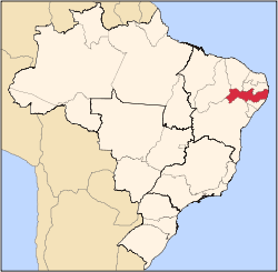
Ibirajuba is a city located in the state of Pernambuco, Brazil. Located at 182 km away from Recife, capital of the state of Pernambuco. Has an estimated (Ibge 2009) population of 7.833 inhabitants.
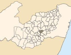
Location of Ibirajuba within Pernambuco.
Geography
- State - Pernambuco
- Region - Agreste Pernambucano
- Boundaries - Altinho and Cachoeirinha (N); Lajedo (S and W); Panelas and Jurema (E).
- Area - 189.59 km2
- Elevation - 612 m
- Hydrography - Una River
- Vegetation - Caatinga Hipoxerófila
- Climate - Transition between tropical (Hot and humid) and, semi arid hot
- Annual average temperature - 22.0 c
- Distance to Recife - 182 km
Economy
The main economic activities in Ibirajuba are based in commerce and agribusiness, especially corn, beans; and livestock such as cattle, sheep, pigs, goats and poultry.
Economic indicators
| Population[1] | GDP x(1000 R$).[2] | GDP pc (R$) | PE |
|---|---|---|---|
| 7.833 | 28.513 | 3.779 | 0.047% |
Economy by Sector 2006
| Primary sector | Secondary sector | Service sector |
|---|---|---|
| 31.04% | 7.30% | 61.66% |
Health indicators
| HDI (2000) | Hospitals (2007) | Hospitals beds (2007) | Children's Mortality every 1000 (2005) |
|---|---|---|---|
| 0.558 | 1 | 7 | 41.3 |
gollark: Apparently, I type faster on my phone than you do on desktop.
gollark: t!speed
gollark: ?tag ∀N∈ℝ TuxN where N≠1 and N≠3
gollark: No idea.
gollark: With specialized keyboard tech.
References
- http://www.ibge.gov.br/home/estatistica/populacao/estimativa2009/POP2009_DOU.pdfIBGE Population 2009 Ibirajuba, page 33]
- Ibirajuba 2007 GDP IBGE page 30 Archived 2016-03-04 at the Wayback Machine
- PE State site - City by city profile
Capital: Recife | ||||||||||||||
| Mesoregion Agreste Pernambucano |
|  | ||||||||||||
| Mesoregion Mata Pernambucana |
| |||||||||||||
| Mesoregion Metropolitana de Recife |
| |||||||||||||
| Mesoregion Sao Francisco Pernambucano |
| |||||||||||||
| Mesoregion Sertao Pernambucano |
| |||||||||||||
This article is issued from Wikipedia. The text is licensed under Creative Commons - Attribution - Sharealike. Additional terms may apply for the media files.