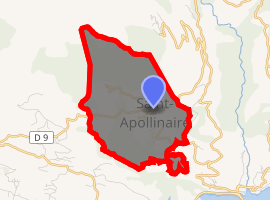
Saint-Apollinaire, Hautes-Alpes
Saint-Apollinaire (Vivaro-Alpine: Sant Apolinari) is a commune in the Hautes-Alpes department in southeastern France.
Saint-Apollinaire | |
|---|---|
.jpg) A general view of Saint-Apollinaire with the church and surrounding buildings | |
.svg.png) Coat of arms | |
Location of Saint-Apollinaire 
| |
 Saint-Apollinaire  Saint-Apollinaire | |
| Coordinates: 44°33′25″N 6°21′47″E | |
| Country | France |
| Region | Provence-Alpes-Côte d'Azur |
| Department | Hautes-Alpes |
| Arrondissement | Gap |
| Canton | Chorges |
| Intercommunality | Savinois–Serre Ponçon |
| Government | |
| • Mayor (2008–2014) | Jean-François Pinoncely |
| Area 1 | 7.54 km2 (2.91 sq mi) |
| Population (2017-01-01)[1] | 141 |
| • Density | 19/km2 (48/sq mi) |
| Time zone | UTC+01:00 (CET) |
| • Summer (DST) | UTC+02:00 (CEST) |
| INSEE/Postal code | 05130 /05160 |
| Elevation | 858–2,120 m (2,815–6,955 ft) (avg. 1,200 m or 3,900 ft) |
| 1 French Land Register data, which excludes lakes, ponds, glaciers > 1 km2 (0.386 sq mi or 247 acres) and river estuaries. | |
Population
| Year | Pop. | ±% |
|---|---|---|
| 1962 | 59 | — |
| 1968 | 63 | +6.8% |
| 1975 | 71 | +12.7% |
| 1982 | 63 | −11.3% |
| 1990 | 99 | +57.1% |
| 1999 | 106 | +7.1% |
| 2008 | 113 | +6.6% |
gollark: Troubling.
gollark: TCP would require me to do a not insignificant amount of work. I would have to update three (3) bits of configuration.
gollark: What is this ”””license checker”””?
gollark: What language?
gollark: What are you *doing*? Why TCP?
References
- "Populations légales 2017". INSEE. Retrieved 6 January 2020.
| Wikimedia Commons has media related to Saint-Apollinaire, Hautes-Alpes. |
This article is issued from Wikipedia. The text is licensed under Creative Commons - Attribution - Sharealike. Additional terms may apply for the media files.