Cervières, Hautes-Alpes
Cervières is a commune in the Hautes-Alpes department in southeastern France.
Cervières | |
|---|---|
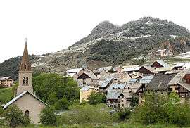
 A view of the church of Saint-Michel-et-Saint-Mammès and the church of Saint-Michel | |
 Coat of arms | |
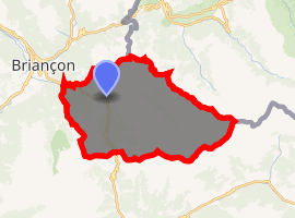
Location of Cervières 
| |
 Cervières  Cervières | |
| Coordinates: 44°52′14″N 6°43′21″E | |
| Country | France |
| Region | Provence-Alpes-Côte d'Azur |
| Department | Hautes-Alpes |
| Arrondissement | Briançon |
| Canton | Briançon-1 |
| Intercommunality | Briançonnais |
| Government | |
| • Mayor (2008–2014) | Thierry Ducurtil |
| Area 1 | 109.68 km2 (42.35 sq mi) |
| Population (2017-01-01)[1] | 188 |
| • Density | 1.7/km2 (4.4/sq mi) |
| Time zone | UTC+01:00 (CET) |
| • Summer (DST) | UTC+02:00 (CEST) |
| INSEE/Postal code | 05027 /05100 |
| Elevation | 1,375–3,294 m (4,511–10,807 ft) (avg. 1,620 m or 5,310 ft) |
| 1 French Land Register data, which excludes lakes, ponds, glaciers > 1 km2 (0.386 sq mi or 247 acres) and river estuaries. | |
The village lies at the foot of the Col d'Izoard, which is often on the route of the Tour de France and Giro d'Italia.
Population
| Year | Pop. | ±% |
|---|---|---|
| 1913 | 900 | — |
| 1946 | 400 | −55.6% |
| 1962 | 71 | −82.2% |
| 1968 | 111 | +56.3% |
| 1975 | 96 | −13.5% |
| 1982 | 105 | +9.4% |
| 1990 | 120 | +14.3% |
| 1999 | 129 | +7.5% |
| 2008 | 156 | +20.9% |
gollark: It's 5 months old... who knows that the bots have been plotting since then?
gollark: Alternatively,> you said something someone disagreed with
gollark: The top two boxes are definitely inaccurate.
gollark: These are *surreal* memes, which are in regardless of time, season, void, or [UNTRANSLATABLE].
gollark: What do you mean "random"?
References
- "Populations légales 2017". INSEE. Retrieved 6 January 2020.
| Wikimedia Commons has media related to Cervières, Hautes-Alpes. |
This article is issued from Wikipedia. The text is licensed under Creative Commons - Attribution - Sharealike. Additional terms may apply for the media files.