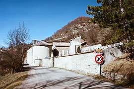
Montjay, Hautes-Alpes
Montjay is a commune in the Hautes-Alpes department in southeastern France.
Montjay | |
|---|---|
 | |
 Coat of arms | |
Location of Montjay 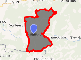
| |
 Montjay 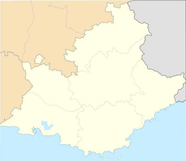 Montjay | |
| Coordinates: 44°21′39″N 5°36′16″E | |
| Country | France |
| Region | Provence-Alpes-Côte d'Azur |
| Department | Hautes-Alpes |
| Arrondissement | Gap |
| Canton | Serres |
| Intercommunality | Baronnies |
| Government | |
| • Mayor (2008–2014) | René Tron |
| Area 1 | 27 km2 (10 sq mi) |
| Population (2017-01-01)[1] | 104 |
| • Density | 3.9/km2 (10.0/sq mi) |
| Time zone | UTC+01:00 (CET) |
| • Summer (DST) | UTC+02:00 (CEST) |
| INSEE/Postal code | 05086 /05150 |
| Elevation | 764–1,298 m (2,507–4,259 ft) (avg. 814 m or 2,671 ft) |
| 1 French Land Register data, which excludes lakes, ponds, glaciers > 1 km2 (0.386 sq mi or 247 acres) and river estuaries. | |
Population
| Year | Pop. | ±% |
|---|---|---|
| 1962 | 75 | — |
| 1968 | 102 | +36.0% |
| 1975 | 76 | −25.5% |
| 1982 | 83 | +9.2% |
| 1990 | 86 | +3.6% |
| 1999 | 79 | −8.1% |
| 2008 | 100 | +26.6% |
gollark: That actually probably *would* put it in the range of practical bruteforceability, since there are only 4 billion possible 4-byte values and anything you're doing by hand can't be *that* slow to run on a computer.
gollark: That's, er, 4 bytes.
gollark: Also also, things involving just scrambling the alphabet and using that fixed "scrambling" for each letter of the input are vulnerable to stuff like frequency analysis.
gollark: Also, the fact that it mixes up the alphabet a lot isn't exactly very relevant, since the vulnerable bit is probably how it, well, generates the "scrambling" in the first place.
gollark: * not practical to decrypt unless you have some extra information i.e. the key
References
- "Populations légales 2017". INSEE. Retrieved 6 January 2020.
| Wikimedia Commons has media related to Montjay, Hautes-Alpes. |
| Authority control |
|
|---|
This article is issued from Wikipedia. The text is licensed under Creative Commons - Attribution - Sharealike. Additional terms may apply for the media files.